Search the Community
Showing results for tags 'site modifier'.
-
Hello all Is it possible to show the DTM without site modifiers ( original site) and with? I would like to set up 2 viewports side by side that show the existing and new conditions. Thank you!
-
Has anyone successfully used 'define by contours' for the new grade limits modifier? I have tried in fresh files and old files and vectorworks keeps crashing. Attached example SiteModelGradingTest.vwx
- 18 replies
-
I am experiencing an issue with Site Models where the underlying existing site data is being altered to meet the grade limit boundaries, when the Site Model picks up modifiers (The Grade Limit is set to affect Proposed only). The Site Model is on its own design layer, the Site Modifiers are on a separate layer, and all the modifiers are set to affect the proposed site only. The grade limit is also on the same layer as the Site Model. Can anyone provide assistance to resolve this problem? Is it a known bug? Tagging the experts here 😄 @Tamsin Slatter @bgoff @Pat Stanford Existing Site Model Problem with Grade Limits.mp4
- 17 replies
-
- site model
- dtm
-
(and 2 more)
Tagged with:
-
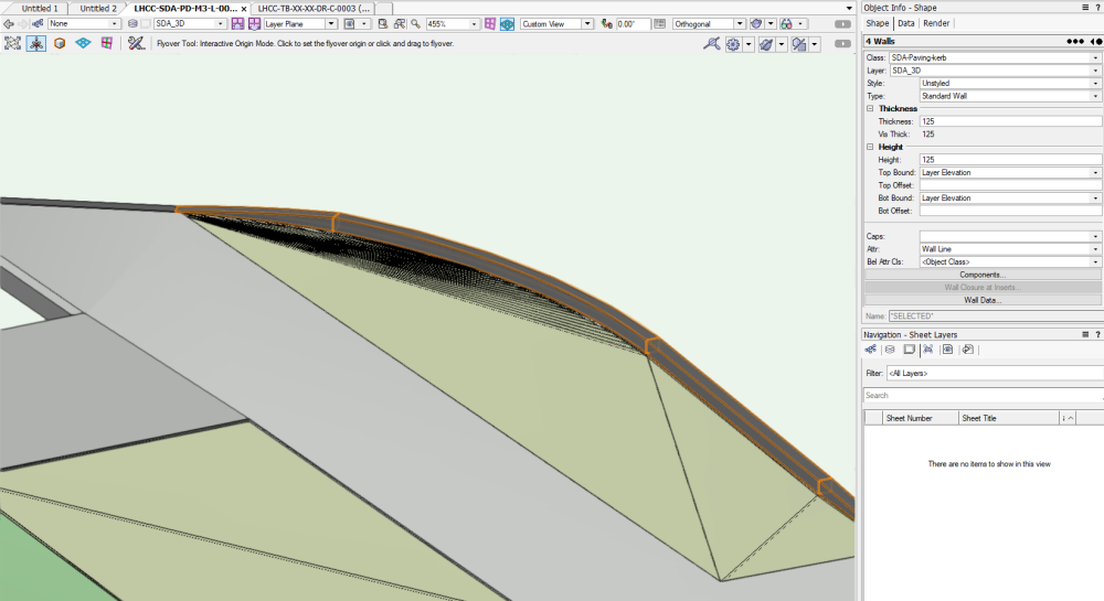
Hi everyone, I have created a 'hardscape' element below in green with walls on the right. The 'hardscape' element is now aligning to the bottom of the wall with site modifier tool. How do I align the hardscape element to the top of of the wall instead of bottom? TIA for your help. Cheers, Nicole
-
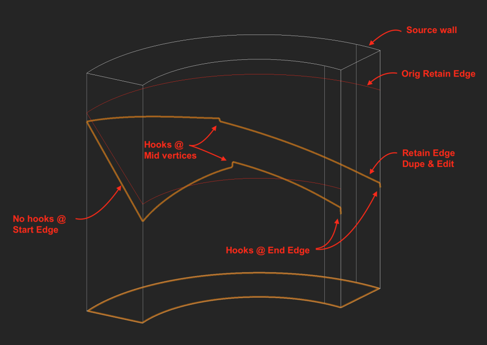
Another Retaining Wall Site Modifier quirk: Create the modifier from a Round (arc) source wall via AEC>Terrain>Create Retaining Wall Site Modifier. Edit the z value at center or end of Left/Right Retaining edges via Reshape tool. Result is a hook, or added short vertical (nearly) segment at the new position. This hook does not have an editable vertex. But it does cause a crease in the site model surface. Strangely, no hooks at start edge if those vertices are moved. In the image, the End edge is hidden for clarity. -B
-
- retaining wall
- site modifier
-
(and 1 more)
Tagged with:
-
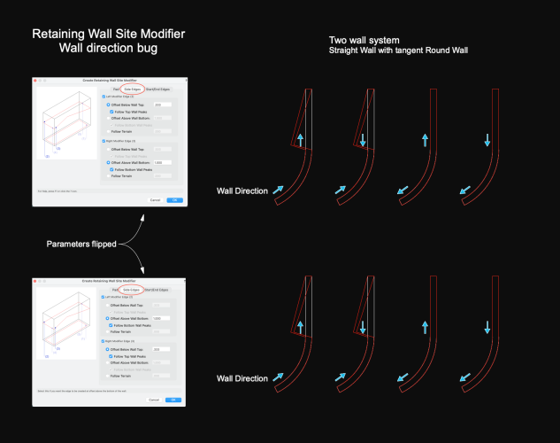
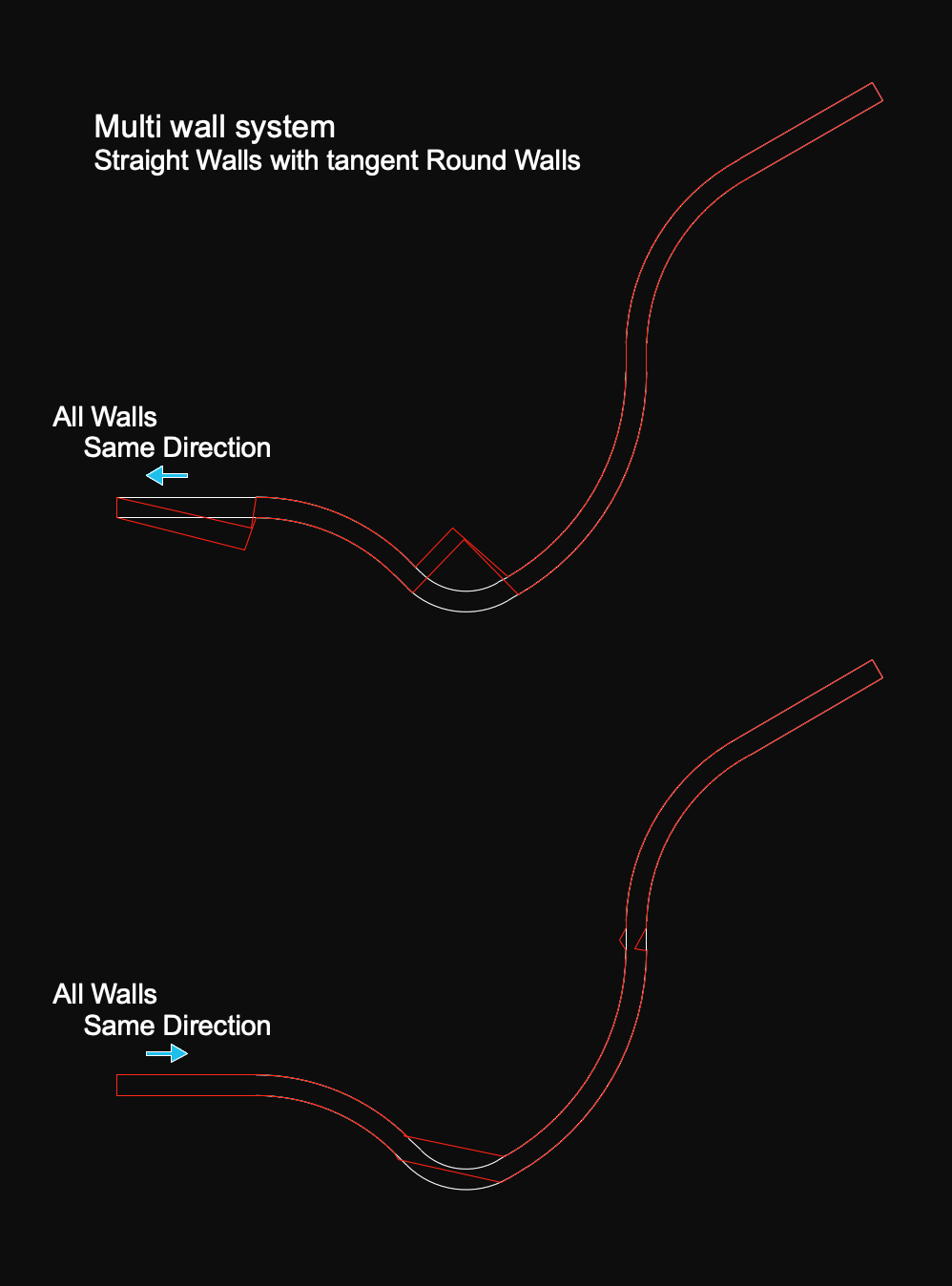
Working with the command AEC>Terrain>Create Retaining Wall Site Modifier, and finding quirks. v2022 file attached Source wall directions determine high/low retaining sides. But some combinations of wall direction produce retainage boundaries jogged out of wall alignment, shown here in Top/Plan. This added kink cannot be corrected via the edit tools. Certain source wall direction combinations produce proper retain alignments in a 2 wall system. I find it difficult to predict which combo will produce correct alignment and correct high/low sides. Multi wall systems may not have a combo that works. Workaround is to apply the command to individual wall sections. -B Retaining Wall Site Mod.vwx
-
Good afternoon folks, I've been banging my head agains the screen for 2 hours now trying to cut out a basement from a site model. I've got a 3D polygon in the outline of the basement footprint set to the proper elevation. If I convert it to a Pad site modifier, the ground slopes into it. I need the edges of the cut to be vertical. I've played around with a Grade Limit 3D poly to the same shape as the basement footprint but it's not really doing anything. Does anyone have a method of cutting a basement out of a site model? This file is in VW 2021. Thanks folks. - Dylan
- 5 replies
-
- site model
- basement
-
(and 1 more)
Tagged with:
-
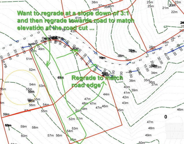
Hello Is there a way to add regrading to a site model so that the amount of earth moved from existing to proposed is determined ? I have a sloping site, and would like to recontour with a dozer so that the general elevations are lowered so the lands match the heights along a road cut. The constant plane pad with a set slope is a start, but not nearly able to reproduce what I am looking for. The attached image is what I am after .... to draw a pad alongside the roadway and set the elevations at each point matching the road elevation ... I did NOT have much success drawing a 3Dpolygon along the roadway and across the lot, with the desired elevations, and then using it to modify ... it didnt affect the model ... I did set the class to site-dtm-modifier ... and it was in the layer modifying the model ... but no effect upon updating. Operator error is an obvious start. Any suggestions for doing this ? or alternative approaches ? ************************************************************************************ Steve Dimond, GSC, M.Sc., P.Eng., Prince Edward Island, Canada MacOS 10.13.6, MacBookPro mid 2015, 16 Gb Ram, Vectorworks v2019 Designer, Renderworks
- 6 replies
-
- site modifier
- pads
-
(and 1 more)
Tagged with:
-
Please make site model modifiers capable of having a pattern or hatch applied. Modifiers show textures in 3-d views, but apparently can't show any kind of fill in a 2-d view. That means if I make a driveway on a site, for example, I have to copy the shape from the site modifier and add it as an annotation to get any kind of fill on it. This is ridiculous. I would like to see Vectorworks scrap the entire site model altogether, and go back to the drawing board, and create a tool that can be used easily and intuitively.
-
Texture Bed and Site Modifiers
ScottLebsack posted a question in Wishlist - Feature and Content Requests
Pad site modifiers should also have a checkbox and texture selection for adding a texture to the modified surface. If I'm using a slab modifier, it probably as likely as not to need a texture different from the default. I use lumion with 3d grass, when I create a pad for a structure (house, pool, sidewalk...), I have to duplicate the path and create a texture bed modifier too. If not, grass will come up through slabs when rendering.-
- 3
-

-
- pad
- site modifier
-
(and 2 more)
Tagged with:
-

VW Landmark Road modifier improvements
Edgar Kaare posted a question in Wishlist - Feature and Content Requests
Dear VectorWorks Landmark friends More and more i miss the Landmark road planning improvements, so i can plan the roads a little more flexible directly on the site model and so i can define the needed cross-section profile of the road side slopes etc. icluded. Here is a good example from Revit (please notice: the awfull background music should be muted): https://youtu.be/tw7_hLQo_H0 So far I understand, is also Revit not a specific road planning software, but still they have the compadibility for planning the roads a little more functional way, not just as a flat cross-section profile based way. This is clear, that i dont wait from vectorworks to have the 100% functionality of road planning-engineering software like for example Bentley Microstation has the InRoads software etc., but a little more functional tools are really missing to have a bit more roadworks and sometimes the communication with the engineers done a little more efficient. Hoping for improvements in next Landmark Road planning tools. Thanks a lot! -
Subdivision Surface as Site Modifier
martinfdc posted a question in Wishlist - Feature and Content Requests
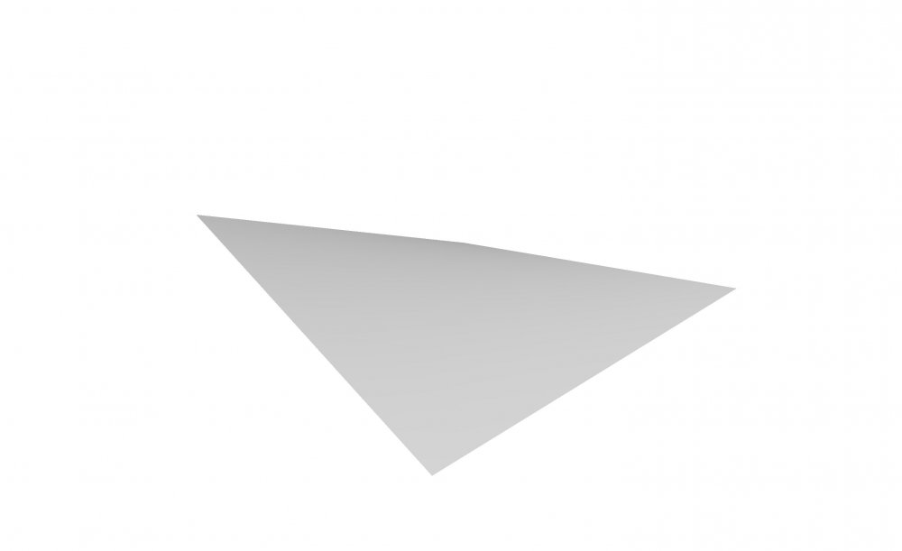
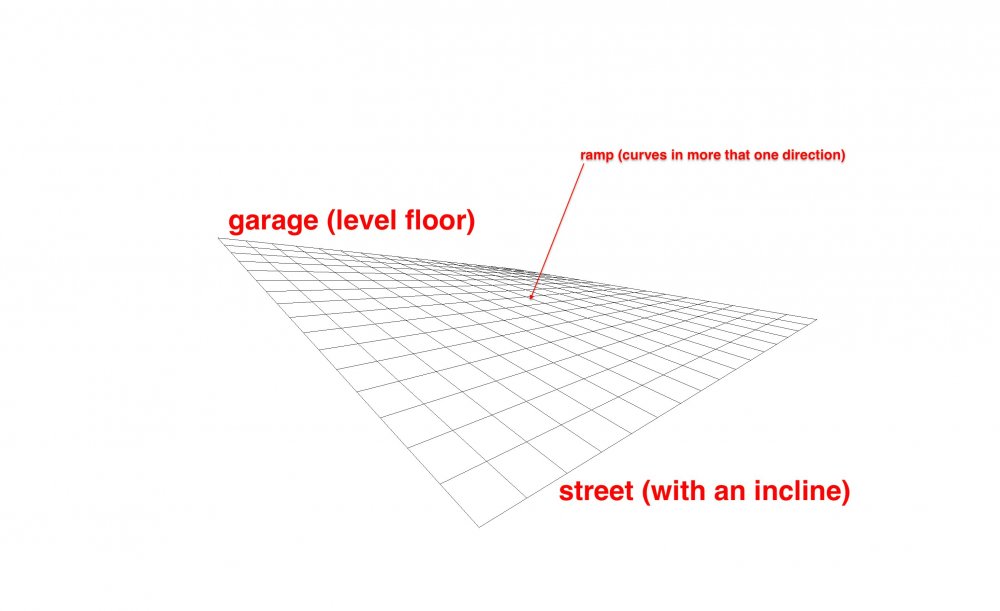
It it currently not possible to have a site model modifier that does a form like the images I attach. I have tried doing this with a 3D Polygon placed under the DTM-Modifier class but the site model reads 3D polygons as contour lines. The pad with slope doesn't provide the form I want to create either. I have also tried creating a 3D Polygon, converting it to Nurbs then via the 3D power pack>Create Surfaces from Curves, then Create Interpolated Surfaces, and then placing that in the DTM-Modifier class but then the site model converts that into a mesh with little information that does not contain the form that I want. So the best way to create this strange shaped would be with the subdivision surface. I hope one day one can use this object as a site modifier. Or it could also be created via an interpolated surface but then the site model should respect all vertices and not read the interpolated surface as quite a basic mesh when the interpolated surface is in the DTM-Modifier class. Maybe I'm totally wrong and doing this type of form in a terrain is possible, if so, I would be very glad if someone tells me how can this be done. This type of form occurs many times in the real world, for example you have a ramp that's connected to a street with an incline and to a garage that it's entry level is straight...- 2 replies
-
- 1
-

-
- dtm-modifier
- site model
-
(and 3 more)
Tagged with:
-
Hello all, I have been working a site model for a quarry. I have two sets of survey data, a topographical survey taken in 2017 in PDF form, and a topo survey from 2018 of the same site in DWG form. I turned the DWG into a site model, and have added in site modifiers of the 2017 data by adding stake points and contours, so that I can compare the two surveys to see how the quarry has changed. I have encountered an issue with a particular contour in the site modifiers, and this contour has flagged up 424 modifier conflicts. I cannot get my head around why only this contour has the problems, and upon clicking the warning triangle it states 'Pads Intersect', however, I have not used any pads, only contours and stake points. Does anybody have any suggestions as to why this is happening? As you can see from the zoomed in images, the modifier conflict warnings are not actually sat on top of 'crossovers' and you can see from other contours that these are not problems. I have attached pictures to help, with the zoomed out image showing only the proposed contours, and the zoomed in showing both (green and blue) proposed and existing. Thanks Joe
- 3 replies
-
- site model
- site modifier
-
(and 3 more)
Tagged with:
-
The Grade Object tool in Landmark has long been a frustration of mine. It is a very powerful tool, but when used in actual applications it is SUPER SLOW and cumbersome. I hope the grading tools and workflows get a hard look for both functionality and usability because many are just clunky and not applicable in a professional setting.
- 5 replies
-
- 2
-

-
- landmark
- grade object
-
(and 3 more)
Tagged with:
-
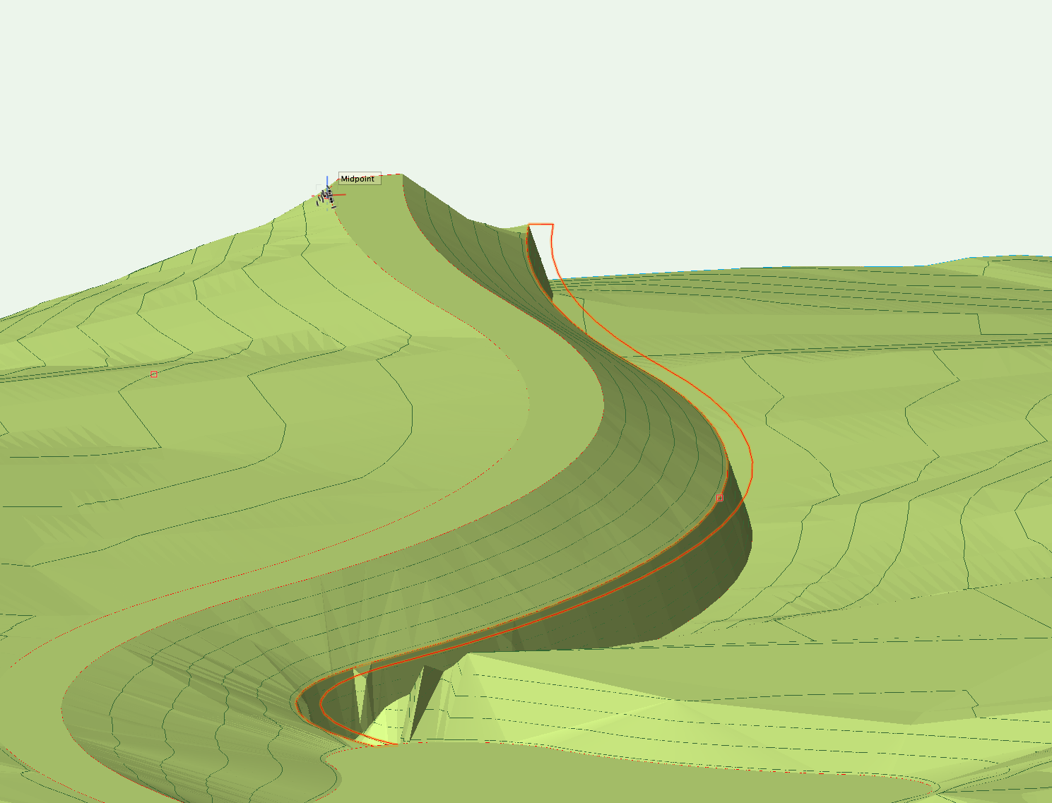
I have created a pad from a closed 3d polygon, which varies in height along a curve on my model. When I update my site model, one edge of the pad acts as I expect it to - the road ramps down to meet the edge of the pad. However, I then expect the inside of the pad to form ground level, and for the site levels on the other side of the pad to meet the edge of the pad - which doesn't' happen? Instead, I get a cliff edge.... can anyone help me with what I'm missing?
- 1 reply
-
- site design
- site modifier
-
(and 3 more)
Tagged with:
-
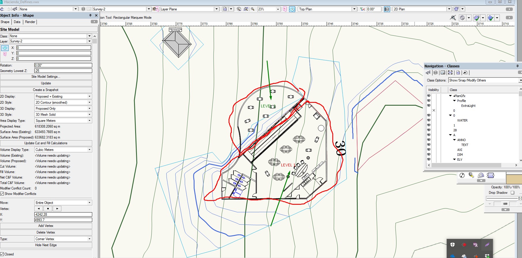
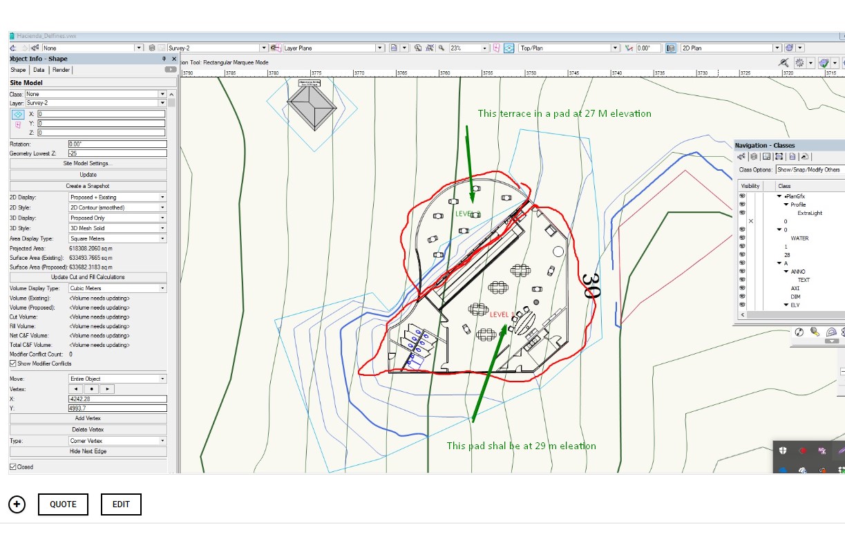
I am working with getting refine skills in Site Modeling. I have a small building resting over a steep hill . I designed one floor building with a terrace at one level and the remaining area steps up into another pad elevation. I have trouble setting the Site Modifier for Pad with retaining wall and normal pad. The problem that I face is that the pad are joined together alone the line that separated both sections of the building returns an error. What technique I need to apply? IS there a better technique to tackle this situation. I sea a lot videos but they don t really take into account Pad modifiers that are aligned one next to the other touching together. Here is a link to the VW drawing... https://www.dropbox.com/s/ro2ke5nzk1dqqh0/Hacienda_Delfines.vwx?dl=0
-
I need help mastering site modifiers tools. I have trouble getting the Boundary limit around a pad. I have set a boundary site modifier for the property limit. Proposed Site Model looks good. But I entered a second smaller grade modifier inside the property surrounding a site modifier pad. But the second boundary limit is not acting as expected. The pad is created but the contour is modified all the way to the outside boundary limit of the property. https://www.dropbox.com/s/ro2ke5nzk1dqqh0/Hacienda_Delfines.vwx?dl=0
- 1 reply
-
- landmark
- site modifier
-
(and 1 more)
Tagged with:
-
I am working on a site model. I created a site modifier in my mother that later erased. But I can not find why the proposed still shows a grade modification. I have checked the only modifier present is the Boundary modifier of the lot. Please help. Here is the archive https://www.dropbox.com/s/ro2ke5nzk1dqqh0/Hacienda_Delfines.vwx?dl=0
-
Site Modifiers - Two Pads with Retaining one inside the other
martinfdc posted a question in Troubleshooting
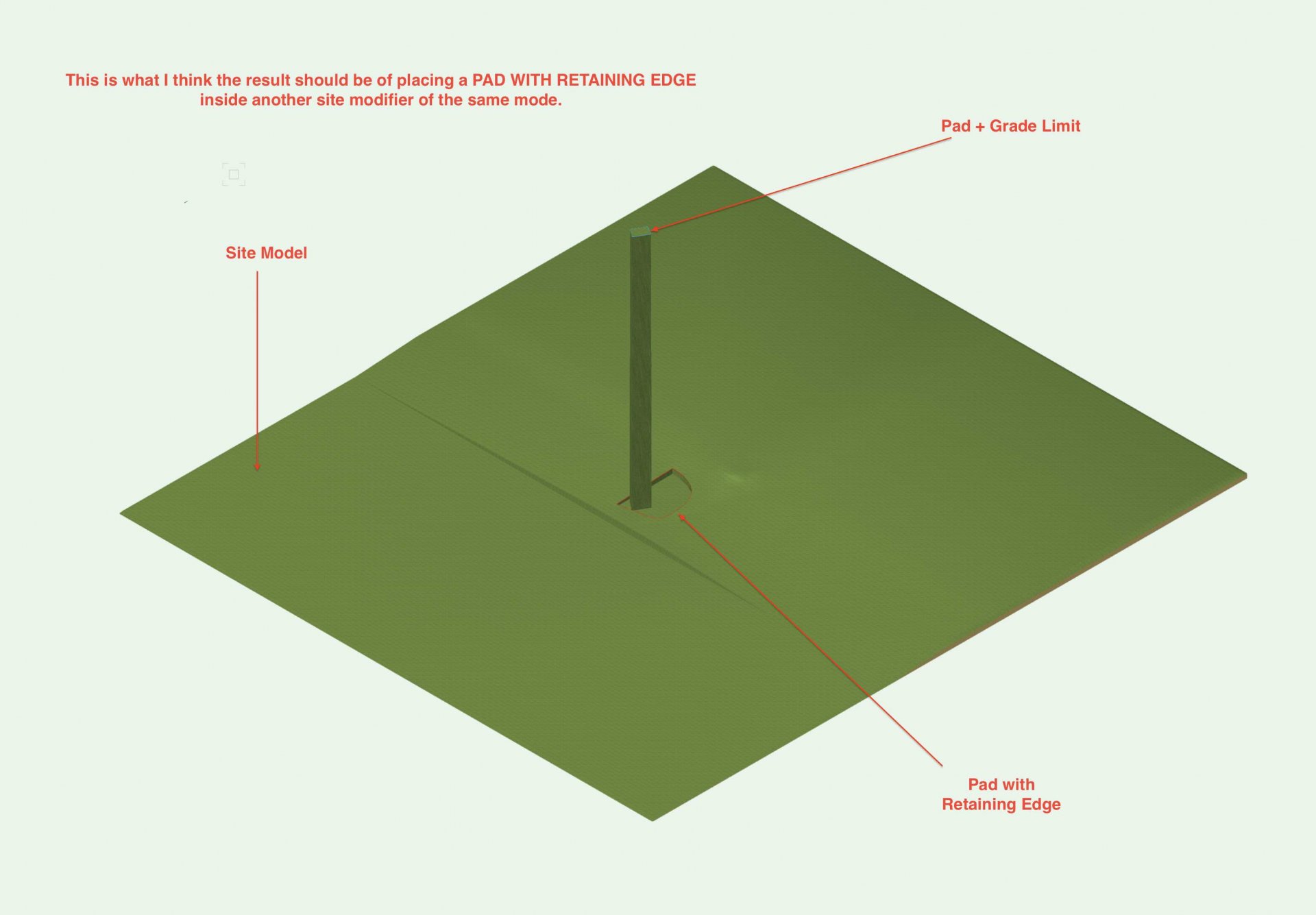
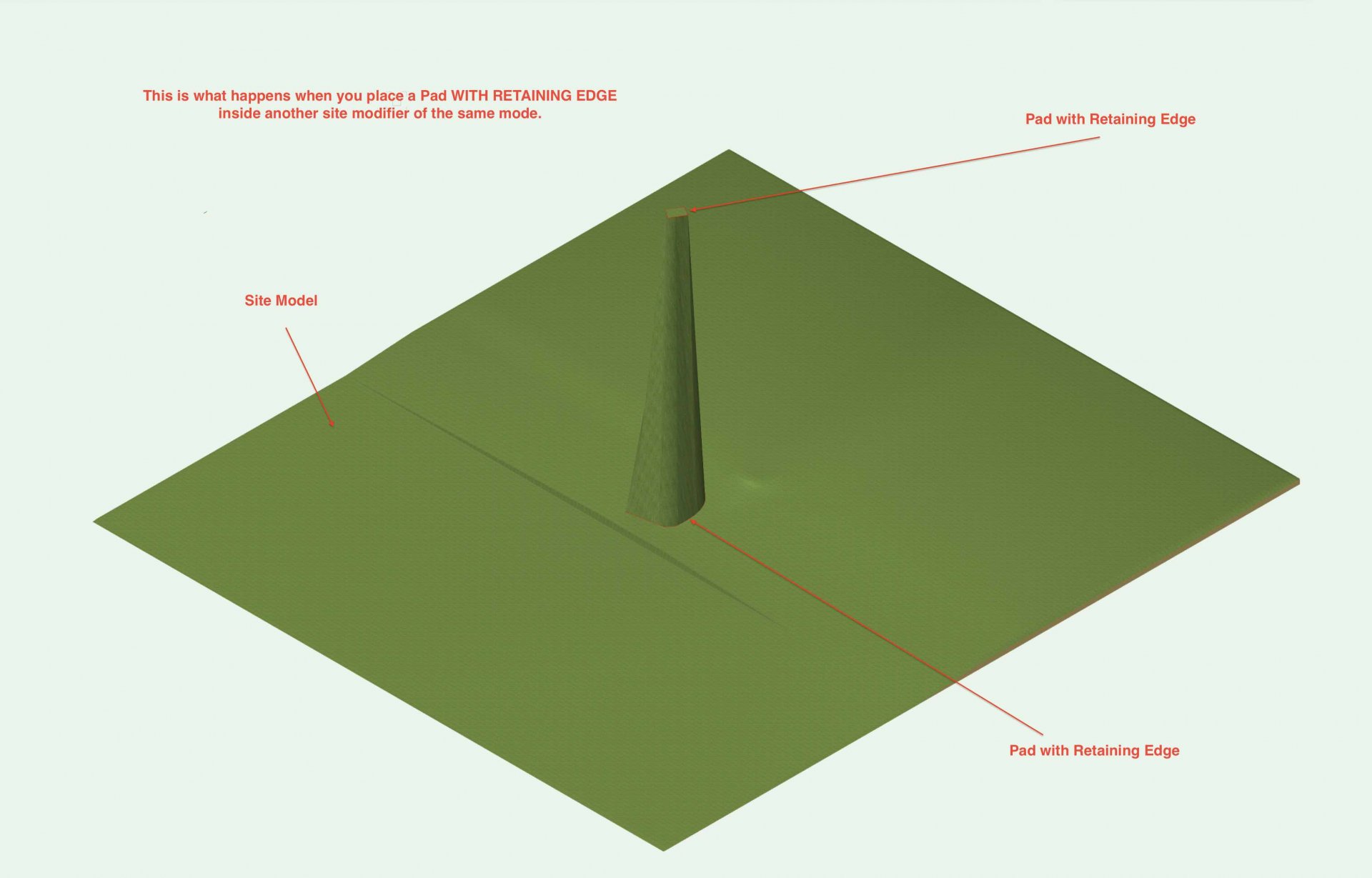
Hi, I'm having trouble getting a Pad with Retaining Edge to Work inside another Pad with Retaining Edge. I attach two screenshots. One is of a Pad with Retaining Edge inside another Pad With Retaining Edge and the other one is the way I believe the combination of the last two mentioned should work (the second screenshot is made though by a Pad with Retaining Edge containing a Pad with a Grade Limits) Am I doing something wrong by placing a Pad with Retaining Edge inside another site modifier of the same mode?- 3 replies
-
- site modifier
- pad
-
(and 3 more)
Tagged with:
-

Stake Objects - Prefix or Suffix
ericjhberg posted a question in Wishlist - Feature and Content Requests
This is a fairly simple request. Can a field be added to stake objects that would allow for the addition of a prefix or suffix. This would allow for more precise graphical communication of spot elevation types (i.e. FS, TW, TS, FL, etc.)? We ideally need this information to use stake objects as annotative tools for grading plans.- 2 replies
-
- landscape
- site model
-
(and 3 more)
Tagged with:
-
The title pretty much describes it - I wish that the 'Retaining Wall Site Modifier' & 'Hardscape Objects' that are included with Landmark would also be included with Architect. All of my projects are modest single-family homes and typically my projects do not have a Landscape Architect on the design team. Many times I have wanted to use just those two objects, just so that I could more accurately integrate my building into the site model. It's only fair since Landmark got the Curtain Wall tool (?) and I can't remember any Landscape Architect I have ever worked with needing to use a curtain wall tool. 😉 EDIT 03/2020: This wishlist request is partially fulfilled in Vw2020: The Help File says that ‘Hardscape’ objects are now available in Architect (but ‘Retaining Wall’ Site Modifiers are still only available in Landmark / Designer).


