
lisagravy
-
Posts
203 -
Joined
-
Last visited
6 Followers


-

Sharepoint and Project Sharing
lisagravy replied to lisagravy's topic in 3rd Party Services, Products and Events
@shorter Yep, I know what we're doing is what's recommended - however we weren't doing that initially (when I first started this thread to troubleshoot the problem in 2020). Back then, we had the central model and user files in the same location, as per @Paul Snell's setup, which is why I was explaining how we'd fixed it. We changed this on Vectorworks advice and things now run far smoother. Completely agree that a lack of back up is an issue for local files, which is why we didn't want to set up desktop locations for user files in the first place - but we solved it with local cloud drives which are backed up. I think you and I are giving the same advice here. The only point I was making was that the 'whole point' to us originally was more about enabling a number of users sharing a master project file at once, rather than re-organising file structure / storage - hence why we hadn't really considered saving the files in the same location to be a huge issue in the first instance. It seems that's how Paul has approached it too, hence my post. -
Sharepoint and Project Sharing
lisagravy replied to lisagravy's topic in 3rd Party Services, Products and Events
@shorter The 'whole point', or benefit really to us was less about file locations and more being able to have multiple users working on the same master file at one time. To avoid people saving on local (desktop) storage, we'd initially set up a location next to the master file for individual user files, as @Paul Snell seems to have done - but this doesn't work. So our individual user files now live on individual (but still cloud!!) storage, as part of personal OneDrive storage linked to individual MS365 accounts. It works much better this way, provided enough time is allowed for syncing / downloading, and the connection is reasonable.- 32 replies
-
- 1
-

-
- project sharing
- project share
- (and 2 more)
-
Sharepoint and Project Sharing
lisagravy replied to lisagravy's topic in 3rd Party Services, Products and Events
@Paul Snell We're managing it by saving the shared master (Project) file on the Sharepoint system, and any user files on personal OneDrive folder locations. This seems to work much better than having all the user files in the same Sharepoint location, however you do have to be careful and make sure you provide enough time for the files to sync via cloud before you quit / shut down your machine, and the same when starting up. -
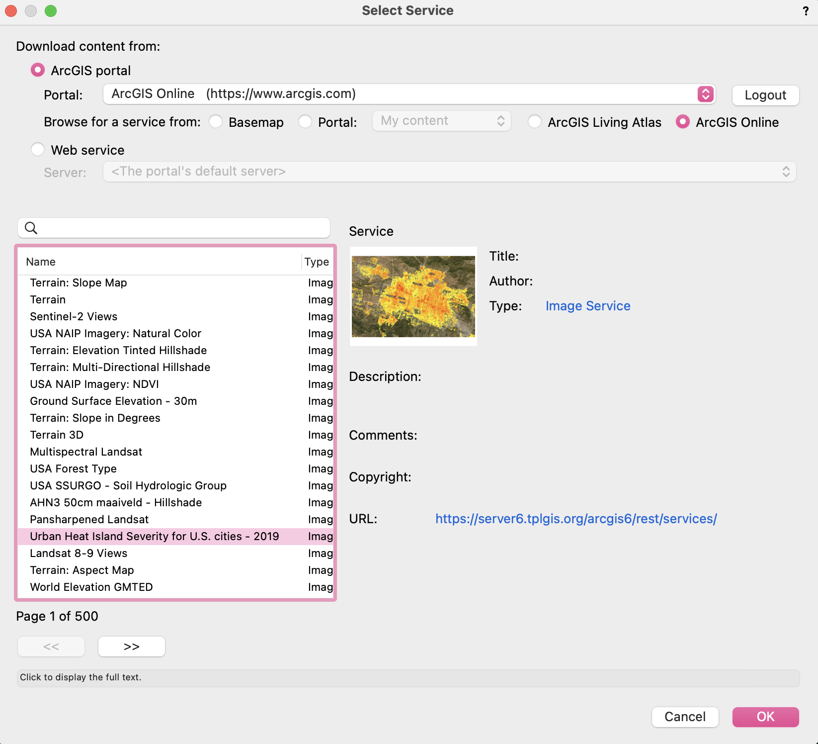
Thanks Tom! Yes, the GIS datasets can cover huge areas which are too big (and far away from the internal origin) for Vectorworks to process, so it'll work better zoomed in. Glad you've got it working! OS Open is a great search for background mapping, but there's tons of other UK data too. If you search BGS, you get British Geological Survey data, for example. There's an ArcGIS Online directory here which is quite useful for the full list of datasets, as long as you filter on 'Feature Layer'.
-
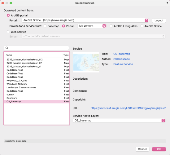
So this is total user error on my part... (Directed I think by a bit of a miscommunication in the 2022 'Help'.) @Tom W. - there isn't a Select Features for Layer' dialogue that appears here - you just bind the layer and then close the layer editing panels etc. It seems like nothing has happened - but THEN you have to navigate to Landmark (or AEC) > GIS > Update Layer from Feature Service, which works.
-
Hi @iborisov - it still doesn't work for me, I've navigated to that exact USA Major Cities feature layer. Happy to have a Zoom chat if that's helpful for you, I'll stick my email on JIRA.
-
@Katarina Ollikainen Thank you ❤️
-
Hi @Katarina Ollikainen - it's four extra fields at the moment really, Field 7, Field 8, Field 9, Field 10. Though I appreciate that some others could be re-allocated despite their name! I've got a tree survey with 32 fields in, and I just hate omitting data! It would also be good if we were able to re-name the existing fields, particularly if we are 're-allocating' their content. I want to use the output as part of an online ESRI Storymap... keen to try out the 'direct from Vectorworks' binding functionality on a live project! But as the client / public will be able to query the data, we'd need to be able to have field names which accurately represent the data content.
-
I know there are a couple of extra fields that can be set for data when importing a tree survey using the import survey function. However I've got a really extensive survey, and would like to add some additional fields. Is this possible at the moment, or is this a wishlist feature?!
-
@Tom W. It did work previously because I tested it, but I haven't in a while... probably since 2021! Portal: My content is from my own ArcGIS Online account, so that's GIS stuff I've already created. The point of binding the content is so that edits in Vectorworks apply to the files online, and vice versa - they effectively sync between softwares. You can however access public WMS data free - you can do that via GeoImage tool. If you select Geoimage preferences and hit 'Select Service', then you can get a ton of (albeit raster!) info to add to your Vectorworks project. You can also add additional datasets you find online if you change the settings to Web Service > Manage Service > Add URL. It's really good. A digression on the linking ArcGIS features bug though!

-
@Tom W. I'm actually getting the same issue... I can select a Feature Service, but when I click OK nothing happens and the layer doesn't appear to bind. Wonder if this is a bug!
-
lisagravy changed their profile photo
-
I know there's a great feature which allows binding a Vectorworks layer to an existing Feature layer on ArcGIS Online ❤️ I just wondered if there was a way to take an existing Vectorworks layer and create a brand new Feature layer to bind it to - essentially creating a Feature layer online directly from Vectorworks layer content? Or do you always have to login to ArcGIS Online first to create an empty feature layer as a path? (Not a huge deal, I'm just always trying to skip steps!) @Vlado? 👀
-
@AlanWThank you!! This works. There was a non-visible existing crop that I hadn't set. Haven't seen that before!
-
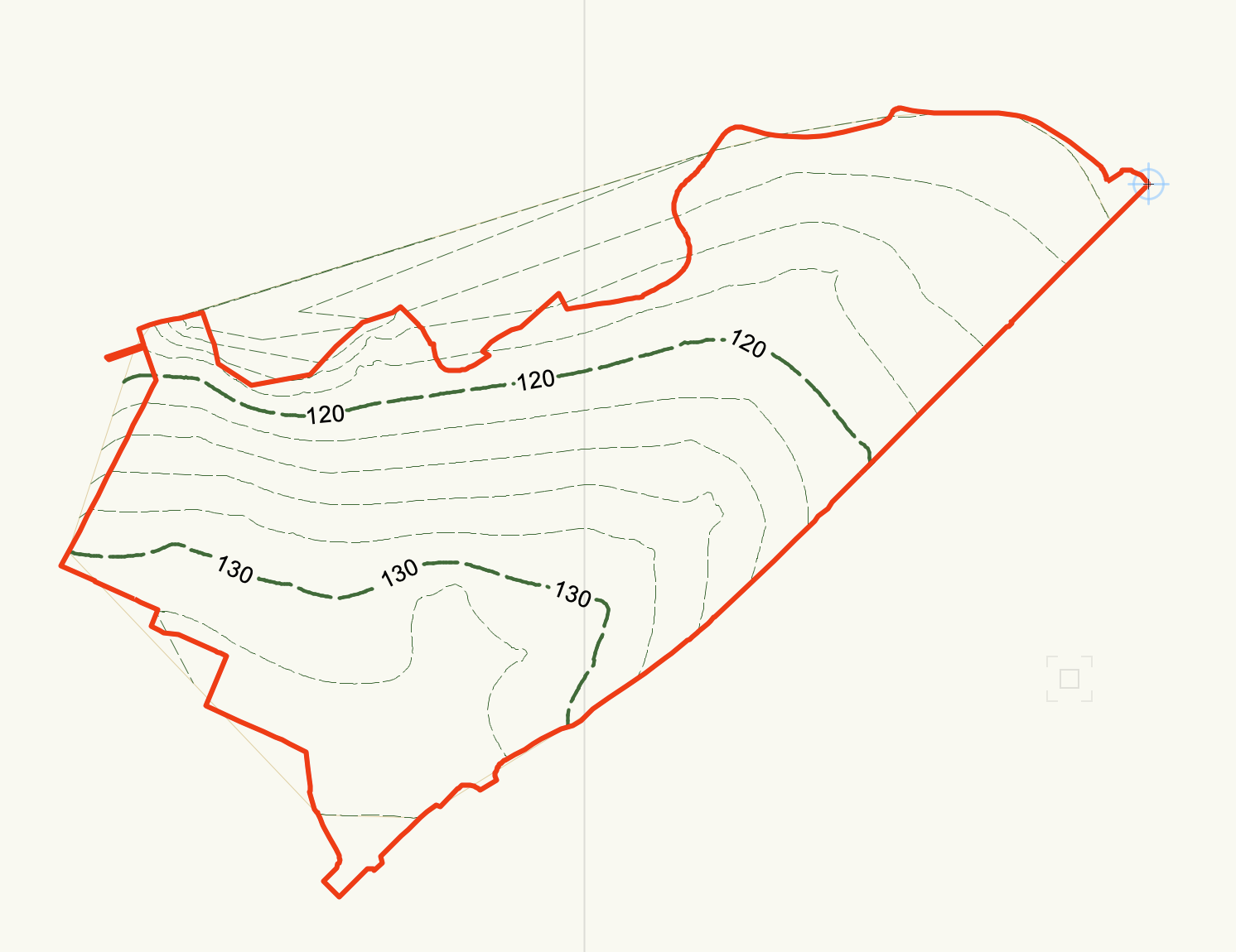
I have a fairly basic site model, and am trying to crop it to a polygon extent. If I right click on the model and select 'Edit Crop' I can paste in the polygon I want, and it appears in the correct place. However, it doesn't crop my site model. If I then go back into the 'Edit Crop' panel, I can still see my crop polygon! But it has no effect, even after updating the model. Anyone else having this issue? Not sure if it is a 2023 bug.

-
Anyone had any success with KML export from Vectorworks? Almost got a lovely 3D model into Google Earth Pro, but it comes in about 100m off in terms of location. I think the geo-referencing in Vectorworks is ok... any tips or tricks to get it to work? Note we've already looked at this on Vectorworks University - seems now I don't even have to put the lat/long in, as it's picked up from the document geo-referencing, so I have no control really over location other than this, and my file settings are correct...
- 1 reply
-
- 1
-
-
- georeference
- kml
- (and 3 more)