
ScottLebsack
-
Posts
124 -
Joined
-
Last visited
1 Follower

Recent Profile Visitors


-
 ScottLebsack changed their profile photo
 -
Site model Cut/Fill Depth contours
ScottLebsack replied to Steve Riddle's question in Wishlist - Feature and Content Requests
There is a cut fill display mode under 3D display for the site model. I usually end up taking a Site Model Snapshot when the site model is in this mode and saving it to it's own layer, before returning the 3D contour display. I think the snapshot can show up in plan view, and you will still have your 3D site model for other work. Hope this may help? -
Seems like it might be good to just have a single "Visibility" button on the OIP and when it opens, have a individual tabs for layers and classes similar the Organization palette
-
Site model Cut/Fill Depth contours
ScottLebsack replied to Steve Riddle's question in Wishlist - Feature and Content Requests
I'm not sure I understand, do you have a graphic representation? I know an alternative for labeling Cut/Fill depth I would find helpful, is an alternate version of the stake tool that indicated the delta between the surfaces -
Wishlist - Wall with multiple wall styles
ScottLebsack replied to Gregovitch's question in Wishlist - Feature and Content Requests
Landscape walls can be quite complex, too. -
I often create individual paver units for a variety of reasons, it would be helpful to have the ability to "group" these individual hardscapes and grade them like a single hardscape. Some of the reasons for creating these "assemblies" is in order to apply records to individual pieces that are thicker at edges, or oversize, or custom cut.
-
Wall Styles VW 2022
ScottLebsack replied to taoist's question in Wishlist - Feature and Content Requests
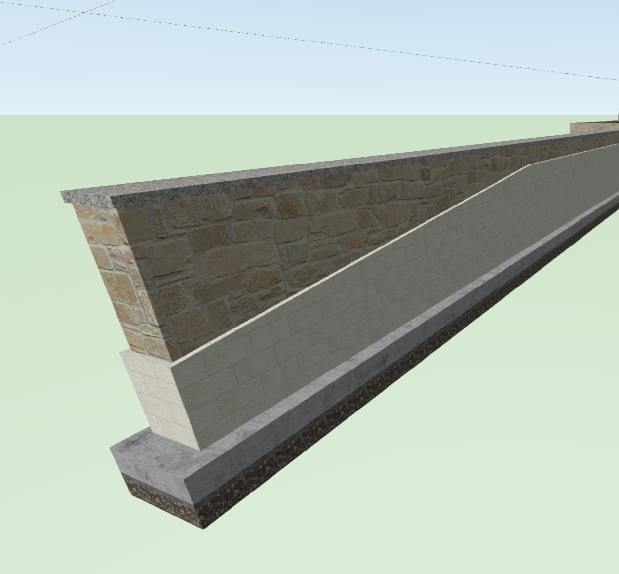
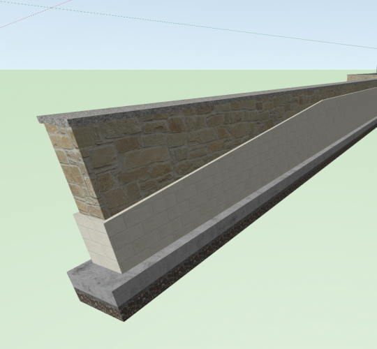
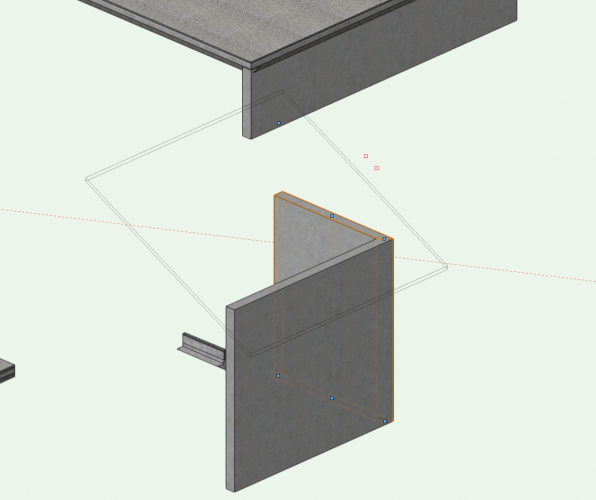
A more comprehensive wall tool would be appreciated, with the addition of materials, I've attempted to include additional information below grade for walls. The work around has been to create a footing and wall cap (hardscapes) 1-wall "core" (CMU or CIP Concrete) and multiple "Veneer" walls stacked on the outside... As long as the wall only has one slope on each side, my "Walls" are made up of 9 walls, counting veneers, and block ups aligned with the wall "core". This is a tedious process, and works, but it far from elegant, and very near a nightmare when editing is required or, when slopes change. Below is the image of a wall with sloped veneer (construction would be stepped but this come close to averaging for takeoffs without making additional walls... This wall with a single slope required 9 wall components (far end is below grade), plus a slab for the wall cap and footing... When it comes time to edit, the stacked components can be difficult to align properly in plan view.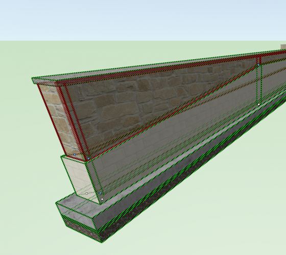
-
Sheet Layer Subsets (Improved Management)
ScottLebsack replied to ScottLebsack's question in Wishlist - Feature and Content Requests
Thought I'd sum up the work arounds I've figured out. The set I'm working on got even more complex. I now have 3 sets of LX.X sheets; CDs, Building Permit, and Floodplain Design Review. I have been able to use the spacing trick @Andy Broomell mentioned, though I've been placing the spaces at the front of the Sheet number - this also allows me to create filters for each... if the sheet number starts with __L (two spaces and an L) then it goes in the Floodway set, and can be indexed in a worksheet easily, too. It's still inelegant, and unintuitive if somebody else has to work in the file, but suffices until something better comes along. It takes a bit to sort when it come to the initial publishing, but I can save a set there, too. It just seems like it would be easier to have sets as an integrated part of the system, and available at publishing time, too. -
@Matt Panzer that was it, thank you!
- 3 replies
-
- 1
-

-
- wall
- sloped wall
- (and 1 more)
-
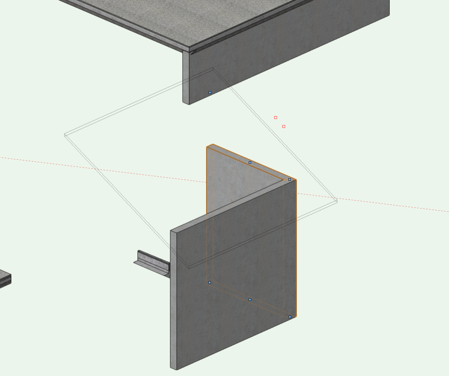
It seem like certain files have difficulty properly displaying sloped walls. You can see the grip floating up in the air. In this case I tried fit wall to object, it appeared to work other than actually displaying the wall properly? I've had this occur frequently enough to notice, in multiple files since beginning with VW in 2014. I've also had the same issue simply dragging the grip vertically, too.
-
Sheet Layer Subsets (Improved Management)
ScottLebsack replied to ScottLebsack's question in Wishlist - Feature and Content Requests
Thanks all for the work arounds, thanks @PatStanford I always forget to use worksheets to manage things like this. I had begun to add a separate sheet number to each sheet as a work around, but I didn't want to have to go into the sheet manager to update them, the worksheets might make this management task easier. Ultimately it is still a work around, but seems like it would gain me the functionality i'm after. Appreciate the help, all. For now the space at the end may work... -
Sheet Layer Subsets (Improved Management)
ScottLebsack replied to ScottLebsack's question in Wishlist - Feature and Content Requests
Alternately having something other than the sheet number be the unique identifier for sheet layouts would alleviate some of this pain. I've looked at adding alternate fields to each sheet for number and abandoning VW's numbering, but I'm worried about all the tables and callouts I would have to update along the way... -
With HTC's recent hardware announcement and professional focus, has there been any more work towards creating a robust consistent VR experience from Vectorworks? If anybody has tips or workflows they have found helpful I would appreciate any insights. We have a client who has used this with their architect and now would like the same experience for our landscape. I'm excited to dig in, but some direction at the beginning would be helpful.
-
I have a sort order applied to my sheet layers in the navigation palette - Why can't I sort/easily print in the same order from the publisher? It would be great to use tags/filters in the publisher, too.
-
Were I tackling the same issue, I would copy my title block and alter the layout to eliminate most of the linework - you could then place it outside the printable area?
-
Sheet Layer Subsets (Improved Management)
ScottLebsack posted a question in Wishlist - Feature and Content Requests
I would really appreciate the ability to create folders or subsets in my sheet layers. Working as Landscape Architects, generally our sheets begin with L. I find through the course of a project, I'll end up with maybe more than 10 sheets that should be L1.0 (Client Exhibits, DR Submittals, HOA submittals, CDs...)- I'm constantly having to rename/overwrite layouts that I would rather not. I try to create a file copy at milestones, but If I need to pull one out of the archive folder it's a pain. Alternately, If I could create subsets in my file for Schematic Design, Design Review Submittal, CD's etc. It would streamline the process. PS being able to print only from a certain subset would be helpful as well.