
steve d.
-
Posts
3 -
Joined
-
Last visited
-

Site Modifiers (pad?) with varying heights along edge
steve d. replied to steve d.'s topic in Site Design
Thank you for the replies ... I did manage to get something of value with the 3D polygons. Worked well actually once I got the bugs out. ... although a pile remains alongside the roadway as the modifiers dont intersect. I could limit the grading to 1 metre and then reset everything ... for an approximation of earth volumes, this works not too badly though as i have it. Can the Grade Tool cross over other modifiers ? When I have used that, it appears to be creating only ditch-like contouring ... ie there is no plane on the grading, just along the line with the elevation changes either side ... much like a trough. Is there a way to use the grade tool ie like the width of a dozer blade, for insance ? Thank you Cheers Steve D -
Site Modifiers (pad?) with varying heights along edge
steve d. replied to steve d.'s topic in Site Design
I played around further with the 3D polygon ... and ensured there was NO crossover on the road or the grade limits from that ... ( although i would like to match the contour at the road ) this then worked as expected ! ... so I think I am away ... but any comments would be most welcome ! cheers sd -
steve d. changed their profile photo
-
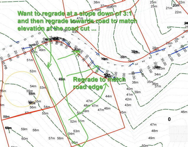
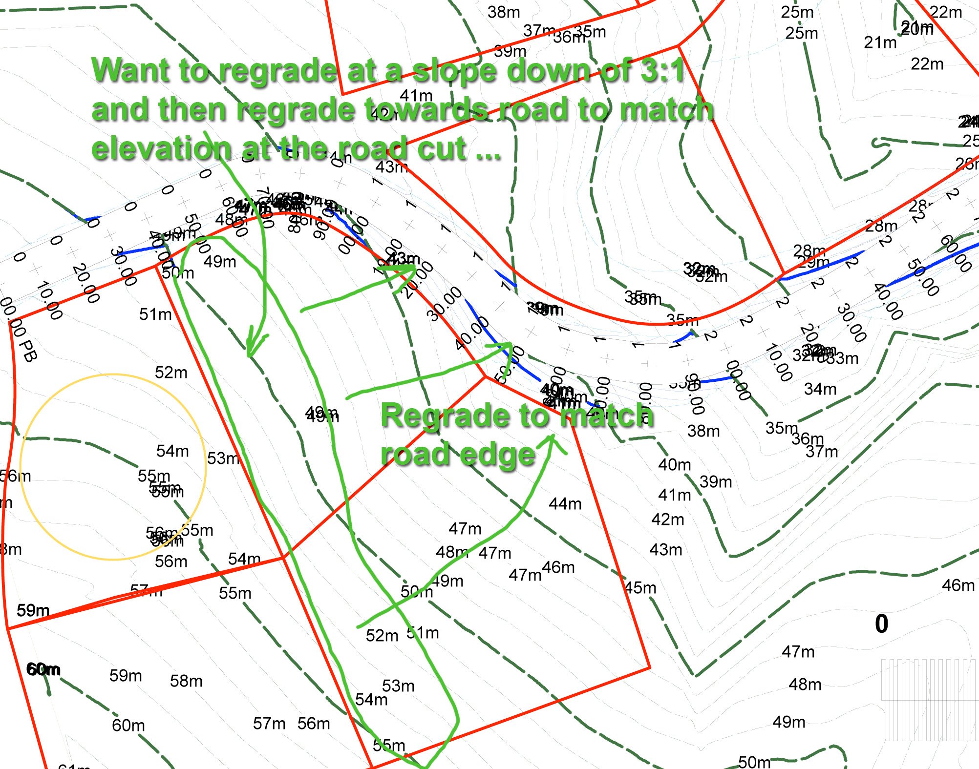
Hello Is there a way to add regrading to a site model so that the amount of earth moved from existing to proposed is determined ? I have a sloping site, and would like to recontour with a dozer so that the general elevations are lowered so the lands match the heights along a road cut. The constant plane pad with a set slope is a start, but not nearly able to reproduce what I am looking for. The attached image is what I am after .... to draw a pad alongside the roadway and set the elevations at each point matching the road elevation ... I did NOT have much success drawing a 3Dpolygon along the roadway and across the lot, with the desired elevations, and then using it to modify ... it didnt affect the model ... I did set the class to site-dtm-modifier ... and it was in the layer modifying the model ... but no effect upon updating. Operator error is an obvious start. Any suggestions for doing this ? or alternative approaches ? ************************************************************************************ Steve Dimond, GSC, M.Sc., P.Eng., Prince Edward Island, Canada MacOS 10.13.6, MacBookPro mid 2015, 16 Gb Ram, Vectorworks v2019 Designer, Renderworks