


Jose E. Calderon
-
Posts
41 -
Joined
-
Last visited
-
I have a drawing with text in 3D space. the text reads the elevation. I need to convert this text to a point loci which will alloe me to build a site model. File attached. surveryNaranjo4.vwx
-
 It it possible to createa road on a site model with a complex cross section profile? I have to design a road with a compelx road - gutter - shoulder profile. Look image attached . The examples in VW Land design only offers a road with a simpel square gutter. Any help?
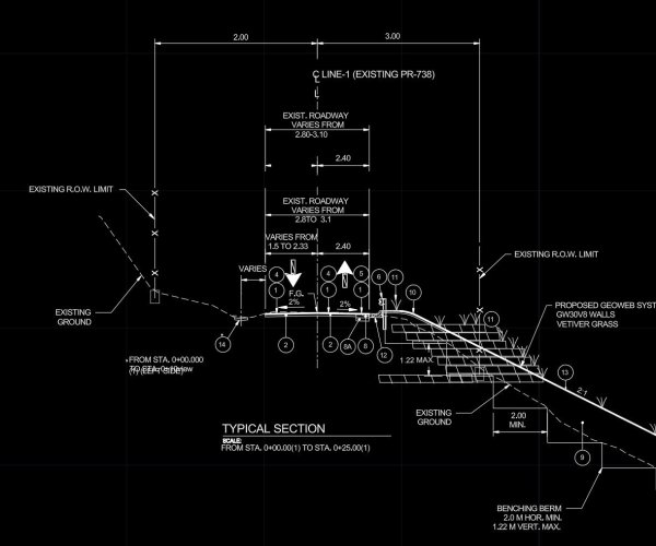
-
Thank you.. ! It was a invisible class.
-
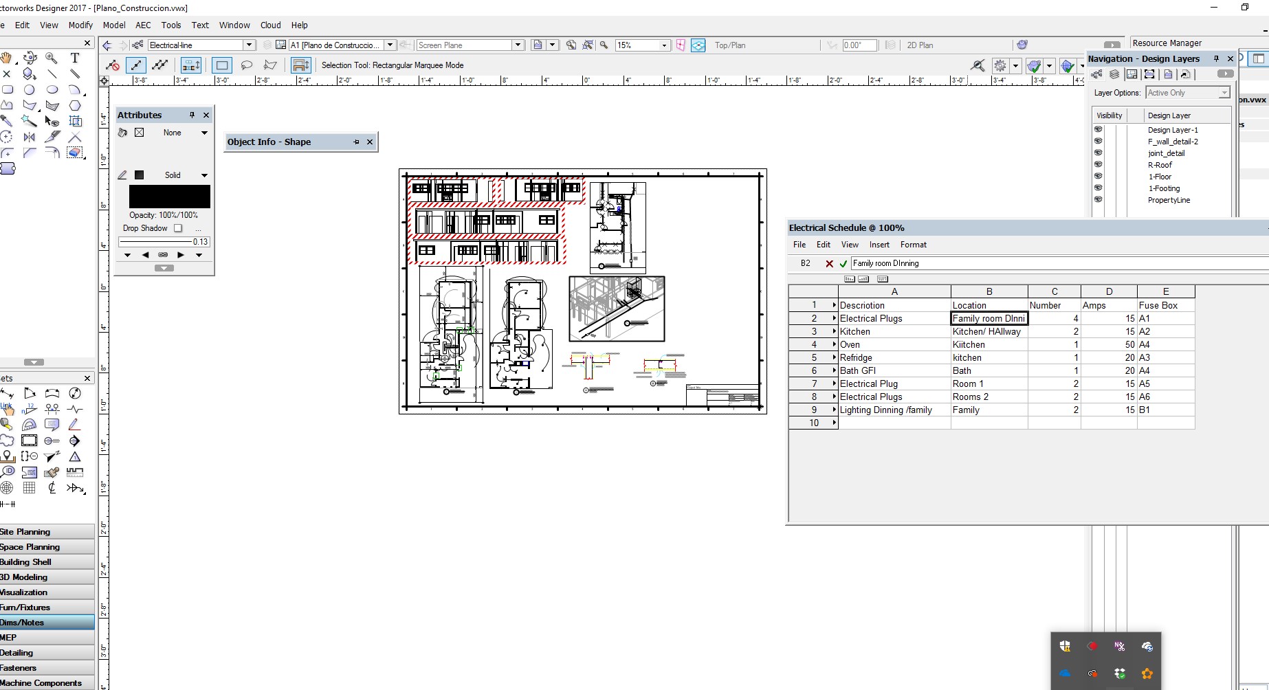
For some unknown reason, a created worksheet no longer displays on my sheet. I find the worksheet listed on my resources but I lost it in the sheet layer. What is the way to search for this lost items??? I opened the worksheet but it no longer displays in the page. Here is a link to th e file https://www.dropbox.com/s/km6thwwbjw59yvk/Plano_Construccion.vwx?dl=0
-
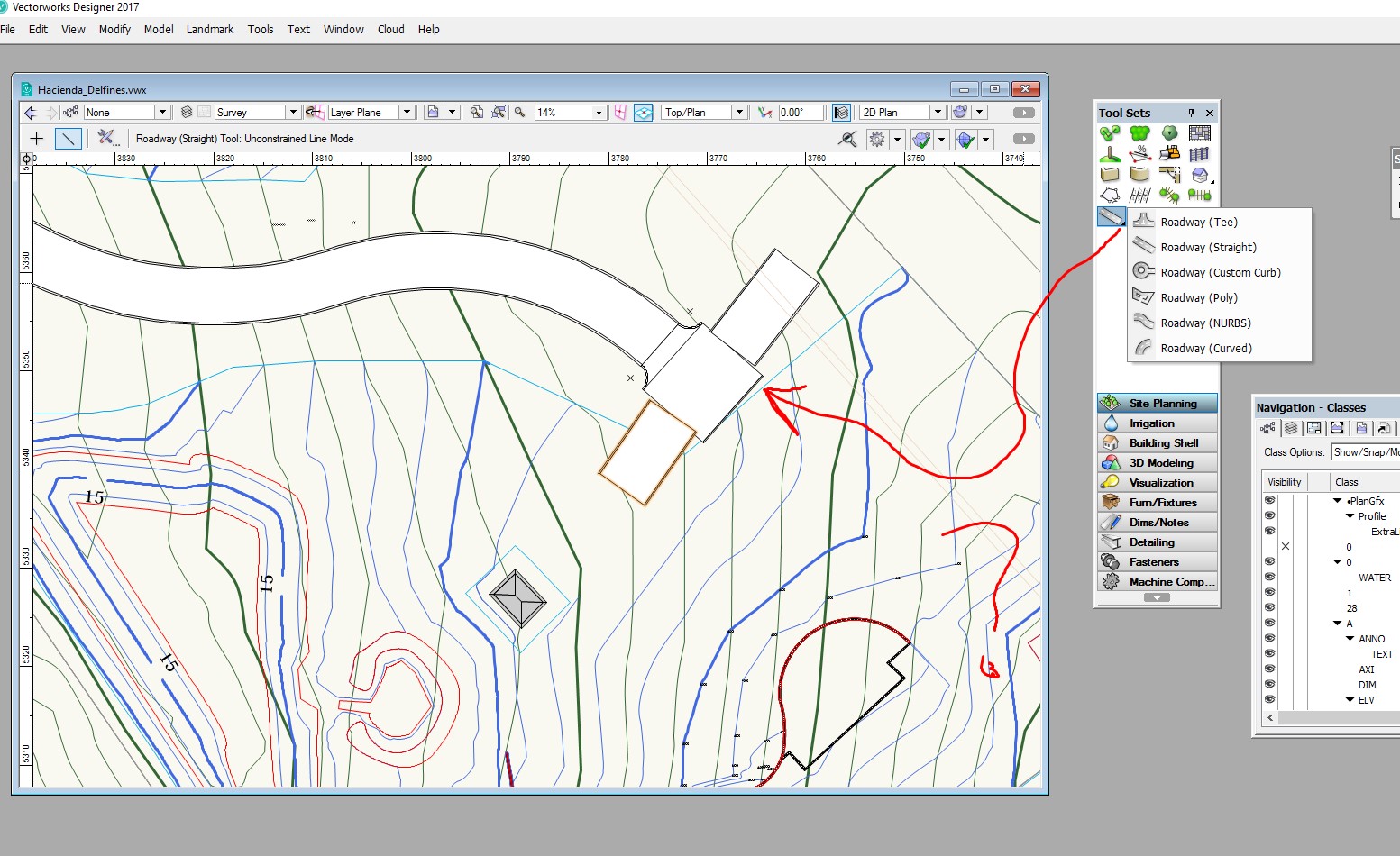
Landmark Road Tee does not join to straight road
Jose E. Calderon replied to Jose E. Calderon's topic in Site Design
Thank you for your contribution. I know this much.. You are using separate modifiers limits for each of the three sections. Use one modifier encapsulating all three sections -
I posted a previous post on this subject but got a limited response. I am simplifying the question this time. It is about the Road Tee command from landmark. I don't see any use of this tool. I align the Road Tee with a straight line , but this is not connecting to the straight line. Therefore, what is the use of this command? Can anyone come here with a good working example? I need to create a network of roads and parking lots connected the peripheral, but not getting too far. I am expecting everything to work 3D and with a site modifier over a site model.
-
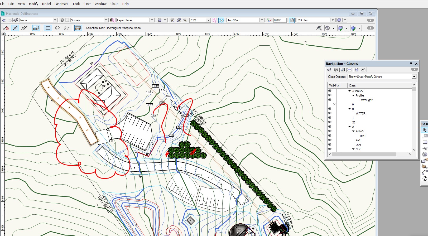
I have gone a long way . Need to design my interior roads and parking space. But I am not getting too far. To many problems not been able to join and site modifiers conflics. Please help. here is my problems. In my design , I have 2 roads and 2 parkings. I need to draw the Road T to access from main road to the parking lot. It looks like there are several ways to get there, but I am not getting very far. I use Polyline to draw 2 roads. Then I use the Road Custom command to do the parking area with the 2D Parkign command to create the parking configuration. But , I am not able to join the roads in a T. I created the 2 roads across my property , but not able to get the ROAD Tee to fit and join the roads. I must be doing something very wrong and the documentation doe not help. Here is the link to the VW file. https://www.dropbox.com/s/ro2ke5nzk1dqqh0/Hacienda_Delfines.vwx?dl=0
-
Problem crating a road frm polyline in Landmark road
Jose E. Calderon replied to Jose E. Calderon's topic in Site Design
Thank you but not sure what do you mean. The instruction says that to use the Polyline tools. There is only one polyline tool in 2D , therefore, how I make a polyline with Arcs only? -
Why I am not able to use the Stations on Polyline command from Landmark?
-
YEs but will rendering isometric views will work?
-
I need help with my Created roof from the walls. I do not know why the roof is residing several units above the wall. There is nothing that I tried to relocated the position. Here is a link to the VW file https://www.dropbox.com/s/ro2ke5nzk1dqqh0/Hacienda_Delfines.vwx?dl=0
-
I created my survey site model in one file and a building in a second file. From the Survey file, I attached the building file as a reference file. But Now , how do I translate and rotate the imported layer so that to register in the exact location over the site model? I see the reference layer , but it is placed way out of place.
-
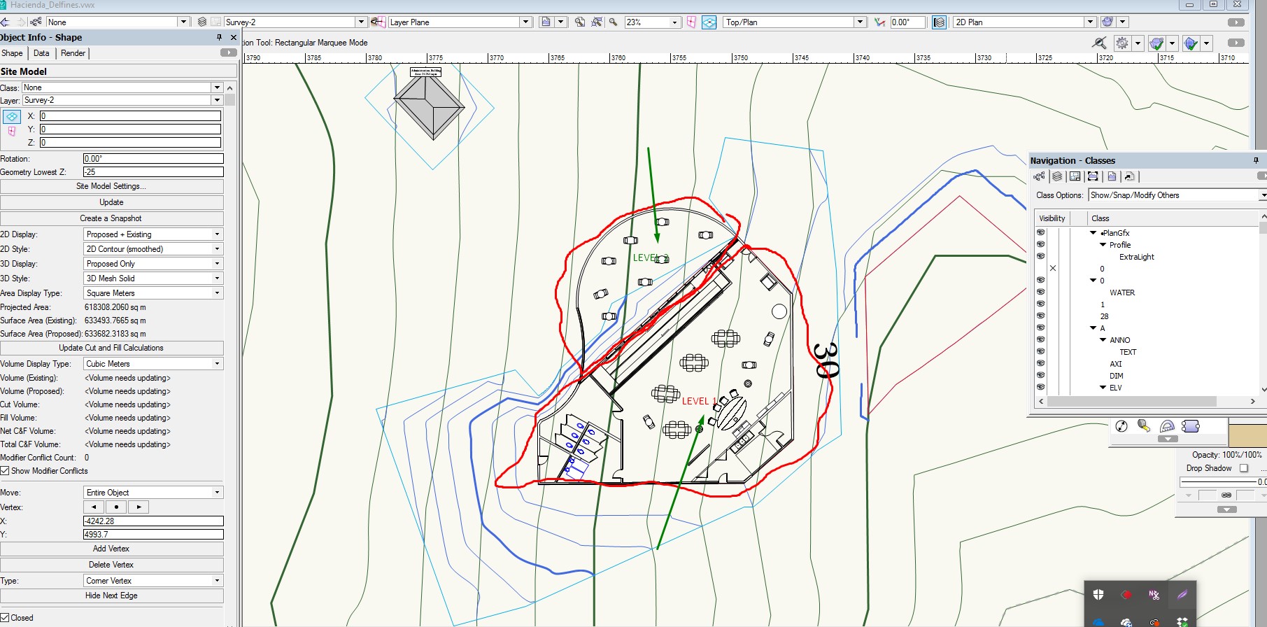
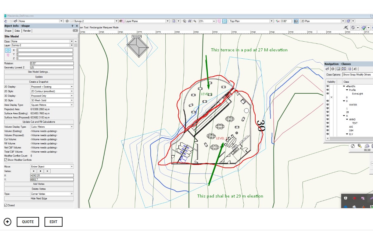
I am working with getting refine skills in Site Modeling. I have a small building resting over a steep hill . I designed one floor building with a terrace at one level and the remaining area steps up into another pad elevation. I have trouble setting the Site Modifier for Pad with retaining wall and normal pad. The problem that I face is that the pad are joined together alone the line that separated both sections of the building returns an error. What technique I need to apply? IS there a better technique to tackle this situation. I sea a lot videos but they don t really take into account Pad modifiers that are aligned one next to the other touching together. Here is a link to the VW drawing... https://www.dropbox.com/s/ro2ke5nzk1dqqh0/Hacienda_Delfines.vwx?dl=0
-
Can yo post a link to the video?
-
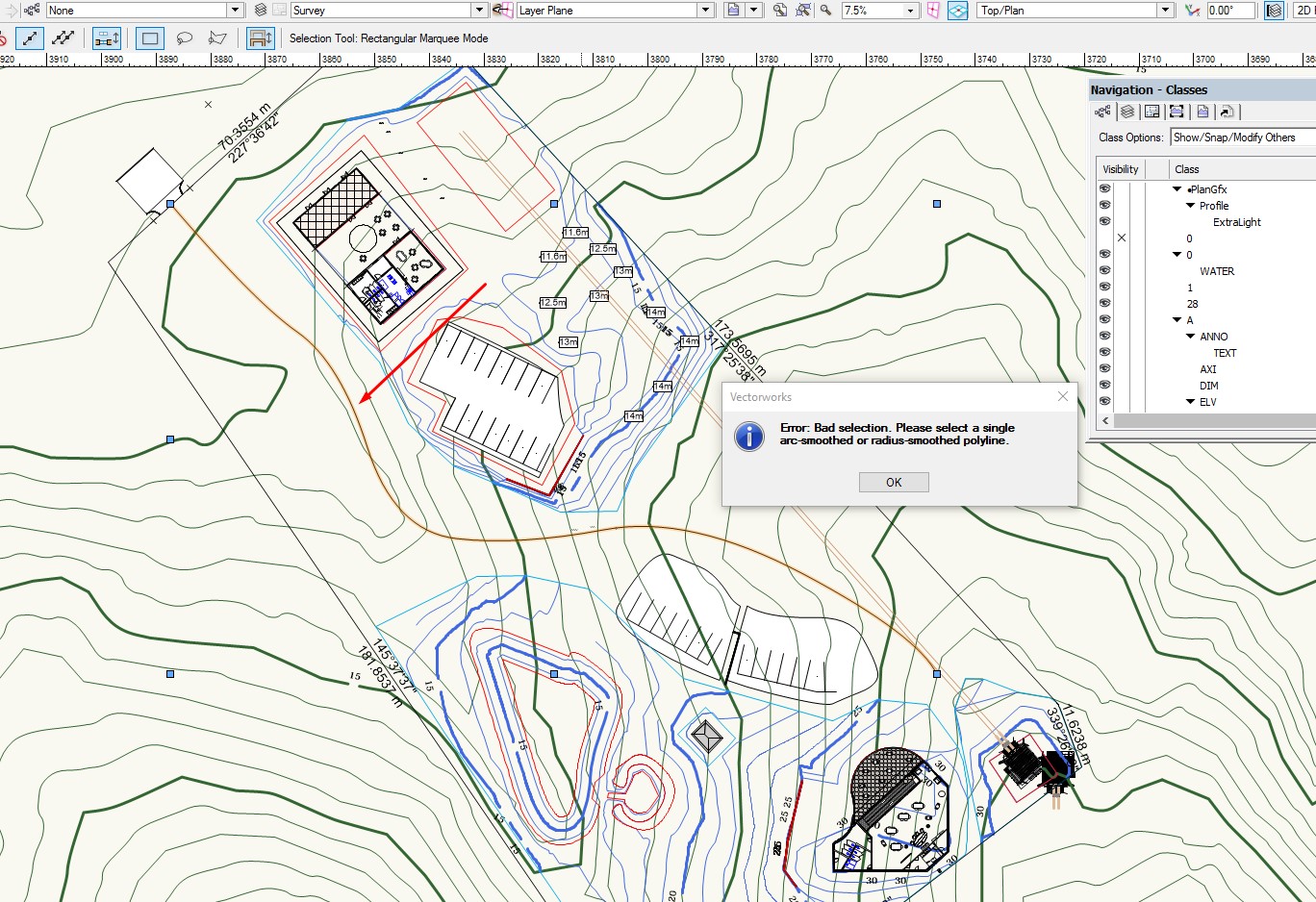
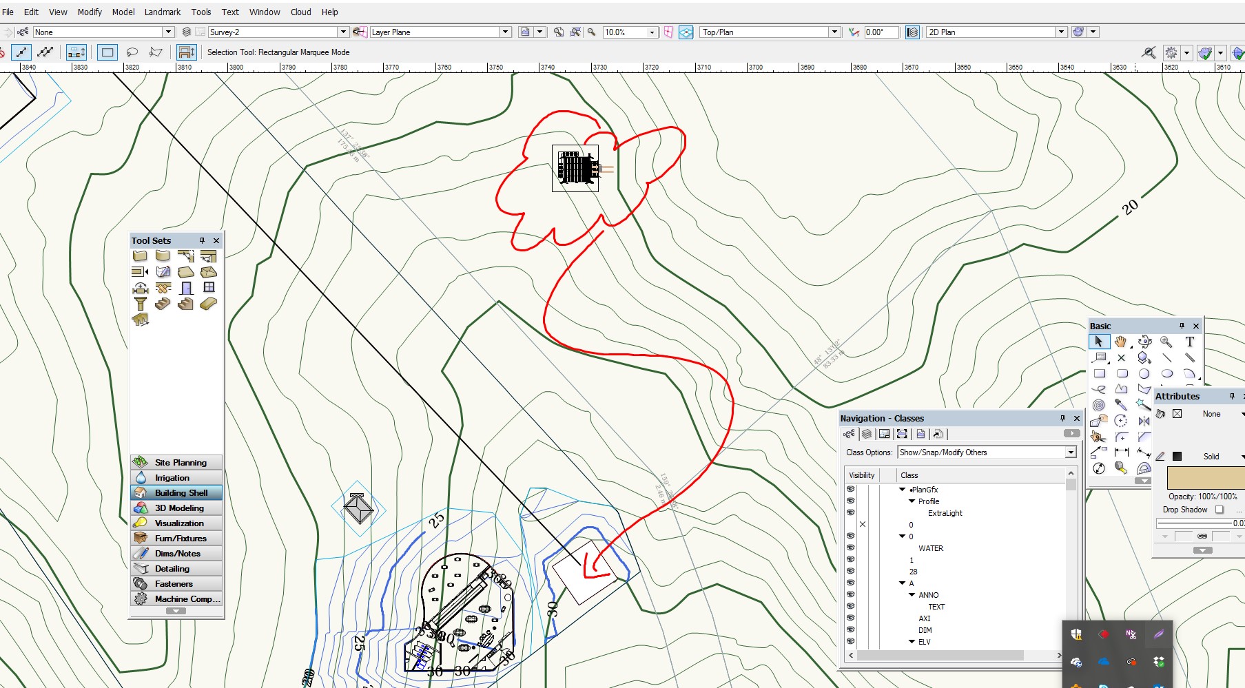
I need help mastering site modifiers tools. I have trouble getting the Boundary limit around a pad. I have set a boundary site modifier for the property limit. Proposed Site Model looks good. But I entered a second smaller grade modifier inside the property surrounding a site modifier pad. But the second boundary limit is not acting as expected. The pad is created but the contour is modified all the way to the outside boundary limit of the property. https://www.dropbox.com/s/ro2ke5nzk1dqqh0/Hacienda_Delfines.vwx?dl=0

