J. Wallace
-
Posts
702 -
Joined
-
Last visited
4 Followers


Recent Profile Visitors
4,406 profile views


-
 We have 1 VW 2024 Landmark license to sell. Please email me or message me if you are interested. License transfer fee paid by purchaser.
 -
Data Visualization settings not saving when file closed
J. Wallace replied to J. Wallace's topic in Site Design
Thanks @Mark Aceto that was very helpful. Take care. -
Data Visualization settings not saving when file closed
J. Wallace replied to J. Wallace's topic in Site Design
Thank you @Tom W. and @Mark Aceto I played around with this a bit more and exported the visualization to my user folder. That seemed to fix the issue. I'm not sure why this does not auto-save to the file itself, but I'm happy I can now use this powerful tool and not lose my work. Thank you both again. -
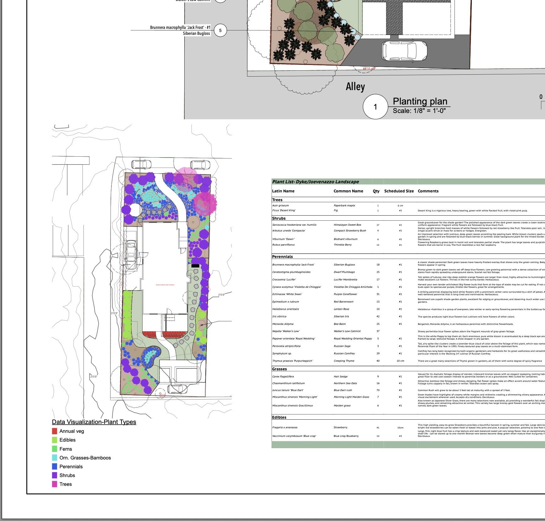
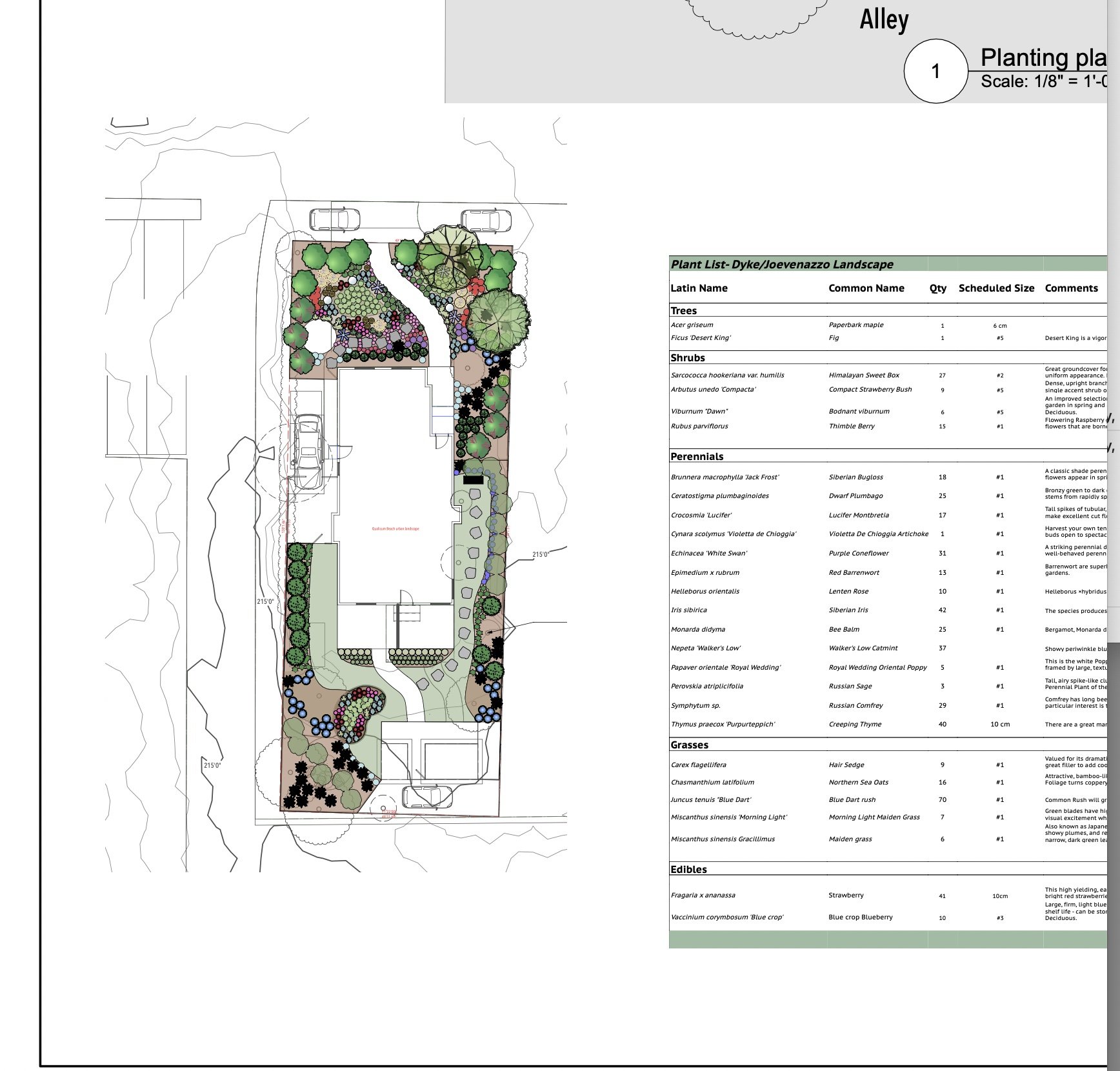
I have a question for those more familiar with the data visualization tool. I have only used this a few times, but it seems like a very powerful tool. In the example below, i printed out a pdf of a design sheet, which I finished up late yesterday. When I opened the file this morning, the file was as I expected it to be, except the data visualization effects were gone. When I click on the viewport and go under the data visualization tab, it does not list the settings I created the day before. Any help would be much appreciated. Screenshots below show last evening's and this mornings results.

-
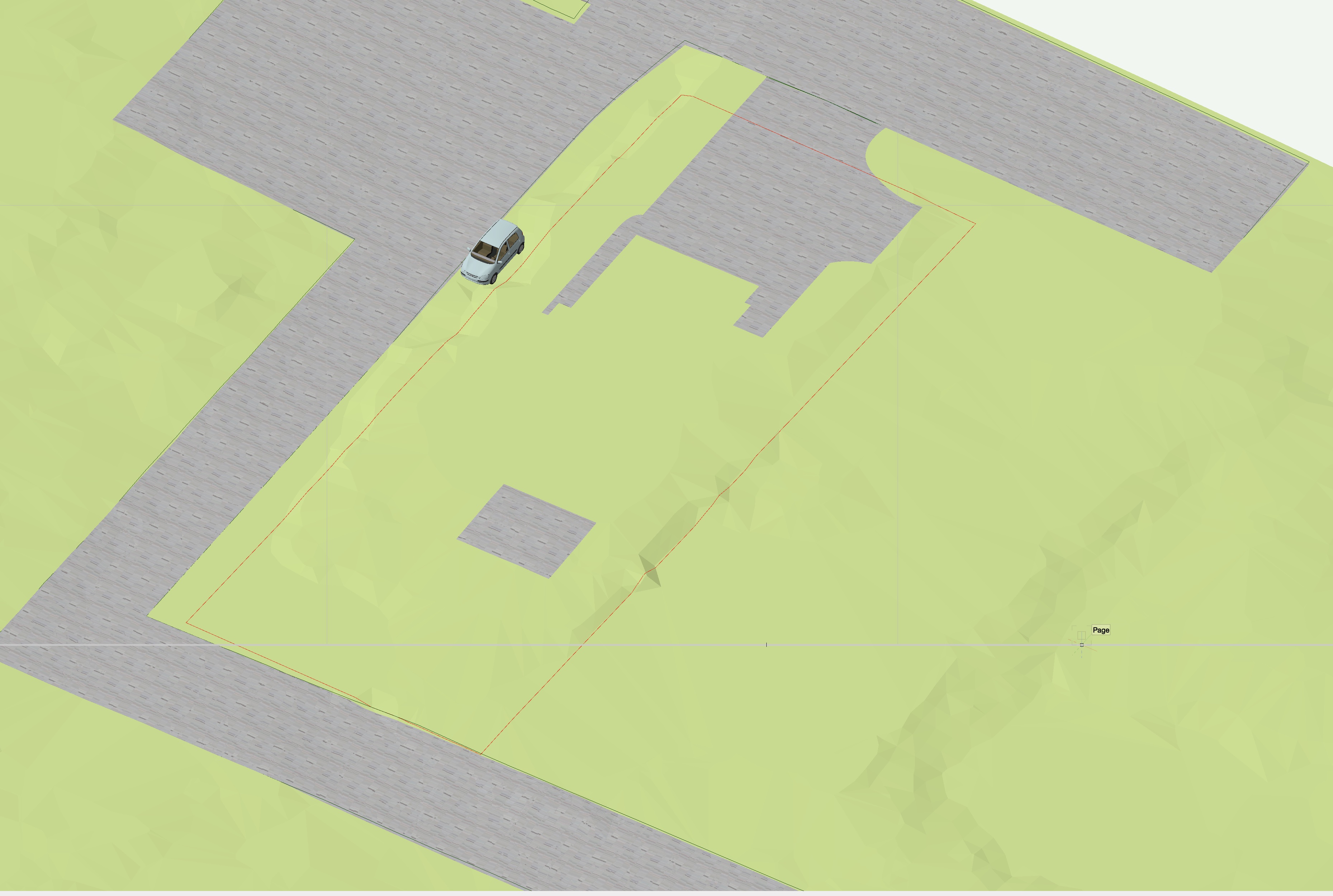
Easiest way to drape a property line on a site model?
J. Wallace replied to JonKoch's topic in Site Design
@jeff prince thanks for pointing that out. Hadn't considered that approach before. -
Easiest way to drape a property line on a site model?
J. Wallace replied to JonKoch's topic in Site Design
@JonKoch we often create a 3d polygon(copy the property line and then paste in place) then send this to the surface. Just make sure to do this in a 2d overhead view and update your site model.
-
Thanks very much @Tom W. and @Jonathan Pickup Super helpful information 👍
-
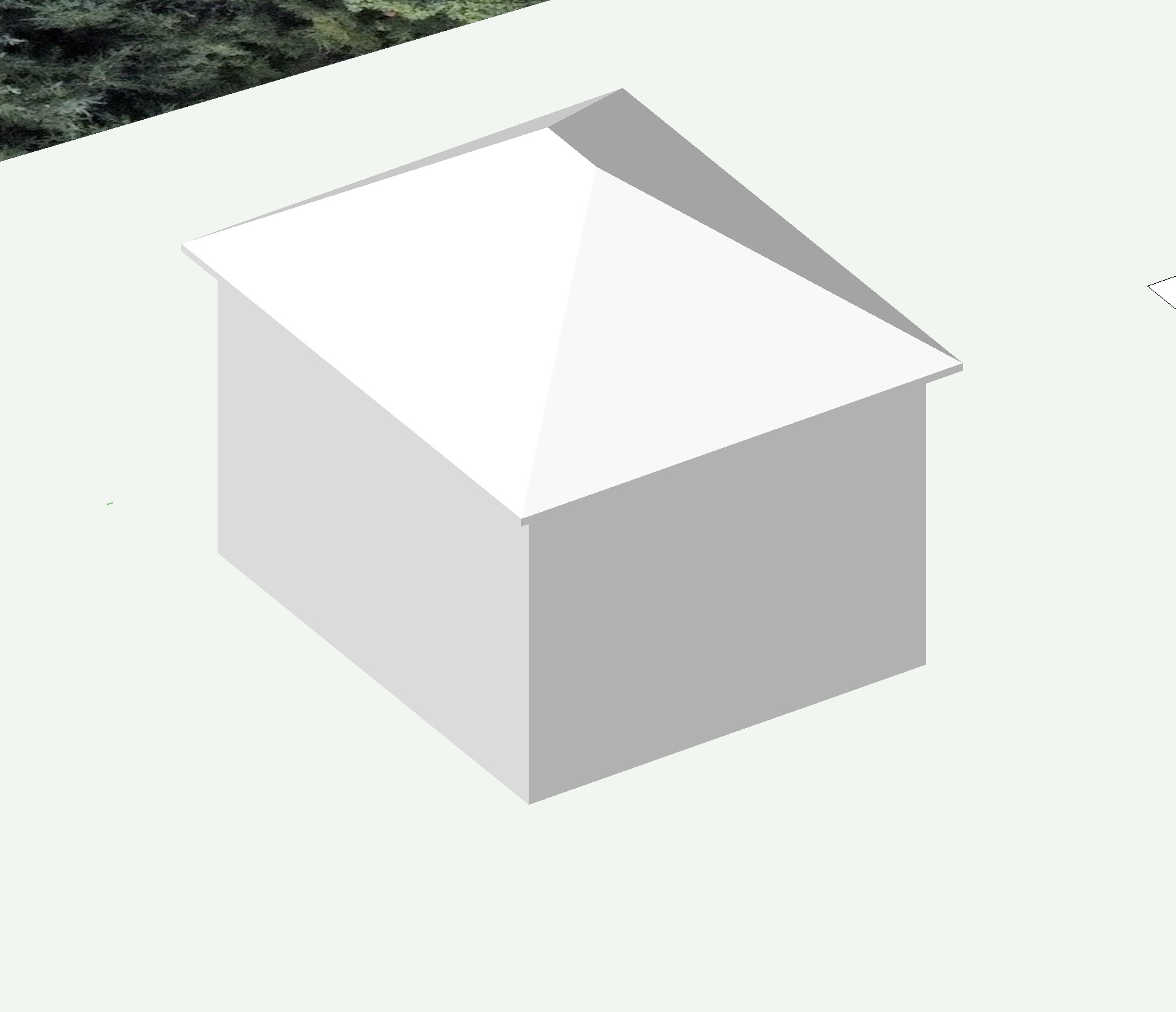
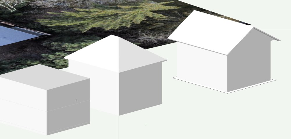
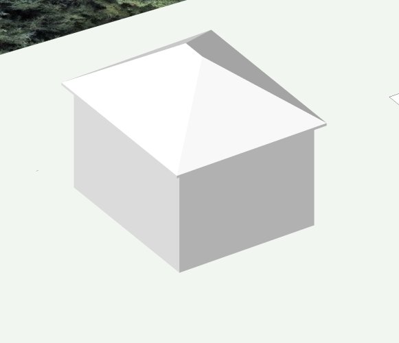
Thanks very much @Jonathan Pickup and @cberg Jonathan editing the roof after creating the massing object was still cumbersome and didn't give me the results I was hoping for. I opted to create four wall and a roof surface and edited as @cberg suggested (this process didn't work with a massing model). Worked like a charm, thanks very much 😀 PS seems like a gable roof should be an option within the massing model OIP
-
Hello all I'm placing a massing model into a landscape drawing and would like to place a gable roof on the model instead of the default which is shown below. I'm not sure if I'm missing something obvious but thought I would reach out to this group for some feedback. I did search for this topic on the forum and didn't see anything, also found some reference within VW Landmark help but it is quite confusing. Thanks to any ideas or solutions.😀
-
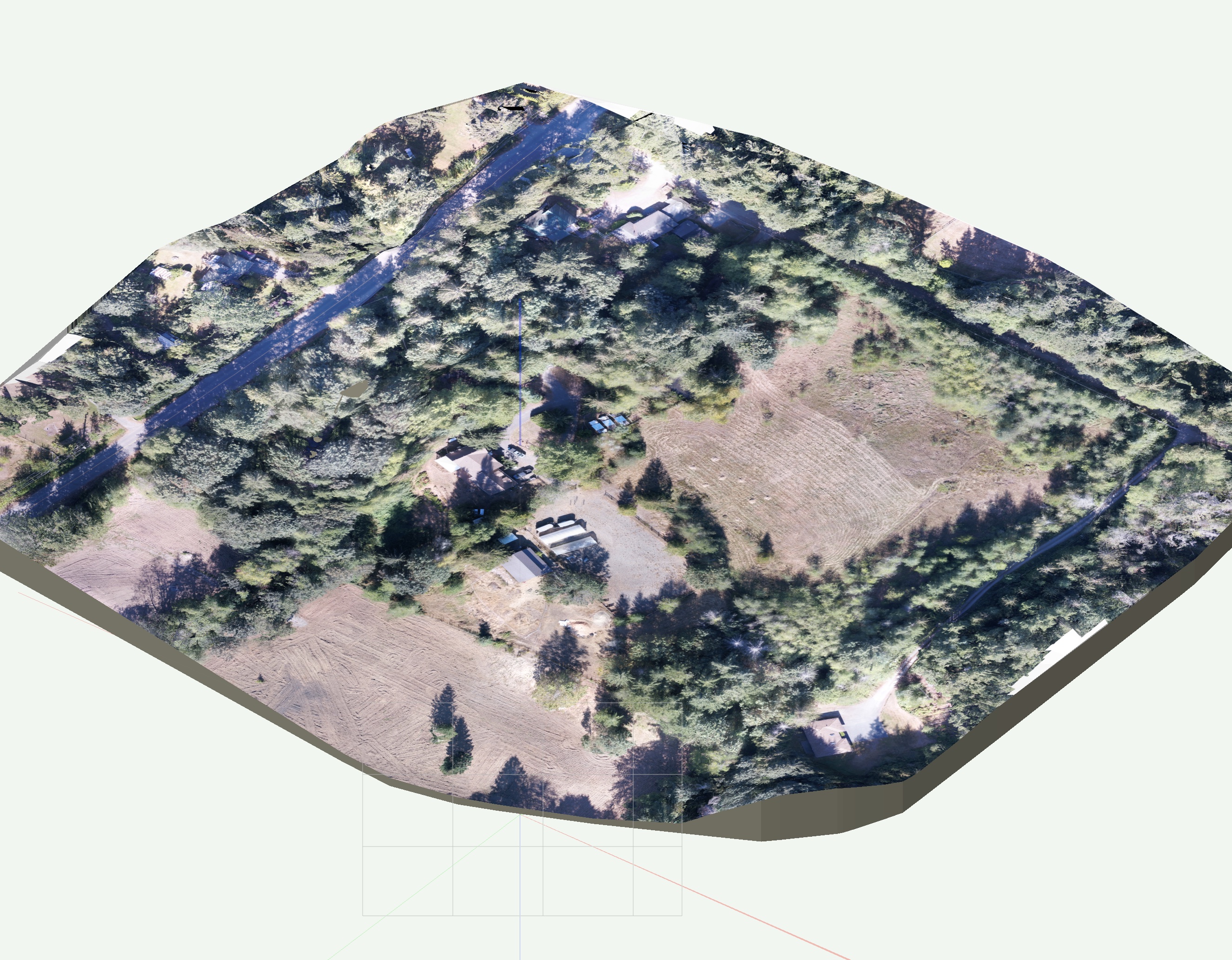
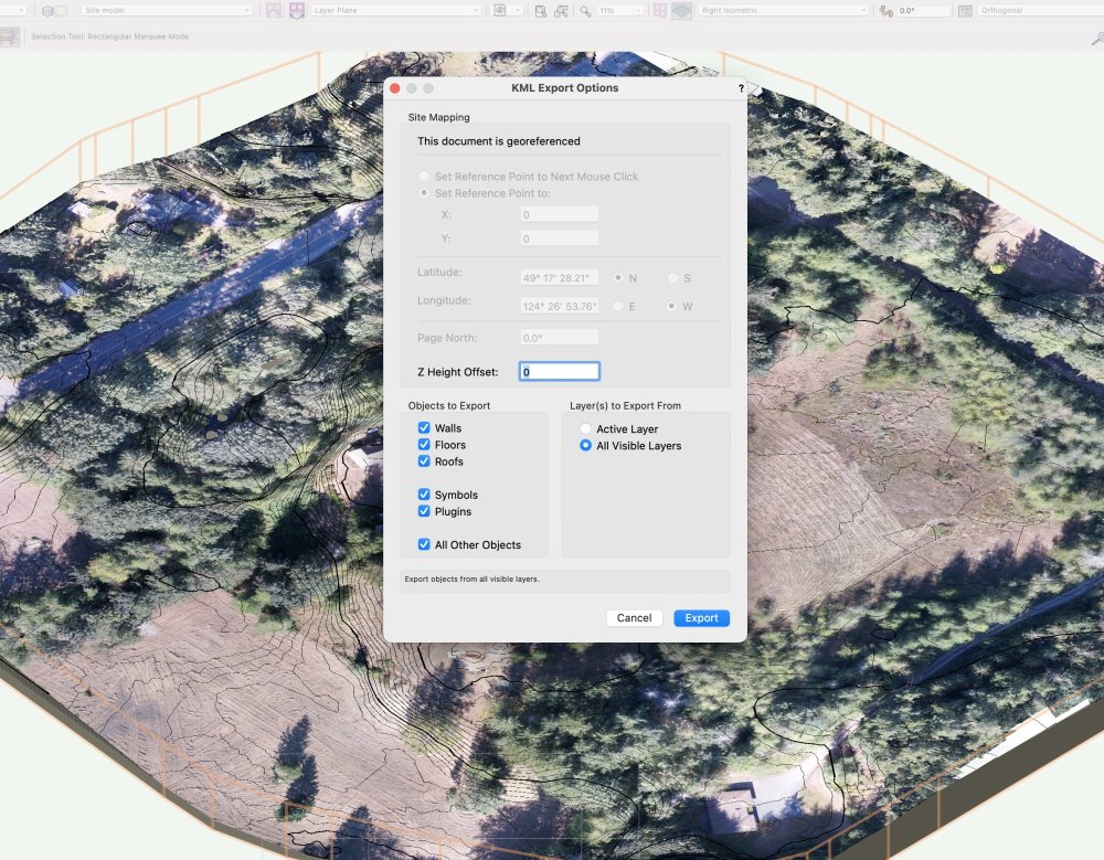
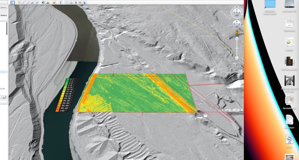
@AlanW that is super interesting, thanks for that. I gave it a try the export .kml command (didn't realize it existed). Unfortunately the results are not ideal. When you export from QGIS (not a site model but other items such as contours) these will stick to the terrain. The VW export has some artifacts within the site model and the model will site above GE. When I enter a negative value of elevation to compensate for the site (178m) (during export) the model does not sit properly. GE has lots of limitations so you can't make any adjustments to the imported elevation after the fact. It seem like they are half way there, I look forward to seeing this refined one day.

- 6 replies
-
- 1
-

-
- sitemodel
- siteanalysis
- (and 1 more)
-
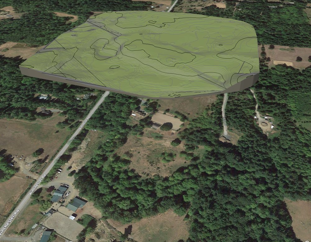
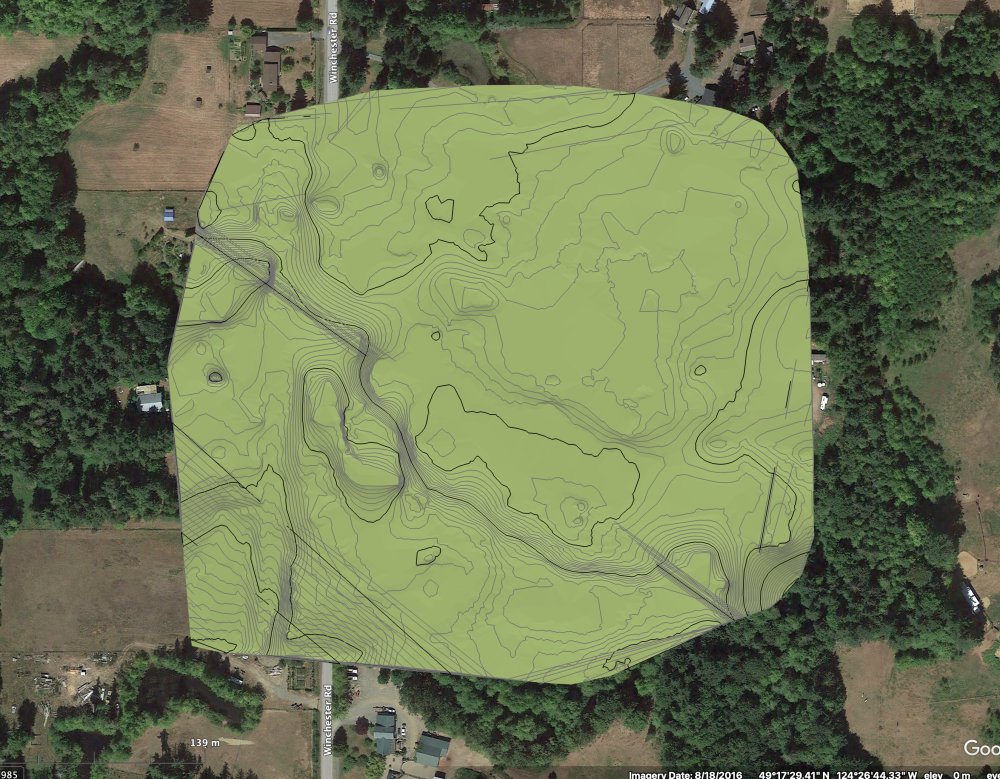
Applying georeferenced drone image to site model
J. Wallace replied to J. Wallace's topic in Site Design
@jeff prince thanks again. After some fiddling around I got it to work.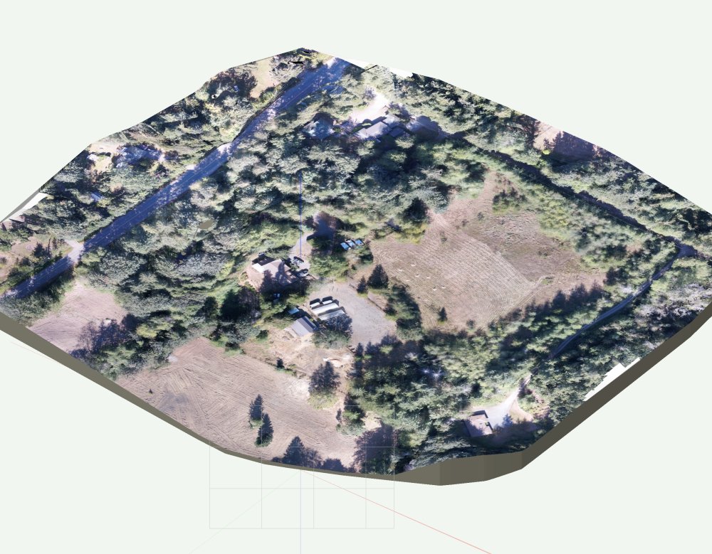
-
Applying georeferenced drone image to site model
J. Wallace replied to J. Wallace's topic in Site Design
Thanks very much @jeff prince. When I posted this question I thought you might be the one who could/would answer it. I'll give it a go tomorrow morning and post the results. Thanks again. 😀 -
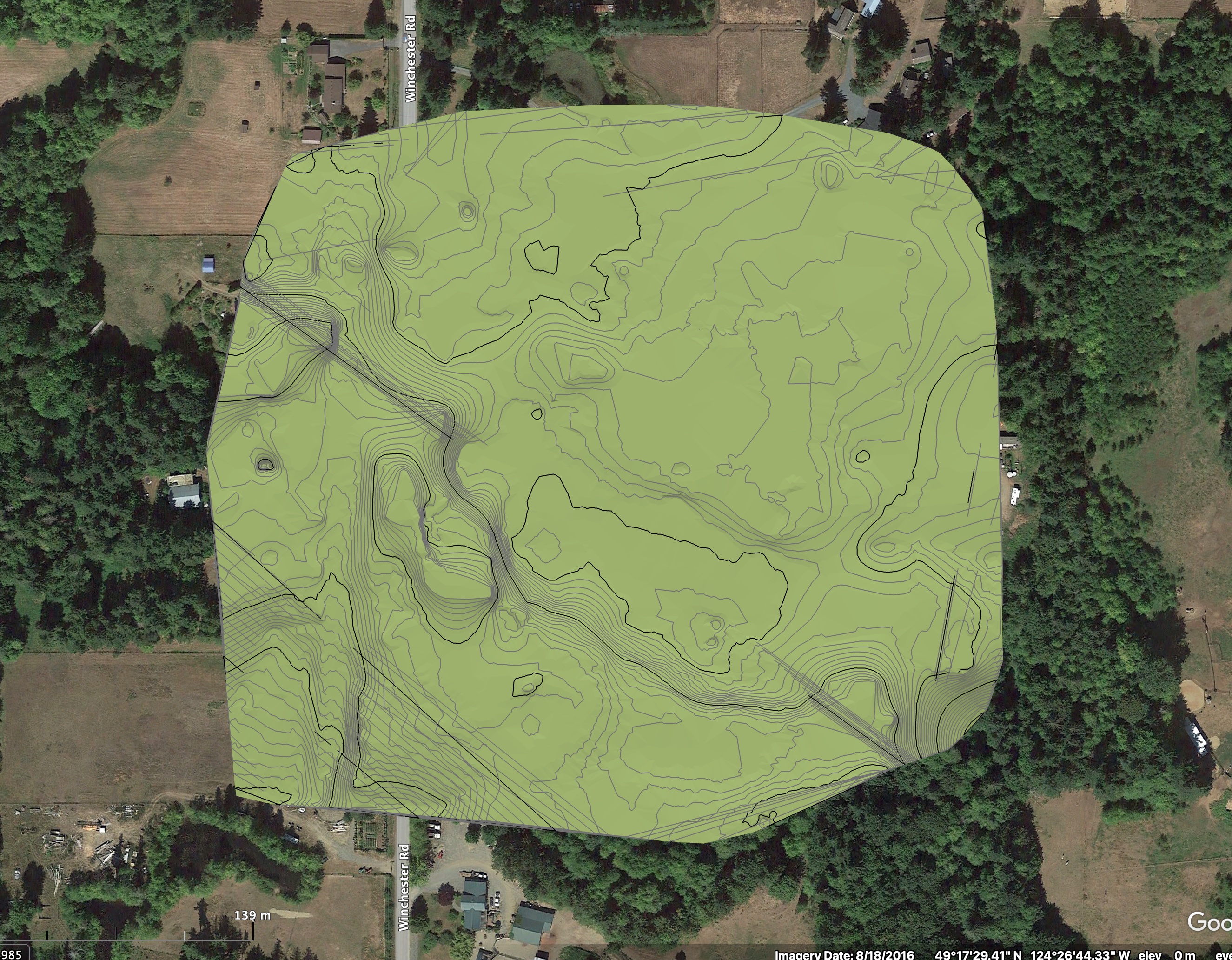
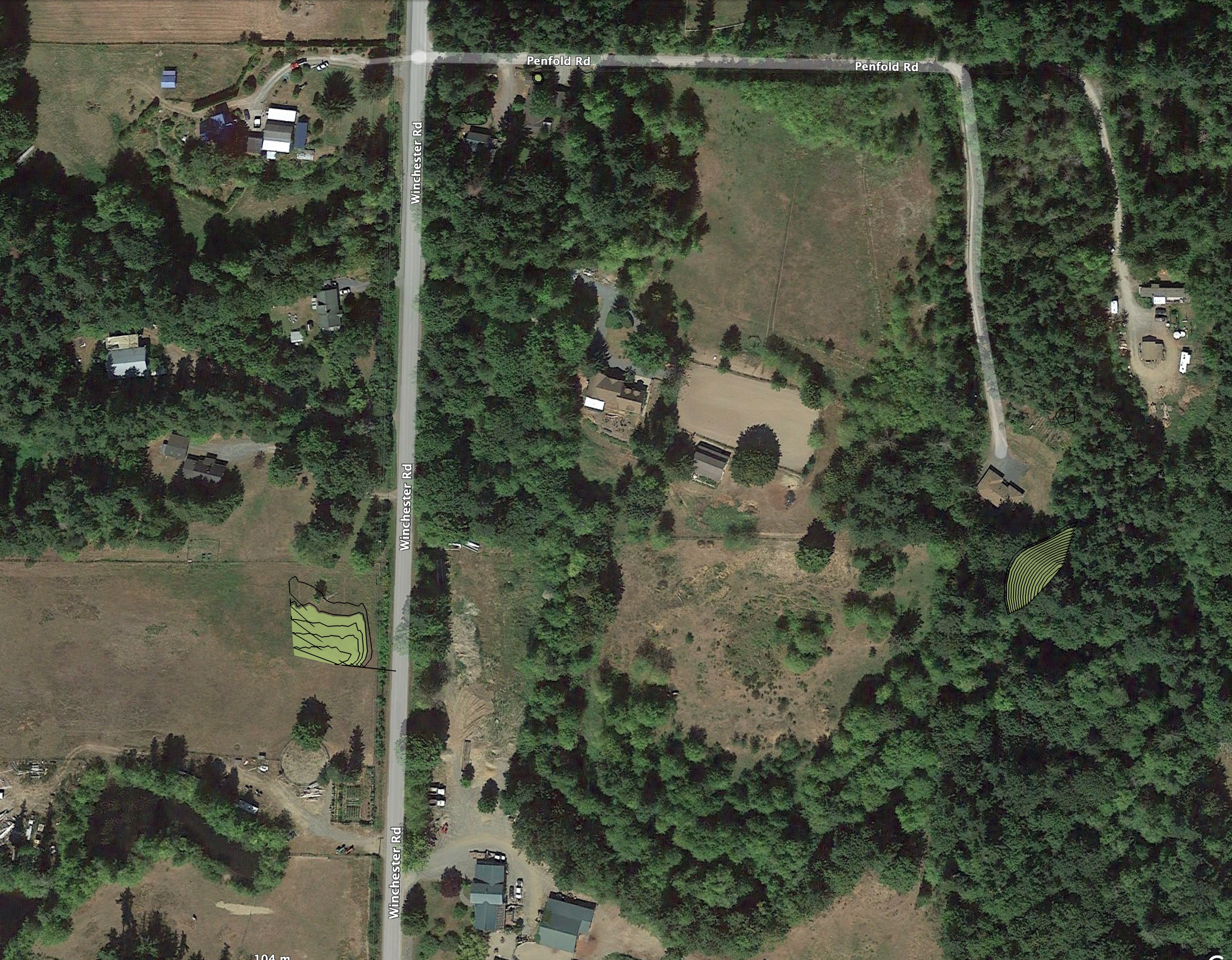
@unearthed I use QGIS for slope analysis. I find it is provides me with better results, the down side is a big learning curve. One thing I do love about QGIS which I would love to see in VW is the ability to export .kml files which can be imported to google earth. A great way to share information with a client. Here's an example...I can't upload the .kmz file for GE or I would have.
- 6 replies
-
- 3
-
-
- sitemodel
- siteanalysis
- (and 1 more)
-
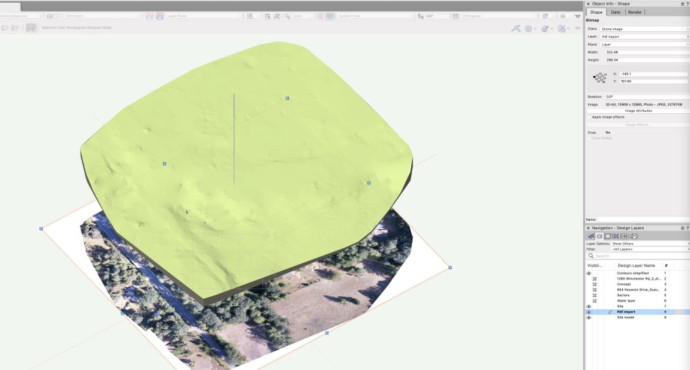
Hello everyone. I have just imported some geoeferenced contour data, created a site model as well as importing a high resolution image. These came from a drone survey. After watching a VW university video on Enhance site file collaboration with georeferencing I see that in VW 2020 (I'm using VW Landmark 2022)you can place a georeferenced image onto a site model. In the video example the image was downloaded using an ArchGIS service. I'm hoping to simply place my drone image onto the site model but I don't see any information on this. I'm assuming that this should be possible. I appreciate any feedback anyone might have. Thanks
-
Good morning @line-weight, I have been playing around with QGIS and CloudCompare for a couple of years. These are pretty amazing softwares that have really been a game changer for us. We are primarliy using this for converting LIDAR imagery that is freely available in BC, Canada. https://governmentofbc.maps.arcgis.com/apps/MapSeries/index.html?appid=d06b37979b0c4709b7fcf2a1ed458e03 The learning curve is pretty steep but it's worth the effort in my opinion. I signed up for this online QGIS course which I can access when I'm working with it. http://www.regrarians.org/qgis-for-mapping-and-design/ Take care and good luck
- 21 replies
-
- 3
-
-
- site design
- site model
- (and 3 more)