-
Posts
87 -
Joined
-
Last visited
Reputation
58 ExcellentPersonal Information
-
Occupation
Landscape Designer
-
Homepage
https://www.kaleiopedesign.com
-
Location
United States
Recent Profile Visitors
The recent visitors block is disabled and is not being shown to other users.
-
Worksheet not picking up landscape area plants
Peter W Flint replied to Nic_Berry's topic in Site Design
I am troubleshooting a number if issues related to the OP with two different LAs on preformatted reports. For instance, some plant images are not rendering in the worksheet. Thoughts are welcome. Reprex attached. Thx, PWF 2024-03-19_forumReprex_wkshtPltImage.vwx -
Is the 'Nomad' app still alive and does anyone use it?
Peter W Flint replied to line-weight's topic in General Discussion
I have shared models in the last few months with some of my tech-savvier/enthusiastic clients and not heard any complaints. There are some UI improvements that address the learning-curve, notably the `?` Help icon with some simple graphic instructions. Classes can also be toggled on and off, those are the improvements addressed over the course of this thread. However, there seem to be some issues in the course of introducing those features that have now made the app less set-up friendly on the deisgner end. For instance, I'm not getting consistent results with availability of higher level PIOs in .vgx files generated after the latest series of updates. Ie doors, windows, landscape areas, fences, or texture beds will not display or be available in class selection. That is a significant step back. Layer organization also seems somewhat arbitrary, meaning layers will not be arranged according to the order in which they are specified in the original file, but they are also not arranged alphabetically so I've not tracked the logic on that. In defense of the developers, I am still drawing in v2022 and the issues above may be related to that. Overall I would say it is still a useful tool provided its limitations are understood, maybe at the conceptual phase when still playing with massing and spatial arrangements. But it now requires more time and energy to set up at more advanced stages of design and I suspect is ultimately more confusing for an end user or client. As an example, I am preparing for a review next week and do not anticipate introducing it as a presentation tool. PWF -
Plant catalog imports field values as records
Peter W Flint replied to Peter W Flint's question in Troubleshooting
Fair point. I think this was partly "complain as problem-solving" and screaming into the void. There is an issue with the way the data is formatted in the catalogs and the way it is read into a new catalog from the edit plant style dialog in the RM, but it works when creating a new plant from the Landmark menu. I am struggling to find a way to reproduce in a time efficient way. Will probably set aside and return to it once I am clear on the necessary steps. -
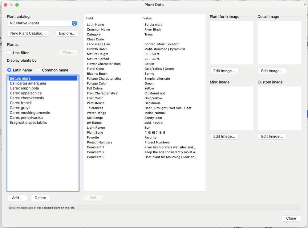
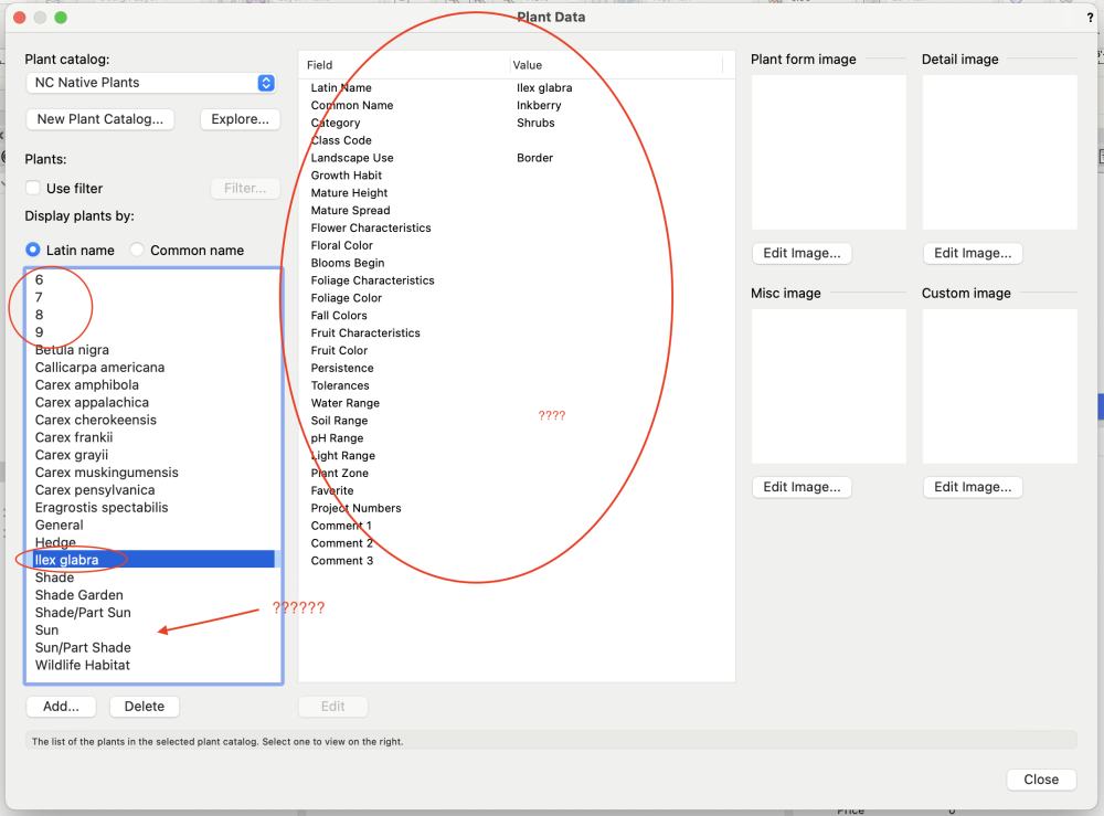
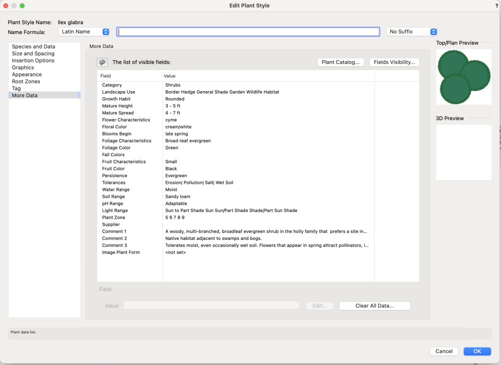
EDIT for clarity: I use the field/record terminology for tabular data as commonly used in GIS applications. When I use the term "record" I am referring to what would be called a "row" on a spreadsheet or an "observation" in other data related disciplines. I am not referring to VW resource records. When prompted to add a new or edited plant style to the catalog, VW will interpret some of the data as new records (or rows) from the values in each field. The pattern I have been able to determine is some hidden delimiter in the data that ships from one of the Vectorworks catalogs. When I create plant data from scratch I am able to import and export between catalogs without issue. As an example, here are some screenshots from one plant edited in the VW2008 catalog. I have edited the flower characteristics, tolerances, and comments fields. It seems when there are multiple values delimited by a space in the same field, VW will interpret as a new record. If I include a pipe (|) VW for read as multiple values. This is not user-friendly. Please do not reply with advice for using plant styles in their own drawings or to avoid use of the plant catalog. I am already familiar with these approaches.
-
Prompted by discussion in this FR, I am able to assign tags to objects in the resource manager but unable to filter by them. I suggest a "filter by tag" drop-down somewhere in the vicinty of the "filter by resource" drop down on the RM ribbon. This adds another layer of visibility once drawings become resource saturated. PWF
-
In my very limited understanding, the reason the folders are "typed" by "things" is because each "thing" involves a different data type. So line types involve one type of data, textures another, and records another. Higher level objects call these different data types into their geometry/settings as specified, which is part of what allows for their customizability. Hence all the "zNested" folders. I agree with the spirit of posts that VW has not quite dialed this in for industry use cases. The design of the RM is really more of a file browser, so "general folders" would actually be drawings stored somewhere in user defaults. I find that even with understanding this philosophically, my resource management is a hot mess. One solution to the "mix and match" request is tags. I am able to add tags to individual resources, however I don't seem to be able to filter by tags. I am unsure what the logic is here in terms of interface design. PWF
-
Problem: Wall components will not complete in a random corner. Solution: 1. Attempt to join walls. 2. Once properly befuddled, ask for help on VW forum. 3. Read the solution. 4. Retry after reading. 5. Success! Weird.
-
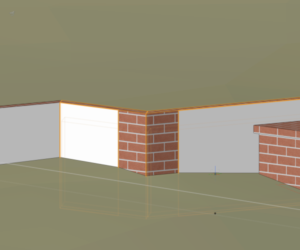
Any thoughts on why the geometry for one component of a foundation wall would fail to complete (or fail to render) for this corner? Its the only corner out of 10ish. See screenshot and file. Thanks, PWF 2024-01-25_wall-comp_forumReprex.vwx
-
Mapping Textures to Scaled Symbols
Peter W Flint replied to Peter W Flint's question in Troubleshooting
Using a material for the original extrude resolves the issue. Still curious as to whether the behavior posed above is expected. -
In the drawing attached I have three identical symbols at varying scales. A texture has been applied in 3d editing space via the texture mapping tool. The object with no scaling renders correctly, the others with upper or lower scaling simply revert back to having a fill. Is this normal? VW 2022 SP6 PWF 2023-09-27_forumReprex_scaledPaver.vwx
-
Symbol insertion Tool - does anyone use it?
Peter W Flint replied to bcd's topic in General Discussion
Similar with @Tom W. I use it via resource selection in the RM, but less so within the tool palette itself. If it's cluttering space, I recommend removing it from the basic tool palette via a custom work space. -
Support for Geopackage files
Peter W Flint posted a question in Wishlist - Feature and Content Requests
The shapefile's hegemony over spatial file formats is quickly becoming outdated in terms of variability and portability, its many limitations are outlined here. Currently the only real useful option when exporting is the the ability to modify attribute records that can then be used as modifiers inside VW. Also, weird things happen in .shp exports (like data coming in as integer!!) The only other export alternatives from spatial applications is the .dxf file, which limits efficiency in modifying by record. I personally like the geopackage format developed by OGC. It permits multiple layers to be stored in one file along with style information. Its an open standard. As of yet unlimited file size, other benefits are listed in the link above. But I am open to other spatial formats if members of the VW community have strong opinions. PWF -
Question about leaders for plant data tags
Peter W Flint replied to laurakukulski's topic in Site Design
What size sheets are you using? I’ve noticed a lot of residential designers limiting themselves to 11x17 and this definitely limits available space. I’ve found with residential clients that ARCH C is small enough to casually roll out on the breakfast table but large enough to get a good scale along with notes and schedules. -
Question about leaders for plant data tags
Peter W Flint replied to laurakukulski's topic in Site Design
@bob cleaver looks like Laura & Jeff covered it for me. Basic premise is pairing the tag ID with an image so any reasonable person can go, “Ah, this picture means this plant, and this tag means this plant, and they are the same so I will put this plant here.” Added redundancy also helps reduce drawing errors from being implemented in the field. -
I’m not at my workstation so can’t verify, but my recollection is that fence tool will send to surface but will not read terrain, it will pick a z-value (lowest?, highest?, avg?) and set the entire fence at that elevation. One work-around I’ve seen is to create one panel, create duplicates with move-by-points, and send each individual panel to the surface. This gets things done okay graphically but doesn’t give you good BIM data. PWF


