
Anna Guzman
-
Posts
38 -
Joined
-
Last visited
1 Follower

Recent Profile Visitors
1,443 profile views


-
Hello, I am trying to change a couple site analysis colors in the Site Model settings on Vectorworks 2024 Landmark, and it doesn't let me change them, I can select the color I want, but as soon as I press ok, the color goes back to the ones I had before, could it be a glitch in the new Vectorworks version? We still have a couple 2022 licenses in the office and are able to change them on those versions. Thanks!
-
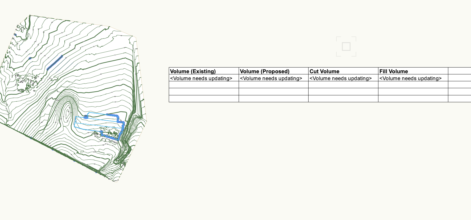
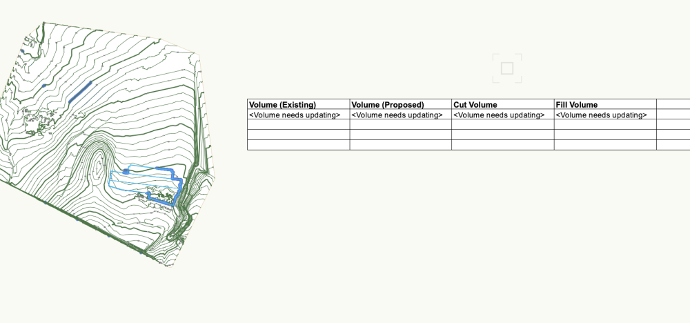
Hi, I'm having the same issue, is there a work around like a report or something to get the calculations in the meantime? I really need to run volumes on a couple site modifiers, but I tried with a report and it keeps saying "Volume needs updating". If someone knows I'll appreciate it. Thanks.
-
Hello! Is there a way to get the roadway slope between stations represented on a road object? Also, is there a way to show the value of "z" for each station automatically as well? Thank you!
-
Apple macOS 12 Monterey Compatibility - Feedback
Anna Guzman replied to JuanP's topic in News You Need
Hi everyone! Just updated to latest Beta version of Monterey, and I can't get Vectorworks 2020 to run! Anyone else working with previous Vectorworks versions having the same issues? Should I downgrade to Big Sur or try reinstalling Vectorworks? Any tips? Started having issues this morning, before upgrading to Beta 12.1 of Monterey, that Vectorworks did boot, but no windows were showing, thought it was because of the Monterey update pending, but now, Vectorworks won't even launch. Thanks!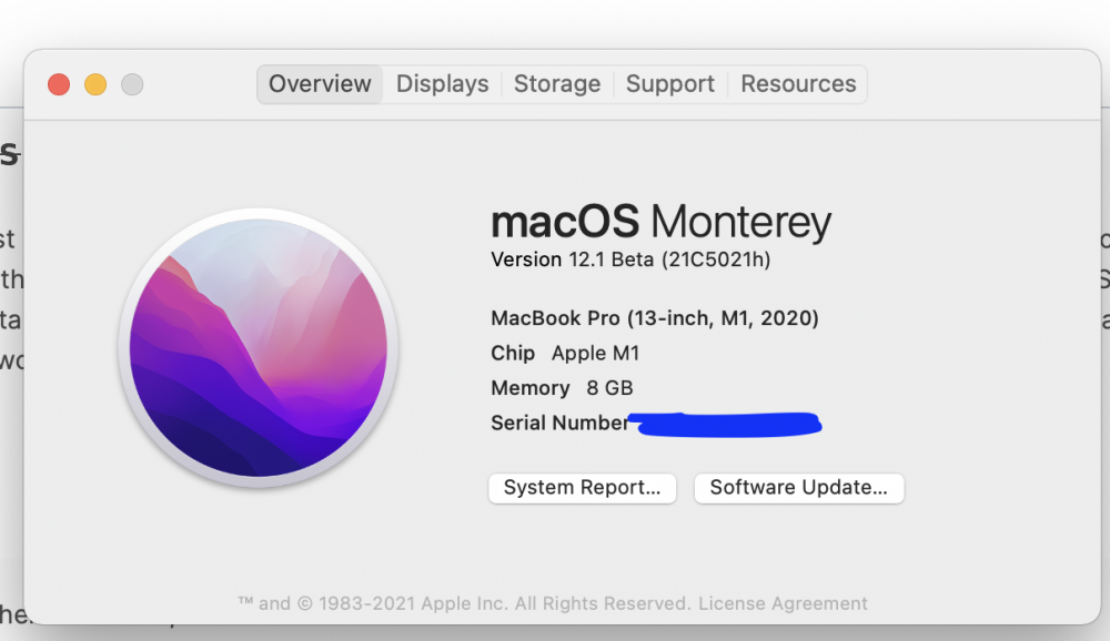
-
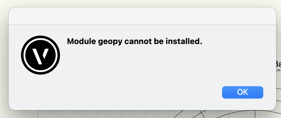
Hello, I just stumbled upon these tools, and seem very interesting. I downloaded the files and tried using the WindRose first. After changing the location, I get a message to install "python module geopy" but after accepting I get an error message, is there a workaround to install this module? Thanks!
-
Thanks!
-
Hello! I have been trying to use the Geolocate tool to add a Geoimage to a couple of projects I have located in Monterrey Mexico. I keep getting back a "Error when downloading the image" message, and can't seem to understand which server to use to actually get the images. I've browsed through the available servers, but can't seem to find one that will show the information for the locations I have for my projects, is this an issue with other countries as well? Can anyone let me know if there is actually a server I could use to get these images? Or if there's a way to use maybe Google maps or any other open sourced map server? Thanks!
-
Apple macOS 11.0Big Sur Compatibility - Feedback
Anna Guzman replied to JuanP's topic in News You Need
@JuanP yes! this was it, now running smoothly, thanks! -
Apple macOS 11.0Big Sur Compatibility - Feedback
Anna Guzman replied to JuanP's topic in News You Need
Hi all. I just upgraded my OS to Big Sur on my MacBook Pro (2018), and everything seems to operate and function well in Landmark 2020. Been working pretty much the same without problems both 2D-3D. The only issue I've experienced so far, is that when I input the cmnd+s to save, the software shuts down. It does do the save, but I have to relaunch the app. If I press "yes" on the autosave I have programmed every 10 minutes, the save command works and the software keeps running. Also if I prompt the File menu and save manually, it works as well. So far, no any other issues. -
Thank you so much Tamsin, I have been having issues getting the internal origin to work correctly on my files, there must be a step I'm missing, I'll try your suggestion of the circle. Thanks again for the tips on the aligned hardscape!
-
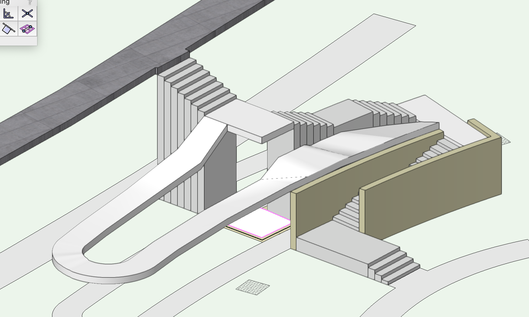
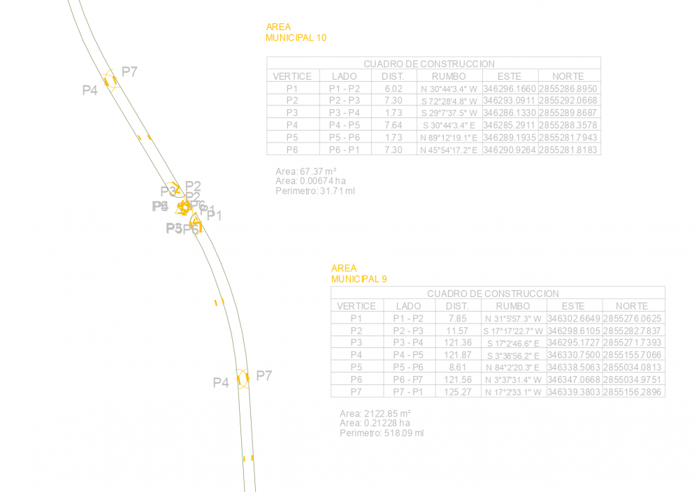
@Tamsin Slatter Hi Tamsin, I ran into this conversation about hardscape alignments. I'm having trouble with it as well. As you can see I have 2 slabs, and a ramp between them. I'm trying to align the "ramp" to both these slabs, but something seems to not be working, and when prompting the "edit surface modifiers", nothing is visible. Could you point out what I have wrong in this model? Thanks! IBC-CD-MP-P5.vwx

-
Pat, thank you so much, we managed to rearrange information to present our drawing. We created a custom report and no longer have to show the specific property line segment records for each property line. Thanks anyways.
-
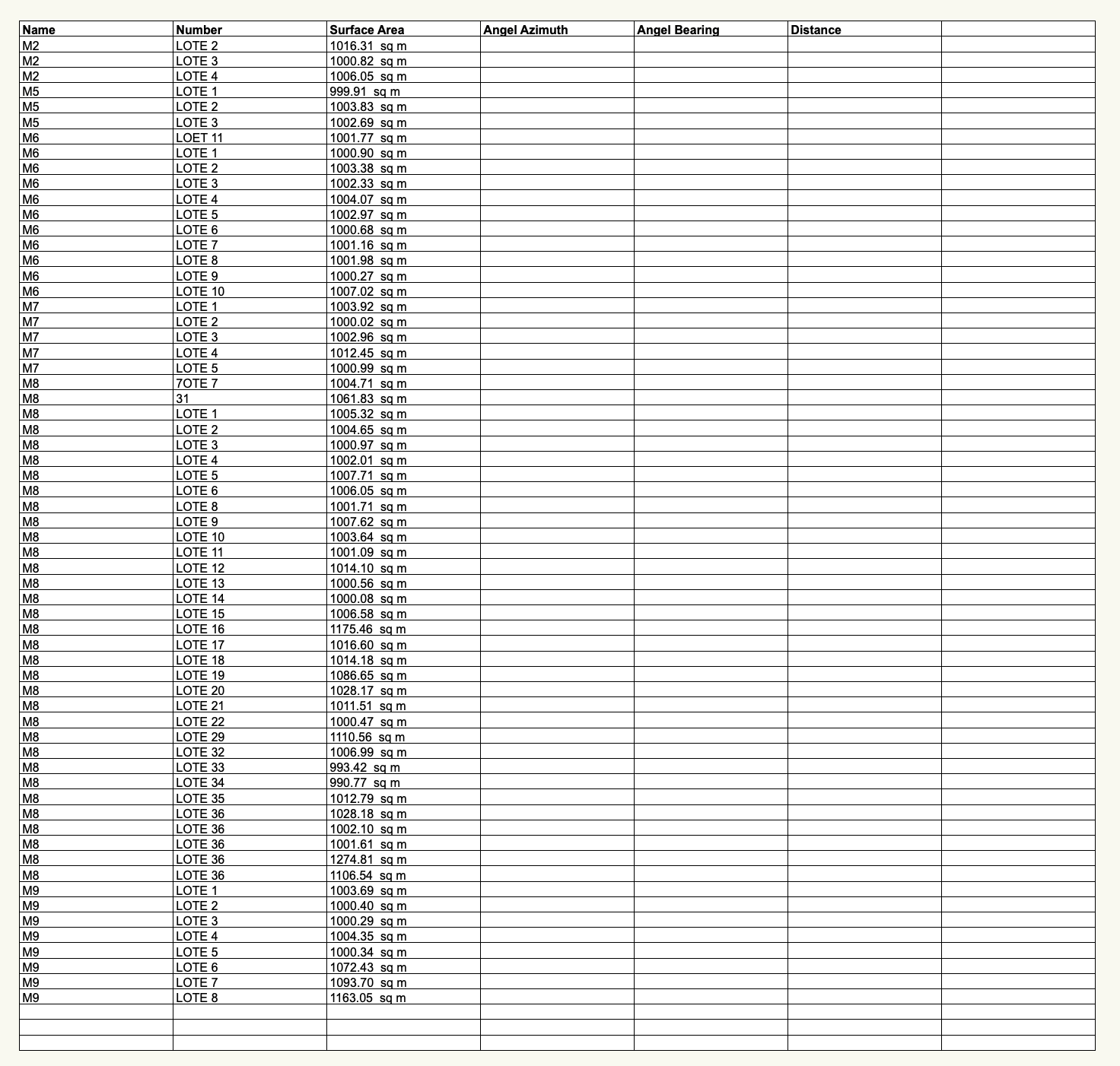
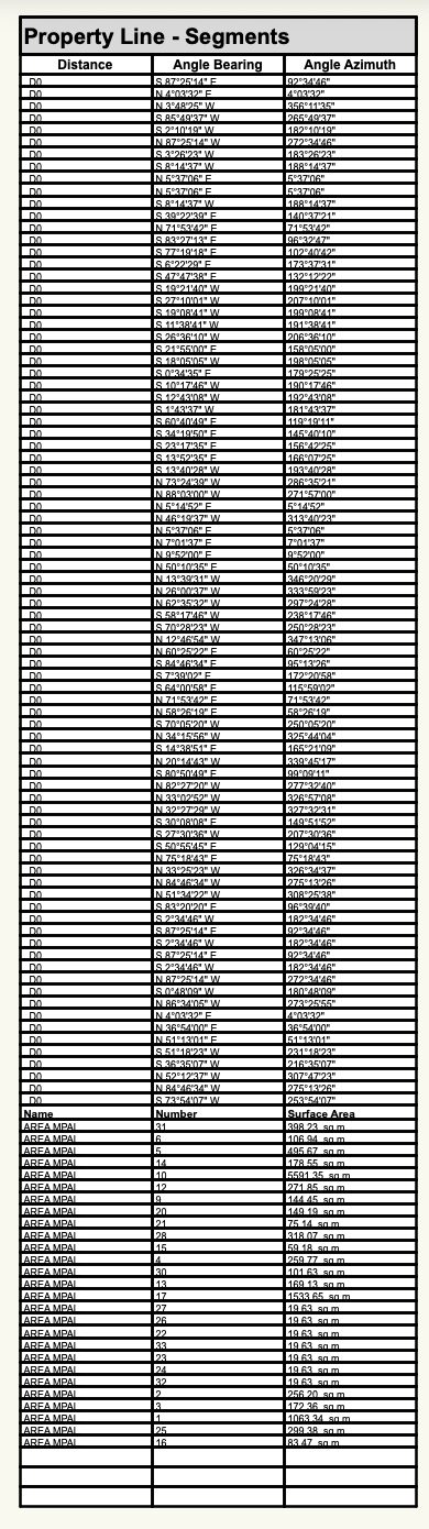
I managed to create a custom report adding the NAME NUMBER SURFACE AREA fields, but now, I get no info on the segment records.
-
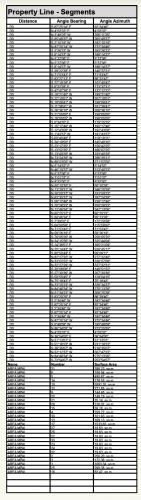
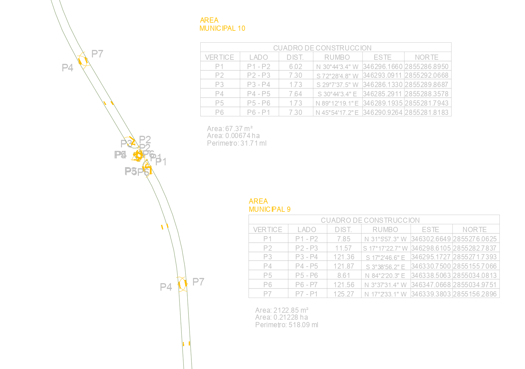
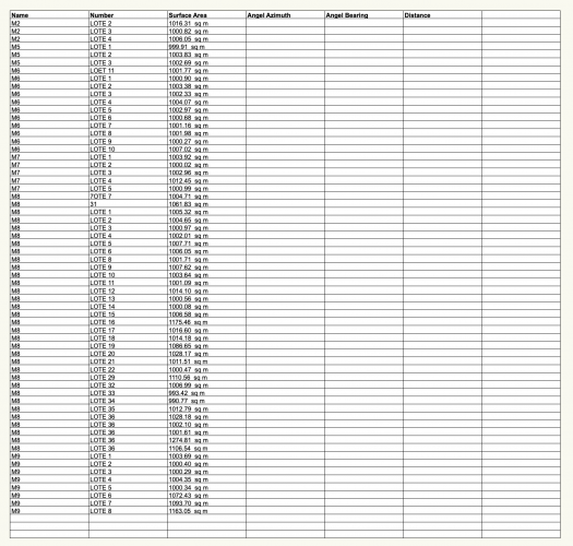
I'm looking to get maybe individual reports for each property line I have, which would look something like this, these I generated with an AutoCAD plug-in that annotates segments for a specific polygon, and also shows the polygon name + area + segment distance + angle. Please let me know if something like this is possible in Vectorworks.
-
Follow up: I have tried to place a "preformatted report" on property line segments, and then create a custom report adding the "Name, Number, Surface area" fields and append it to the existing report, but it adds it at the bottom of the report, not as columns to recognize the initial angle, distance that would belong to each property line next to it's name.