J. Wallace
-
Posts
702 -
Joined
-
Last visited
Content Type
Profiles
Forums
Events
Articles
Marionette
Store
Everything posted by J. Wallace
-
Thought folks might like to see this as there has been some discussion on the new iMac Pro lately.
-
@JohnAthaydeyou might want to check out this post...
-
Have a great holiday season. Thank you for all participating in this excellent forum, it's been a game changer for me.
-

Object Info Palette does not work properly in VW2018 SP2
J. Wallace replied to Kaare Baekgaard's question in Known Issues
I'm having issue with the OIP pallet today, does not display the highlighted item unless you select File>save. -
Resource Browser image size
J. Wallace replied to domer1322's question in Wishlist - Feature and Content Requests
Totally agree, colours within the colour palette are another small hard to distinguish item. -
Thank you @zoomer and @Benson Shawfor those comments. I found the culprit. Some how a pad was hidden within another pad which seemed to cause the crash. You can see I'm getting a few pads. It would sure be nice if there was a way of automating an offset when snapping in a site modifier class so that no pads would ever overlap or touch. I usually draw a polyline>offset the shape 1mm>create objects from shape>site modifier. Still seem to get conflicts occurring.
-
I have just started using VW 2018 landmark and noticed that when site modifiers conflict (touching) that I get VW crashing instead of the usual modifier conflict count in the OIP. Anyone else finding this?
-
Double ouch if your looking at this with Canadian dollars... $6,300
-
Dual Dimensions in the OIP
J. Wallace replied to Bruce Kieffer's question in Wishlist - Feature and Content Requests
Totally agree, I often need to flip between feet/inches and meters. Anything to improve this would be great. -
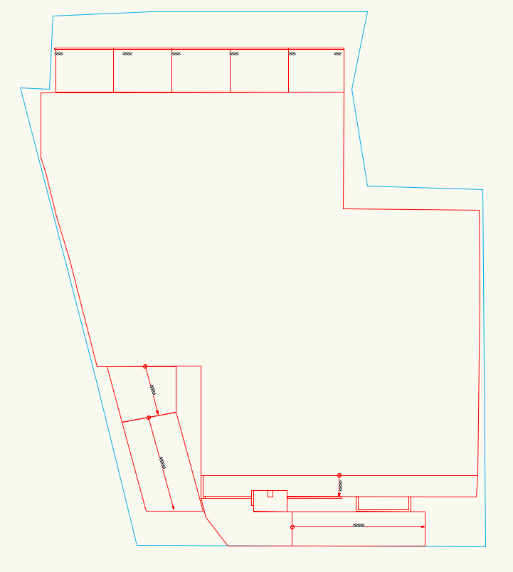
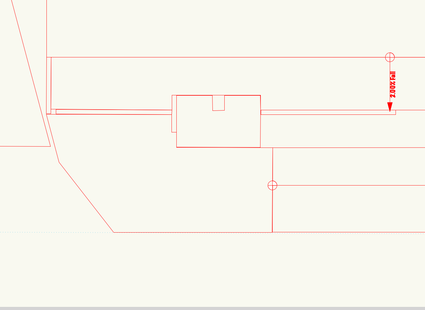
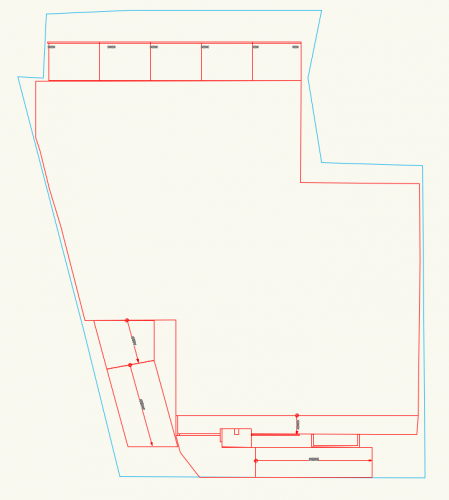
Haven't run into this before, but on a current project it would be great to have control over the opacity or depth of the greyed out layers or classes. The attached image is an example of how I would like to further reduce the visibility of some existing site features such as fencing while still having them there for reference.
-
I find the same thing @domer1322, raising the elevation is the work around that I use. Generally I find texture beds tricky.
-
You might find what your after at the bottom of this help page. http://app-help.vectorworks.net/2017/eng/index.htm#t=VW2017_Guide%2FSiteModel1%2FCreating_a_Spoil_Pile_Area.htm&rhsearch=cut and fill&rhhlterm=cut and fill&rhsyns=
-
Can one import a mesh object and use this within a site model?
J. Wallace replied to J. Wallace's topic in Site Design
Thanks very much @Art V...I'll check those out. Thanks again everyone! -
Can one import a mesh object and use this within a site model?
J. Wallace replied to J. Wallace's topic in Site Design
Thanks very much @Benson Shawfor your GIS insight. I think I'll download the QGIS and work on learning this. I can see drone data being invaluable for some of my future projects. Fascinating work. Thanks again. -
Can one import a mesh object and use this within a site model?
J. Wallace replied to J. Wallace's topic in Site Design
Thank you very much @Art V, your file worked really well. Imported with any issue albeit some distance from 0,0 as you mentioned. I really appreciate the effort you took Art and it is a huge improvement over the low res. image I was sent yesterday which has a pixel area of 10cmx10cm. Thanks again Art and everyone for their comments/advice.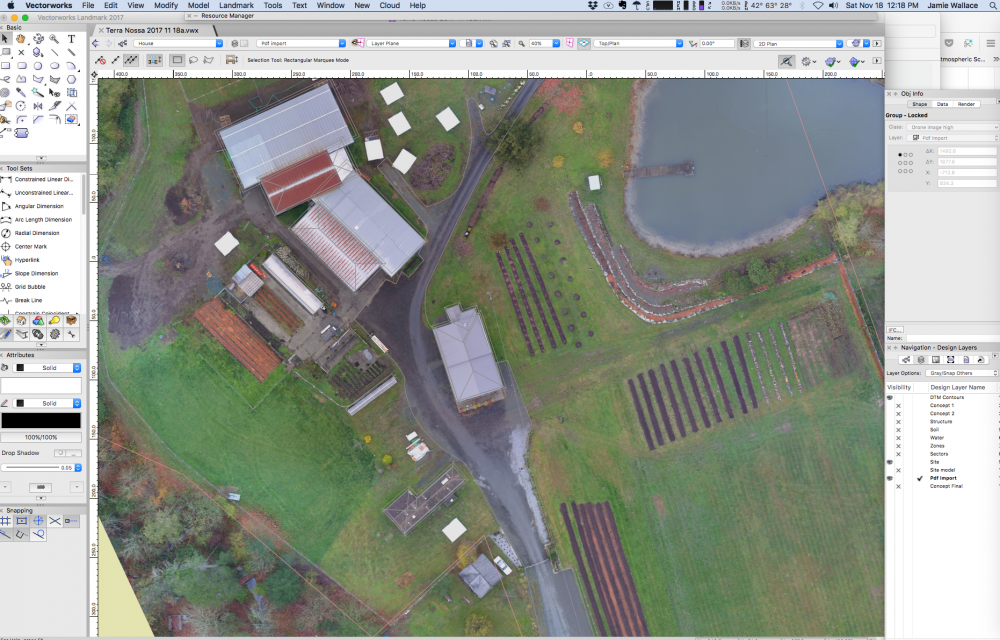
-
Can one import a mesh object and use this within a site model?
J. Wallace replied to J. Wallace's topic in Site Design
HI Art Here are those other files you spoke about...The new .tiff file has a few minutes left to upload. Thanks very much for your help...this is a real education. https://www.dropbox.com/s/m8qutidkv7q650w/Jaan_Mill Bay_transparent_mosaic_group1.tfw?dl=0 https://www.dropbox.com/s/5kxa8gkeqlj2wyk/Jaan_Mill Bay_transparent_mosaic_group1.prj?dl=0 -
Can one import a mesh object and use this within a site model?
J. Wallace replied to J. Wallace's topic in Site Design
Thanks @Art...I'm not sure I can convert or do much with the image, I put it on drop box but I don't have anyway of opening this as I don't have any GIS software, it is one of those software's I can see diving into soon. I did get some tiled images but fitting these together might be a challenge. Thanks for the great advice Art I'm hoping the lower res image will help. https://www.dropbox.com/s/0f1n08k09jrd0jb/Jaan_MillBay2_transparent_mosaic_group1.tif?dl=0 -
Can one import a mesh object and use this within a site model?
J. Wallace replied to J. Wallace's topic in Site Design
Thanks @Benson ShawI was a little nervous diving into this, spending $1250 and not be entirely sure of the results. So far I'm impressed with the data I was provided and the mesh (along with textures) is pretty cool. It's a shame that the mesh can't be effectively integrated into the site model. I have aligned it pretty close onto the model with the thought of tracing in all the infrastructure, roads, fencing, buildings (will be massing models). Tomorrow I should have a .tiff image I can import, the drone operator sent me a 560mb tiff image that I can't import or open in any of my software. Tomorrow I can a lower resolution version, failing that the mesh will guide me. I'll keep you posted. ps the model is around 34 acres quite a bit bigger than my last one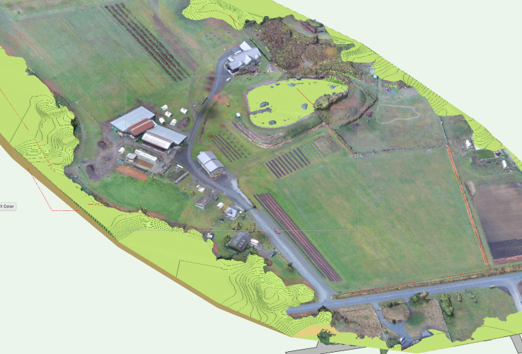
-
Site model will not display tags or elevations
J. Wallace replied to J. Wallace's topic in Site Design
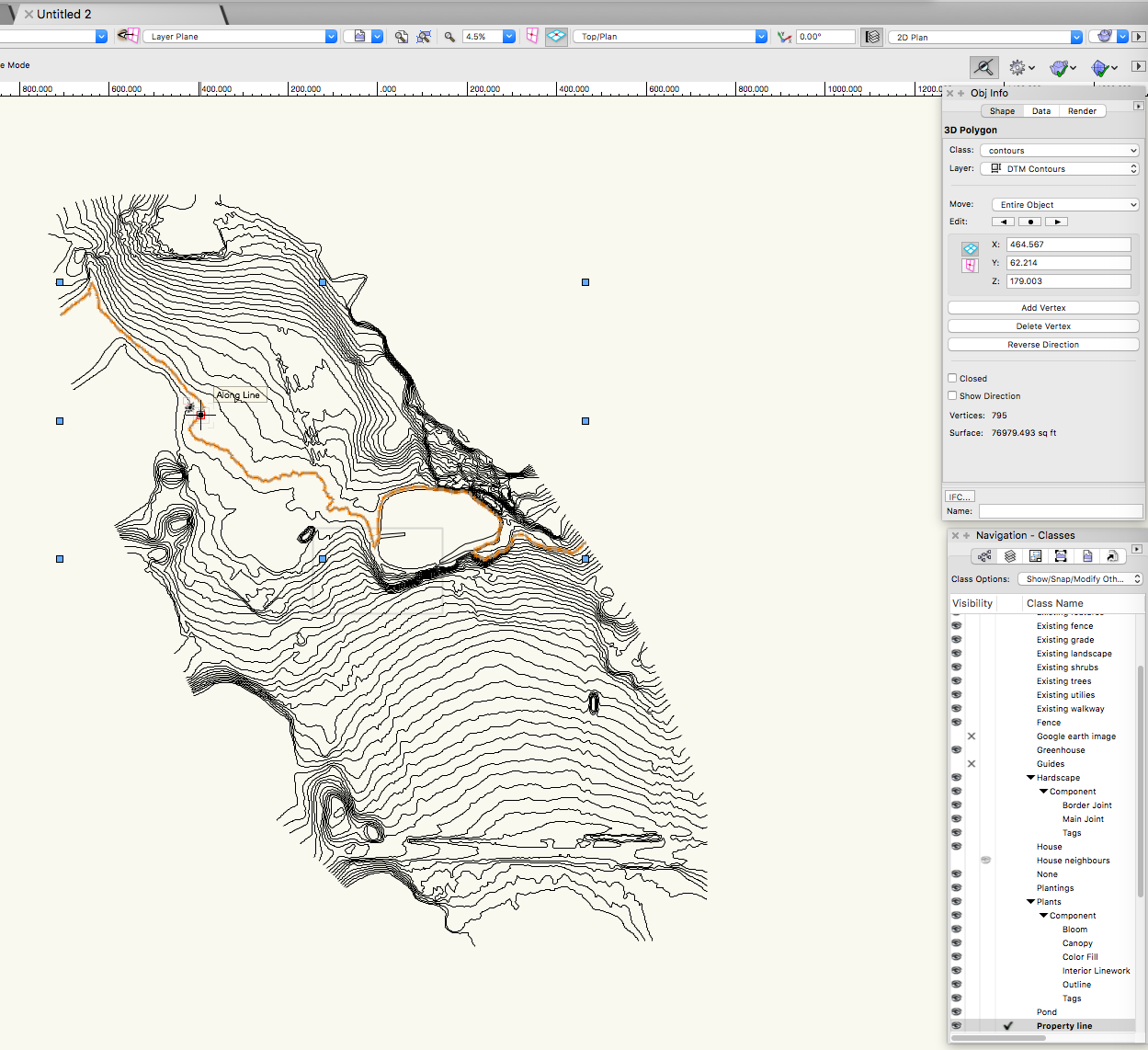
Just to let everyone know I started from scratch in VW 2017 and it now works. No idea why this caused an issue. Interesting thing I did discover was that if you scale a site model you lose your 2d contours but the 3d works just fine.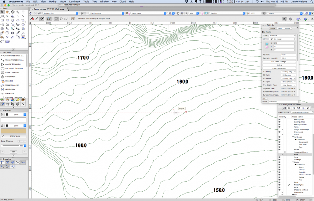
-
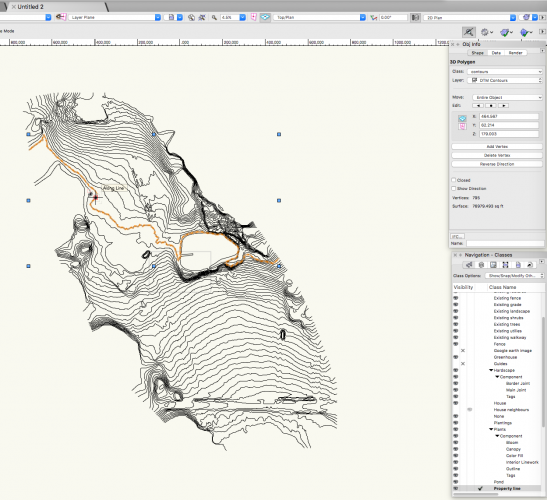
Site model will not display tags or elevations
J. Wallace replied to J. Wallace's topic in Site Design
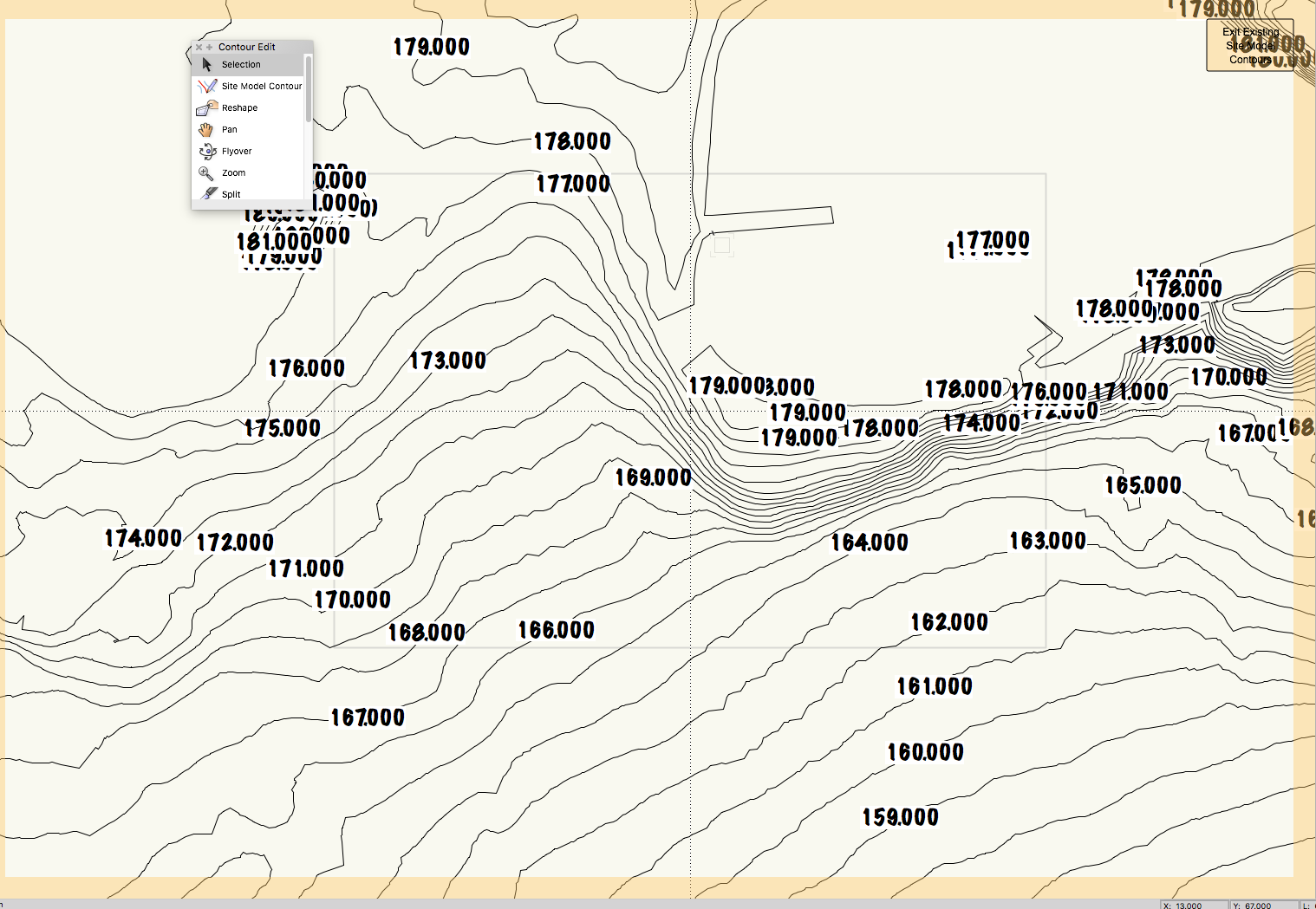
When I edit the source data I see the tags? ps image shown is using VW 2018
-
Site model will not display tags or elevations
J. Wallace replied to J. Wallace's topic in Site Design
I got similar results with VW 2018 -
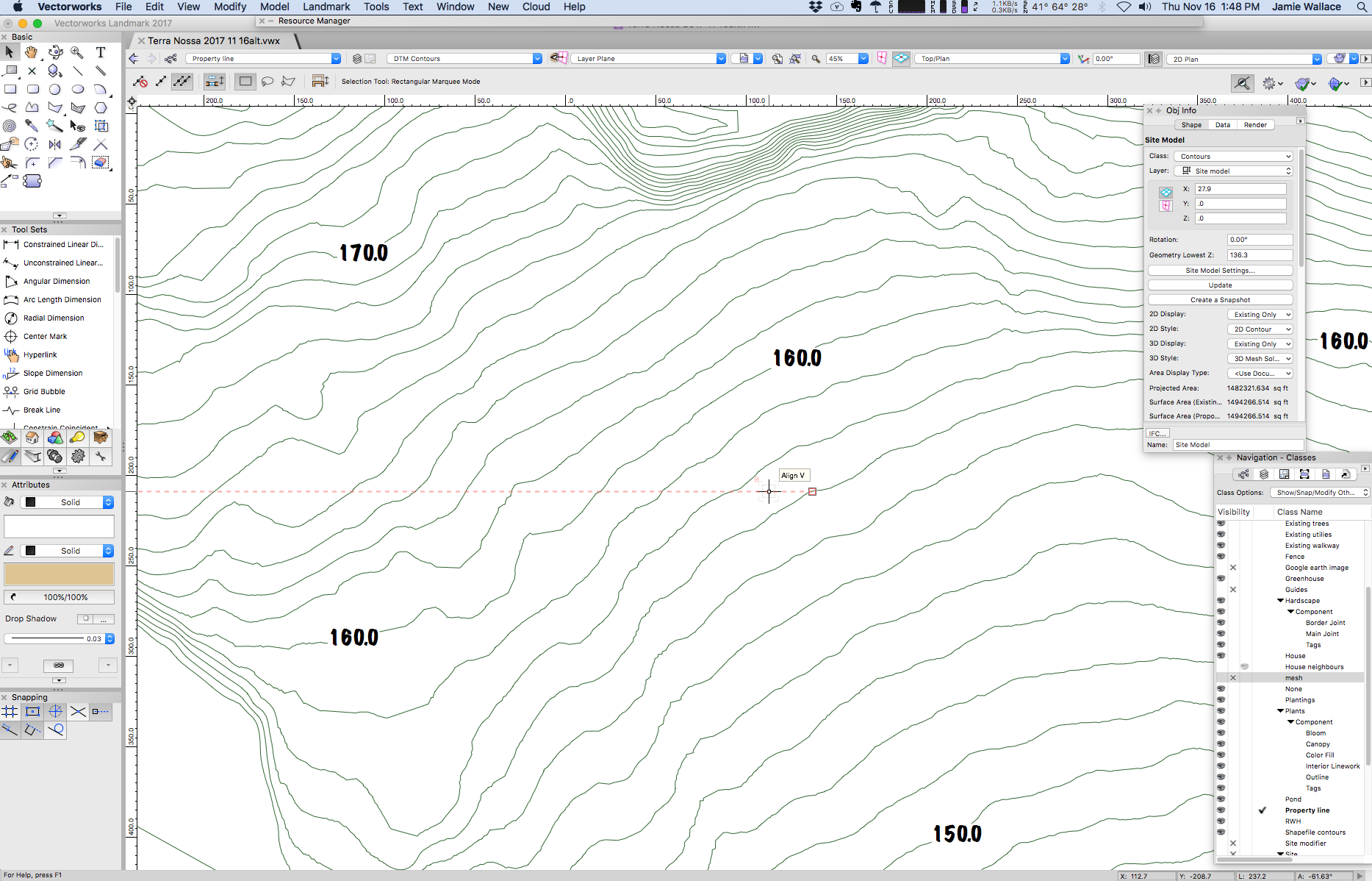
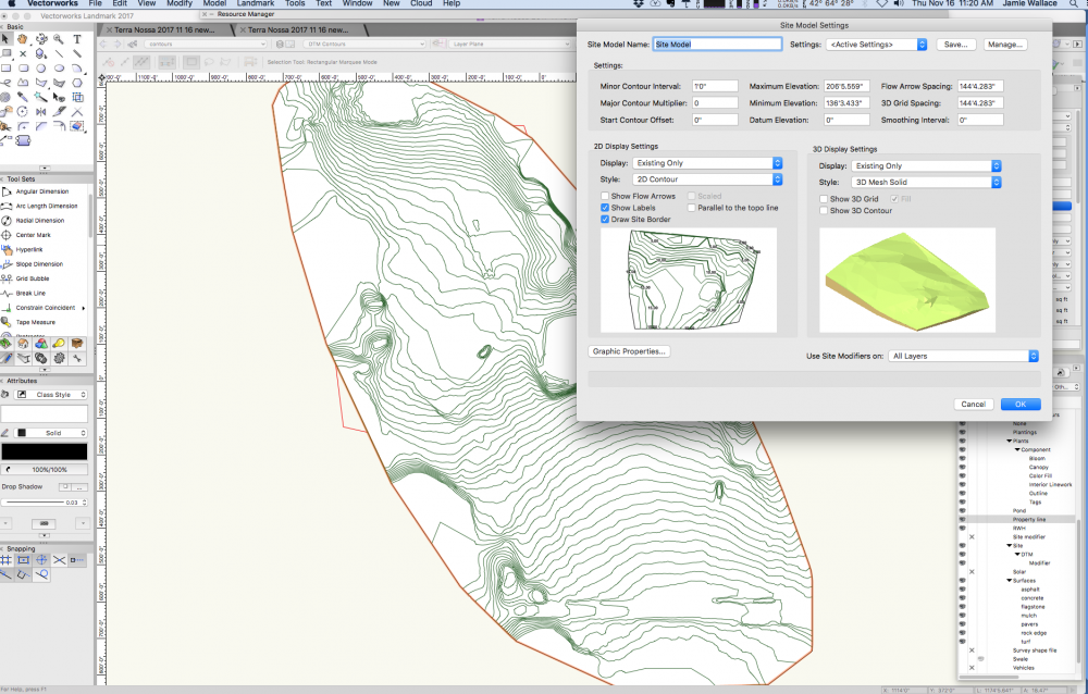
Hi I'm having a bit of a challenge with a site model which I've created from a shape file which generates 3d polys. The model works well in 3d but I don't get any labels on my 2d contours? Before creating the site model I double checked the 3d polygons and they have a z value.
-
Can one import a mesh object and use this within a site model?
J. Wallace replied to J. Wallace's topic in Site Design
Good idea Dave. This must be a 2018 feature, I'm still using 2017 until the sp2 comes out. I might try it out for fun. Thanks -
Can one import a mesh object and use this within a site model?
J. Wallace replied to J. Wallace's topic in Site Design
Added some texture to the mesh and I'm really impress. A shame this can't be integrated to the site model.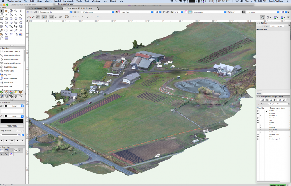
-
Can one import a mesh object and use this within a site model?
J. Wallace replied to J. Wallace's topic in Site Design
Yes but apparently the operator had to make some adjustments to the contour map and mesh due to the water.