
aage.langedrag
-
Posts
88 -
Joined
-
Last visited
Content Type
Profiles
Forums
Events
Articles
Marionette
Store
Everything posted by aage.langedrag
-
 Many thanks to @Katarina Ollikainen who came up with this solution. Would never have came up with this without your brilliant help.
- 6 replies
-
- 3
-

-
- plant record
- worksheet functions
- (and 1 more)
-
HI @Pat Stanford. Sorry to bother you with questions but I see that you have good solutions and answers to similar challenges. Do you see any solution to my question?
-
Hi @Scott Campbell No stress but nice to get a solution. Have searched for a long time for a method without success.
-
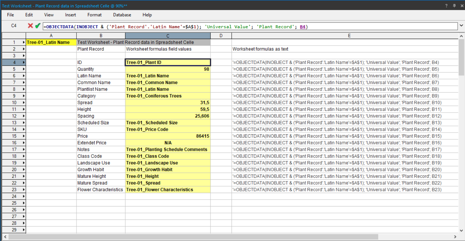
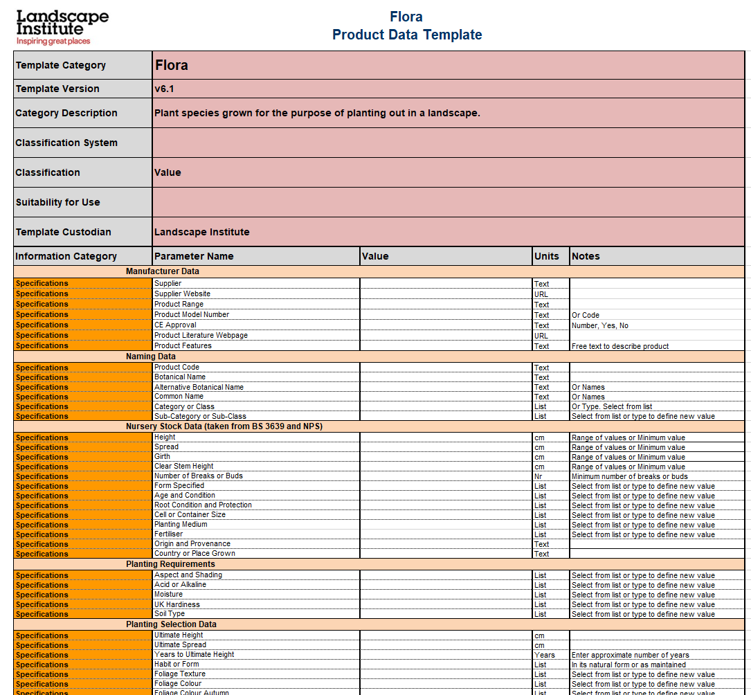
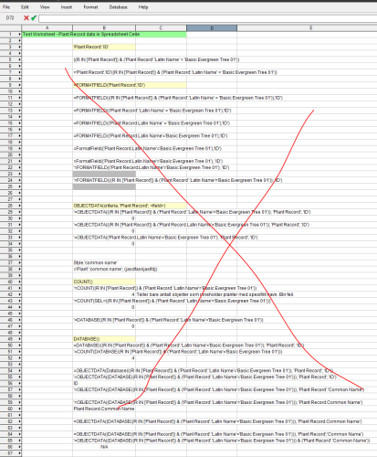
Hi @Vlado I want to be able to retrieve information from specific plants into various Cells in the Spreadsheet and not the Database inside my Worksheets. This can easily be done for several built-in objects in VW, not least for Materials. I am unable to find a solution for how to do this with information on specific plants. Information contained in the 'Plant Record'. I want to be able to retrieve various data from the 'Plant Record' into various cells in my Spreadsheet where I search for the plant's 'Latin Name'. An example is that I want to have a Spreadsheet in VW with similar layout as we have in UK Landscape Institute PDT Flora 6.1 - 28/06/2016(see image and attached excel file). Appreciate being guided on the right path. Image shows how I would like to be able to display data in the same way as PDT. Image shows my countless attempts to retrieve data from the plants' data located in the Plant Record. I know I'm not good at this, but I didn't think it would be so difficult 🙂(My file is attached) The reason I don't use Database for an entire row is that I want to be able to vary the layout of where the information should be in a Spreadsheet. Here are some other points that I have experienced when setting up many rows as a database; 1. On large files that the program takes a lot of time to calculate data when I have set up many rows as a database. 2. When I copy several database rows, I only get one row as database and the others are changed to Spreadsheet with text and numbers from the previous database. 3. When I copy a row, I have to go in and set up summation and sorting again for each and every column. This takes time so I had hoped the program remembered this when I copy. PDT_Flora6_1.xlsx Test Worksheet- Plant Record in Spreadsheet Cells 2024-01-04_v2024.vwx

- 6 replies
-
- 1
-
-
- plant record
- worksheet functions
- (and 1 more)
-
How to get plant image props to render at night correctly?
aage.langedrag replied to JonKoch's topic in Rendering
I would strongly recommend using add-ons along with Vectorworks which will provide significantly better quality for viewing models with proper lighting and surroundings. Especially since Vectorworks has live sync to these programs. Have used both Lumion and Twinmotion with very good results. Not least the opportunity to use VR and stand inside the model yourself and adjust lighting, season, etc. Agree that it should be possible to get realistic images in the VW, but 3D plants inside the VW can quickly bring the whole model to a standstill, so this solution will only work on small models. These films are old and bad but give a good picture of the possibilities. Especially that we can change the season, time, weather, etc https://youtu.be/gBar9btdmmk?si=45HrcbOQ-U6IX023 -
The meaning of the Data Tag is the same in all programs that function as a database, Autodesk Revit, ArchiCAD, Vectorworks. Is there something I have not understood about the fact that you can use a data tag to read information from several objects? Maybe you want something here that has nothing to do with Data Tag. Maybe you have to use other functions. Data Tag is "alive" and reads information from objects. What happens if you or others change one of the objects that was similar to not being the same anymore and these use one and the same Data Tag? Data Tag is not an extended 2D text box where you can put arrows in all directions. Maybe it's me who hasn't seen what this is about.
-
@JonKochThanks for suggestions. The object is sent down to sea level. I thought it was because I cut a recess in my coating but as you can see I have copied the object backwards in the image and this also goes down to sea level. Or do you mean that I have to define height in the Landscape area and not send to a Landscape area or Hardscape which is itself draped on the Site model as I have done?

-
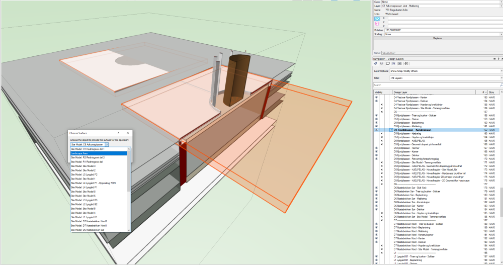
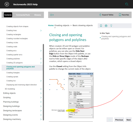
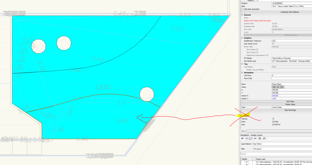
Which formulas must I use to find Landscape areas and Hardscape where the objects are not marked as "Closed"? I want to create a data visualization that can color all my objects that are not "Closed". Or if that doesn't work, I want to be able to take out a Worksheet that shows me whether objects are closed or not. A big wish I have is if someone can give me a simple visual overview of Vectorwoks' Plug-in Objects (Built-in) and their properties and which formulas I have to use to retrieve these properties in the Data Manager for IFC mapping, Woorksheets , Data Tags, etc.? I keep finding that a few of my Landscape areas and Hardscapes are sometimes not marked as "Closed". This is not always the first thing I look for, so often there are quite a few errors that I have to search for before I discover that the object is not closed. I therefore want to insert a visual check in my model with hundreds of objects so that I can check these before sending out to IFC. https://app-help.vectorworks.net/2023/eng/VW2023_Guide/Shapes1/Closing_and_opening_polygons_and_polylines.htm
-
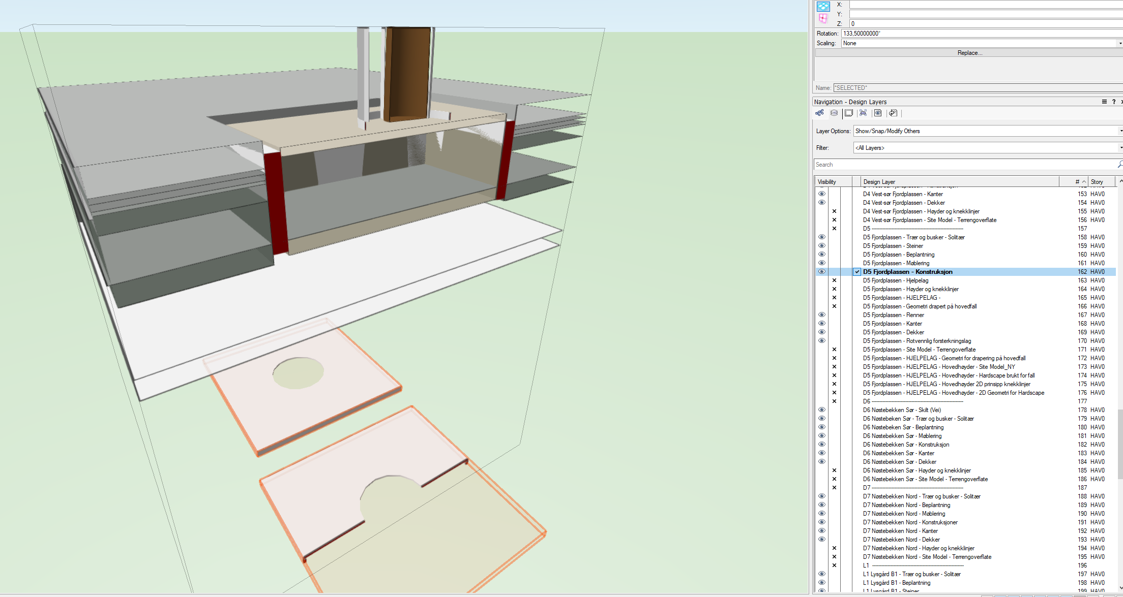
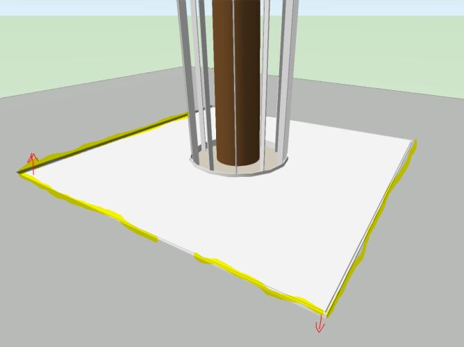
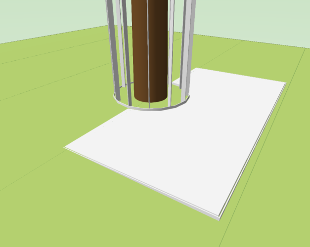
How can I get the Symbols that I want to send to the Surface to follow the slope of the surface and not remain horizontal? In Autodesk Revit, I can decide myself whether Symbols such as a bench should stand horizontally, while the tree pit as shown here should follow the slope to the Site model and Hardscape. Our model must be 1:1 with how it is built as they build according to a model and not drawings. @Scott Campbell @Katarina Ollikainen
-
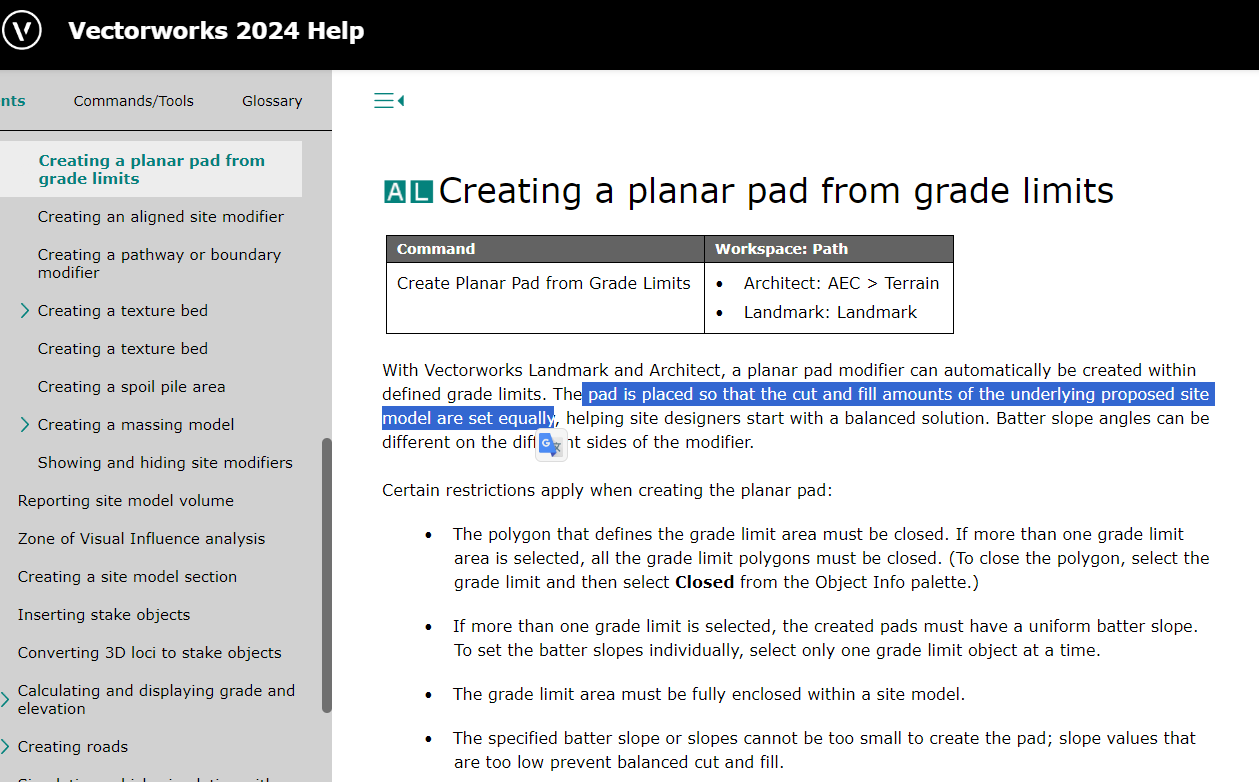
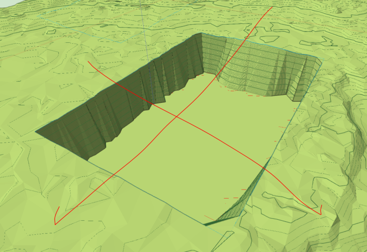
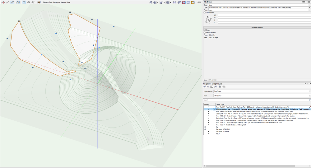
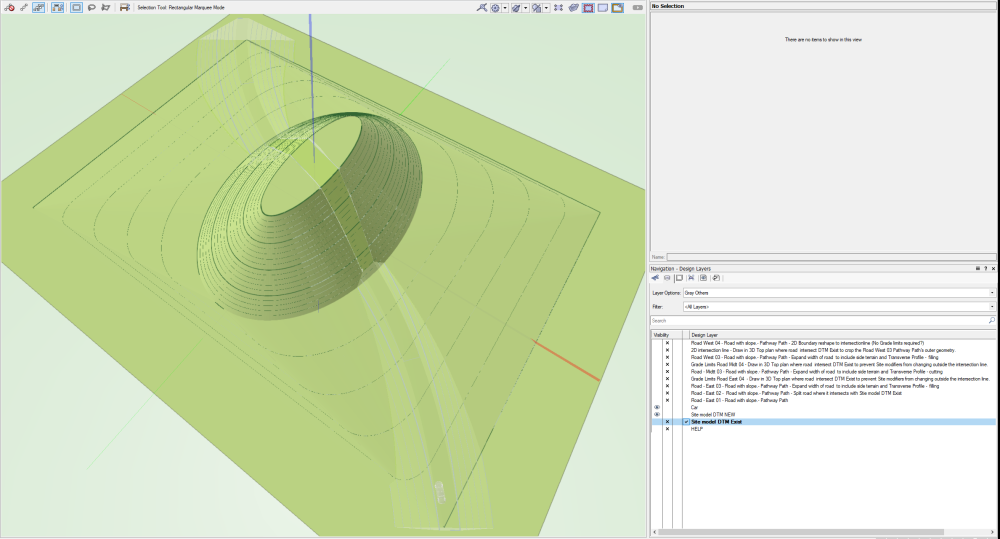
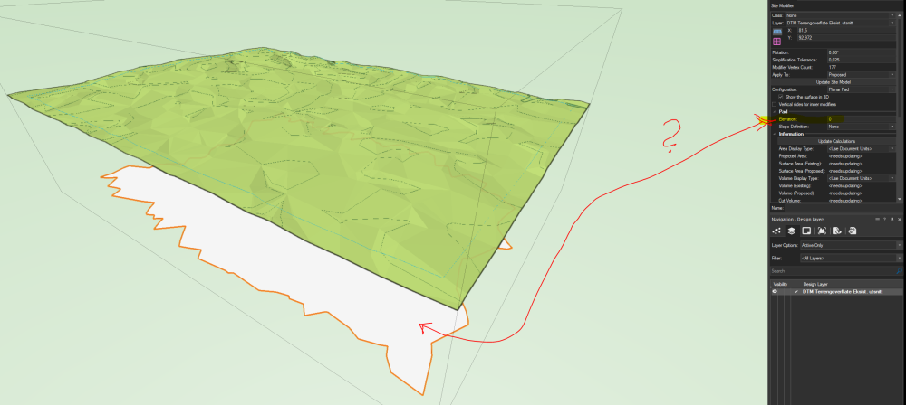
Hi, @JonKoch If I understand this function correctly, I should be able to set out a Grade limits over a Site model, then the function "Creating a planar pad from grade limits" should automatically calculate the outer geometric shape and height so that the mass balance will be equal to zero. I do not expect this to be at sea level as I show in the picture and as you have also achieved as I see it in the model you sent. Have I understood your model correctly?

-
Materials and Colors doesn't export with IFC
aage.langedrag replied to Moe_90's topic in Architecture
https://forum.vectorworks.net/index.php?/topic/105541-ifc-export-with-separated-components/&do=findComment&comment=478337 -
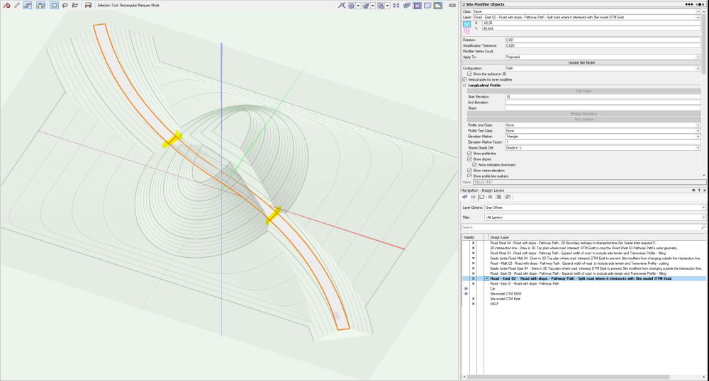
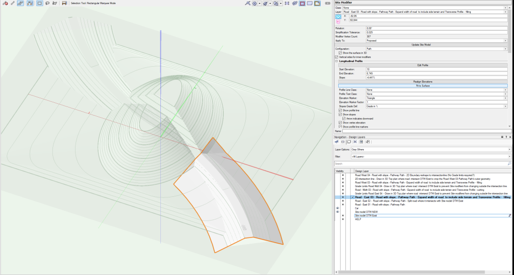
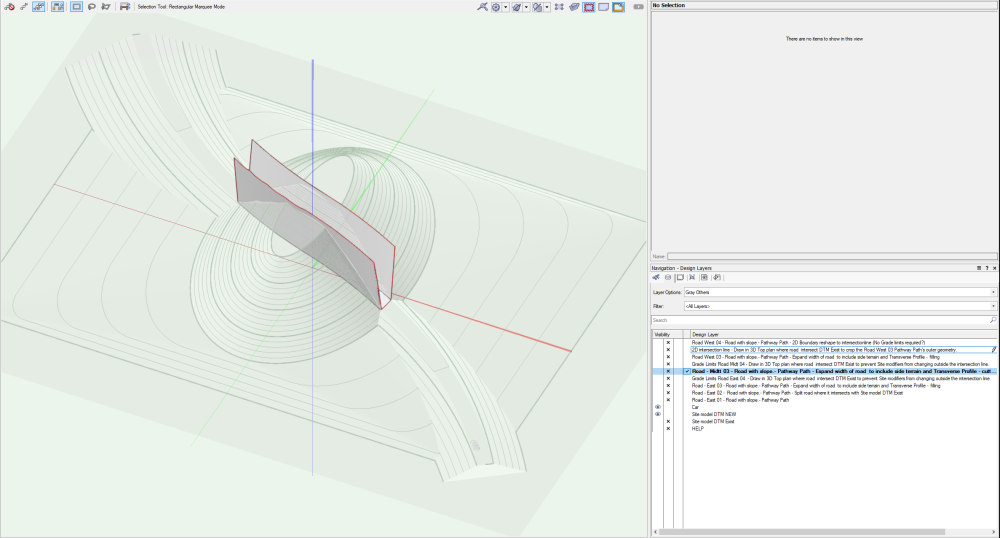
Here is a new file that shows suggestions for workarounds that correspond to the solution that @Scott Campbell showed but here using Site Modifiers as geometry to find the intersection between new and existing DTM. 2023-11-05_Site Modifiers - Batter Slope constante v2023.vwx


-
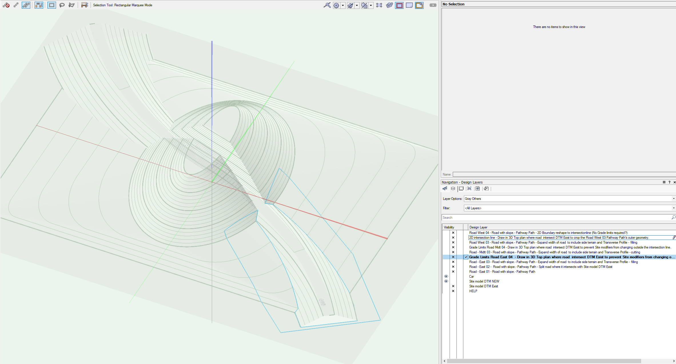
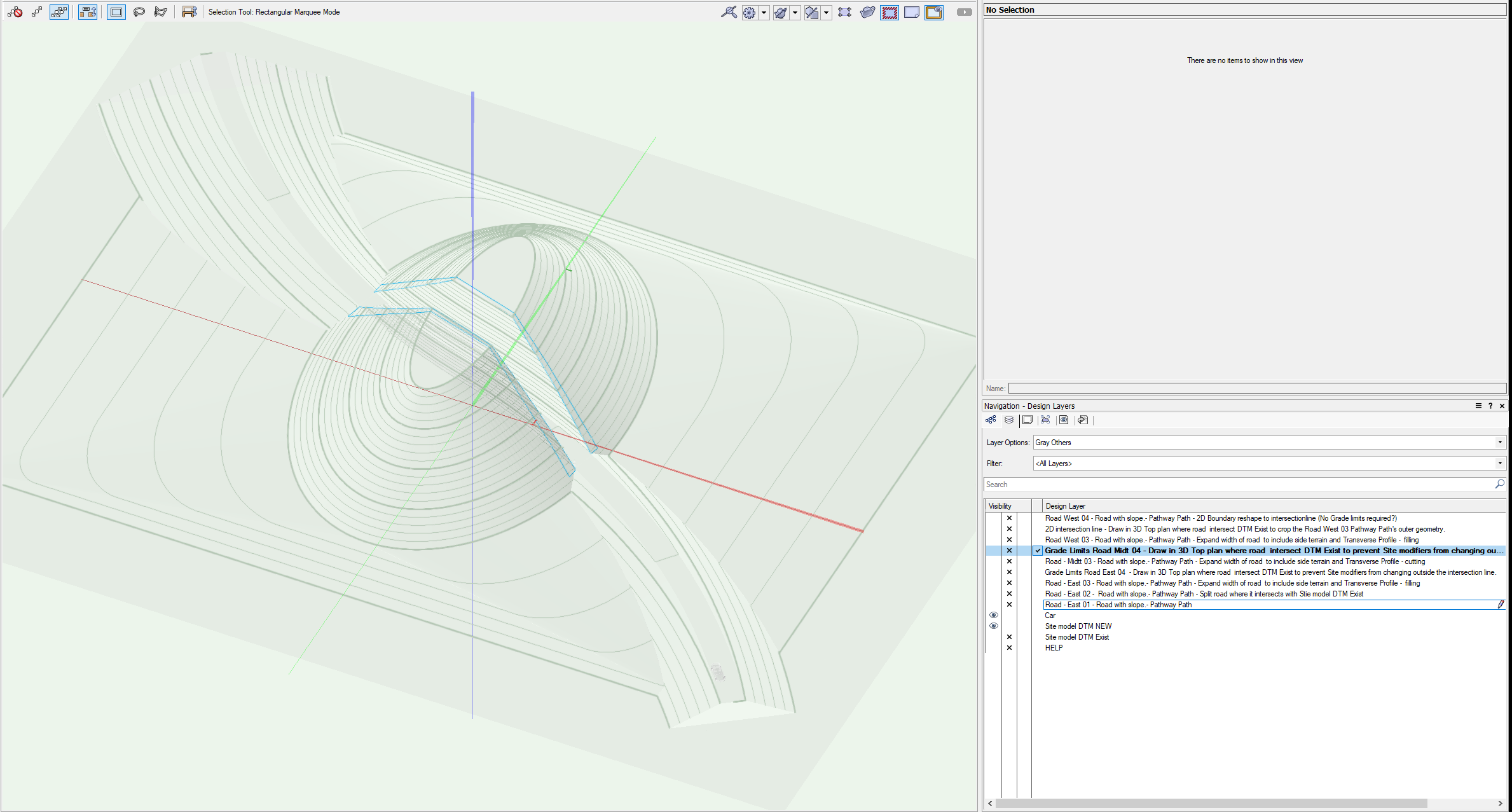
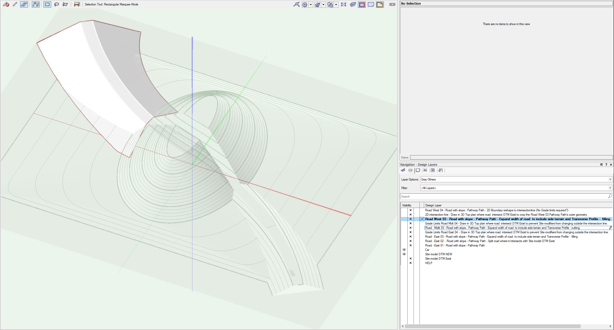
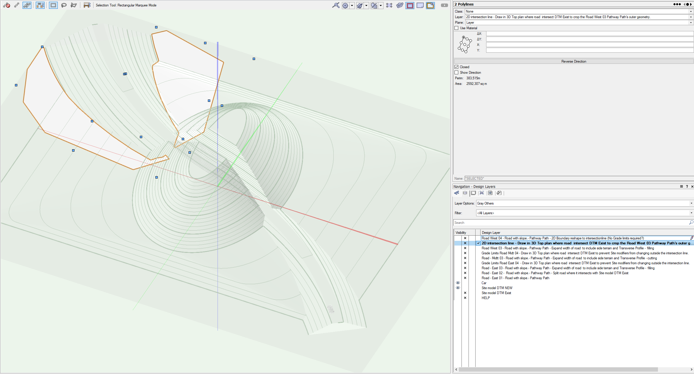
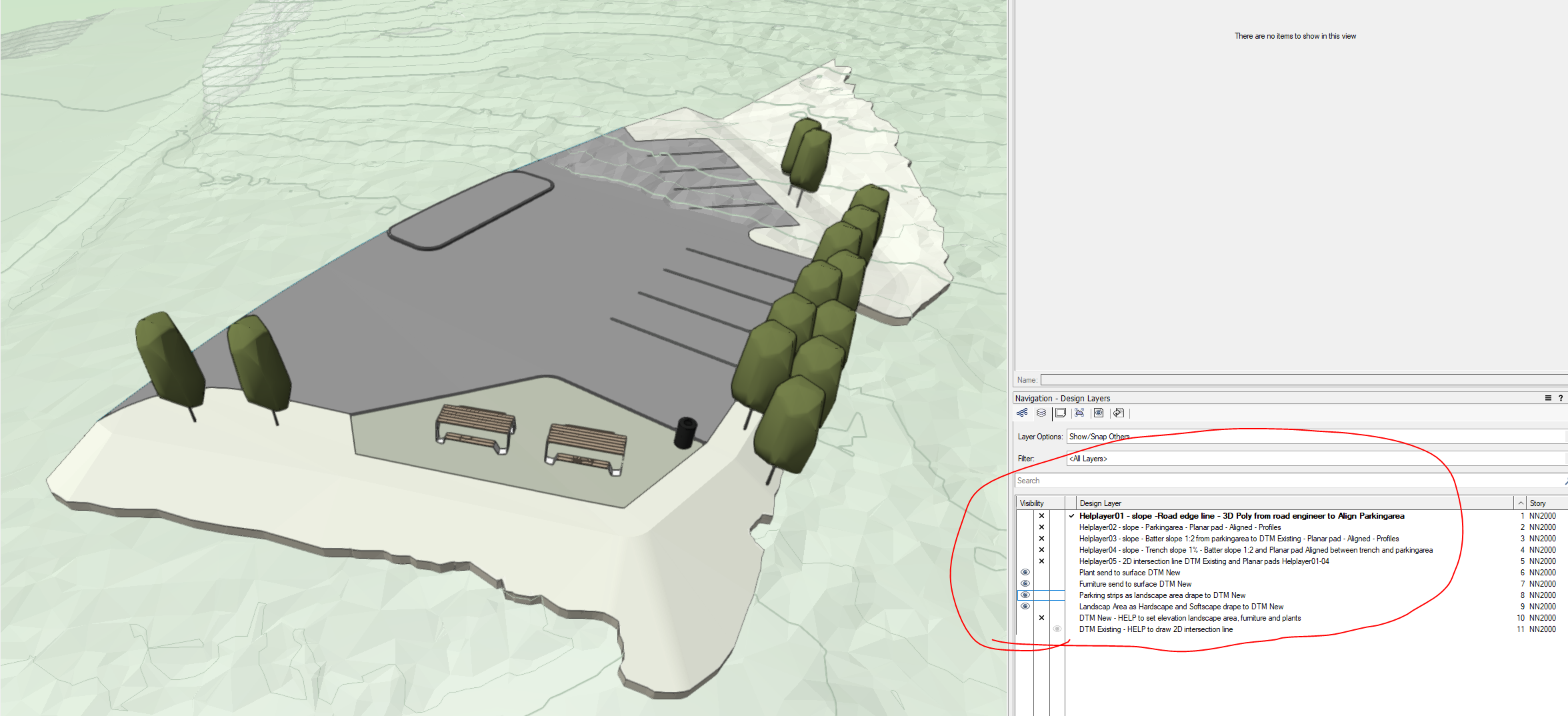
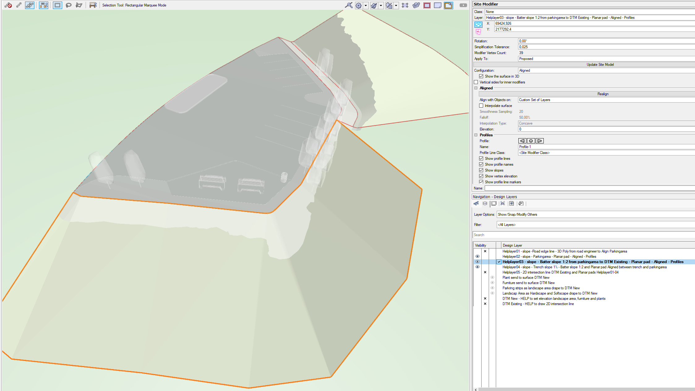
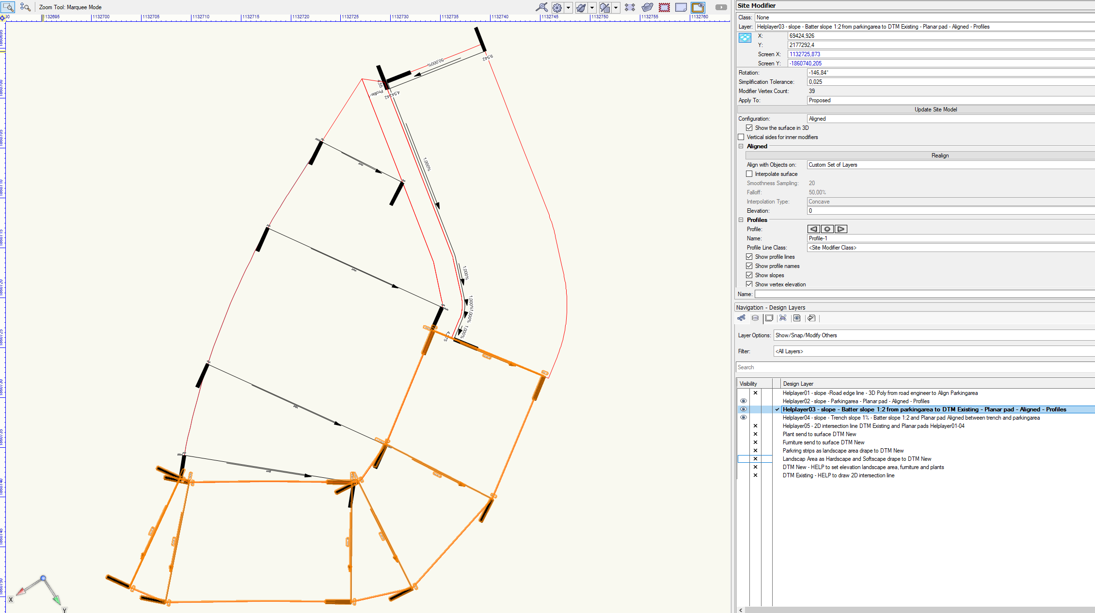
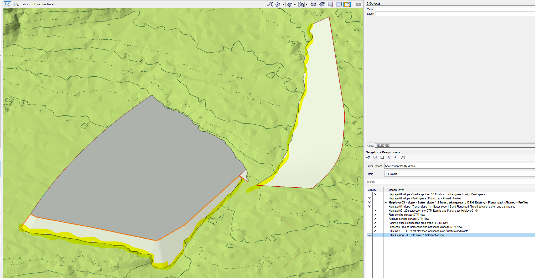
Thank you @Scott Campbellfor the very good explanation and well-described workaround until we have a better solution in place. Looking forward to this being a built-in solution in the program @Vlado. I am attaching a new file that shows the solution to today's work. Hope this solution, which is currently a workaround, can be of help in finding better solutions. Feel free to give feedback on how I could make this even easier. I have tested several variants of finding the intersection line automatically as it is time-consuming to draw this manually in Top plan (3D).We are not going to deliver the 3D Site Model surface at this time, so now it was fastest to do it this way. Especially since heights will be adjusted, we can reuse Planar pads geometry and only adjust the Landscape Area that intersects with DTM Existing. Site Modifiers - Batter slope -work-around _KOPI-2023-11-06-2254.vwx


-
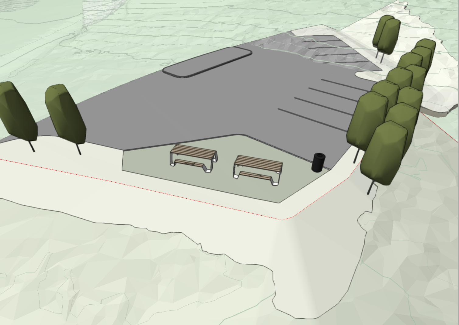
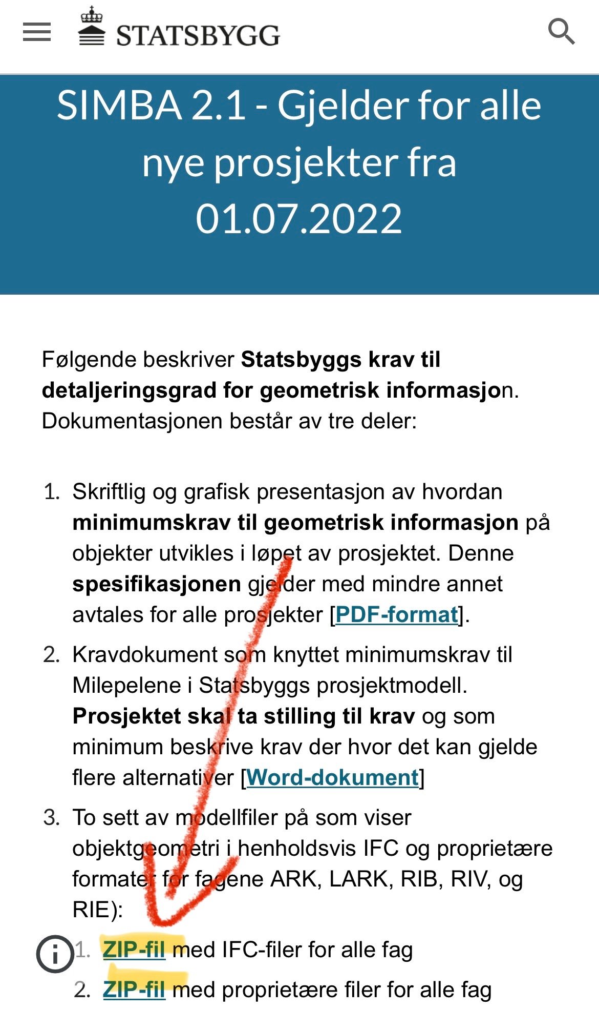
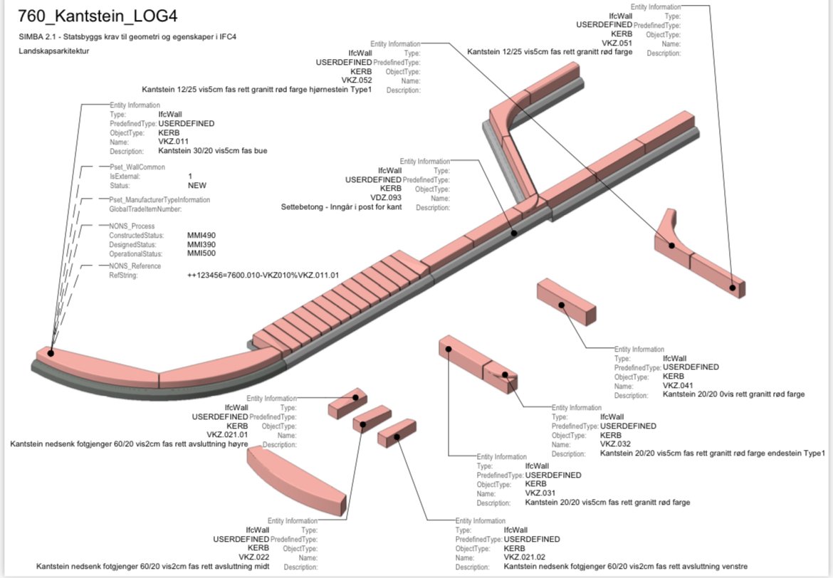
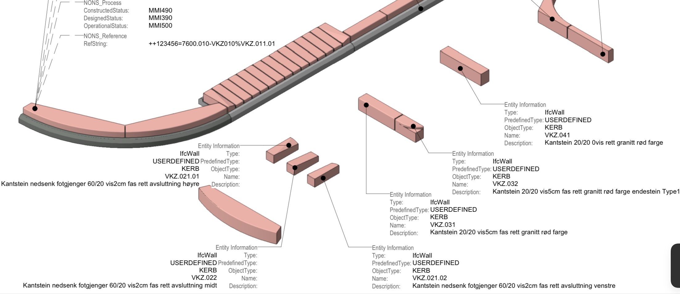
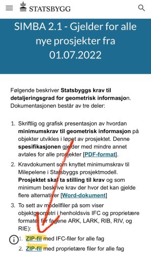
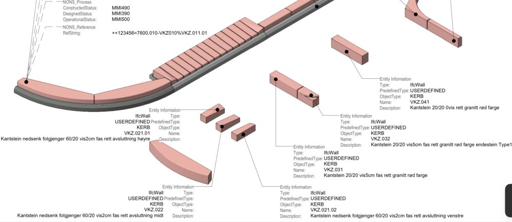
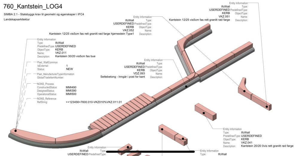
When will Vectorworks come with the possibility to test/use export to IFC4.3/ IFC4x3 which is adapted to outdoor design? Autodesk has included IFC4.3 in both Revit and Civil3D. Transport projects in Scandinavia use Trimble Quadri and they also have access to IFC4.3. Several projects we are involved in are considering the use of IFC4.3 and then we should also be able to deliver on this from Vectorworks. https://bimcorner.com/key-changes-in-ifc-schema-shaping-openbim-for-infrastructure/ https://bimcorner.com/ifc-4-3-on-construction-site/ https://bimcorner.com/spatial-breakdown-structure-in-ifc-4-3/ Statsbygg the Norwegian government’s building commissioner has completed solution for Ifc4.2 (4.3) for Landscape Architecture. Download zip files for IFC and proprietary files, Vectorworks. https://sites.google.com/view/simba-bim-krav/simba-2-1-gjeldende/simba-2-1-geometrisk-informasjon-detaljeringsgrad

-
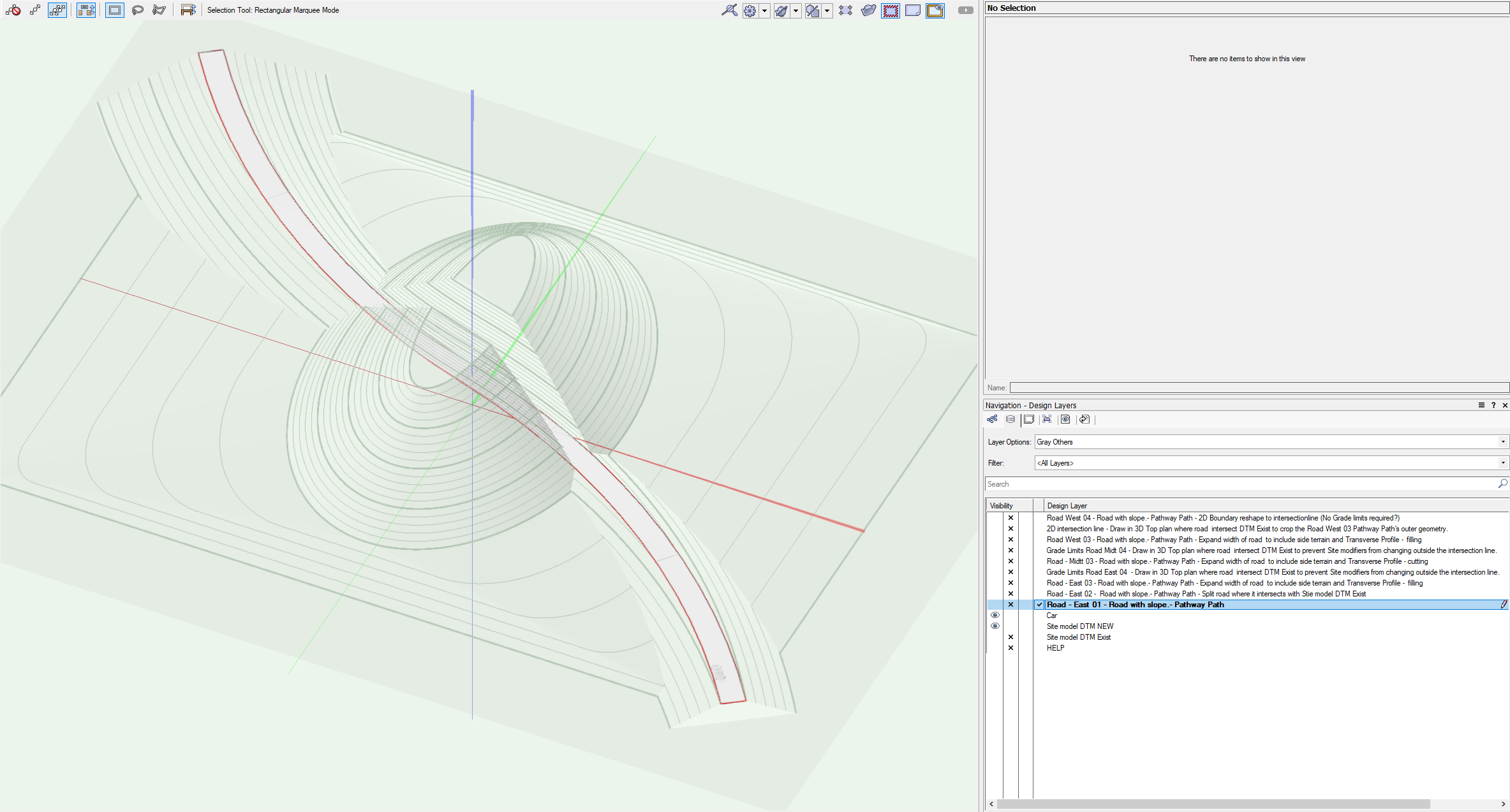
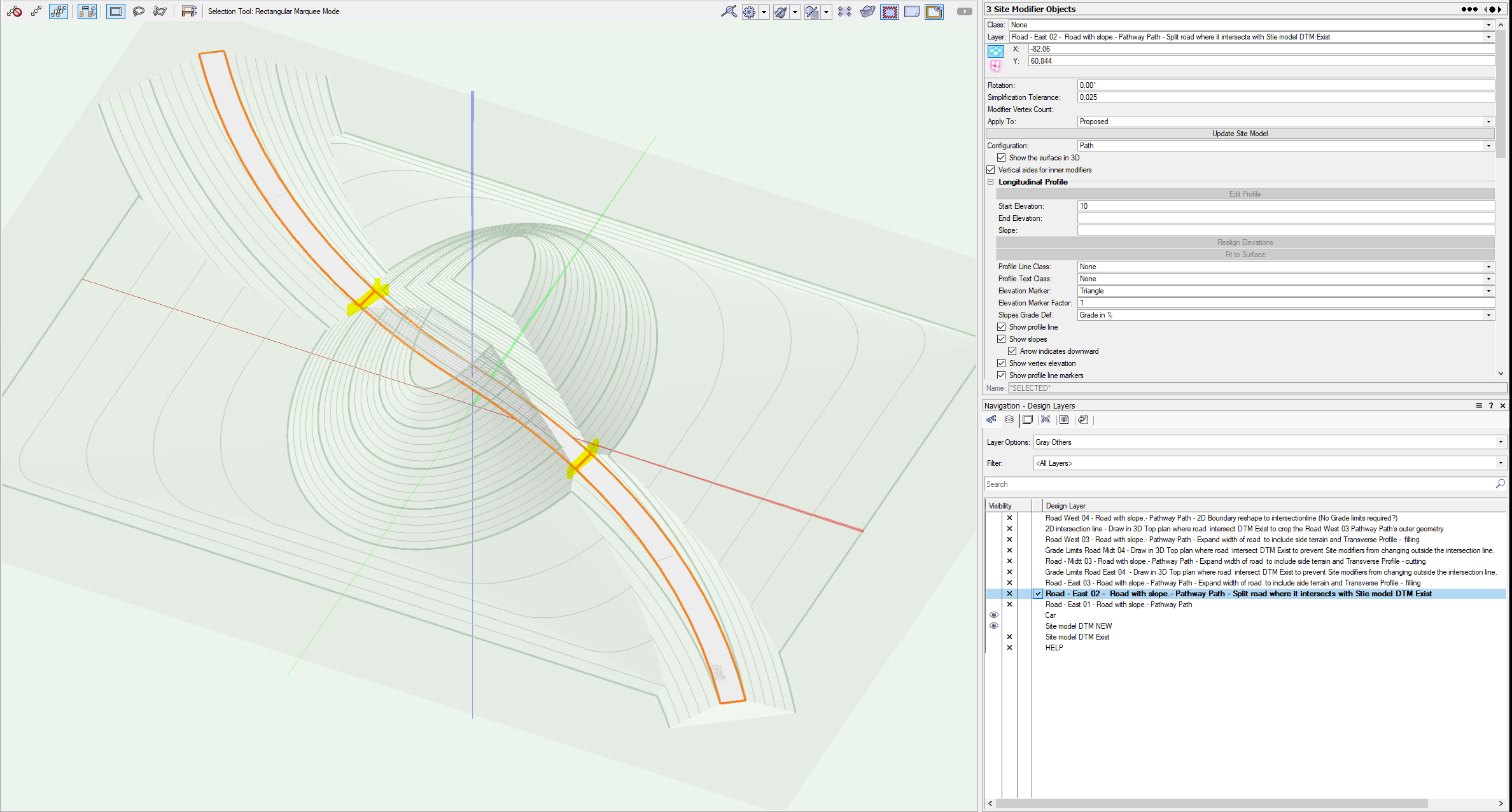
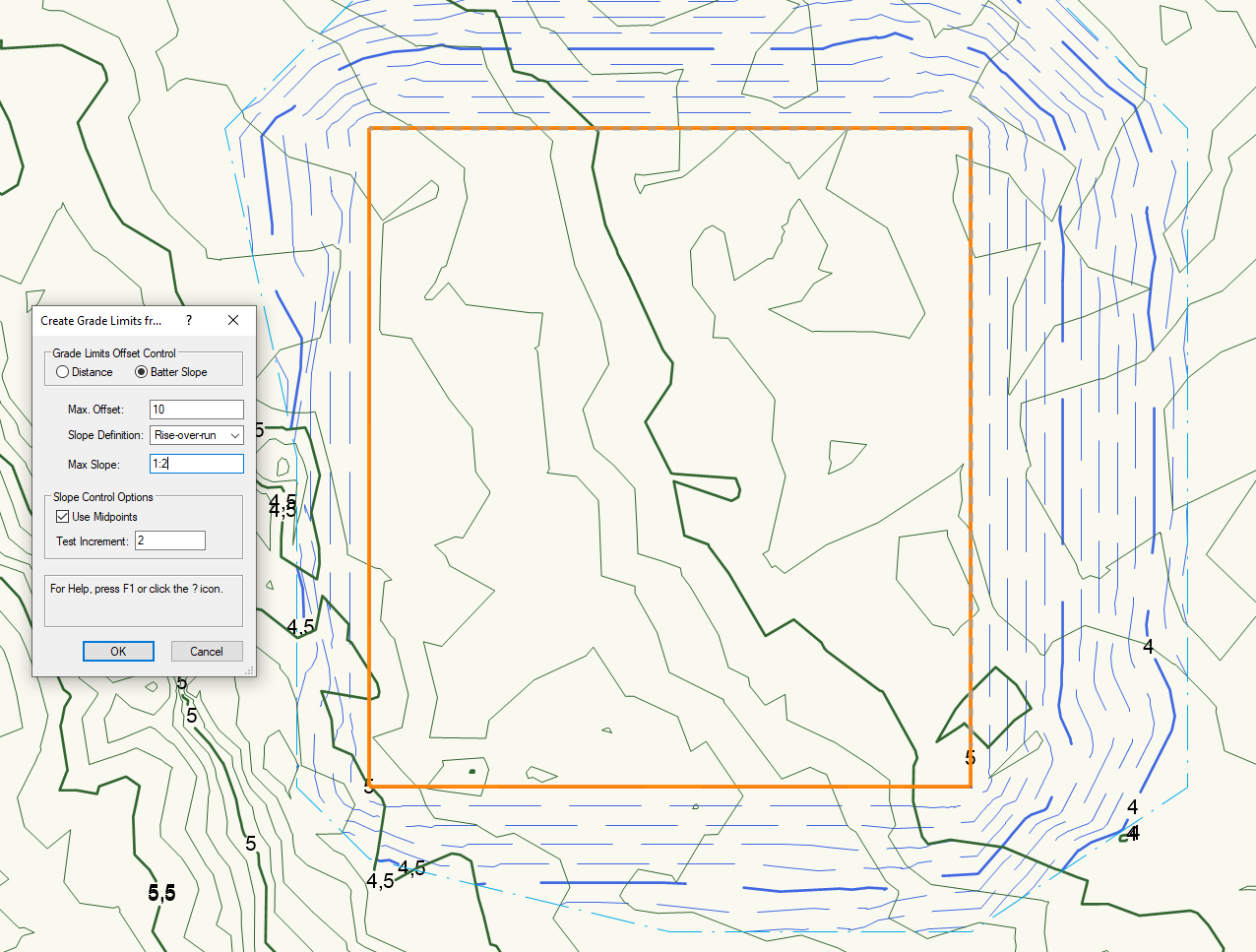
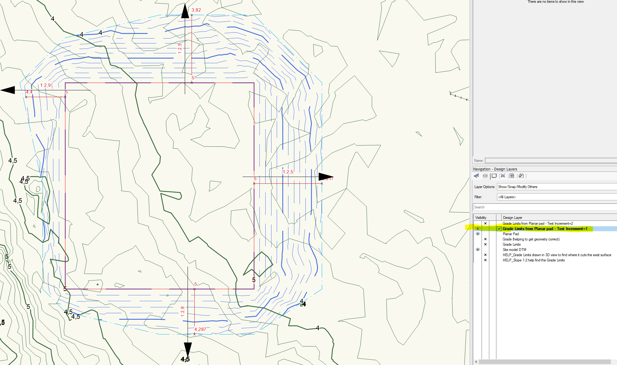
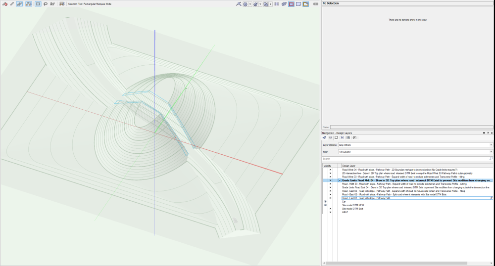
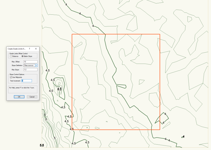
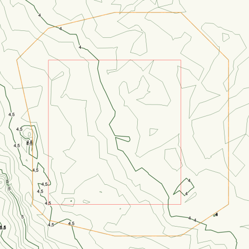
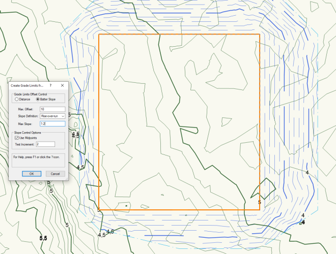
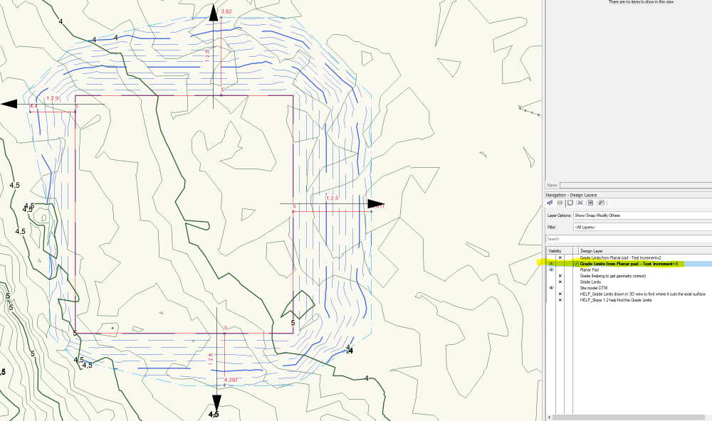
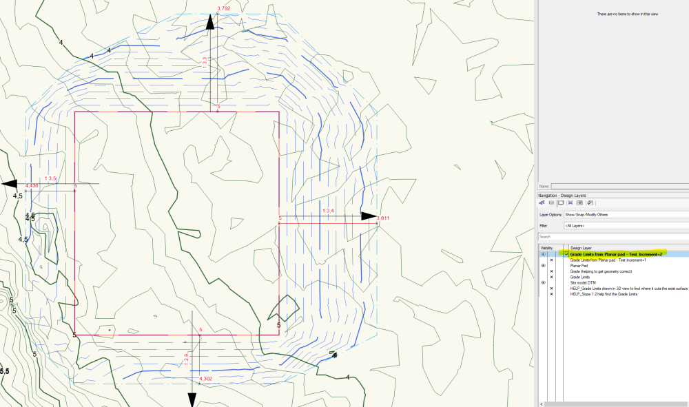
Thanks Eric. @Eric Gilbey, PLA I have tried this but have received many suggestions for Grade Limits, none of which are quite right. This left me very unsure whether this would work. Which settings should I use so that Batter slop is constant and exact 1:2? Site Modifiers - Batter slope with constant slope - 2.vwx To me it looks like this function only controls Max Slope and not exact Slope. As you can see in the pictures, none of the edges have been given a 1:2 slope. As you can see in the picture, the Grade Limit moves quite a lot when I set Test Increment = 2. What am I doing wrong?
-
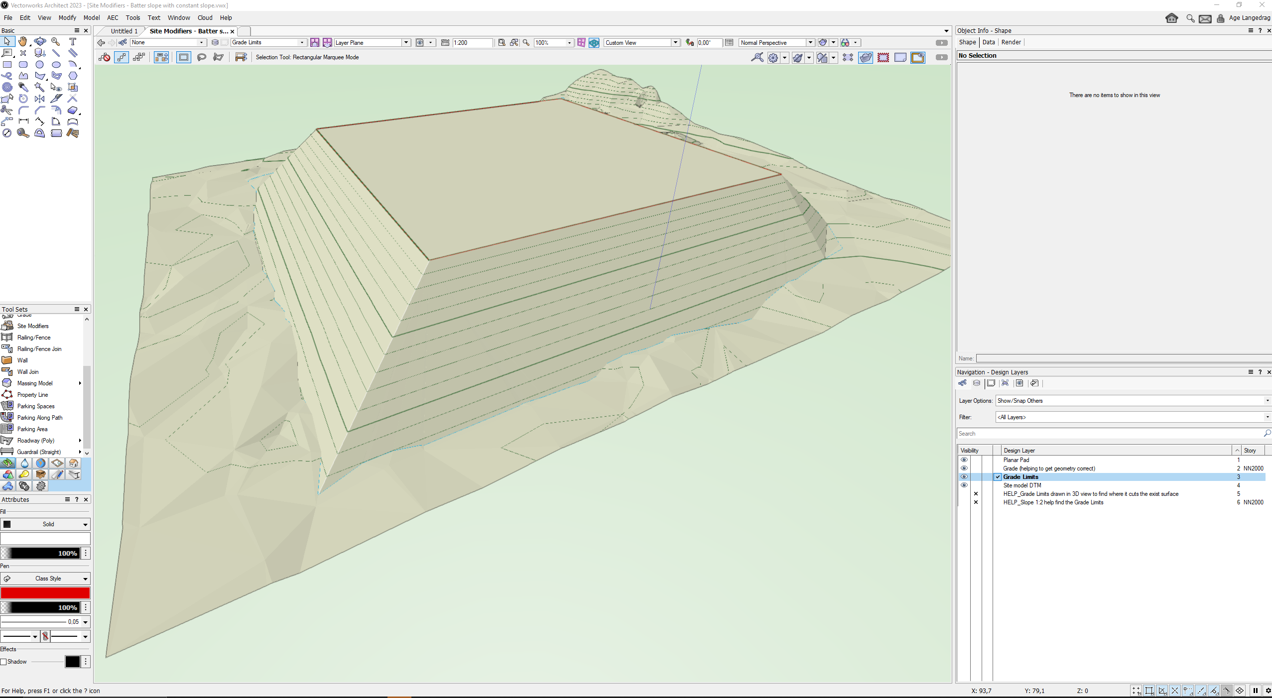
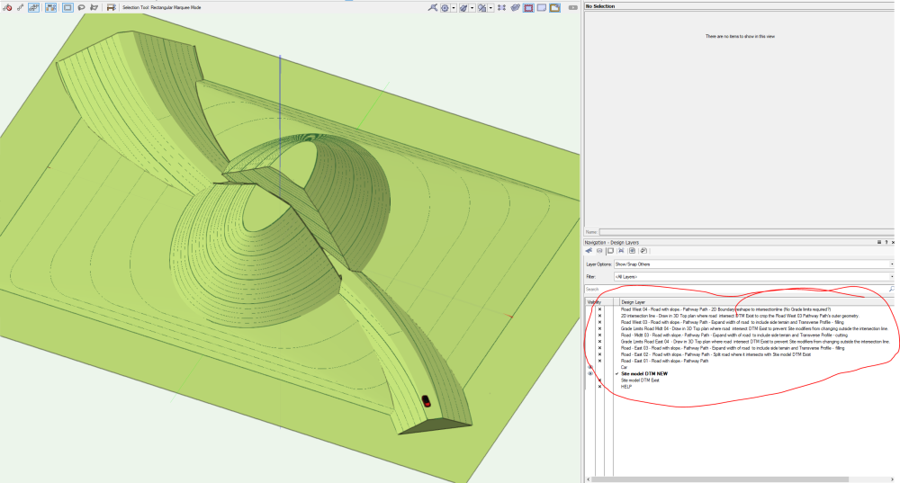
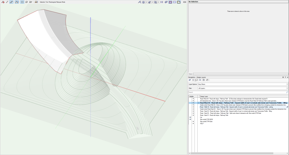
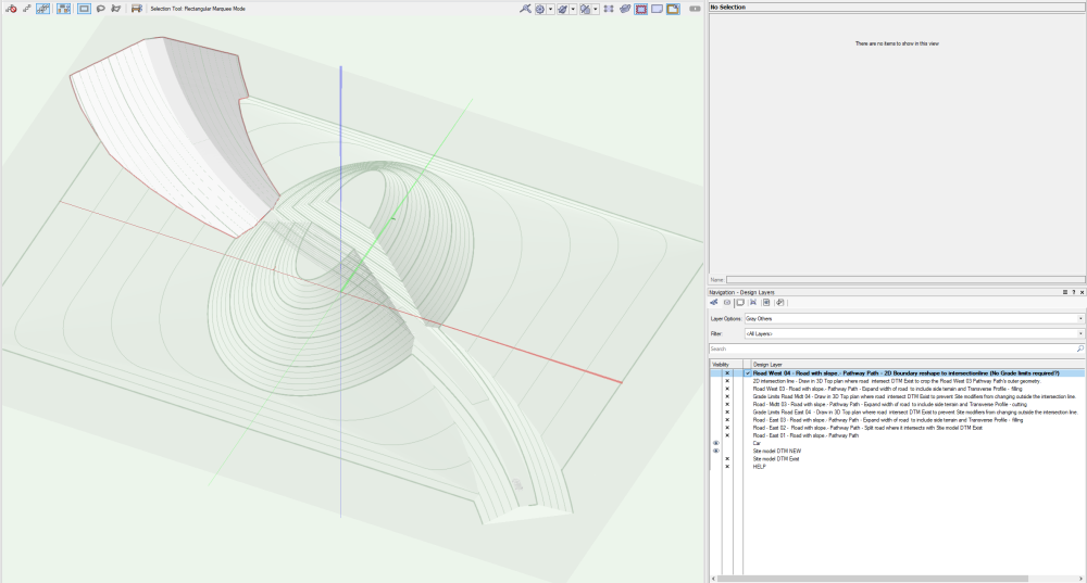
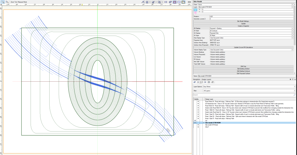
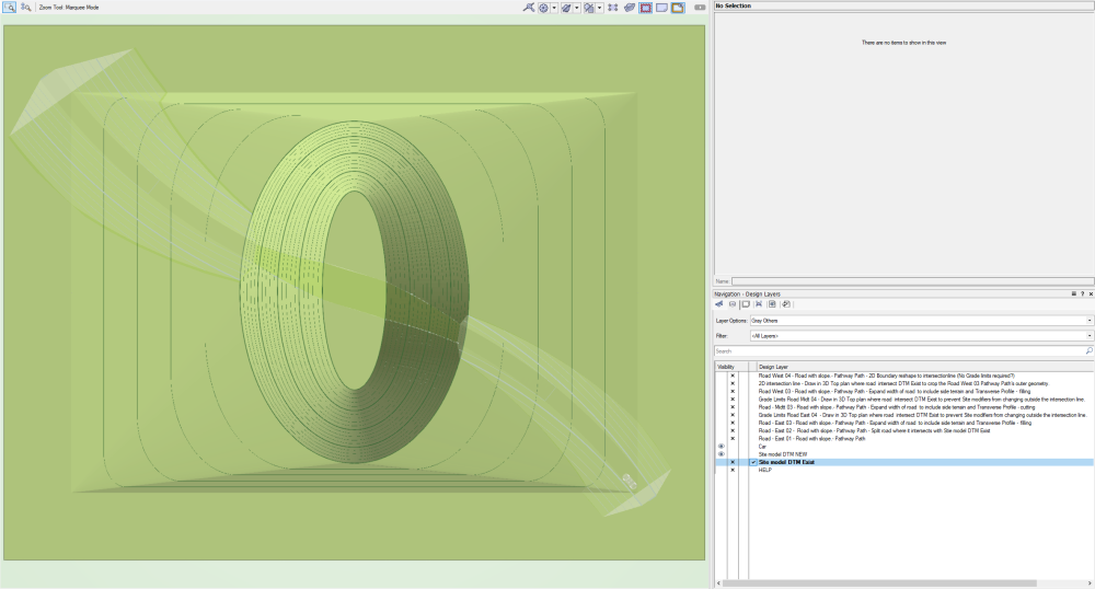
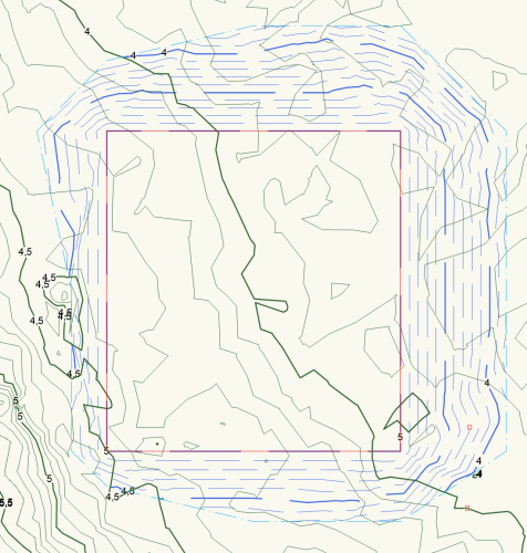
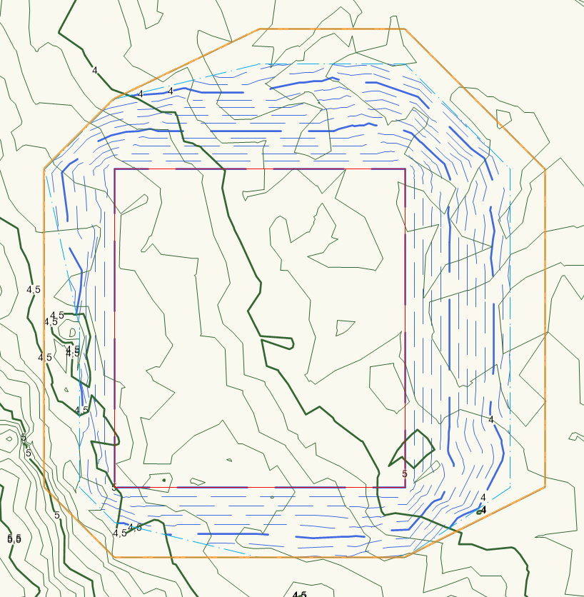
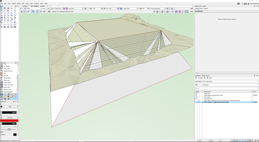
How can I control the Batter slope from a Site Modifier, example Planar Pad so that it has a constant slope of 1:2 down towards existing terrain and automatically created a Grade Limit in this line? @Katarina Ollikainen @Tamsin Slatter @Tony Kostreski Site Modifiers - Batter slope with constant slope.vwx How can I determine the Batter slope individually on the different sides of a Planar pad? Example show a rectangular Planar pad I want to adjust constant Batter slop individually on each of the four sides. One side slope 1:2, next 1:4, next 10:1 (cuts in rock), last vertical. Is this possible? Which methods are recommended when the Planar pad has a slope on all its sides? Can I set it so that a Fill batter automatically gets a 1:2 while a Cut batter gets a 10:1 if it cuts through rock? These are functions we must have control over when we work in transport projects together with road engineers. In Scandinavia, Landscape Architects and Road Engineers do a lot of terrain modeling since we do not have pure civil engineers who process site prep. The important thing is that I must be able to lock the Batter slope to a constant slope and that a Grade Limits is automatically created where the filling/cutting stops against the surface of the existing terrain. This is a line that is difficult to calculate on our own and we have to get help from the software to calculate. Can I use a Planar Pad with constant slope or a Hardscape with slope and automatically crop this to existing terrain? Or can I have the intersection generated and then create Grade Limits from this intersection? How do I do this? I have manually modeled this line in 3D where I see the intersection and this is both time-consuming and inaccurate. Need all the help I can get to find the right way of working in Vectorworks.

-
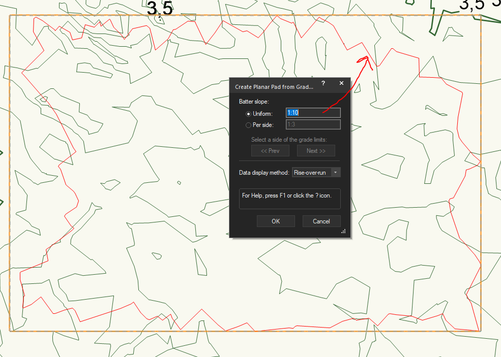
Great feature but can't get it to work. @Katarina Ollikainen @Tamsin Slatter @Tony Kostreski If I understand this function correctly I should be able to set a Grade Limits and automatically create a Planar Pad based on mass balance inside the Grade Limits and definition for Batter slope. I then expect my Planar Pad to also get a height that is correct, an elevation. It looks correct in 2D plan but Planar Pad have elevation 0. Is this a bug or am I doing something wrong. See also the attached file and film that shows the problem. Link to the description in Vectorworks 2023 Help. https://app-help.vectorworks.net/2023/eng/VW2023_Guide/SiteModel1/Creating_a_planar_pad_from_grade_limits.htm?rhmapfs=true 2023-11-02_09-48-36_Creating a planar pad from grade limits.mp4 Creating a planar pad from grade limits - v2024.vwx
-
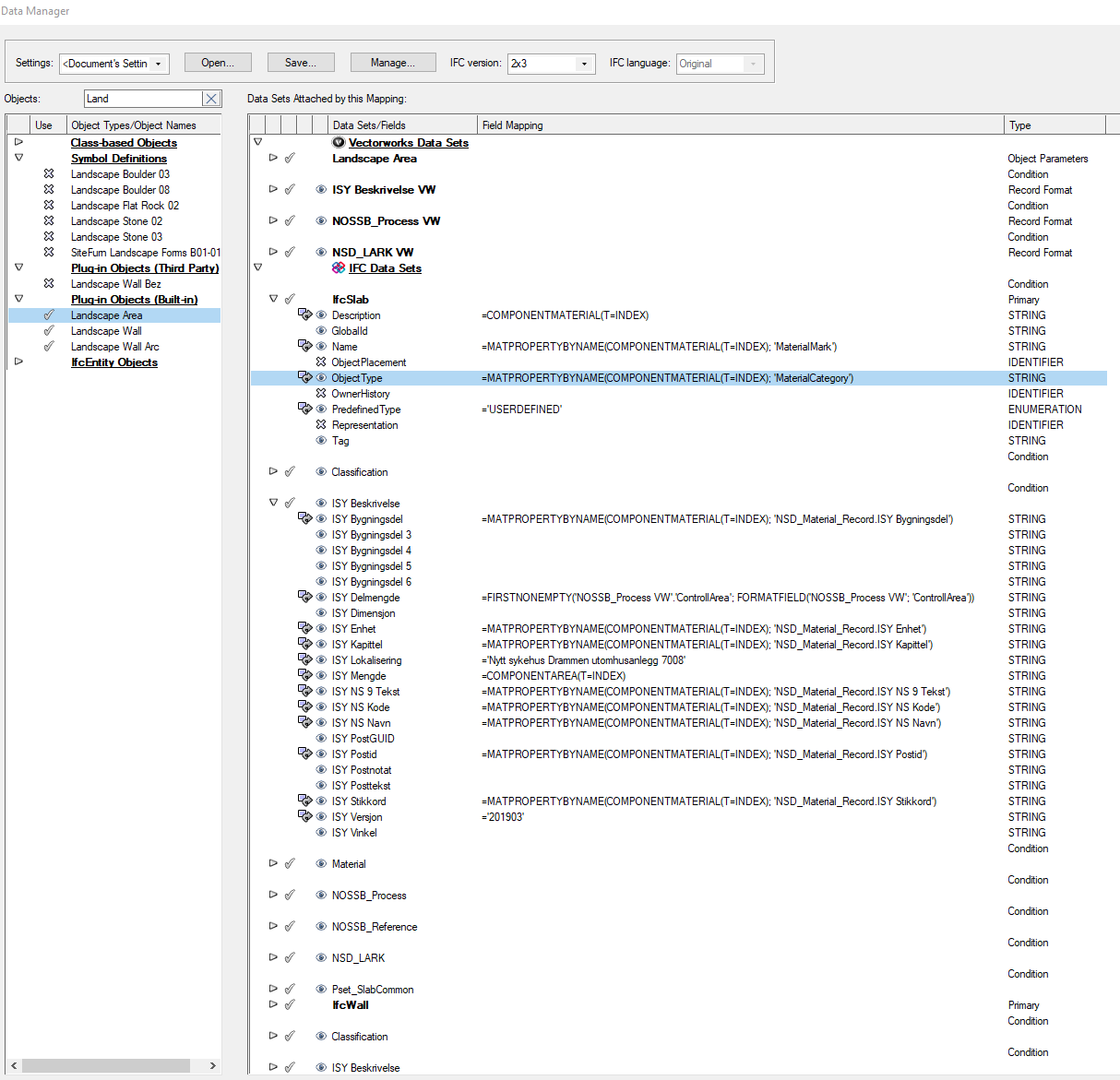
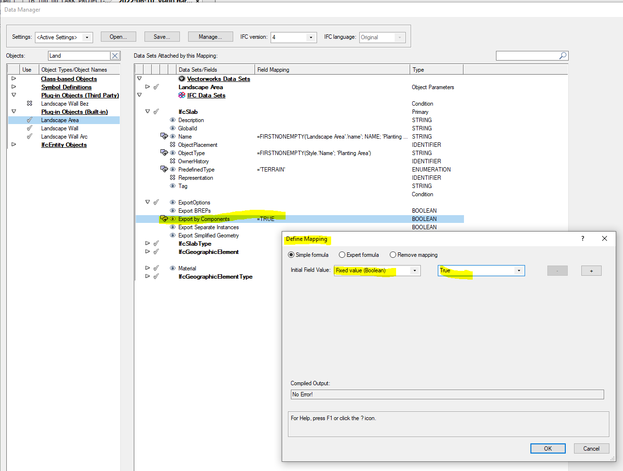
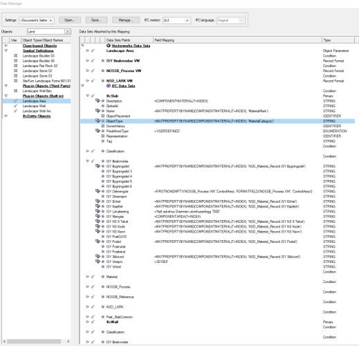
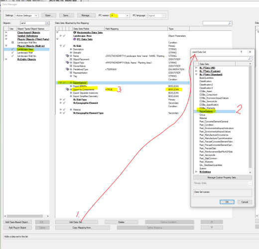
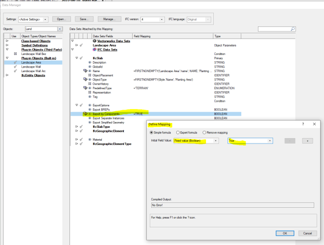
Here is my setup in the Data Manager, which shows examples of settings for each material layer in Landscape Areas that are exported as separate components to get properties in IFC from the materials that belong to each individual layer, component.
-
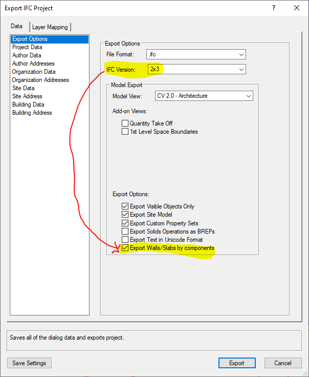
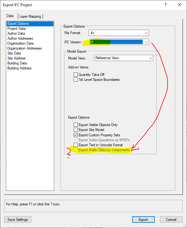
Landscape Area and Hardscap can be exported to IFC with each layer exported as separate objects with their own properties. For IFC2x3 you can use the setting in the export setting itself, but for IFC4 you have to enter the settings in the Data Manager. For each Plug-in Objects one must add ExportOptions, select <Export by Components>. Since this Type is BOOLEAN, you must choose =TRUE
-
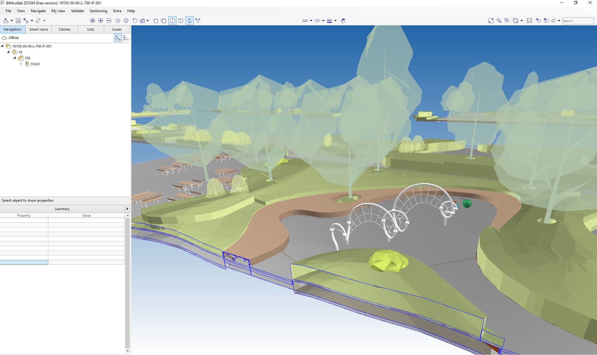
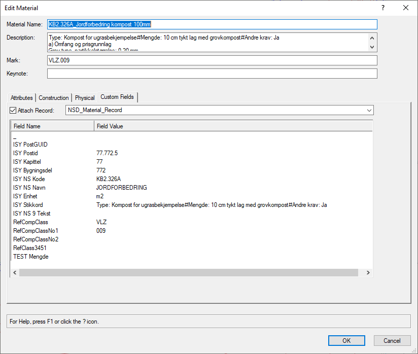
I have set all my materials only as Style Solid color and at the same time changed all my Texture so that these also only appear as with RGB colors in the model and in IFC2x3. In order to have 3D solitary trees and plants shown as transparent, the entire object is overridden in the export, with the Class on which these are located controlling this. Hopefully there will be a better solution to this eventually. IFC2x3_Objects with RGB colors.ifc

-
Scan to BIM - Who is using this or would like to?
aage.langedrag replied to LDraminski's topic in General Discussion
We have used external companies that have expertise in surveying and deliver detailed BIM models. Attaches a link to the company. Point clouds are delivered divided into different thematic categories according to the standard for this, such as terrain surface, buildings, different types of vegetation, constructions, furniture, etc. https://www.geoplan3d.no/laser-scanning-og-bim https://www.geoplan3d.no/files/skann-til-bim-9555.pdf -
Thank you very much Pat. Now this works too. Thanks for the wonderful help. Now I think it's evening for me here I am sitting at 10:00 pm on a Friday night. Hope it's not as late where you are 🙂 Wishing you and yours a good weekend. Looking forward to taking this up again on Monday and knowing that everyday life has become much easier. Thanks again and have a nice weekend.

- 25 replies
-
- 3
-
-
- selectsamestyle
- landscape area
- (and 1 more)
-
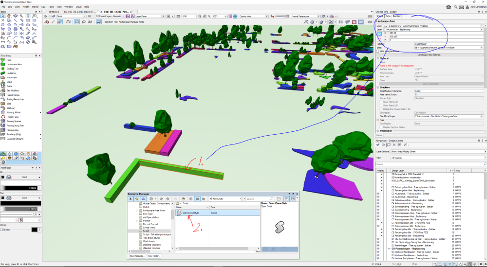
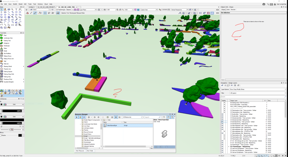
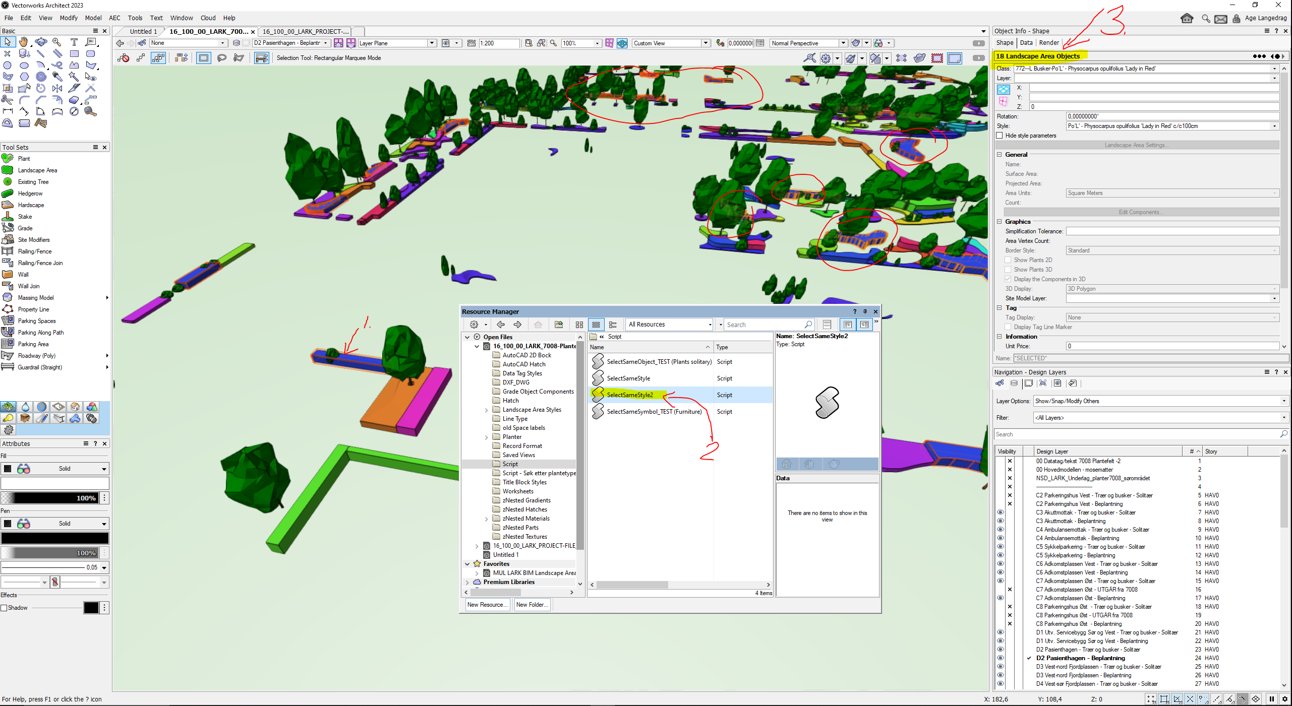
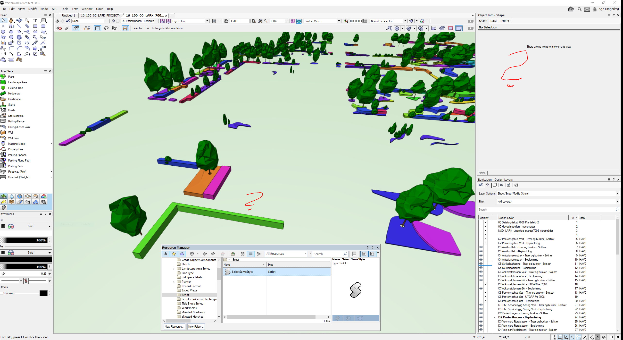
Hi The. Thanks for the link to the script. I have now tested it through the various tests shown earlier and it works on Furniture and Equipment which are 2D/3D Symbols. But for Landscape Areas both used as Hardscape and Plant Field it does not work. Not even for solitary plants. Great to be able to use this by right-clicking on the object and choosing script instead of using the Select Similar Tool and then choosing the right setting 🙂
- 25 replies
-
- 1
-
-
- selectsamestyle
- landscape area
- (and 1 more)
-
Super. Attaches a link to WeTransfer for download. Let me know if you don't get access. https://we.tl/t-viuAA54318
-
I want to be able to select Landscape areas used as planting fields, which is what they should be used for, and select planting fields with the same Style Name. I'm trying to use the script SelectSameStyle but doesn't seem to work? Is there something I'm doing wrong? This is in a new file that I have copied over Script to. When I run the Script the OIP is reset and the object I selected is no longer selected and neither are any other objects.