techdef
-
Posts
244 -
Joined
-
Last visited
Content Type
Profiles
Forums
Events
Articles
Marionette
Store
Everything posted by techdef
-
@Katarina Ollikainen I've attached file from another project, similar issue (actually the one that caused the request in the first place). I cannot get this file to behave as well using your tips. Can you please advise? -jamie DTM Issues.vwx
-
Hey folks, table chairs tool. Client wants a straight table for 30. Pull down maxes out at 20. Any way to over-ride?

-
Hey folks - I'm not getting anywhere trying to find the 2022 docs for this so here's the question: Can I use the Roundup function within a data tag? =Roundup(#AREA##sq ft_1_0#/150*0.67,1) is what I'm trying to do, and it just shows that text in the tag. The math works without the Roundup call. thanks
-
Ah, just had a longwinded follow up, but finally got @Katarina Ollikainen tip to work, thank you all!
-
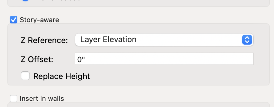
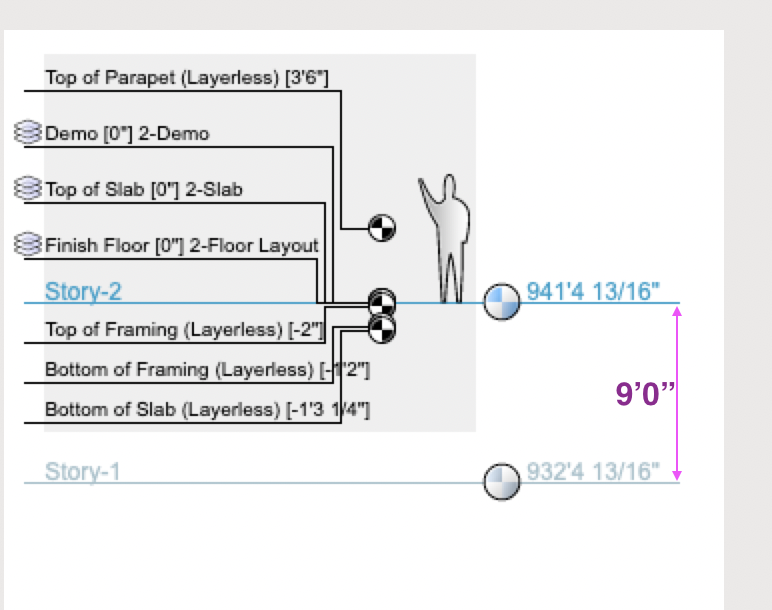
Tom, that's what I was afraid of. I think "story aware" is not quite the right term for this. Am I the only one who would use this?
-
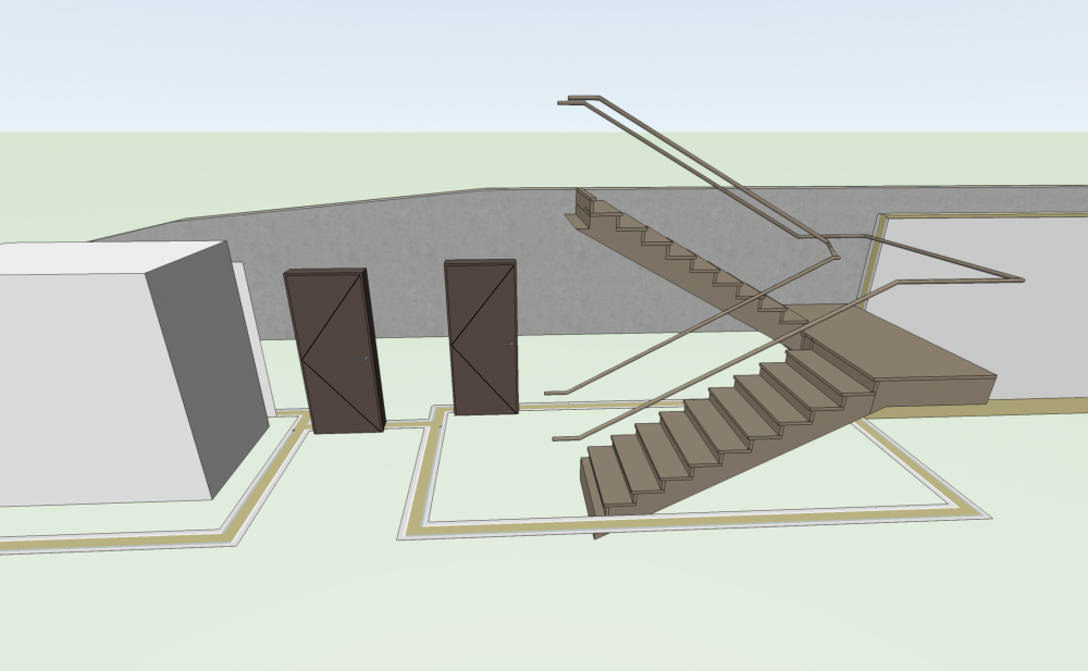
Folks, I may be way off base here, but am failing miserably, so this is either a request for help, or a feature request... Working on a core for a 10-12 story building. Preferably the core is a symbol, so its the same all the way up. Symbol is "Story aware". Walls drawn in the symbol are completely arbitrary on height as far as I can tell, with most being 0" tall. I'm trying almost everything I can think of to make these walls make sense, but ideally, the walls would be truly story aware and respect the layer heights of the story the symbol is placed into. For super extra credit, the stair tool would work in this same fashion, for obvious reasons. So, how come my walls are 0 height? It appears the only way to set a wall's height is to set the component's top offset relative to the layer level? That's crazy.
-
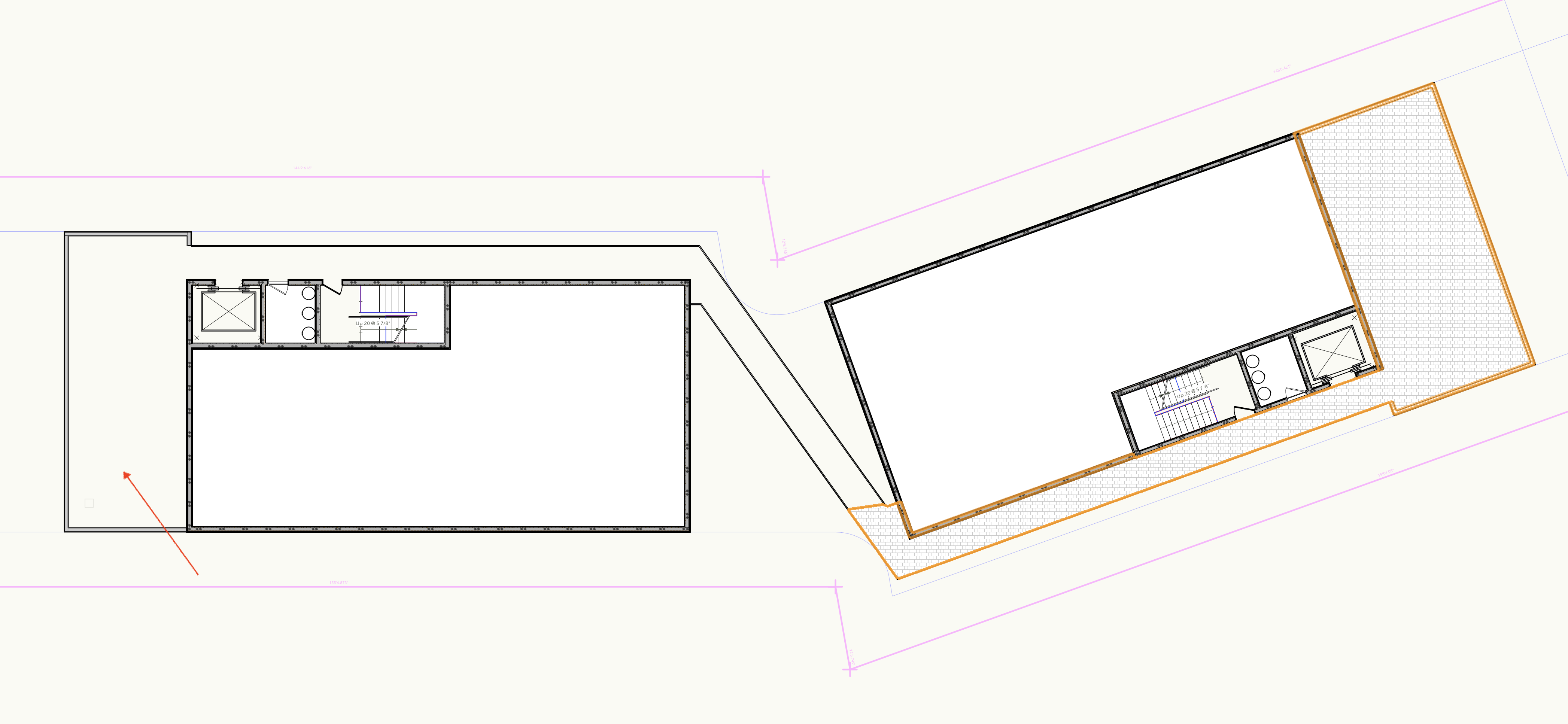
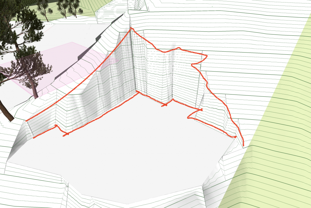
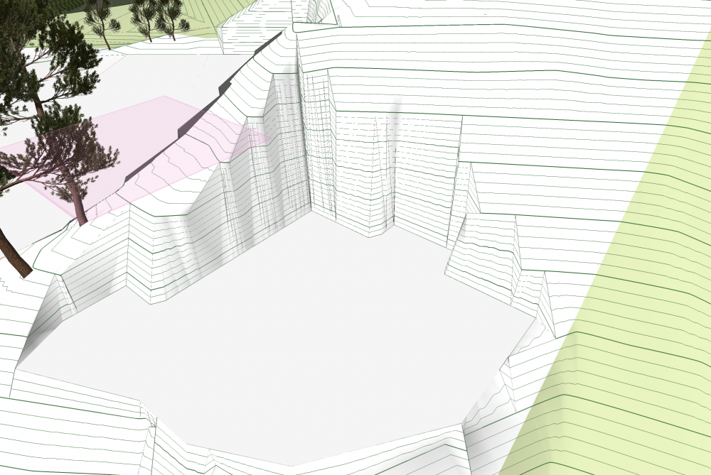
Hey folks, I'm having some floor slab generation issues. Trying to fill a long winding balcony/roof deck and it just wont go. Ive tried clicking everywhere within the slab zone (including the point of this red arrow), and somehow it only filled the bottom right corner (shown with the tile texture). Same result when I manually select the walls.

-
That is exactly the case. I was hoping for some way to keep everything else in the class w/ shadows without having to brute force them.
-
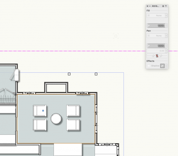
VW 2021, SP1.1 We like to use Schematics Classes on correct Story Layers for early sketch designs. I'm moving Spaces to those classes too. The Class has Drop Shadow turned on. Most objects you can turn the shadows back off on the Attributes palette. Somehow its grayed out for Spaces. How can I turn these shadows off (other than a different class). thanks, -jamie
-
MIchealk, thanks for the response. The Custom doesnt seem to handle 3 parts gracefully, ie: two rows, with two columns above one wider. Mine keeps freaking out and growing and growing. Also, assuming WinDoor isn't on Mac? but that may be a bad assumption.
-
I know its not a transom anymore, but same idea. We have to have glazing to 42" above finish floor here to keep kids from falling out. I'd like an easy way to make solid glazing below, then mixed design above.
-
Please see the dumb mockup below. I'm guessing this would be cake for you guys, and would be a really nice little add for us users.
-
Editing a Data Tag in 2022 and there's something new in the Classes pulldown. Doesnt seem to do anything or be useful, but it sure hints at the Something Weve Been Asking For [being Active Class] Fingers crossed

-
Thanks for the reply - I've done a quick sketch below. Its more visible at the top of the cut, where one would expect a nice smooth line, directly above the modifier at base of wall. Instead its flared out (ok, fine, but not helpful at lot-line developments), but certainly there is some triangulation happening. Double-checked those two things, mesh smooth is at 80, and OpenGL is set to Very High. When using Grid for terrain the effect is almost nonexistent, though that brings its own other set of undesirable behaviours (like losing contour lines!)
-
Hey folks, wondering if I'm missing something - getting stair-stepped results when applying modifiers (pad w/ retaining shown below). Wondering if there's a setting someplace to up the resolution on this that I cannot find?
-
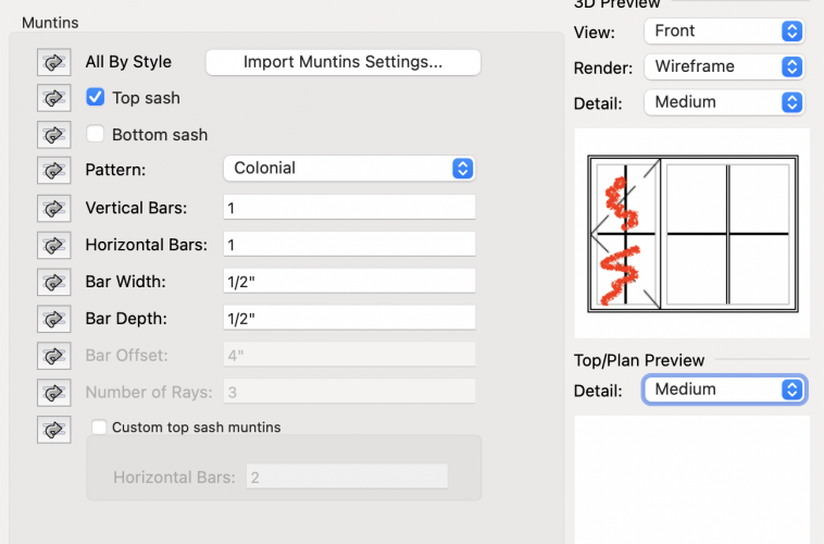
Trying to make an asymmetrical window, but would like a vertical mullion on the fixed glass portion, but not on the casement. Impossible?
-
Pat, since I'm just in shematics, there arent really any viewports yet worth saving. Not having to set rotation on all the new ones would outweigh... I'm already georeferenced, so perhaps this isnt possible, but it seems like there should be a way to set a user grid of some sort
-
Sadly this did nothing. I'm already Georeferenced FWIW.
-
Hi all - been doing SDs for a 7 sided flag lot. Finally have a preferred orientation for the main part of the design. Is there a way to 'flatten' or 'codify' the plan rotation? Ive saved several views for things, and now would like one of them to be the new normal. thanks
-
Worksheets: formula for counting number of items
techdef replied to Christiaan's topic in General Discussion
Picking this back up - I'd like to filter Parking Spaces by size, ie: to separate out Standard from Compact (and possibly also by story). Looking at the above, and tried: =COUNT(IF((B3>=18), 1, 0)) which somehow yielded 9409. Perhaps the If function doesnt like feet and inches? Long story short, the first pass would be a cell which displays Number of Spaces >= 18' x 8'-6" and a cell for Number of Spaces < 18' x 8'-6" thanks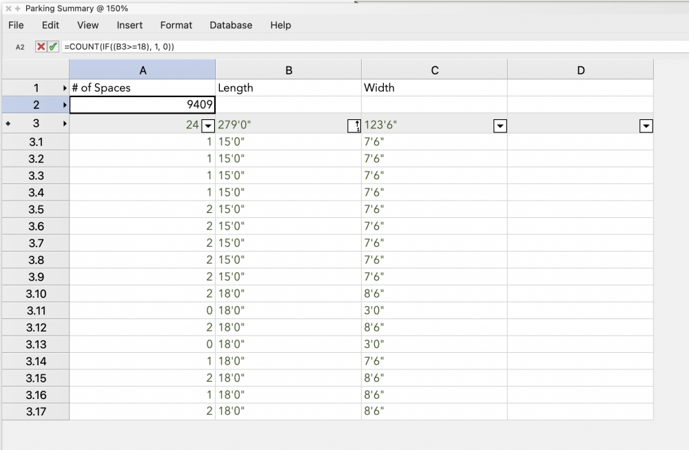
-
Parking space count in a worksheet/database
techdef replied to Jim Smith's topic in General Discussion
Nice, thanks for this. Now we need a tag for Compact Spaces... -
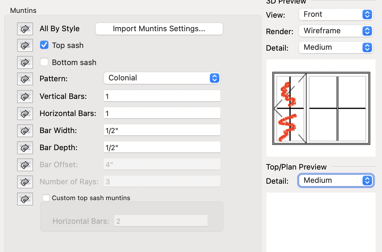
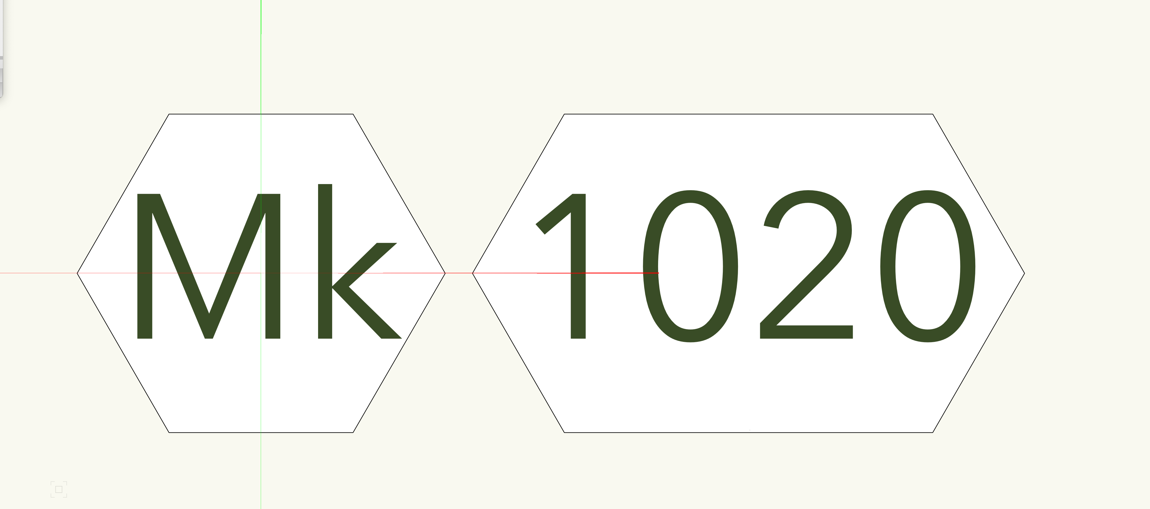
Looking to make an expanding hex for window & door tags, concept similar to the Drawing Label tool constraints. With 2 characters, it would be a symmetrical hex, with 3 -4 it would stretch...

-
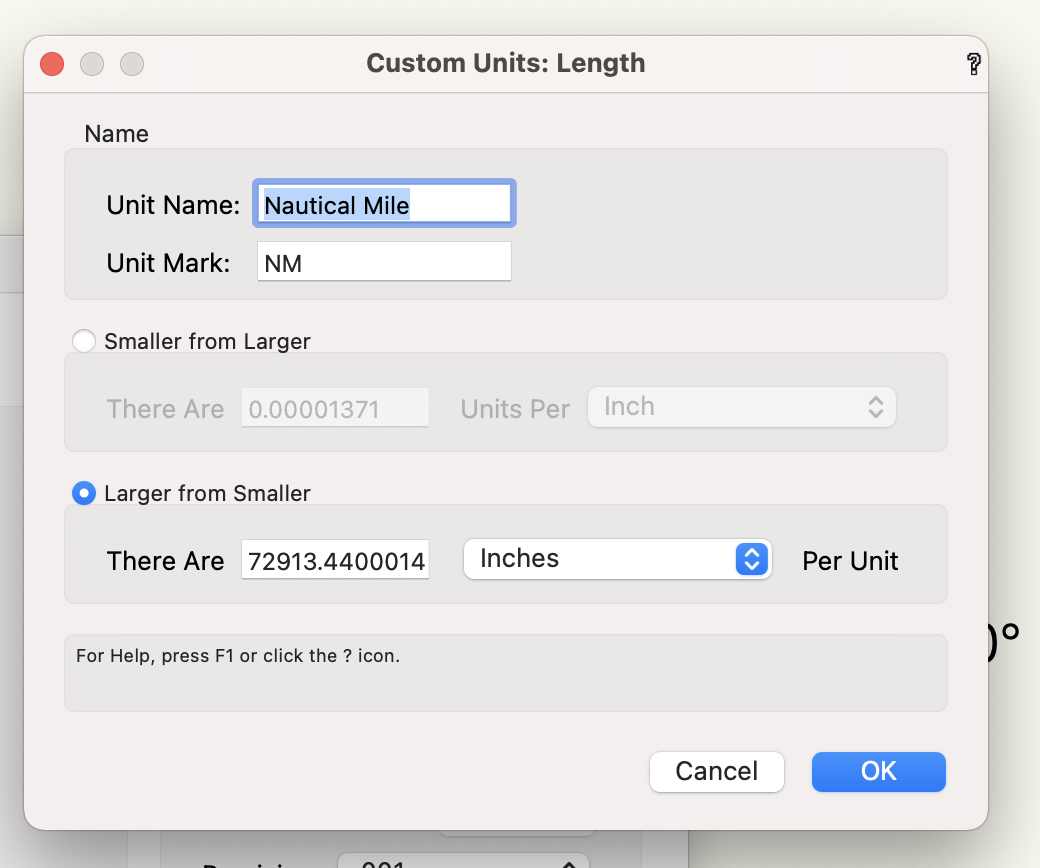
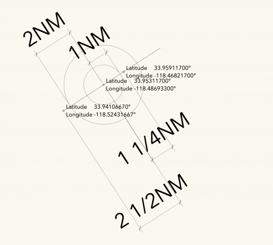
Hey friends, looking for some ideas on what I've screwed up: trying to plot some GPS way points from a nautical map. We have known coordinates for several (12+) waypoints in Lat/Long format. I've set my file up to use Nautical Miles as the base unit (though this is likely where I've gone wrong?). Using georeferencing. I'm getting a discrepancy of about 25% scale. Waypoints should be 2 miles and 1 mile apart respectively. When measured, theyre showing as 2.5 an 1.25 miles apart. This is consistent over all my points. Have I screwed it up with the units, or my georeferencing somehow? thanks

-
Is there a place to change the Lat/Long coordinates format? I have reams of input data in Degrees & Decimal minutes, would prefer not to convert them all to decimal degrees if possible
-
Has this been changed in the past 19 years?