Search the Community
Showing results for tags 'grading'.
Found 9 results
-
 When using the stake tool, you currently have the option to "Set Elev to Site Model" as a way of creating spot elevations for a grading plan. This is great when documenting the surface of a site model for high points and such, but often the elevation we are looking to document is actually a feature such as finish surface, top of wall, bottom of wall, etc. These items are placed on top of a site model, so a stake object trying to query their top elevation will only return the elevation of the underlying site model. There should be a way for the stake tool to recognize modeled elements in the drawing to pull this information into its reference.
- 21 replies
-
- 12
-

-
- site model
- grading
- (and 2 more)
-
Gradient Cut Fill Site Model Visualization
ericjhberg posted a question in Wishlist - Feature and Content Requests
It would be awesome if you could generate a 2-dimensional visualization of a Site Model's cut/fill, but instead of just static Cut = Red and Fill = Blue...you could assign a gradient for each that could color the site model based on cut severity or fill severity. For example a White to Red gradient for cut that the greater the value of cut, the deeper the shade of red. Additionally a White to Blue for fill that the greater the value of fill, the deeper the shade of blue. This would be an extremely useful way to visualize site models. @Tony Kostreski @Eric Gilbey, PLA @Vlado @bgoff- 4 replies
-
- 4
-
-
- site model
- landmark
- (and 2 more)
-
I often create individual paver units for a variety of reasons, it would be helpful to have the ability to "group" these individual hardscapes and grade them like a single hardscape. Some of the reasons for creating these "assemblies" is in order to apply records to individual pieces that are thicker at edges, or oversize, or custom cut.
-
Send Objects to Surface...works sometimes, but not always
ericjhberg posted a question in Troubleshooting
We often work with site models to visualize projects and there has always been an issue with sending items to the surface. Sometimes it works and other times, no matter what I try, it doesn't Curious if anyone has determined best practices for this or experienced the same issue and have a work around? -
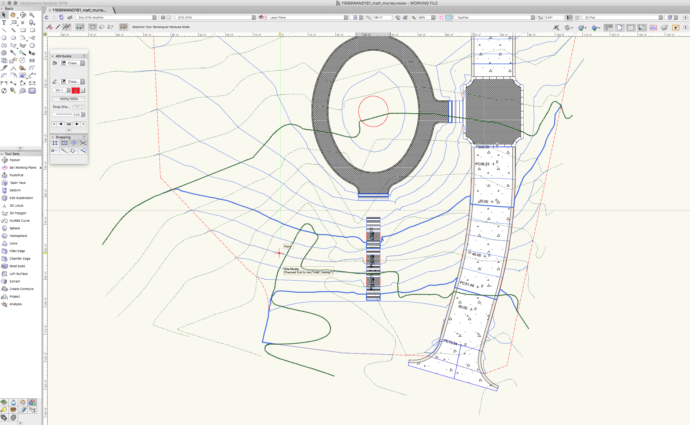
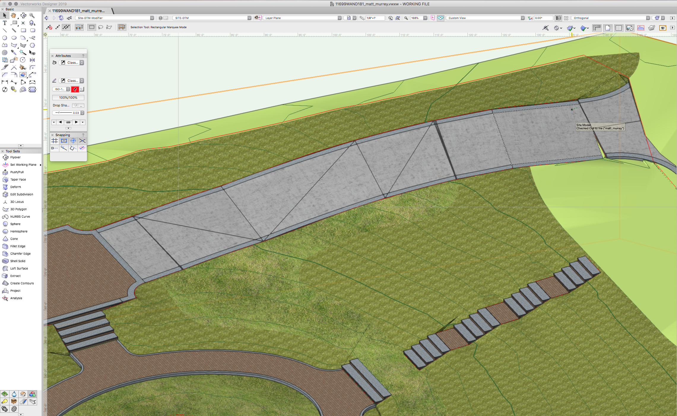
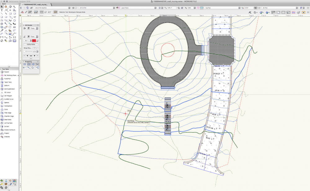
Hello. I have a road poly going down a slope. There is a pad modifier at the bottom of the road and the grade limit is set to the property boundary. I added a nurbs curve to the top edge of the road for finished grade at the road edge. 3D view shows to be accurate (top of paving = to adjacent grade). The contour lines however are not following the top of paving, instead they are following the 'cut' below the road on the DTM. While this is accurate for the cut, it is not accurate in terms of a site plan. Is there any workaround for this? See attached screenshot.

-
The Grade Object tool in Landmark has long been a frustration of mine. It is a very powerful tool, but when used in actual applications it is SUPER SLOW and cumbersome. I hope the grading tools and workflows get a hard look for both functionality and usability because many are just clunky and not applicable in a professional setting.
- 5 replies
-
- 2
-
-
- landmark
- grade object
- (and 3 more)
-
Using Landmark for about two months now and running up against what seem to be software limitations. Are there tools in Landmark for creating complex roads/paths with custom profiles, ie various curb and crown profiles? This is a HUGE must for modern day landscape architects. More specifically, we need to be able to create roads with stations such as in the polyline road tool, but with the editability of the nurbs road tool. We also need vertical curve/alignment controls. The problems with current tools: -non-realistic relationship to site model/grading and lack of vertical curve controls -lack of profile controls, ie crown and curb/gutter profiles -lack of customizability and accuracy. We need to be able to create a road with various stations at varied elevations with various curband gutter profiles and customize turning radii at junctions.
- 3 replies
-
- 2
-
-
- site modeling
- grading
- (and 1 more)
-
Wouldn't it be great if we could layout streets/ driveways/ roads with vertical curve alignments? My wish, aside from world peace, would be to have the ability to create 3D polys that use all the geometry of vertical curves that you would use in road alignments. I've included description from a college course on the subject and a spreadsheet from Michigan DOT that will run the calculation. I use to do these by hand when I first started as a designer in a landscape architecture firm. The built result is a smooth and beautiful transition that avoids abrubt grade changes. GEOMETRIC DESIGN of CURVES.pdf MDOT-Vertical_Curve_Calcs_120887_7.xls
-
Stake Objects - Prefix or Suffix
ericjhberg posted a question in Wishlist - Feature and Content Requests
This is a fairly simple request. Can a field be added to stake objects that would allow for the addition of a prefix or suffix. This would allow for more precise graphical communication of spot elevation types (i.e. FS, TW, TS, FL, etc.)? We ideally need this information to use stake objects as annotative tools for grading plans.