Jump to content

Search the Community

Showing results for tags 'grade tool'.

  • Search By Tags

    Type tags separated by commas.
  • Search By Author

Content Type


Forums

  • Announcements
    • Announcements
    • News You Need
    • Job Board
  • Feedback
    • Roadmap
    • Wishlist - Feature and Content Requests
    • Known Issues
    • Wishes Granted / Issues Resolved
    • Forum Feedback
  • General
    • Troubleshooting
    • General Discussion
    • Architecture
    • Site Design
    • Entertainment
    • Vision and Previsualization
    • Braceworks
    • ConnectCAD
    • Energos
    • Rendering
    • Workflows
    • Buying and Selling Vectorworks Licenses
    • Hardware
  • Customization
    • AI Visualizer
    • Marionette
    • Vectorscript
    • Python Scripting
    • SDK
    • 3rd Party Services, Products and Events
    • Data Tags
  • Solids Modeling and 3D Printing
    • Subdivision
    • Solids Modeling
    • 3D Printing
  • Vectorworks in Action
  • Archive
    • Resource Sharing
    • Machine Design

Calendars

  • Community Calendar
  • Training Calendar
  • Webinars
  • Community Groups

Categories

  • Knowledgebase
    • Tech Bulletins
    • Troubleshooting
    • Workflows
    • How To
    • FAQs

Categories

  • Marionette - Objects
  • Marionette - Networks
  • Marionette - Nodes
  • Marionette - Menu Commands

Product Groups

There are no results to display.


Find results in...

Find results that contain...


Date Created

  • Start

    End


Last Updated

  • Start

    End


Filter by number of...

Joined

  • Start

    End


Group


Occupation


Homepage


Hobbies


Location


Skype

Found 4 results

  1. I would like to request Unit and Labelling for the grade tool similar to the Stake Tool. Units for grading are often not the same as the drawing units. our drawings are usually millimetres and vertical grading units are often metres to conform to the survey units. Also the ability to label a grade is important such as bottom of stair, bottom of curb, etc. Stake has all of these features. We have to double the amount of work in our grading drawings by using the Grade Tool to calculate and show slopes and the use the Stake Tool as a 2D graphic for labelling. Very time consuming.
  2. Hi, I have made a section in a site model and would like to put out some heights/spot elevations on the terrain. Can you do it and what tool would you use? Thanks! /Elin
  3. Hi, at our office we are using civil to make grading plans today. Although our plan was to start using VW landmark to do this. When we have been trialing this there are quite a few tools that we miss in VW which are our most important when we are putting out elevations and grades on our plans. For example in Civil, we can draw a line which at every vertex has an elevation. Every vertex we then can set a new height to, and the line and site will change. Further we can pick a group of these vertex and give them a slope, for example a "constant grade" along this line. See screen shot below to understand how it looks like in Civil. Another great tool is to be able to hover the cursor over an area and it then show us the elevation in one point immediately, as well as hover over a sloping area and it will tell you towards where and how much it slopes. Next thing id like to see in VW is to be able to have an area (such as a pad/hardscape/or just 3D lines) that in every corner can have different elevation values which you can edit. I understand that this is not desirable on floors in a building, but when planning landscapes the ground is hardly ever completely flat. I'd like to see a greater flexibility here. I've seen that aligned hardscapes has this modify surface tool, but for now it is not good enough. For example this is too hard to use because first you need to go inside the object to edit, secondly when putting out grades or stakes on it, the elevation resets to + 00.00 because then the object you are modifying is the 0. This is very annoying and difficult to understand unfortunately. Would it be possible to integrate these tools into vectorworks? Why haven't you already? Thanks alot! Elin
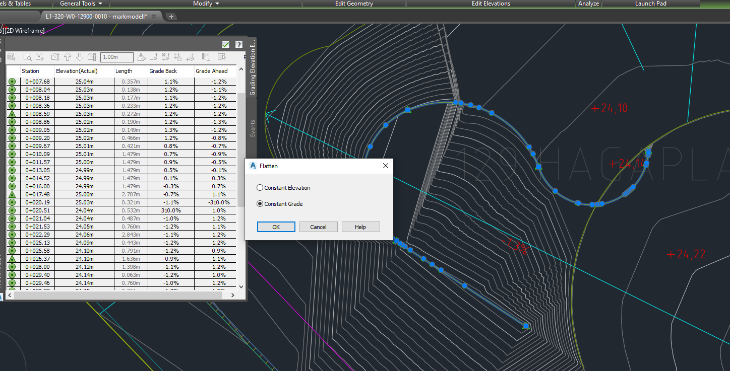
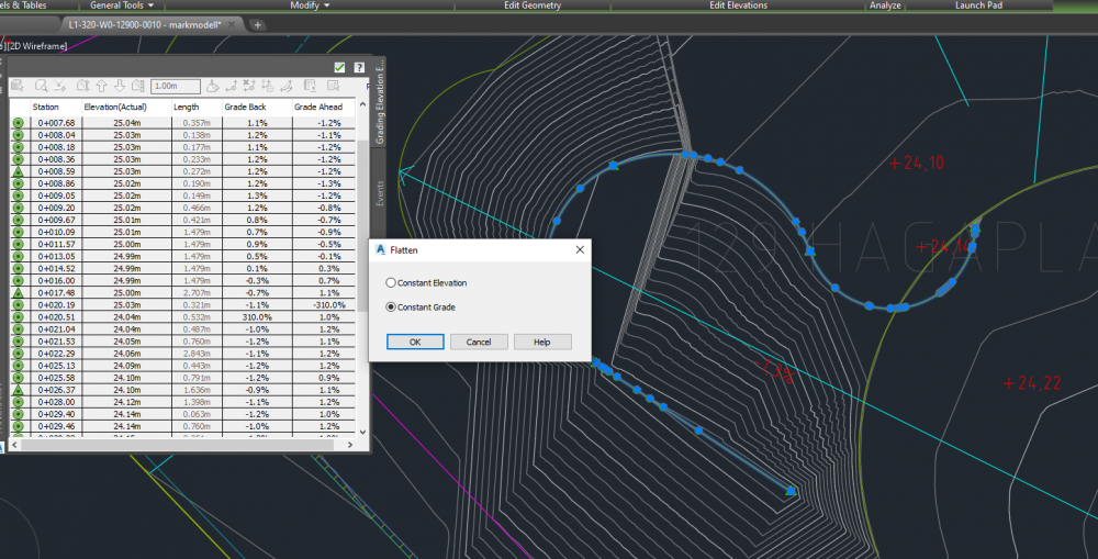
  4. Hi, The grade tool could have tick boxes for: -lock elevation -lock rise/run or percentage AND then show the result live, before the grade line is set. Let's assume that: -I want to do a preliminary study of the site in regard to site elevations, just to get an overall idea what kind of "elevational situations" are going to occur. -I know the future floor level and the surrounding street levels, and the maximum allowed slopes. If want to test several different options; elevations and grades, I have to draw a grade line for each of these "guesses" with different settings. Why not change the tool so that I can see the end result before I click to set the line? Just like the floating coordinate bar next to the cursor does. To put it another way, the ability to see the numerical result "live" before the grade line is set. If I lock the run/rise ratio, I see the elevation at the end of the grade line change live depending on the lenght of the line, and if I lock the elevation, I see the run/rise ratio change live. This would allow me to get the about right elevation easily, after which one can input the exact numbers into the tool.
×
×
  • Create New...