Elin
-
Posts
12 -
Joined
-
Last visited
1 Follower

-
@Dave Donley Hi Dave, Thank you for your reply. Thats great to hear that you are working with Enscape to achieve that and then we know that it is not possible at the moment. It would be lovely if you can reach out to us when its possible if its not too far ahead in time! Best regards, Elin
-
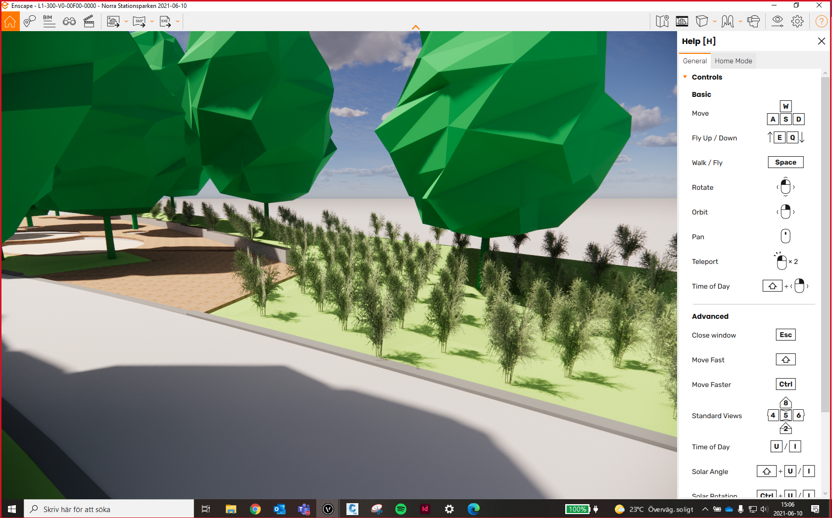
Hi, Lisa and I are colleagues and we are soon going to use vectorworks to do some renderings with Enscape in our model. One other thing that would be much apprechiated if you look into this topic about how vegetations is visualized in VW and Enscape, is how landscape areas is appearing in Enscape. It would be amazing if landscape areas from VW would have a nicer look when we view them in Enscape. Right now they just appear as square figures and very simple. Thank you and hoping there is a solution! Elin
-
@Rossford Thank you for your reply! "I haven't done it in a while, or in 2021 but did experiment with using the road tool and its distribute stake command to create swales with constant grade and gentle curves (using polyline alignment mode.) If rendering, you obviously have to pick a more turf like surface image." Sounds clever to use the road tool. It could be an option for us, but how would you do it if the walkway/road has a varying width? Quite often our paths are changing in both width and height with flowing shapes… "I still do fairly traditional contour grading, sometimes by hand, sometimes by inserting/reusing contour shapes (i.e., a mound is often a mound and you can just trim the bottom lines as required) and signatures (i.e., 3% swale, etc.) For this, I have long lobbied VW to add a tool I think is in ACAD, which is the stretch tool, i.e., pull multiple poly lines contour lines and have them stretch evenly to elongate a mound (yes, in 2D before you convert to 3D. Sadly, I haven't had enough time (or grading work) to play with the push pull aspects now in LM." I didnt understand exactly what countour shape, signatures is (and how it looks like) and how you make a swale? Would you mind taking some screenshots/instructions of how you do it? That would be so kind. We could definitely need some tips how to make swales and mounds.
-
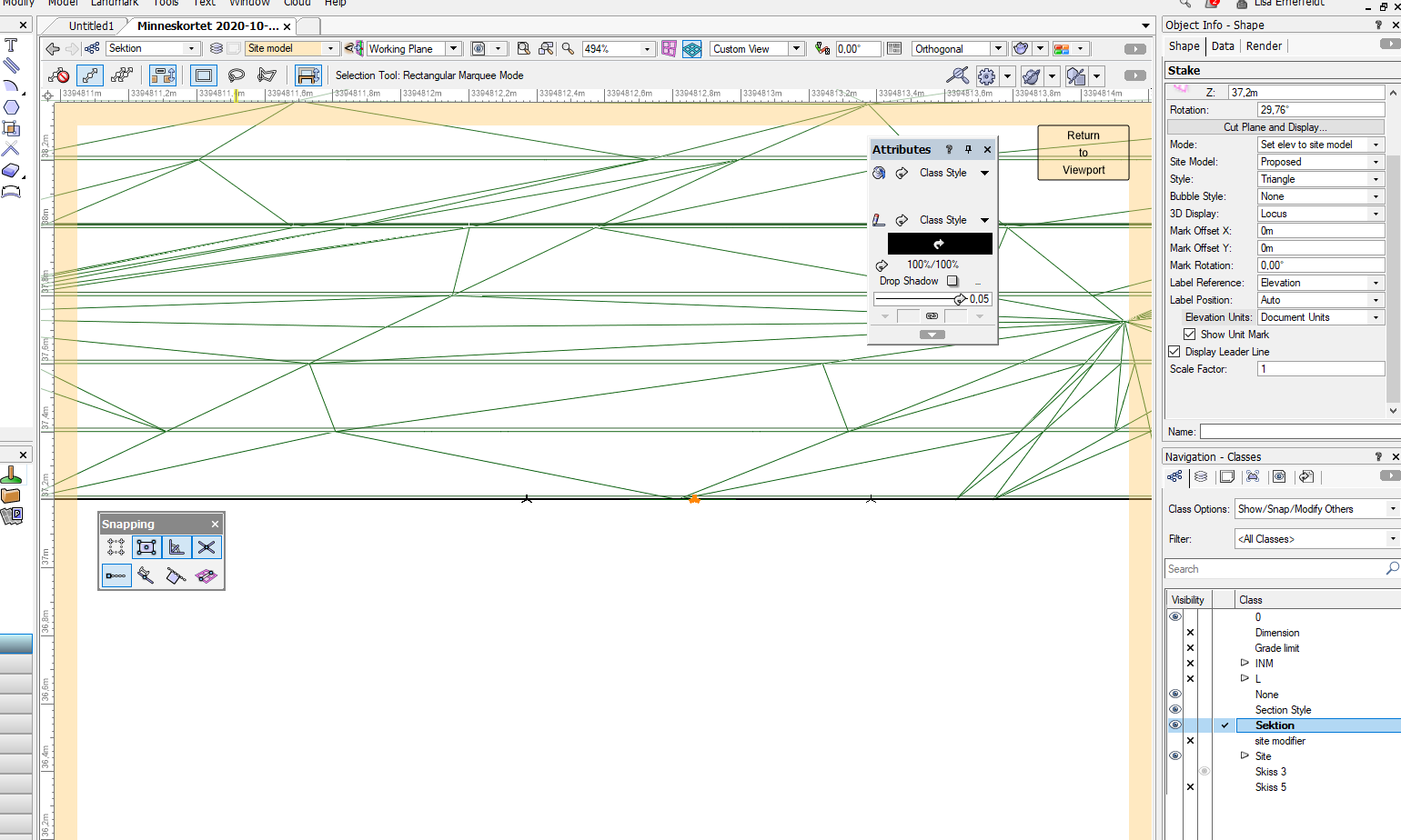
@Tamsin Slatter Thank you for replying and helping out! " Have you tried using the Grade tool? It won't solve all your desires, but a network of grades can have each connection point set to a specific elevation or you can set a specific grade to calculate the elevation at the connection points. " Yes, I’ve been trying to use the grade tool as much as possible but I think it’s a bit blunt and difficult to work with. The abillity to connect them into networks is great, but If we’d do a network of grades it would be helpful if it could affect not only the coneccting grade but also the ”whole”. As in my example screenshot the whole line is having a downward grade of for example 2.5 %. Another thing on our wishlist is to be able to do grade objects with a radius, or is this already possible? I know you can do a contour in whatever shape and give it a slope, but this makes the countour slope only in one direction and isnt sloping along the curve.. "To view the elevation of the site at a specific point, the Stake tool will report the surface of the existing or proposed site. It doesn't show the direction of fall, but it does provide the elevation. You can move it across the surface and it will update." About the stake I saw now it was changing the numbers when moving it around, although we’ve seen it hasnt worked perfectly, maybe because the site model isn’t updating simultaneously and you have to do it manually. Why is this? When working in civil and revit the site is updating itself as you work with it. This creates an issue when you dont know if you can trust the numbers on the site in VW since the surface might not be updated and the numbers might not have changed. What we have discovered is also that stakes cant be placed on a surface such as a harscape? When making grading plans we’d need to place elevations/stakes on top of the finished surface as well as on the ground/site model. Can a grade/stake objekt edit the harscape/surfaces without going ”inside” the object? We’ve been trying to use the surface modifier in hardscapes but doesn’t find it very helpful and a bit confusing. For example, if we have an area in a form of a square and want different elevations in each corner, how would you do it (with what type of object ie hardscape/pad etc, and with what tool? stake/grade etc)? Is there any other tool that we could use and modify with?
- 11 replies
-
- 1
-

-
- grading plans
- landmark 2020
- (and 3 more)
-
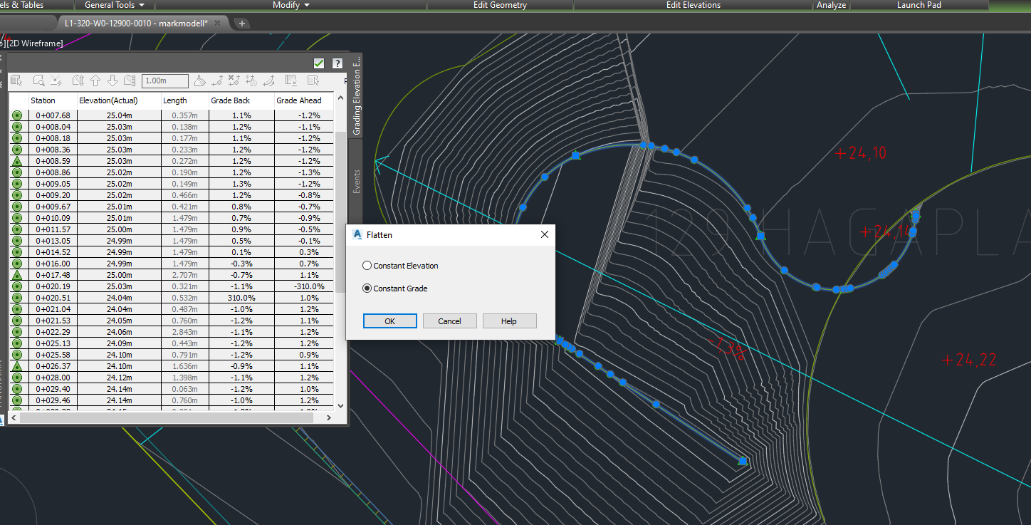
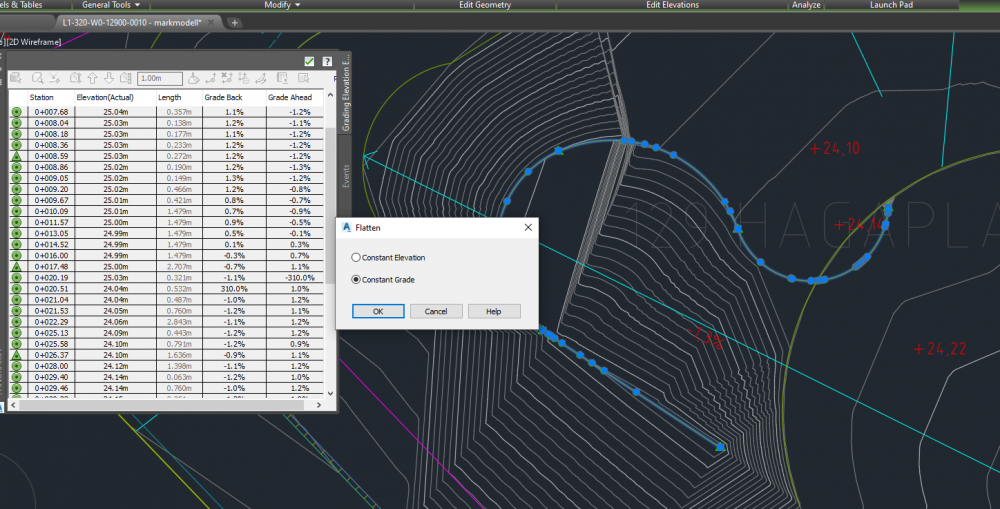
Hi, at our office we are using civil to make grading plans today. Although our plan was to start using VW landmark to do this. When we have been trialing this there are quite a few tools that we miss in VW which are our most important when we are putting out elevations and grades on our plans. For example in Civil, we can draw a line which at every vertex has an elevation. Every vertex we then can set a new height to, and the line and site will change. Further we can pick a group of these vertex and give them a slope, for example a "constant grade" along this line. See screen shot below to understand how it looks like in Civil. Another great tool is to be able to hover the cursor over an area and it then show us the elevation in one point immediately, as well as hover over a sloping area and it will tell you towards where and how much it slopes. Next thing id like to see in VW is to be able to have an area (such as a pad/hardscape/or just 3D lines) that in every corner can have different elevation values which you can edit. I understand that this is not desirable on floors in a building, but when planning landscapes the ground is hardly ever completely flat. I'd like to see a greater flexibility here. I've seen that aligned hardscapes has this modify surface tool, but for now it is not good enough. For example this is too hard to use because first you need to go inside the object to edit, secondly when putting out grades or stakes on it, the elevation resets to + 00.00 because then the object you are modifying is the 0. This is very annoying and difficult to understand unfortunately. Would it be possible to integrate these tools into vectorworks? Why haven't you already? Thanks alot! Elin
- 11 replies
-
- 3
-
-
- grading plans
- landmark 2020
- (and 3 more)
-
@Pat Stanford I understand. The stake was "set elevation to site model" but I also tried to change the mode to "Use onbly as 2D/3D graphic" but it still doesnt show anything. @Frederic_Vbc Unfortunately the tag doesnt show either. I dont know what you are thinking about this issue, but for us this is a fundamental tool that we would need and use everyday. We are working hard to implement VW for us as a landscaping firm, but still think the program is missing some basic tools that we would really be in need of!
-
Hi Pat, I tried but with no success unfortunately.. I can see the stake object in plan and also the locus when I edit "section in place", but shows no tag.


-
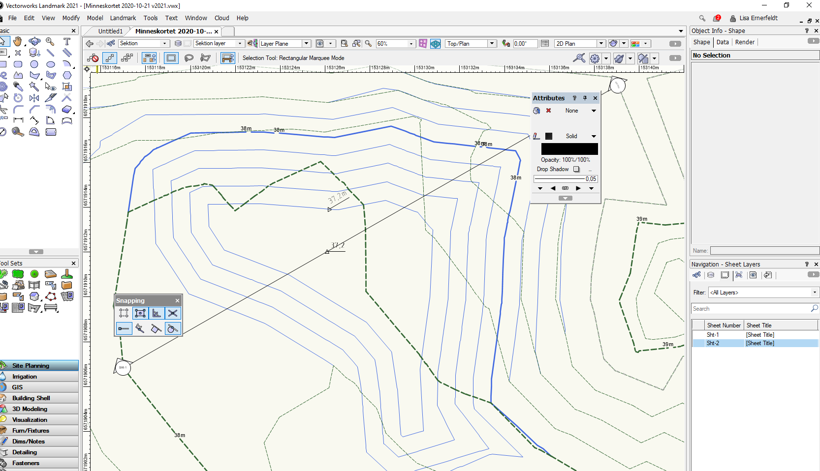
Hi, I have made a section in a site model and would like to put out some heights/spot elevations on the terrain. Can you do it and what tool would you use? Thanks! /Elin
-
Nope, that pretty much solved it! Thank you!
-
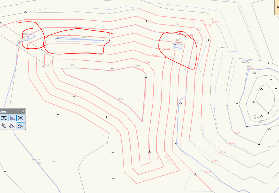
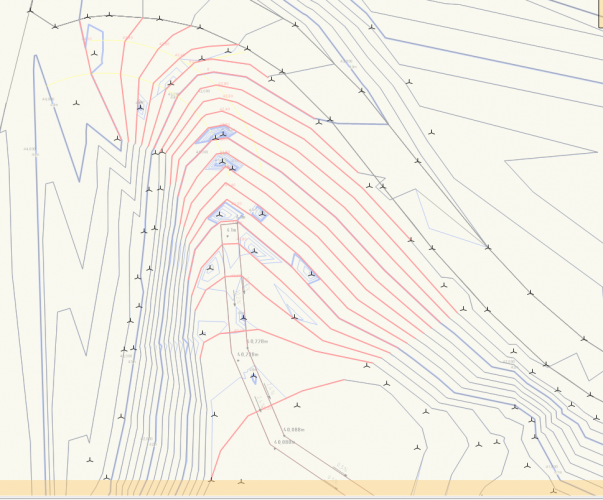
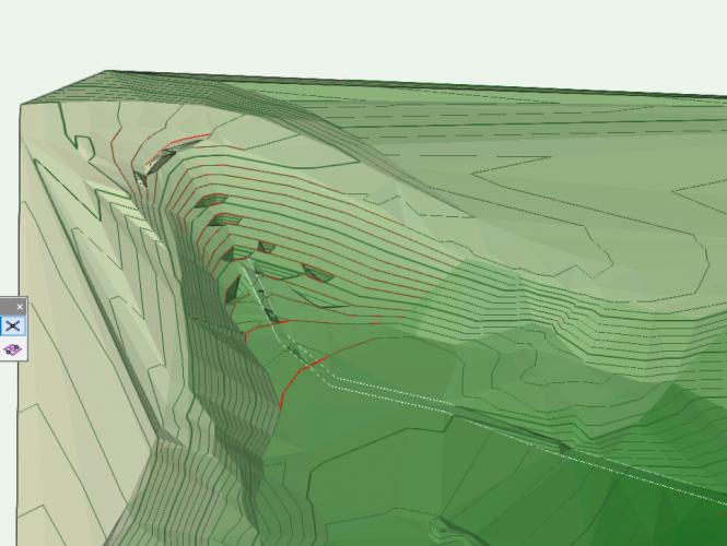
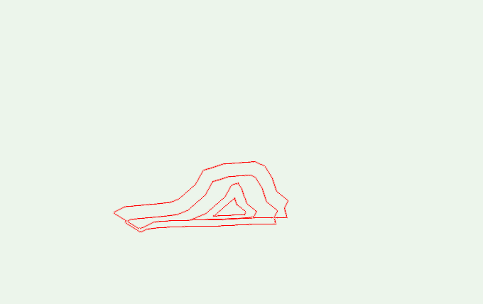
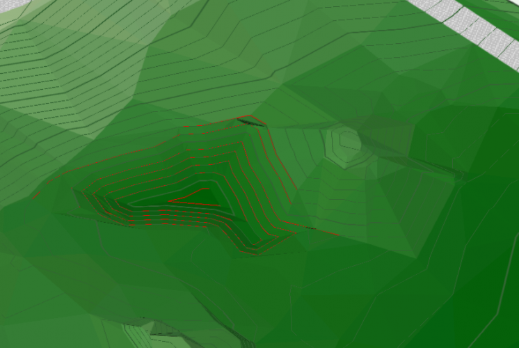
Hi, I am using c ontours to make changes in my site. When I draw them as proposed and update the model (which is also showing proposed), the 3D-locust that the site model is built up (source data) of is still affecting the terrain. Why is it like this? I don't really want to delete the imported info cause I still want the original (existing) terrain to be correct ... Ill post some pictures below .. Thanks for help 🙂

-
-
Elin joined the community
-
Hi! I want to create a solid volume out of a few 3D-polylines to calculate the volume from this. The purpose is that we are drawing a pond and need to know how much water it can hold. We have already made a terrain and can get some numbers from the cut-and-fill calculations but it would be helpful to be able to draw the actual bowl too. What would be our best option/tool to do this? I can try to post the model or pictures if that helps further!! Happy for some help! Elin