nca777
-
Posts
120 -
Joined
-
Last visited
Content Type
Profiles
Forums
Events
Articles
Marionette
Store
Everything posted by nca777
-
have a screenshot or sketch?
-
VW just cannot do some of the things I need it to do, or it takes an inordinate amount of time, like drafting a parking lot for example. With command keys in cad I can draft and average commercial parking lot in minutes. VW takes me much longer using buttons and it seems to get the lot into 3D is almost impossible without advanced 3D modeling...then you have to make changes. VW has some nice capabilities, but a lot of the tools seem sort of half developed, at least in the BIM world, which makes me question why we aren't just using CAD if modeling is such a pain. I guess it depends on your needs...
-
Not sure, maybe I could get the tin. Sometimes I find it on a frozen layer in CAD. I'll look into it. thanks
-
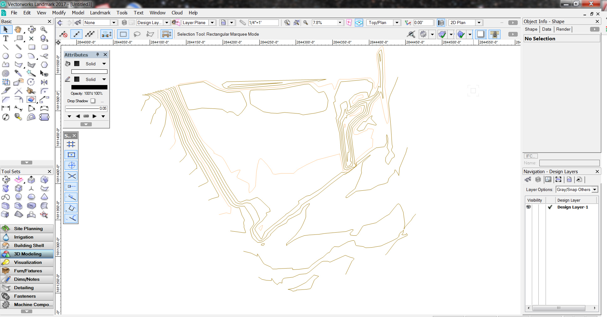
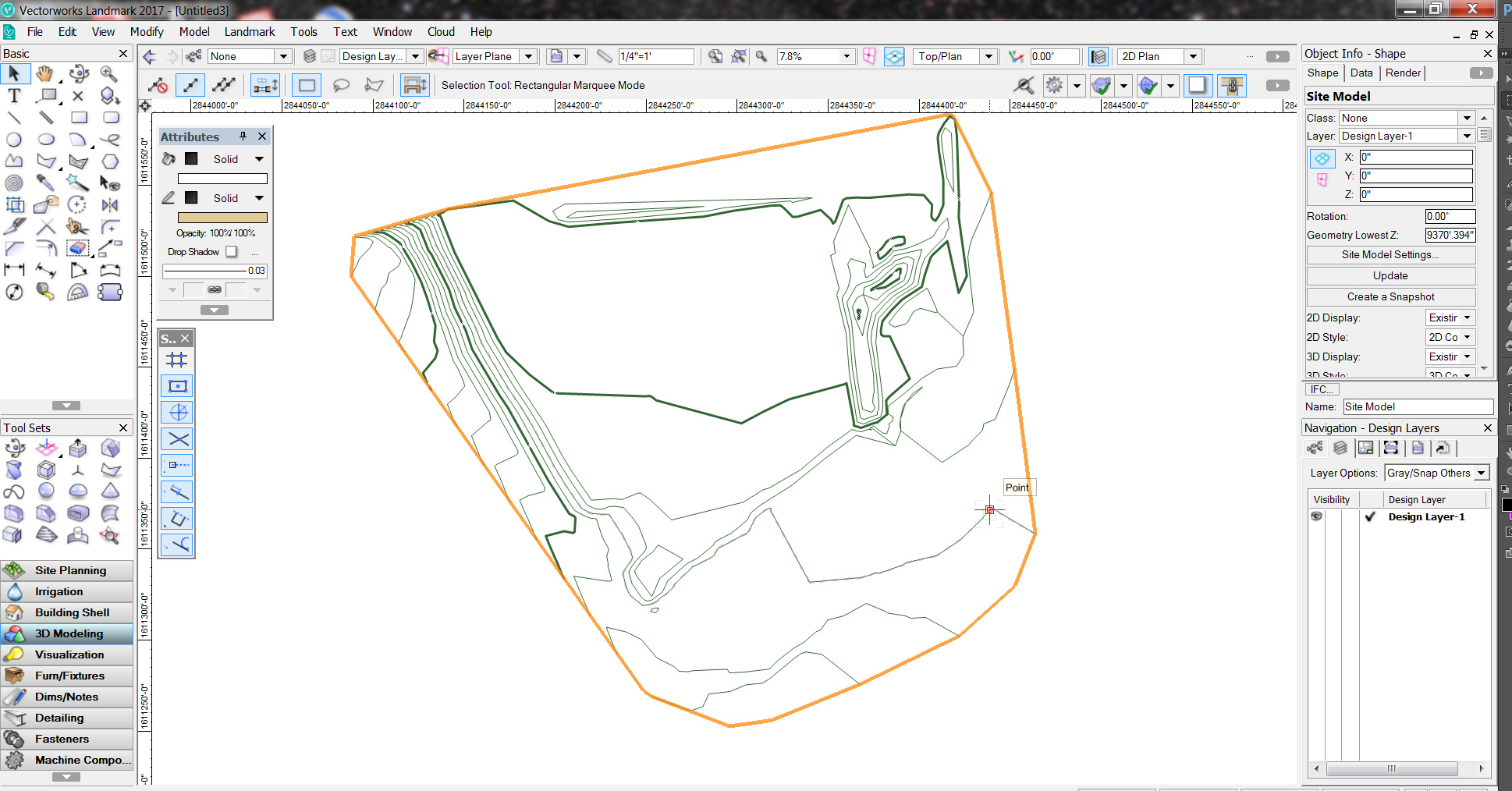
Makes me a little leery thinking about recreating topo--it's pretty standard in our practice to maintain consistency in referencing the survey from one discipline to another. The surveyor carries their own liability tied to the documents/files they create. A lot of our projects deal with pretty tight code constraints from building height limits to slope, cut and fill limits, etc, etc. Interpolation is not really acceptable for documentation. 6-12" in grade change for a landscape architect can be pretty substantial, whereas a builder might fudge it all together, a good LA will add steps, walls, terraces, grading to create defined spaces.
-
Not getting any response to this in 'site design' forum. We need to send our site model via ifc, ideally. Every attempt no matter the setting or scale of site VW crashes. Any recommendations??
-
Ok, will try...working on exporting an ifc of a site model of another project now...that seems to be a whole other ball of wax...
-
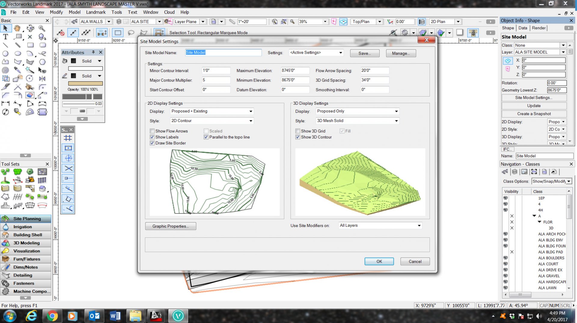
Correct. The (minor) contour interval in this case is 1'. The major contour multiplier is set to '5'. FOr every 5 contours the site model generates a graphically heavier contour line. Changing the contour interval arbitraily would not be an option. thanks!
-
Hmmmm...I'm not seeing anything about 'resolution.' The site model uses the original cad topo from the survey, not moving anything , so not sure there either...thanks for the help!
-
Trying to export an IFC of our site model, which is not very complex. I've tried it on several projects of varying scales to no avail. Is there a workflow specifically for exporting site models?
-
I'm not sure what else I would do. These are 1' contours, set at 1' intervals at real-world elevations per the survey. Final construction documents need to be 1' contours as well. Unfortunately, this has left me using vectorworks for limited site modeling pplications but not quite meeting needs for documentation.
-
Thanks rossford...I've tried #1, but tedious process with less than adequate results. #2, will do!
-
I have topo data (contours) from a cad survey with accurate z elevations. Problem is, when I convert to site model they simplify or bridge and lose a lot of detail and accuracy to the original survey topo. I've searched the forum and founf similar issues, but not sure this was ever resolved ?? Is there a setting I'm missing?


-
Seems the most logical means is drafting as if in CAD, ie 2d geometry,--centerline, offset, radius/fillet, etc then creating objects. In doing so, I'm just finding the draft a little flukey, maybe Im just too accustomed to autocad. It would AWESOME to have a detailed workflow tutorial specific to roads and parking. Current tutorials Ive found across the web are woefully insufficient for real world projects. Jonathan, the problem in as far as I can tell with the workflow you suggest is getting proper inside and outside turning radii while keeping consistent lane widths. Maybe I need more practice..
-
Need help designing Roads with Landmark commads
nca777 replied to Jose E. Calderon's topic in Site Design
We are running into similar issues with the given road tools and find we need to revert back to autocad to draft driveways, roads, parking, especially on commercial/public projects. we desperately need a better road and grading toolset. I would urge the vw development team to look at autodesk civil 3d for examples. in the meantime we are getting by with texture beds in combination with pad modifiers and contour modifiers. as far as i can tell you cannot connect a polyline road to a pad if thats what your parking areas are composed of. -
Sounds familiar. We also work with a very savvy archicad group. Thanks for the tip on your workflow-- interesting.
-
Just came across an issue with the above method-- when 'editing the path' all other objects/linework disappears when editing inside the 'group' leaving no base linework/objects to reference. In other words, if I have a road meeting another road I need to edit that geometry to meet the road edge. If Im editing the path there is no edge to reference.
-
Thank You. This is helpful. A common workflow for Landscape Architects is to draw roads/paths with line segments tangent to the adjoining arc segments. Typically, in AutoCAD these are drawn from centerlines and offset. It seems one could adapt a traditional CAD workflow (drawing lines, arcs, offsets, etc) then create objects from the composed polys.
-
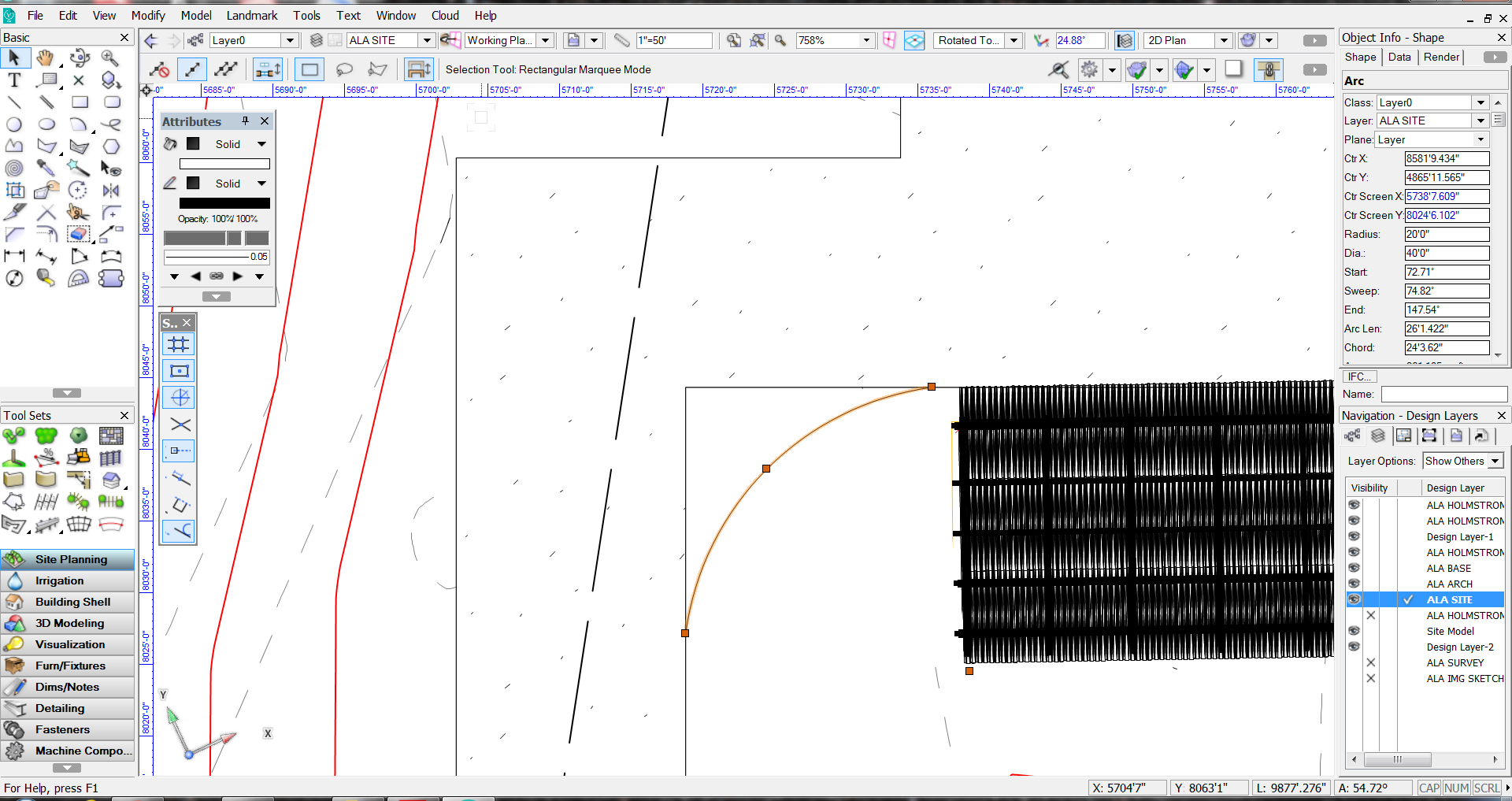
Arc Length Dimension Tool
nca777 replied to Kevin McAllister's question in Wishlist - Feature and Content Requests
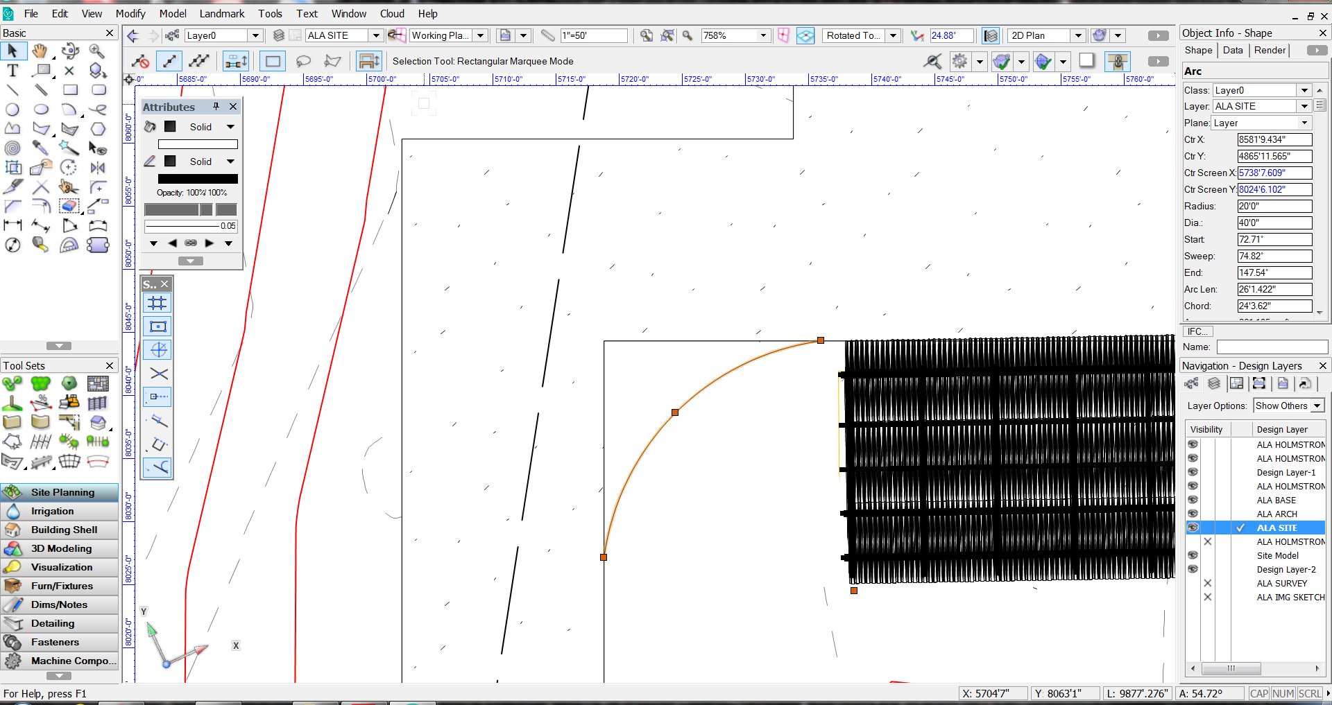
Seems we cant dimension hardscape arcs? I cant even figure out how to draw a tangent arc in a hardscape object, but even after I've created an inaccurate one it seems its impossible to dimension the arc radius !!? -
How do I do this? Seems this should be a very simple operations. In AutoCAD this would take me about 5 seconds. Not finding this to be very intuitive.

-
how do I draw an "arc-tangent' radius to edit a site object (hardscape in this case)??
-
Struggling here with creation of a basic driveway and autocourt. How do you add radii to hardscape objects like a road while maintaining constant width, as in a road or driveway?
-
Just a thought---If you are an LA. It makes sense to have discussion with your consultant team about who controls the master site model. This should be abargaining chip for all LA's in the future--we control the site model/dtm. All other site models will be mesh exports from our master file.
-
This would be fantastic as we typically work with architects, in particular creating their own DTM/site models. However when importing/exporting the geometry is reduced to a 'dumb' mesh. So, yes, in as far as I know, you would need to re-create the DTM.
-
Learning quickly here and running up against what seem to be many of the sam requests as other users. Please consider this post a +1 on this request. Ideally scale and rotate tools would take a hint from AutoCAD's "scale reference" and "rotate reference" commands. Thank You.
-
Import IFC from architect workflow please.
nca777 replied to nca777's question in Wishlist - Feature and Content Requests
Got it. I think you answered my question for the most part re: main level FFE. Assuming architects set main level ff to to start, yes that would make sense to elevate based on main level. I was confused about where the o elevation would be on a dvlp. I'll do some more tinkering, but this helps. thx!