Search the Community
Showing results for tags 'sitemodel'.
Found 10 results
-
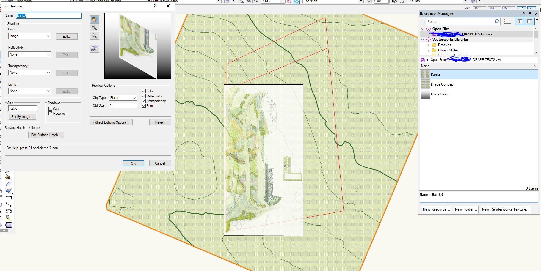
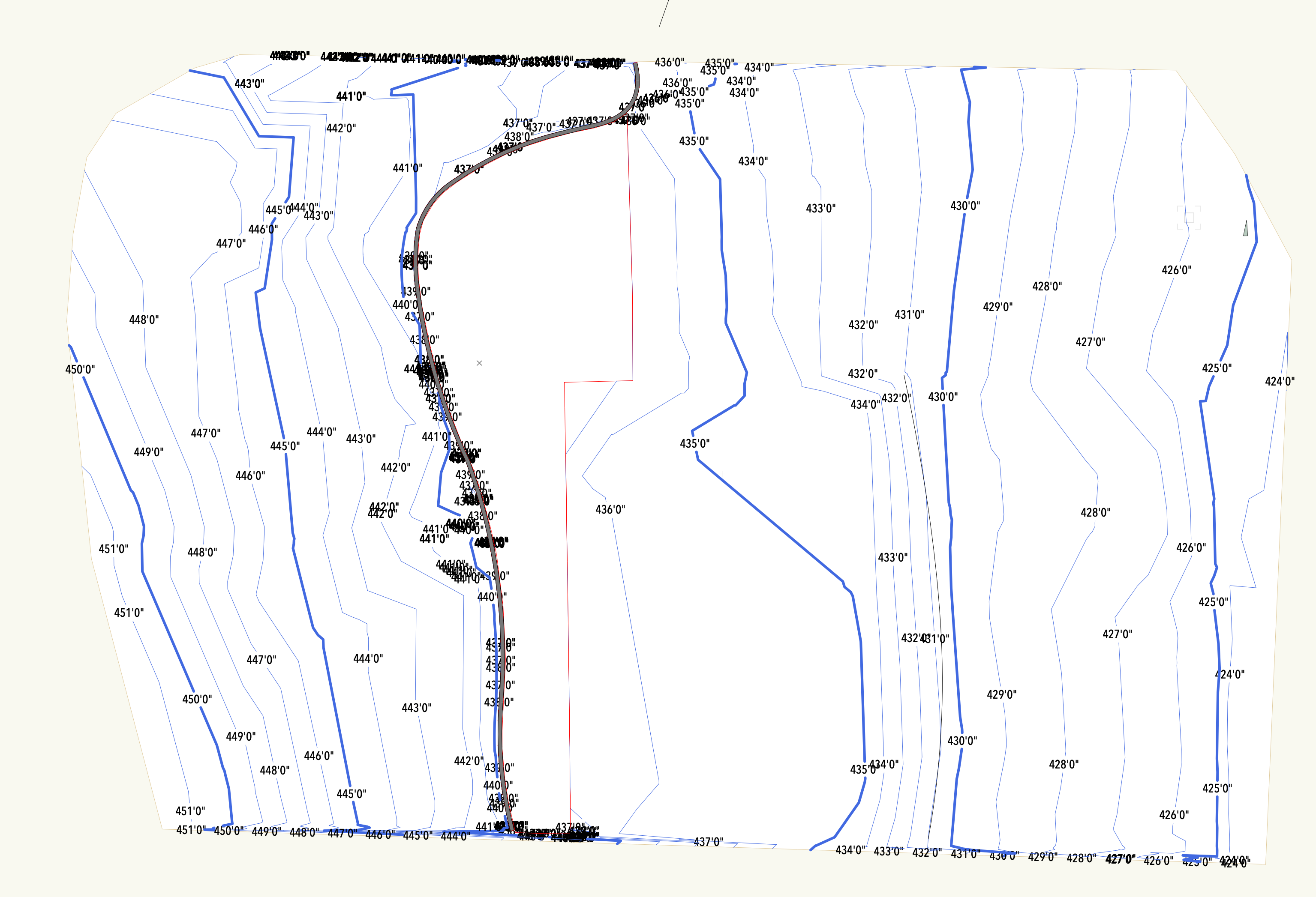
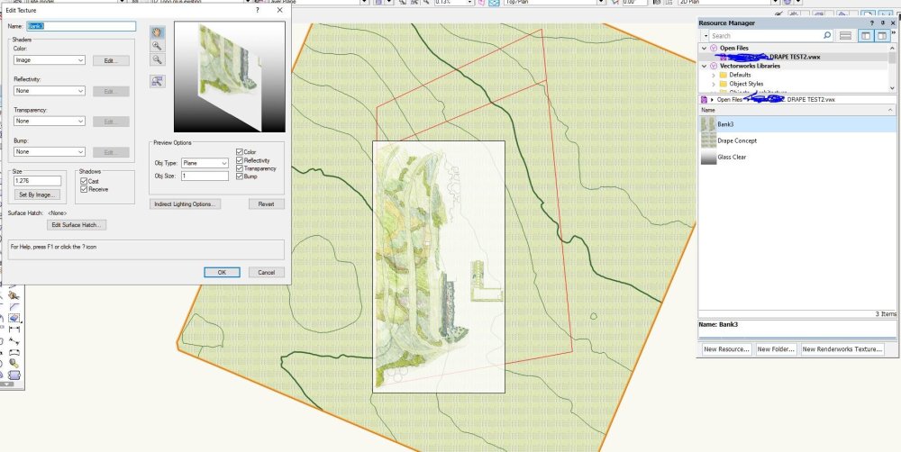
How do I drape an image over terrain/ a site model? My image is a jpg with a pencil concept The image in the space is a texture in a rectangle I'm using as a visual guide at the size, orientation and position that I want the surface to be at. My site model is built from 3D polygons contours. Red poly is my referance object to orint image position I've tried the texture mapping route but get repeated crashes when I try and chhange the I and J dimensions - or the image size reverts just after it display at a larget size. I don't do a lot of 3D in VW and there seem to be a lot of possible ways to do this and a lot of ways that are a waste of time. So has anyone got a workflow that has a useful outcome? For the purposes of this I've centred my drawing on the origin.
-
 5-10 minutes to delete a single contour label?!? I am having serious issues with editing the site model for a current project. As others have experienced as well, I keep getting contour labels stacking on top of eachother/obscuring eachother. Is it a problem with Vectorworks or how can I troubleshoot the issue with my model? I'm working in VW2024 SP.1. The site model copied to a clean file is around 20 mb. I have all non-site related classes and designlayers turned off.
-
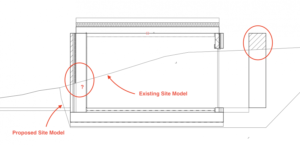
Hi all, I have a simple rectangular building which is partially embedded within the side of a slope. I have a proposed site terrain model on one layer and the existing terrain on another and I want to create a section which shows the existing and proposed terrain lines. Despite putting the Existing Terrain on a the NONE class and turning fill and skirts off, when I create a section the Existing Terrain creates a white fill which partially covers the fills of the perimeter walls although the outlines of the walls are visible. I have turned off 'Display Extents beyond Cut line" but still the white fill is present. How do I get the Existing Terrain line to display a line only ? And how do I make the terrain lines thicker please? Any help appreciated. Using VW2020
-
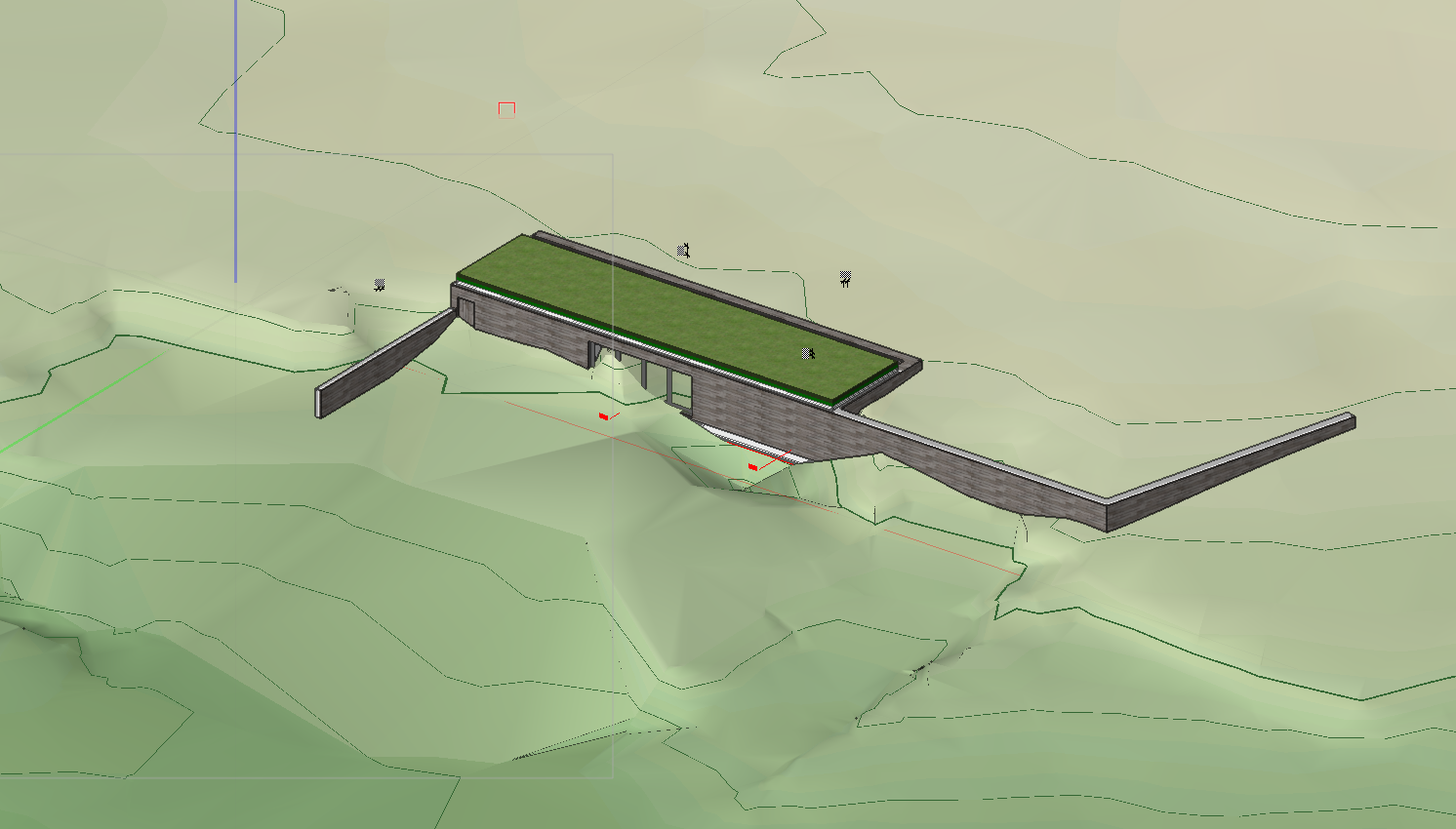
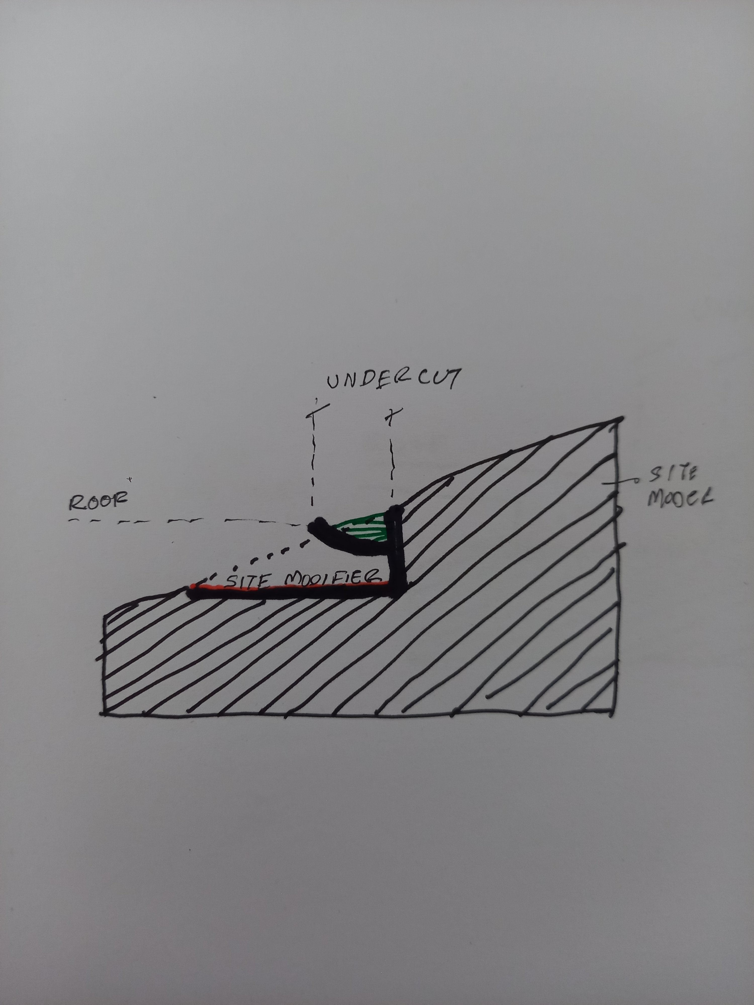
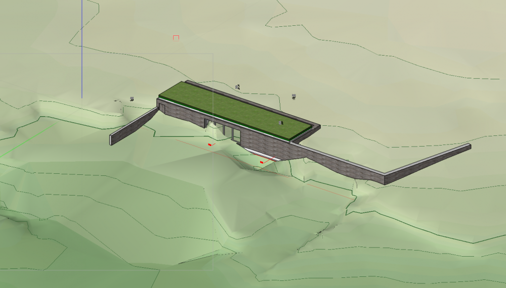
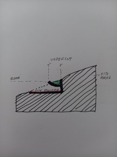
Hello, VW community! I am trying to model the site spilling onto a roof in VW. I am attaching a sectional sketch of what I am trying to achieve. Essentially I am trying to spill the site topology onto a roof (green bit) - however, the site modifier makes a clean vertical cut. Does anyone know if we can do 'undercuts' with site modeling, or has anyone got a suggestion on how to model this? Best, Demetris
-
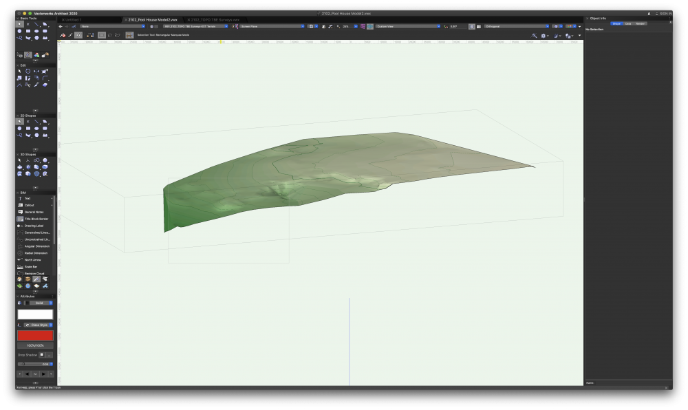
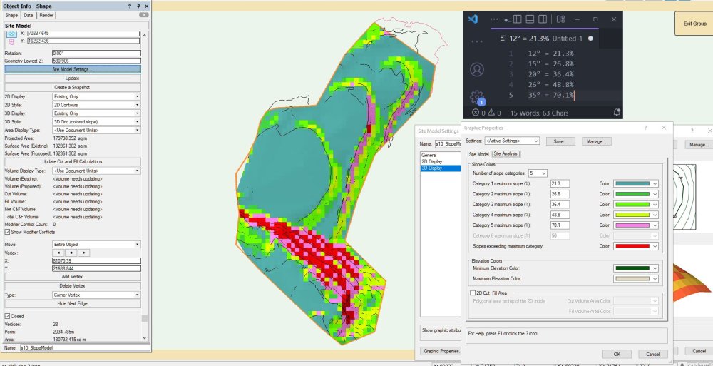
I've built a slope model of one of my sites - an 18Ha quarry surface [ignore the VSCode note in the image] Is there any way to query the model data, all I want to do at this point is count grid squares for the different slope categories. If the model is exploded the 3D polygons that make up the grid can be counted using the selection wand but that doesn't seem a smart way of using a CAD program, so is there something better? I thought I could count squares via reports but there seems to be no way. Could Marionette do this? I'm on vw2018 with Landmark
-
I work primarily in the entertainment/events industry, but have recently purchased some land and would like to develop my site plan with VW. I only have the Spotlight license and understand that the site model tools (among others) aren't available without Architect/Landmark. I'm trying to avoid the expense of an additional license for a one-off personal project. Does anyone have any good workarounds for creating topography of a site using more rudimentary tools? I don't mind a bit of added manual work to get it done. Many thanks!
-
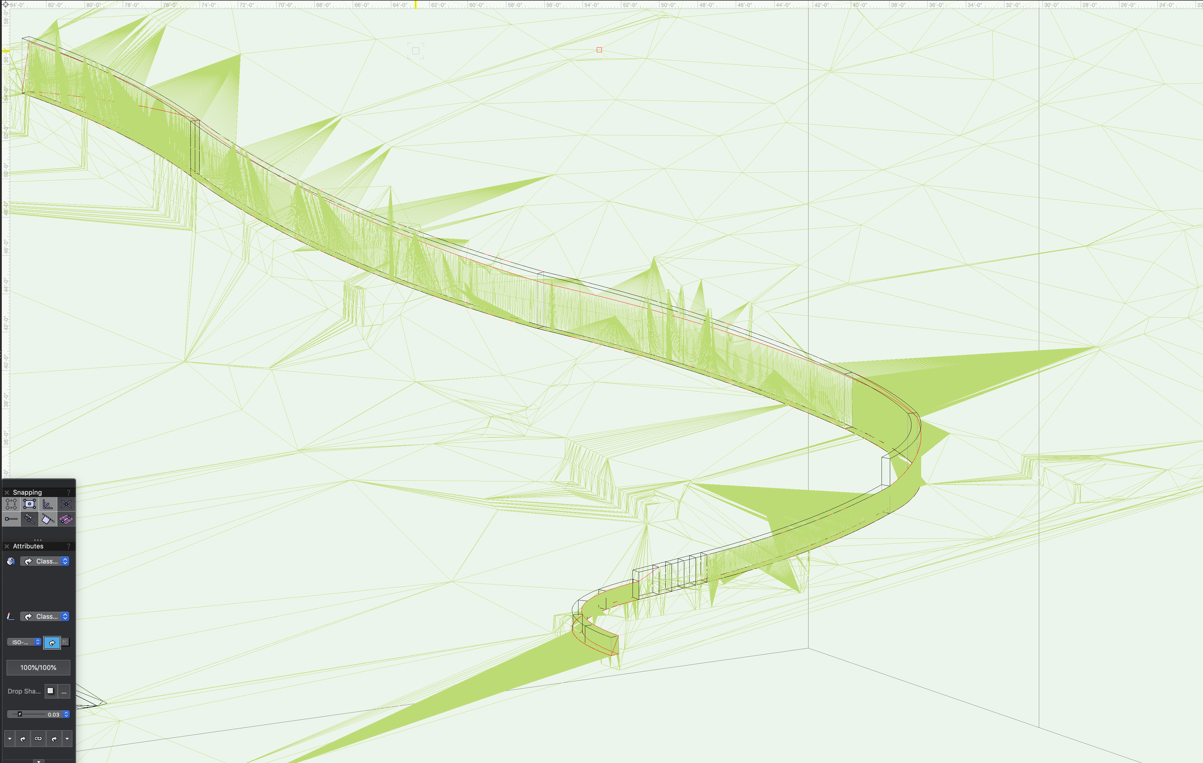
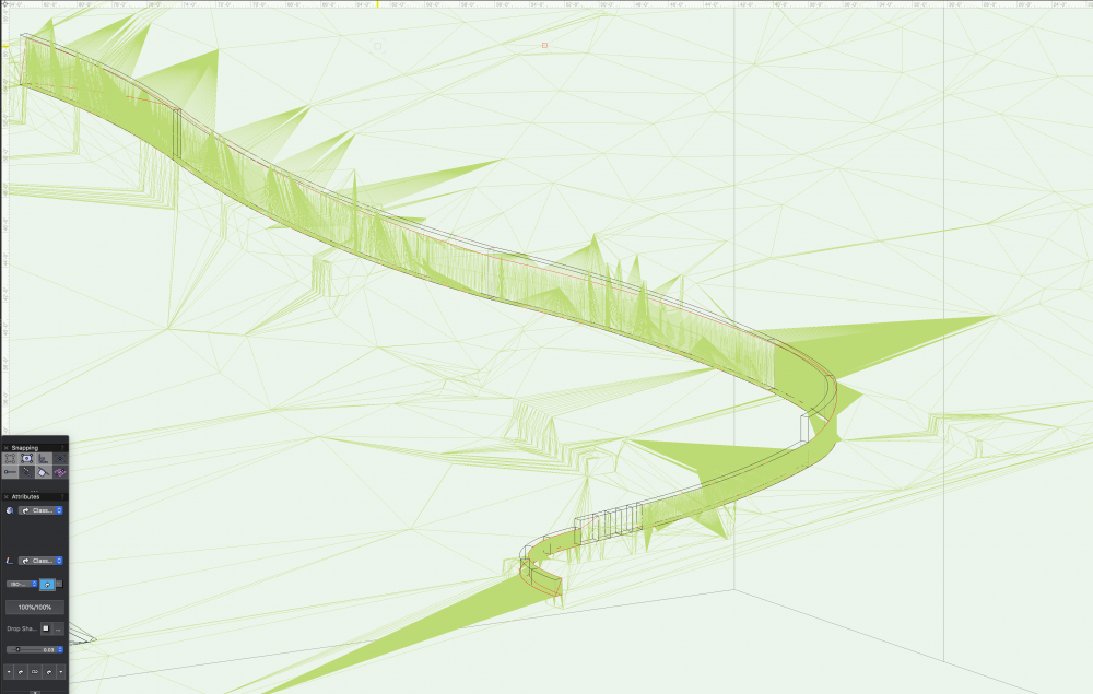
I posted this within the site design forum but perhaps it is better suited here. Hello everyone I started having an interesting challenge on Friday with a small site model and a curved retaining wall site modifier that was inserted. I've never experienced this issue and hope others might see an easy fix. To clarify: I have a small site model (under 1/2 acre) that was created using survey 3d polygons. All the polygons have low numbers of vertices so the model itself seems stable and easy to move around. In this design we are placing a new retaining wall that curves across the rear landscape. The file is not huge 120+ mb It appears that when one creates a retaining wall site modifier in a curved shape that the results can cause severe slow downs and crashes in this file. If you take a look at the second image I attached you'll see countless lines coming from the site model and running behind the retaining wall, this is where I think the issue is If I delete the retaining wall site modifier the file behaves itself, when it's present I have to wait several minutes for the site model to update and for the open GL to render. Even then the open GL looks poor regardless of settings. This has never happened to me on my current computer. When I change the retaining wall shape and reduce the curves, add a new retaining wall site modifier makes for a more stable file. I can conclude that these curves are causing some issues with the site model and making the file un-workable even with a robust computer. Has anyone noticed this limitation before? It's not great for us as we often work with organic shapes. I've attached the file having removed everything but the site model, the wall, retaining wall site modifier and a small pad in front. No modifier conflicts are reported. I would love to hear peoples comments on this. Thanks for any thoughts you might have. Site model.vwx

-

Site modifier editing improvements
ScottLebsack posted a question in Wishlist - Feature and Content Requests
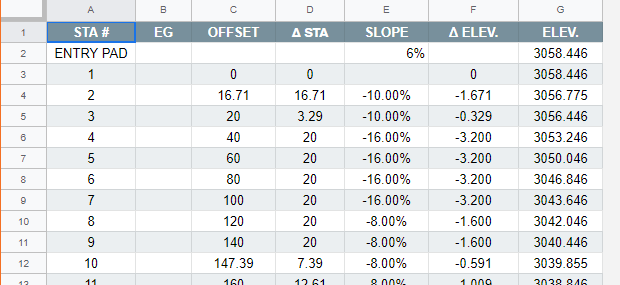
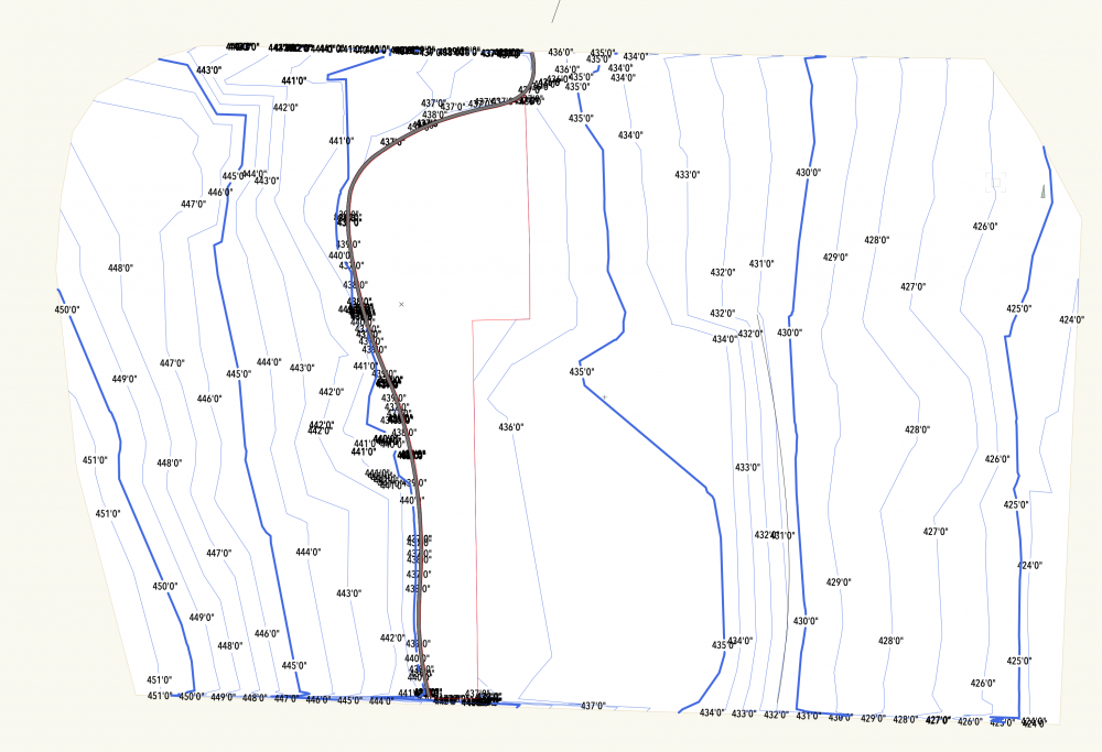
I would appreciate an interactive table for editing site modifiers. This would apply most effectively to road modifiers and pads with retaining edges. I would need it to display elevation, and slope between points and allow me to edit or lock either and calculate the other. It would also be useful to add vertexes, like rows in the proper location. The modifier in your drawing, when editing could appear with numbered vertexes that correspond to rows in the worksheet. I've attached a screenshot of the google sheet I use to calculate road polys, but having this integrated would be very helpful...
-
Hi is there a decent way to use walls on slopes . The wall should folllow a parallel height to the ground . fixed height on starting and ending point. but should follow down a hill.. if I send my wall to the surface to my model, it follows perfectly on the bottom the slope.but not on the top.. is there any way not to correct it manually ? thanx in advance
-
Hi, So I have a site model which was generated from 3D locus points. I Used the generate site model option from the AEC toolset. How do I crop it down to a particular area? Im using VWX 2016 for MAC Many Thanks, David