Search the Community
Showing results for tags 'survey'.
-
Version 1.0.0
17 downloads
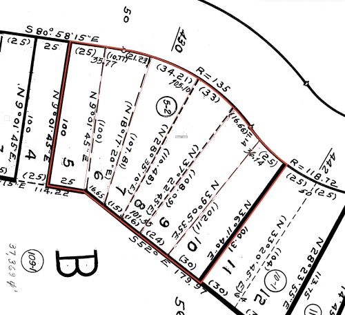
This is a pretty basic Marionette object to help me build property lines without having to use and troubleshoot the existing Vectorworks Property Lines tool. It builds a single line based on the entry of survey data (ie: 125.5' N 40° 35' 19" W). This works one at a time and does not build arcs. I've tested it on a few particularly messy plats and it seems to work well enough. After producing a single property line, ungroup and arrange it where you want it (Marionette will place the line at 0,0), then repeat until you're finished, easy! If you're super into the Property Line tool, you can gather all the lines together, compose them into one poly, and Create Objects From Shapes the whole thing into an official Property Line. I hope you find this helpful. -
Does anyone have recommendations as to what deliverables to request from a surveyor in order to have a smooth import and DTM creation workflow in VW? I typically work on single family residences, so the survey areas are relatively small. @zoomer it looks like you've already thought about this. Do you have specific things you ask for?
- 10 replies
-
I have been trying to import a large point cloud and I cannot seem to figure out how to get it to the right scale. I have tried every combination of units, both pre-setting drawing units and changing the point cloud import units and nothing I do has yielded successful results. The import has yet to come in at the right scale or x,y,z location. Anybody out there with some tips?
- 13 replies
-
- 1
-

-
- lidar
- point cloud
-
(and 2 more)
Tagged with:
-
Hello all, I have been working a site model for a quarry. I have two sets of survey data, a topographical survey taken in 2017 in PDF form, and a topo survey from 2018 of the same site in DWG form. I turned the DWG into a site model, and have added in site modifiers of the 2017 data by adding stake points and contours, so that I can compare the two surveys to see how the quarry has changed. I have encountered an issue with a particular contour in the site modifiers, and this contour has flagged up 424 modifier conflicts. I cannot get my head around why only this contour has the problems, and upon clicking the warning triangle it states 'Pads Intersect', however, I have not used any pads, only contours and stake points. Does anybody have any suggestions as to why this is happening? As you can see from the zoomed in images, the modifier conflict warnings are not actually sat on top of 'crossovers' and you can see from other contours that these are not problems. I have attached pictures to help, with the zoomed out image showing only the proposed contours, and the zoomed in showing both (green and blue) proposed and existing. Thanks Joe
- 3 replies
-
- site model
- site modifier
-
(and 3 more)
Tagged with:
-
I'm trying to figure out how I can collect elevations and other site data necessary to make landscape models with 2' contoursby myself, without having to hire a surveyor for smaller/residential projects. Is it possible to use something like the Geneq isxBlue? If so, what else would I need besides the receiver, what kind of program would I also need to purchase to make the data useable? I'd really like to be able to use VW Landmark, but I just can't figure a good way to get useful data to work with. I'd like to be efficient as possible without having to get a degree in surveying. Is there a combination of devices like a laser level and GPS? Even that seems like a lot of extra work to enter points into VW Landmark, but if that is the best way, I'd like to know. Even if I got $20,000 + to buy a total station, could I learn to use that on my own and what else is needed to accompany it to collect useful data? thanks for all your advice Eddie


