


Moe_90
-
Posts
23 -
Joined
-
Last visited
Content Type
Profiles
Forums
Events
Articles
Marionette
Store
Posts posted by Moe_90
-
-
EAP
in Marionette
Hello Everyone, is there anyupdate regarding that topic?
unfortunately the edited file and the video are not availabe anymore, is it possible to repost them? that would be so great -
Hallo Fabrice, is there any update?
-
Update:
i did mange to create the marionette Object, the issue seemed to be with the way the Path is created, for some reason, using compose node to make the path make a problem when creating a marionette Object, so instead, i made the path using 3D points and 3D Poly, which works fine.
the issue now, is the center point, on which the profile is using to get extruded along the path, it seems that the Path extude node uses the center of the profile to extrude it along the path.
my question now is, can i choose another point on the profile, so the path extrude node uses it to extrude the profile along the path??
-
 1
1
-
-
i tried to recreat the same network, but without the Move and the Rotate Nodes, and it still presist
my theory is, somethin goes wrong in the path Extrude node, when the wrapped networks turns into Marionette Object, which i am not sure what is exactly
-
Greetings everyone,
i am new in marionette, and that is my first week, and while i was trying to create a tool that will create a parametric L-Shape Wall for corners, something doesn't work when i try to make the wrapper into marionette object.
i attached the file so you can under stand what i mean.Vectorworks 2023
what could be the reason for such result?
-
Hello everyone, is there any update regards the Get 3D info node? i also get errors using it
-
Hello everyone, i hope you are doing well.
i run into an issue while trying to import IFC Datamapping set into an older version of Vectorworks (2021)
i used Vectorworks 2023 Datamanager to create class based IFC Mapping, and i saved it, but when i try to import it in Vectorworks 2021 Datamanager, it told me it is an invalid file.
is there anyway i can import the Datamapping set for Vectoworks 2023 into Vectorworks 2021?
-
Thanks for your reply,
what i miss in that tool is the ability to create Reataing wall with Profile, like L Profile, or trapazoid Profile for example.
is there a way to achieve that result ??
-
1
-
-
it would be helpful to have a tool that creats reating wall for landscape site.
-
Thanks a lot for your reply, those Demo are really helpful.
are you aware of any other sources, where i can find examples for that type of projects, which is being built/was built?
-
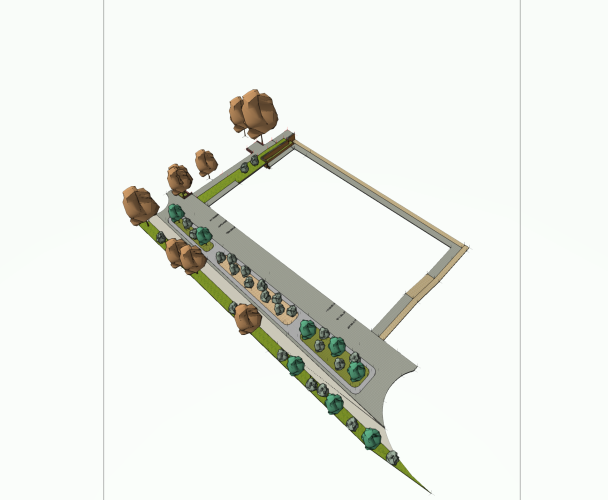
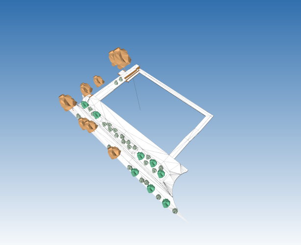
Greeting everyone,
I am not sure if that is the right place to post my topic in, but i couldn't find a suitable place, so i am trying here.
It is about Landscape projects that use the BIM-Method in Planning and Execution.
If there are any well known examples from the world, where I can look and study it?
espically in the area of Parks and Pedestrian Zones.
that would be very heplful,
Thank you guys
-
Thanks very much, that looks very promissing to explore and try out.
-
so i did some research, and i found this formulas list, which is very helpful in my opinion.
https://developer.vectorworks.net/index.php?title=Worksheet_Functions#Text
and using expert formulas in the Data Manager, i can map the field i want to the info i want to show
my problem now, is how can i add Units symbol to the data field? because the when i use the equation for length, it just map the value, and doesn't show the unit (m², m, kg, etc..)
how i can add the Unit symbol to the formulas, any help? -
Update:
i have got in contact with service select team in Vectorworks, and the told me that up until now, that feature isn't supported, yet, and maybe in the future it will be there. -
i am using BIMCollab as viewing software
i can assign colors to IFC entities in IFC viewer using the filter options, but the IFC entity itself will be white
i read about IFC 4 and it has the ability to read colors assigned to and Object, and it works well when i creat a 3D object and fill it with solid color, but when i use hardscape tool to create ground cover, it export the geometry with white colors, and it ignores the fill color i choose in vectorworks, and i have no idea why it happens and how to overcome that
-
you are right,
if you look at the IFC model, you will see some elements has colors, also the building form the the architect has colors.
my question is, how can i assinge colors to Hardscape instead of it being plain white.is there and option to do that? and how to do it?
-
Hello everyone, I hope you are well.
i posted that already in Site Design forum, but i though maybe here it will have a better chance.
I would like to ask if there is a way to map the geometric information of an object, such as length, width, height, volume, etc.... to the required IFC date field
How can I assign this information? Is assigning to a customPset an efficient workflow?thanks in advance for your help
-
Hello everyone, i hope you are doing well.
when i try to export the model in IFC 4, it exports all geometries that is made by hardscape tool (Belag/Weg tool in the german Version) all in white, with no material or color (see the pictures in the attachement for better understanding of what i mean)
only simple objects or pre-made symbols do have colors.is there a reason for that? how can i export the wanted colors/textures with the IFC model?
thanks in advance.


-
1
-
-
Hello everyone, I hope you are well.
i posted that already in Site Design forum, but i though maybe here it will have a better chance.
I would like to ask if there is a way to map the geometric information of an object, such as length, width, height, volume, etc.... to the required IFC date field
How can I assign this information? Is assigning to a customPset an efficient workflow?thanks in advance for your help
-
Hello everyone, I hope you are well.
I would like to ask if there is a way to map the geometric information of an object, such as length, width, height, volume, etc.... to the required IFC date field
How can I assign this information? Is assigning to a customPset an efficient workflow?thanks in advance for your help
-
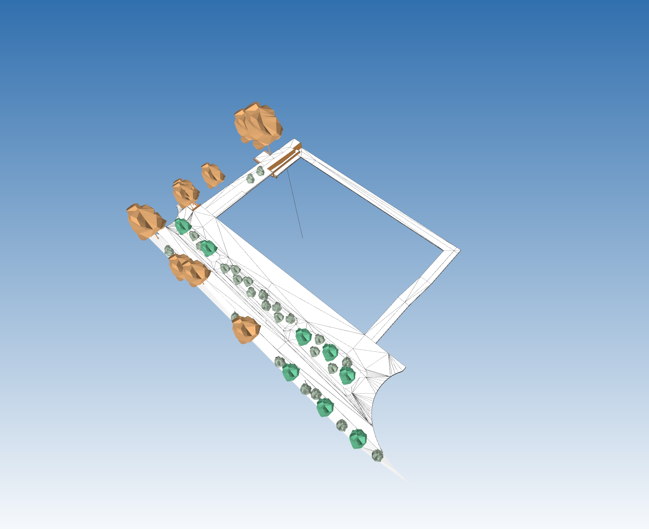
Good day everyone out there,
I would like to ask about the workflow in order to create a surface from 3d Locus points, and then merging two surfaces together and calculating the volume resulting from combining both of the surfaces.
here is the screen shot
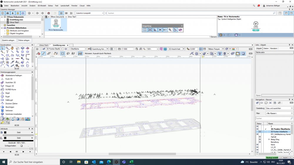
the red line upper part is the outline of asphalt road, and the above 3D points is the survey points of it's surface
the lower part is the underlayer surface it has also 3D survey points, but frozen
The problem: i want to find out the Volume of the asphalt needed to cover the area.
The process: Creating an upper and lower surface of the asphalt using 3D points, merging the two surfaces, and calculating the resulting volume.
The question: how to create surface from 3D points, and how to merge two surfaces to create volume and calculate it? and is there another way to solve the problem?
i am using VW 2021 Landscape
thanks
-
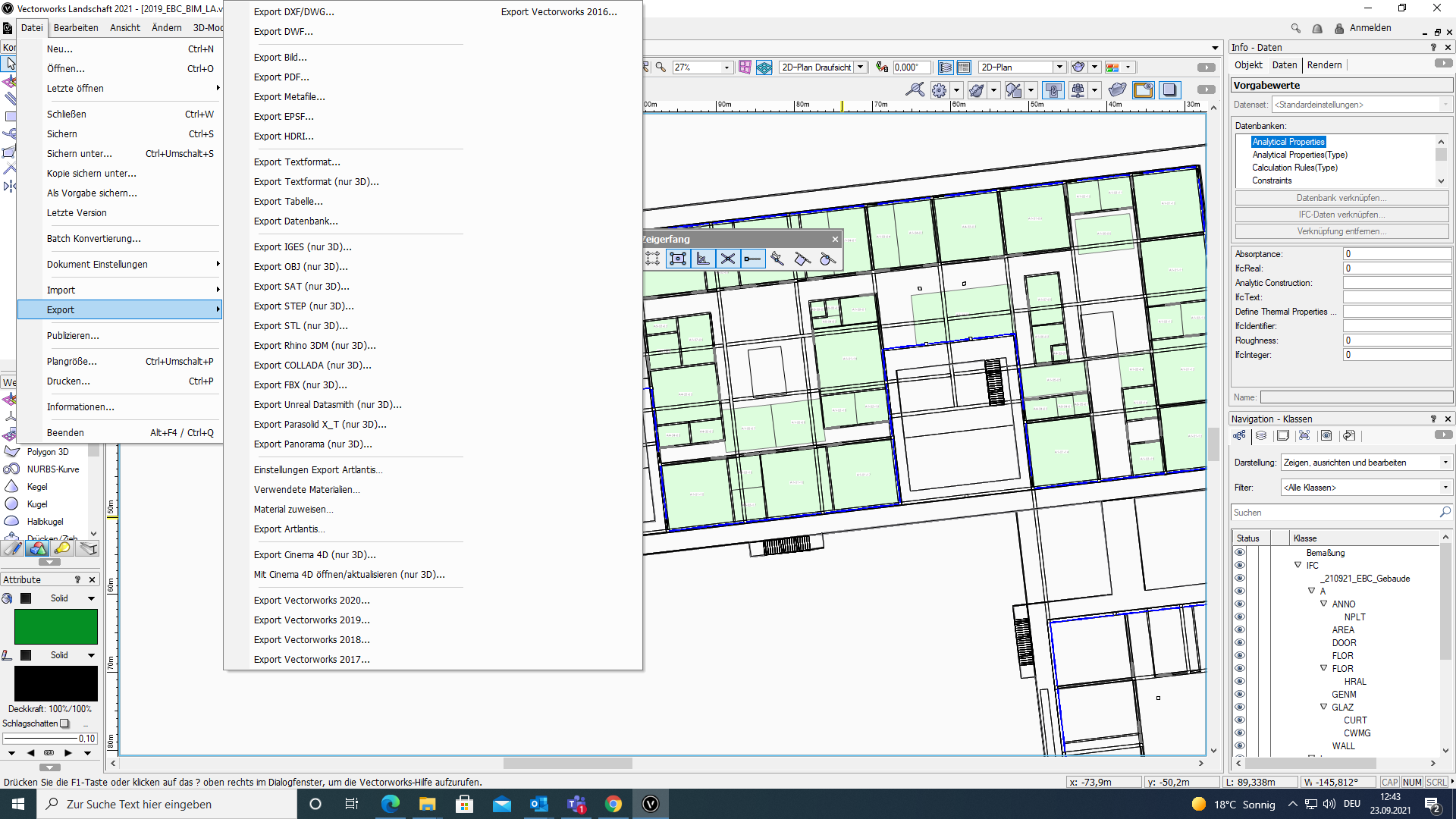
Good afternoon everyone.
i am new to VW, and i want to export a file to IFC, but the problem is that i can't find the IFC export option in the Export menu?
i am using VW 2021 Landmark, SP3 R1Here is a screenshot for better understanding.
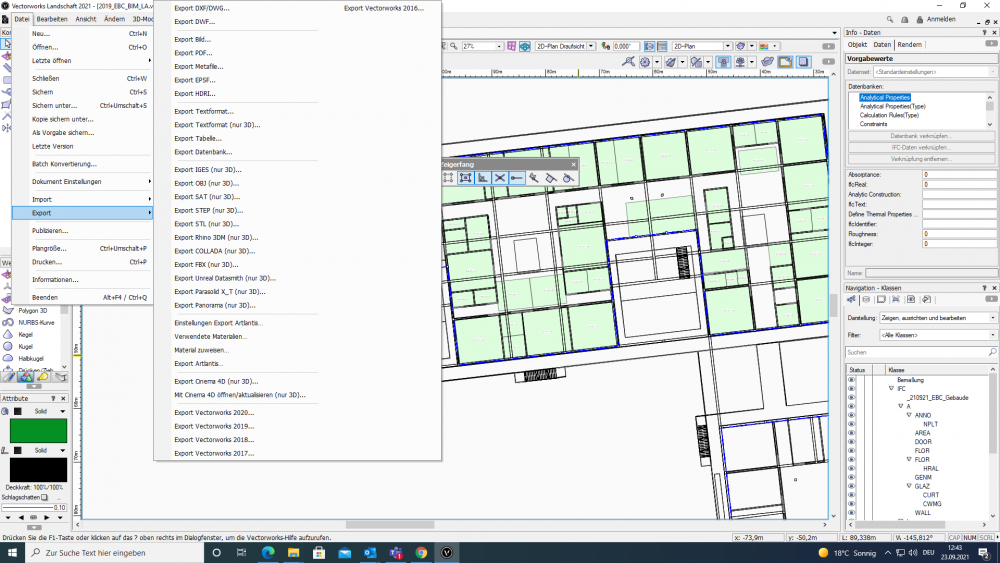
Thanks in advance for your time and help.


Problem when create marionette object from a wrap node
in Marionette
Posted
Update:
looking more into the Path Extrude node, and searching the Caves of the internet, i reached that topic from @AlanW from 2016
i ended up using his solution with editing the path extrude node, by removing the lines that responsible for the profile center, and it worked fine with me as i wanted.
thanks very much @AlanW