


LavenderGardens
-
Posts
6 -
Joined
-
Last visited
Content Type
Profiles
Forums
Events
Articles
Marionette
Store
Posts posted by LavenderGardens
-
-
On 4/25/2024 at 4:38 PM, Jeff Prince said:
The easiest way to do things is usually the 2D way...
...with some helper geometry to snap to automatic 3d working planes.
You just have to draw on different planes and then turn your 2D work into 3D Polys.
Here's a video, easy peasy.
how are you snapping to the face of the rectangular geometry? When I try that I just get a 2d line even when I using the 3d polygon tool. -
19 hours ago, Jeff Prince said:
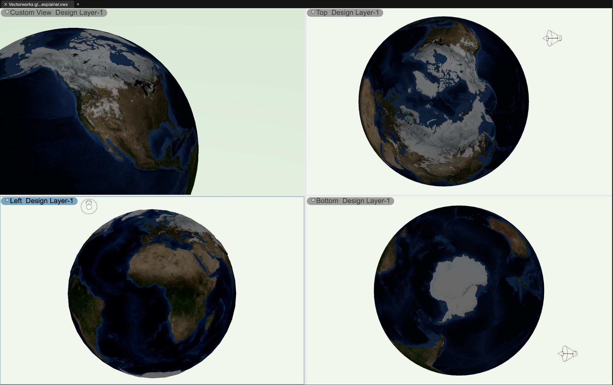
I've always been partial to globes with a bit of raised relief myself...
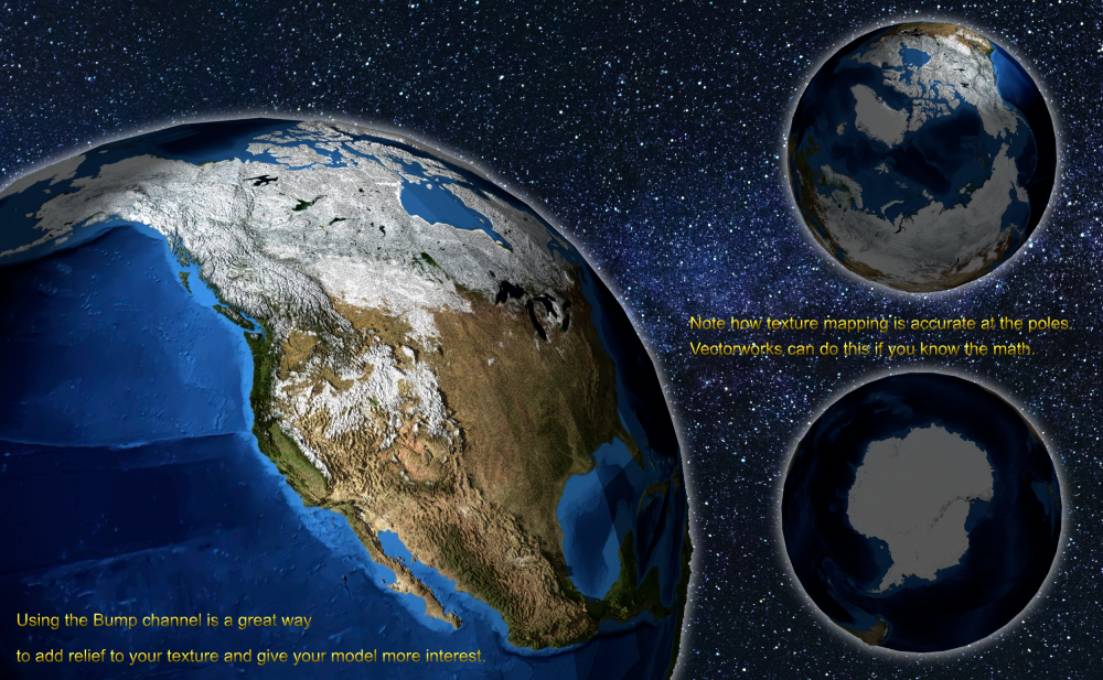
Just make a Vectorworks sphere.
Then, make a texture from an image. The best results use an image made from equirectangular projection.
Finally, texture the sphere using spherical mapping.
The trick to accurately scaling and placing the texture involves Pi and the length of a 90 degree arc based on your model size.
The previous examples here by @Kevin K and @VIRTUALENVIRONS may be salvageable in that regard, I don't know where they got their textures.
And yes, I did do it in Vectorworks...

Beautiful work. How did you make your board showing the three views of Earth on the star field? Is that Vectorworks too? -
16 hours ago, Jeff Prince said:
See this video for an explanation of why your model is misbehaving...
You make it look so easy! How long did it take for you to become a wizard?-
 1
1
-
-
16 hours ago, Jeff Prince said:
That's not making your work more accurate, it's just bringing your computer to its knees for no reason.
You have said this more than once during our training sessions. What a great thread, thank you for spending the time writing it!-
 2
2
-
-
On 10/8/2018 at 10:05 AM, Jeff Prince said:
For those interested, I have combined my VW site model generated from survey data with the 3D model generated from aerial photographic survey. Of the images attached, "3 model and aerial" really shows the level of accuracy when you look at the parking lot at the right side of the stadium. Those little islands in a sea of green are cars picked up by the drone that were not accounted for by the survey crew. The same is noticed with vegetation and a building excavation that began after the survey crew had visited the site. It's really pretty amazing how close things are.
Green = VW site model, Ghost = Drone generated model

Drone generated model

Green = VW site model, photo model by drone poking thru. Note parking lots and footing of buildings as they relate to the largely flat property with photo textured cars, vegetation, and buildings poking thru with a fair degree of accuracy.

Drone model with 3D contours from VW site model shown in white.

This is an amazing thread with so much helpful discussion. I can see all of the videos and some of the photos posted, but I do not see the images in the message above. Is there something missing or could it be an issue on my side? I am new to the forum and neither my phone nor my computer display the images quoted.Thank you all for any help!
-
1
-


PNG export with alpha channel for transparency
in Wishes Granted / Issues Resolved
Posted
He has great taste in music with these videos.