Search the Community
Showing results for tags 'laz'.
Found 2 results
-
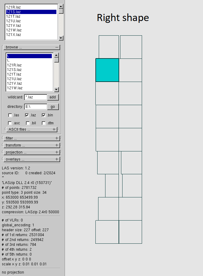
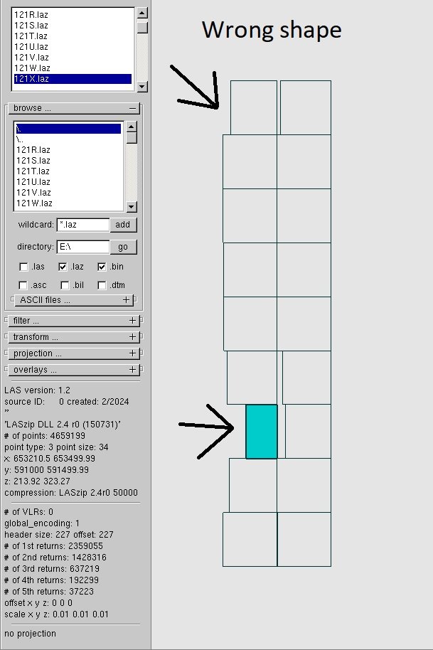
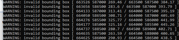
Hi everyone. I worked in MicroStation on classification of LIDAR. And after I converted .las to .laz I used a macro for .laz files to classify from one class to another. So, that operation broken the shape of my files. I don't have any backup for files so if I don't find a way to return the right shape of .laz files I have to start my work from the start. Is there any way to fix shape of .laz? Or maybe I can fix it manually to set, somewhere, the right coordinates for each corner of the .laz file? I attach examples of shapes which are right and wrong and examples of warnings which I received when I tried to convert broken .laz to .las by laszip. I will be appreciated if somebody helps me.
-
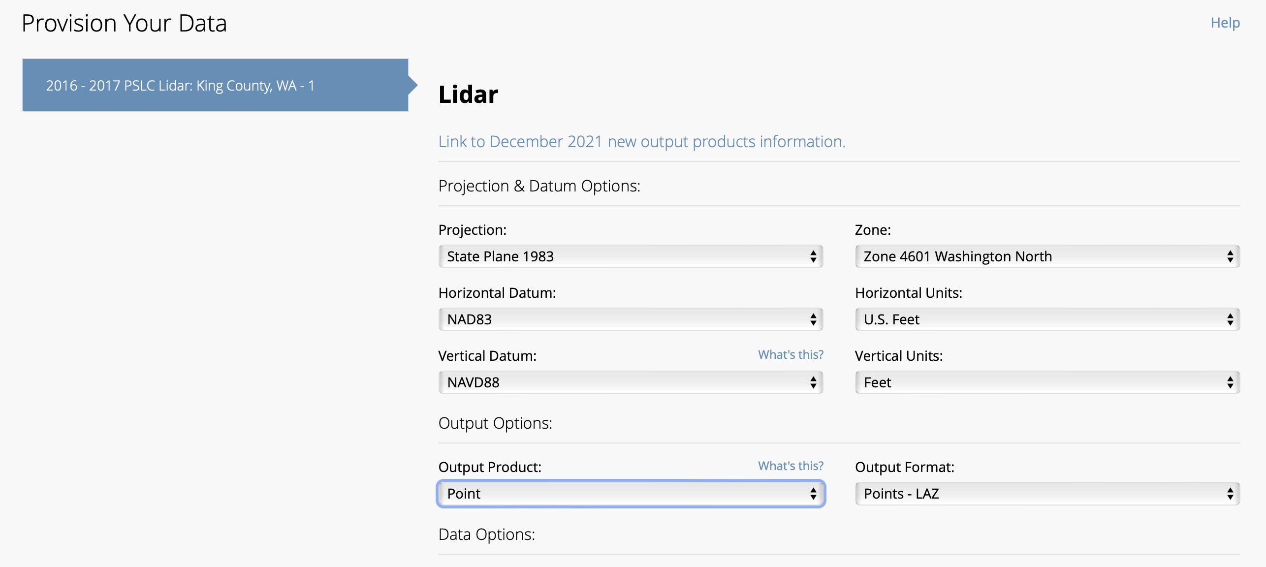
vwx2023 and vwx2024 produce error when trying to import NOAA Data Access Viewer shapefiles, LAZ and LAS point clouds. These all open OK in QGIS. I attach a couple zip files downloaded from the NOAA site. If anyone wants to test. OR grab your own from the NOAA Data Access Viewer site (search it). Job921534 is contours folder (SHP and support files) from a small portion of Seattle WA. Job 921535 is point cloud folder (LAZ and support files), same boundary, ground only. Image file shows the georef settings native to both SHP and LAZ Here is vwx detail from the LAZ file import: GIS ErrorLog.txt CPLErr( 3 ), err_no( 4 ) Unable to open /Users/bensonshaw/Desktop/NOAA Test/wa2016_pslc_king_Job921534/wa2016_pslc_king_Job921534.shx or /Users/bensonshaw/Desktop/NOAA Test/wa2016_pslc_king_Job921534/wa2016_pslc_king_Job921534.SHX. Set SHAPE_RESTORE_SHX config option to YES to restore or create it. Anyone know how to edit that SHX file config? Or why the file path shows twice? One with extension .shx, the other with SHX? file in the folder is lower case. Strangely, I collected similar area from the Data Access Viewer 3 years ago. NOAA might have changed something. Those earlier files import into vwx2024 and earlier. The SHP file conforms to (or establishes) the georef of my vwx file. The LAZ file imports, but at great distance (ignores the file georef) and needs rescale. If the contours and LAZ are captured from same area boundary, the LAZ can be accurately located and scaled to overlay the contours. Thanks - B wa2016_pslc_king_Job921534.zip wa2016_pslc_king_Job921535.zip