burgcj
-
Posts
6 -
Joined
-
Last visited
Content Type
Profiles
Forums
Events
Articles
Marionette
Store
Everything posted by burgcj
-
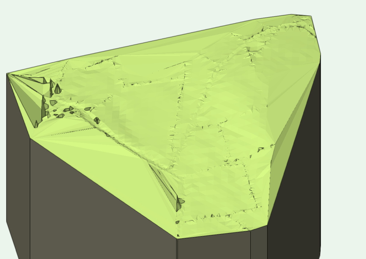
This is what i'm getting, you can just about make out the track that cuts through the land. most of the data is supposed to represent drystone walls and verges that i'm not quite getting. I ran the data validation and removed duplicate points. It seems to want me to have my lower elevation set at 0. Not sure why i'm getting the spikes in the bottom left either! Any help would be greatly apprecaited. Happy to attach a file

-
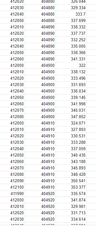
Would the attached work? I've checked them in grid reference finder and it appears to point me in the right direction but they don't look the same as yours!
-
Thanks very much, I've just receieved the .csv file today so i'll see how I get on! Cheers
-
Test Proximity and Text to 3D Loci
burgcj commented on SBarrettWalker's file in Marionette - Networks
 Hi there, Is there a way I can load this un VW 2019 as unfortunately I don't have 2023! Cheers Chris
 -
Hi all, Sorry for the delayed reply, I've been occupied with drawing bridal gates and stiles before I can get back to this model! All of the info/options you've provided look spot on, I'll have a look through all of the various links and also try to go back to the topo contractor for the spreadsheet of info as I'd like to try both methods if I can. In case anyone is interested, the topo data is of a Byway (BW) which i'm tasked with repairing/ resurfacing and installing sufficient drainage (working with drainage team) to mitigate the water erosion and damaged caused by 4x4 vehicles. I've floated the idea of bringing the levels back up on the BW to a similar gradient as the natural slope of the hillside to allow the water to run off in the direction it would have prior to someone bench cutting a big track down the middle of it. Thanks again for all of the great advice, i'm sure i'll be back with another question regarding 3D modelling existing terrain and layering proposed improvements clearly. Cheers
-
Hi all, Does anyone know if it's possible to create a site model from the topo data I have, all of the tutorials I have watched have had contours across the whole document, mine doesn't appear to have as many. I may well be reading it wrong, as it's the first time i've tried to do this. The document does contain plenty of elevation info as text and 2d shape but there doesn't appear to be any contour lines throughout the entire document as I've seen with others. The only contour lines is has are for either side of the 'track', top/bottom edges and the dry stone walls surrounding. I've attached a series of images of parts of the topo to give an overview. Images