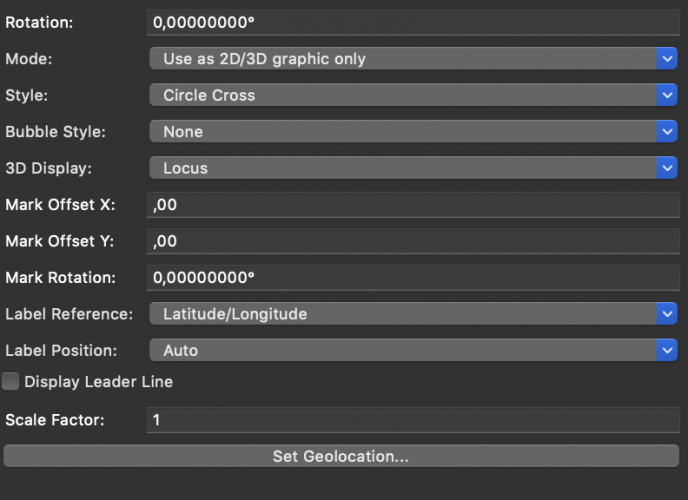
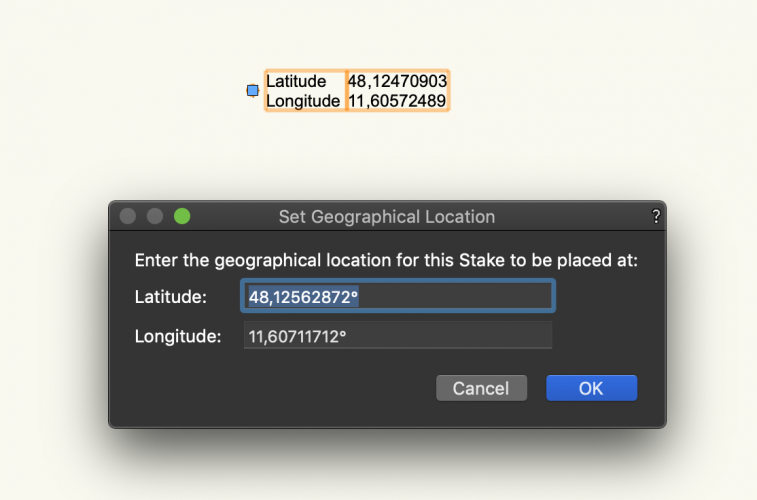
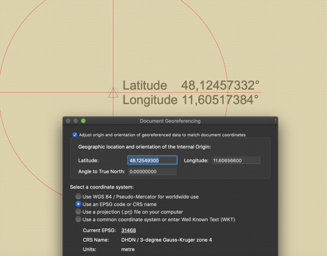
I´ve a problem with the GIS Stake Tool in a georeferenced File. The LAT/LON Values that are shown by the Tool differs from the coordinates that are shown by e.g. the Origin or the "set geolocation" dialogue in the preferences. It only differs a bit, but is very annoying when i want so reference files. I go to "set geolocation" of the Tool and type in some LAT/LON values. When i click OK, the Stake Objekt positions itself to these coordinates, but show Coordinates, that are slightly off. When i reposition them , the upcoming dialogue shows the correct coords. that i entered. Same with the Origin. When I check the LAT/LON position of the Origin in the documents preferences, they are correct, but when i place the GIS Stake tool on the origin, it shows coords. that are slightly off. I can´t explain the difference.
- The File is in the EPSG:31468 System.
- The User Origin matches the coordinate system.
- The Units are meters, everything is Z=0 and the Scale is 1:100.
- The Problem appears is multiple files.
-VWX 2020 SP3 on Mac.
Thanks for your help!
Martin