


BNicholson
-
Posts
2 -
Joined
-
Last visited
Content Type
Profiles
Forums
Events
Articles
Marionette
Store
Posts posted by BNicholson
-
-
On 11/14/2016 at 7:22 AM, Art V said:
Copying my reply to someone else in another topic:
"When importing the dwg file containing the survey make sure that in the location tab of the import dialogue you set the option " Align with internal origin" . That way the 0,0 of your survey will align with the internal origin of your document an shifts or your origin should not occur. Upon (re)importing updated files and maintaining this setting it should import at the proper location.
The "downside" is that the survey may end up (hundreds of) miles away from your internal origin.
Shapefiles should already import aligned with the internal origin of the document provided you did set up the georeferencing properly.
Rule of thumb for working with georeferenced files... make sure all origins of all documents are aligned with the internal origin and then leave it alone, that should prevent shifts of the origin, especially if you are referencing files."
If the survey is the basis for all drawings then the above does apply, as it also means everyone should be working at actual/real coordinates and not some local 0,0,0 at the corner of the construction site. If you have to reference to the construction site local grid then you'll have to meddle with the survey origin etc. and will have a risk of drawings shifting as you are experiencing now. I wouldn't worry too much about your survey being kilometres/miles away from the origin, as in my experience this does not really cause much issues unless you are dealing with extremely large drawings or with lots of polygons having lots of nodes (or a combination of both).
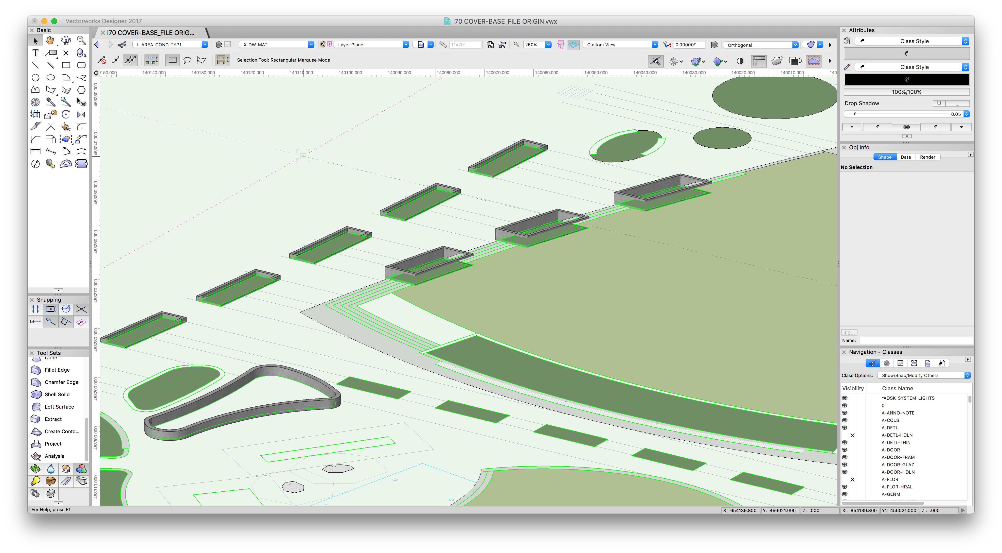
I had the same issue when setting up my current project file and found that "Align with Internal Origin" kept the origin of the civil engineering base file intact. The 'downside' of having the drawing objects miles away from the origin is revealing itself in the graphic display of my 3D objects. This is something that I have experienced in SketchUp as well and makes collaborating on a multi-disciplinary team challenging. I attached a file showing how my raised planters were getting clipped and some elements appear to be floating. A previous firm I worked for used Revit for architecture models and they created a collaboration worksheet which identified the real-world coordinates and rotation and placed a graphic marker at this location. Their process was to then move all live linework closer to 0,0 and export the file to the real-world coordinates and rotation or move linework back to the graphic marker. It sounds complicated but there were 6 separate firms sharing Revit models and AutoCad files and this kept everything lined up.
Just wanted to share my current and previous experience if it helps.
Offset Irrigation Pipe
in Wishlist - Feature and Content Requests
Posted
Yes I recently joined Vectorworks as a landscape industry specialist. While I don't have a lot of experience designing irrigation systems, I know that irrigation pipes are often laid in the same trench and often need to be represented graphically by tighter parallel lines, @Bryan G. provided input into the development of the irrigation tools and uses the tools in his workflow and might be able to comment further.