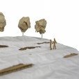
Unexpected view clipping in 3d
Screen Recording 2020-01-08 at 15.39.23.mov
Anyone know what to do about this? The project is centred on the drawing origin, user origin is set to (0,0). There are no objects in the visible layers that are far away from the drawing origin. Any other ideas how to stop it from doing this?
You can get around this by having a 'project zero' that is agreed upon. As landscape architects, we always work in World Coordinates, so here is a workflow for allowing smooth file sharing:
1. Set up your drawings in the correct WCS.
2. Set your user origin to match the coordinate system.
3. Set your internal origin to the agreed or desired '0,0' for the project (somewhere nearby of course) by using the Geolocate tool.
4.

