Search the Community
Showing results for tags 'geolocate tool'.
Found 1 result
-

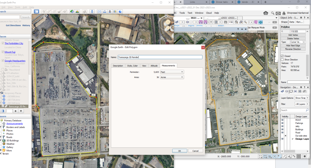
Vectorworks Geolocate tool wrong work?
Vectorworks drafter Shiv posted a question in Troubleshooting
I have drafted site plan in vectorworks using reference geolocate tool image. But I got deference google earth dimension size and Vectorworks geolocate tool image. Here I am attached Here left side is google earth area getting 36 acre and right side is vectorworks AREA 56 ACRE GET USING Vectorworks geolocate tool image. What can I do? I have tried scale but geolocate tool map image not reduce. My team need work on 100 acre so land going high in vectorworks. Please Suggest