Jump to content

Esa K

Member
  • Posts

    4
  • Joined

  • Last visited

Reputation

2 Neutral

Personal Information

  • Location
    Finland

Recent Profile Visitors

The recent visitors block is disabled and is not being shown to other users.

  1. Not quite sure. Just sent a message to the service provider and tried two days later. I guess they had something in their system that blocked it be used via Vectorworks.
  2. Hi, Returning on subject with good news. I contacted the service directly and now it works. Image quality is a bit questionnable but just needs to use smaller areas and combining them to get good enough quality. Attaching screenshots of my settings.
  3. Hi, Thanks for the answer. Ah okay. Do you have a hunch whether it is due to Vectorworks or the Helsinki system? I'm thinking of contacting Helsinki map service if that would help on the issue. Do you know if there's a possibility to download geotiff from kartta.hel.fi? Sorry for offtopic from Vectorworks.
  4. Hi, A newbie to georeferencing and geoimage here. Sorry in advance as this has been probably answered truly many times. But I'd appreciate any help on this matter. 
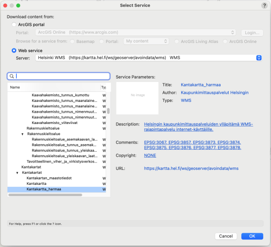
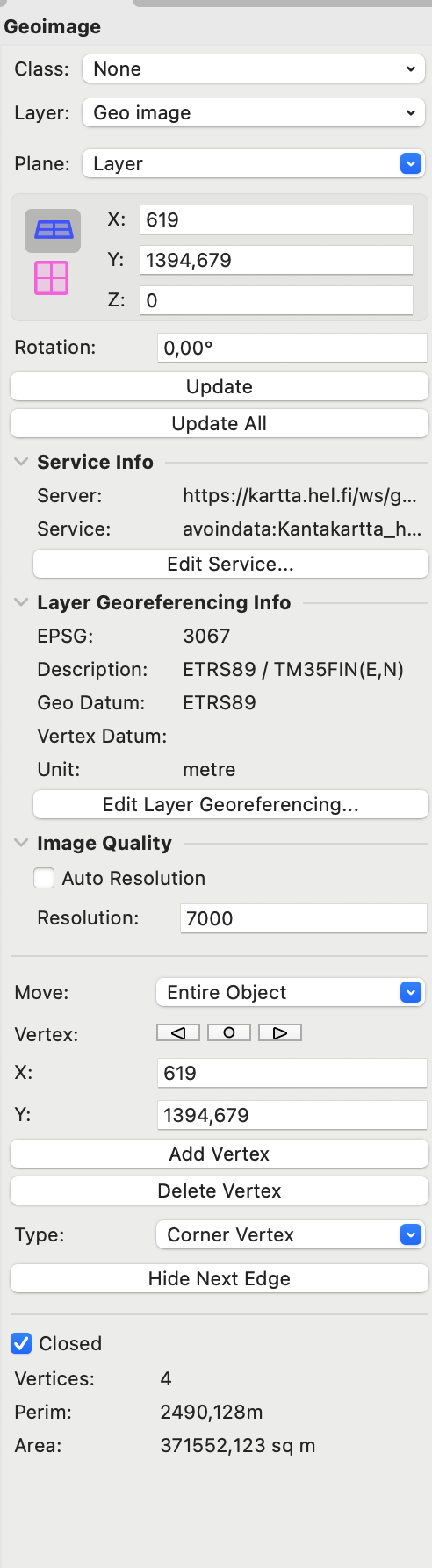
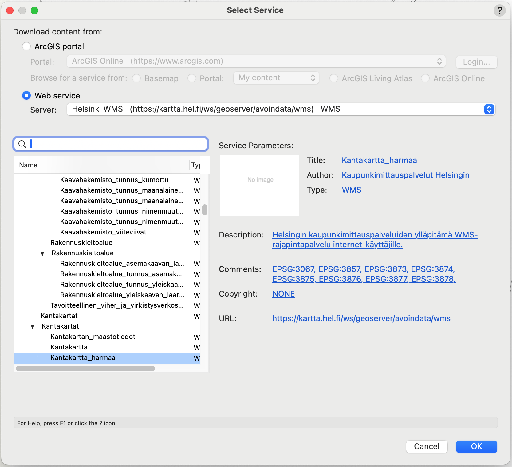
I'm working in event production with handeling bigger outdoor events. I've earlier on just taken screeshots or something similar to showcase area. But now knowing that you can geoimage easily, would be great to use this feature in all projects. But with the ArcGIS the quality of the satellite picture is really low (attached is a screenshot, it gives me a best quality of 1300 in Helsinki area). Kartta.hel.fi which houses Helsinkis official maps has really good ortophotography. Is it possible to somehow get kartta.hel.fi image to geoimage and how? 
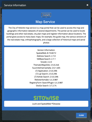
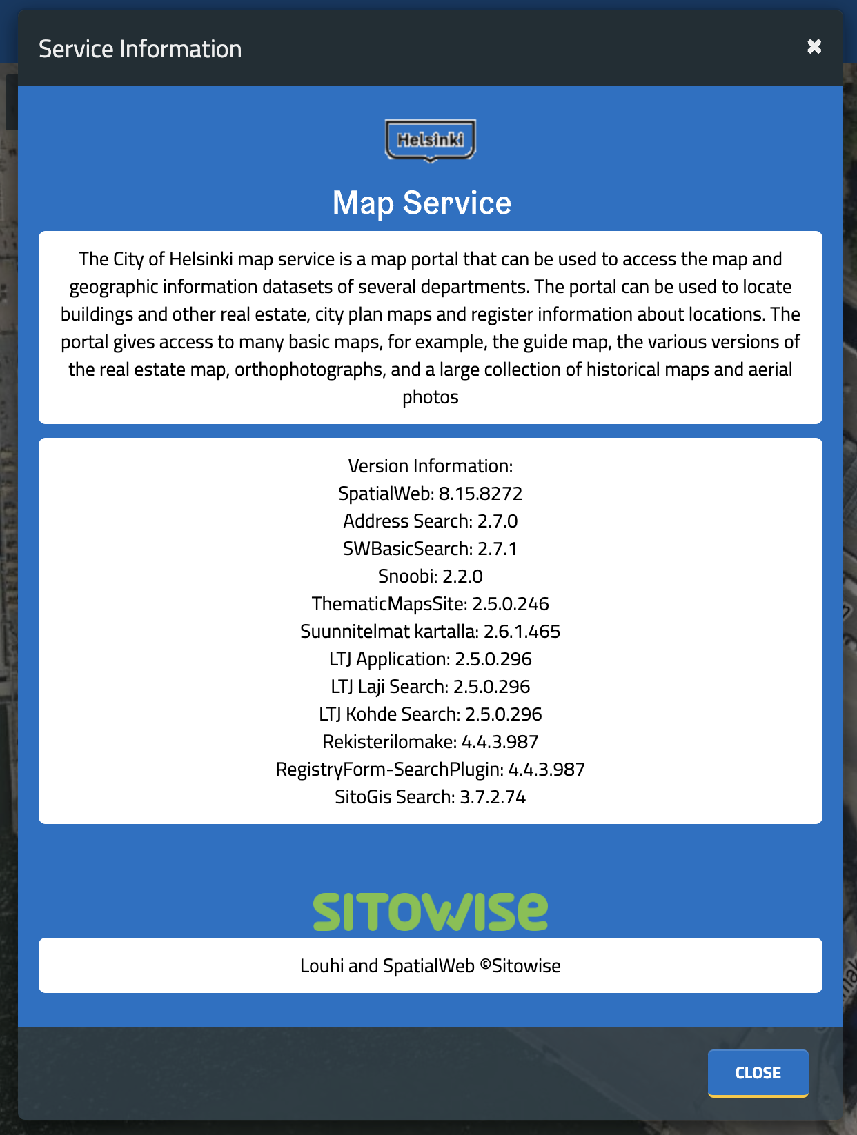
Attached is a screenshot of what kartta.hel.fi provides as service info. And if kartta.hel.fi is not useable, is there any other suggestions where I can get better quality picture. I'm using 16" Macbook Pro with M1 Max with 64Gb RAM Thanks again in advance!
×
×
  • Create New...