Rebecca R
-
Posts
18 -
Joined
-
Last visited
-
Hi, Is anyone able to tell me an easy way to provide multiple Sheet Layers, each containing multiple annotated section viewports, in dwg format please? An engineer is requesting drawings supplied as pdf, to be supplied in dwg format so that he can work on them in 2D, but my sections have been taken from a 3D model... He essentially wants the Sheet Layers as 2D drawings complete with annotations on Design Layers and exported as a dwg file/s. I'm using VW 2024 - hoping this is a magic function that it has - Many thanks in advance!
-
Providing existing and proposed site model elevations
Rebecca R replied to Rebecca R's topic in Site Design
Hi @kwik, great to have a visual example like this, thanks. I'll have a go with data tags as I'd like to be able to do it all with one click, but if it doesn't work, I'll do something like you suggest for sure. -
Providing existing and proposed site model elevations
Rebecca R replied to Rebecca R's topic in Site Design
Hi @Nico_be, thank you very much for responding. Yes, the terrain section function is useful, but I'm looking for a means of annotating a top/plan drawing - I've been doing some research and I think perhaps datatags might be the answer but think I might have to build my own... Wish me luck! -
Hi all, can anyone advise on what would be the best tool/method/workflow for providing existing and proposed site model elevations (together) ultimately to be displayed on a Top/Plan viewport on a sheet layer. Many thanks in advance!
-
Thanks @MethodDesign, very kind of you to provide such a detailed response. I've moved on from this project now for the time being at least and I'm not familiar with QGIS but I'll certainly look into this if the issue arises again, which I'm sure it will. Great to have the very informative thread here to refer back to. Thanks again!
-
Hi Jeff, I replied to your message before reading this. You've been really clear and I feel like I've got a good enough grasp of what needs doing now. Thank you! Great that this is on record on the forum for others now too. Enjoy your break, you will be missed! Rebecca
-
UPDATE: We have had no joy using Blender to convert the files @Adios amigos - I think this is beyond our expertise!
-
Hi Jeff, I've sent the point cloud data now as well. The info you give about the files I sent is really helpful. My partner uses Blender so I'll see if he can do anything with it - he doesn't usually work with this sort of data but you never know! If you can give me any pointers on tidying up my point cloud data it would be much appreciated. Again, many thanks for your help, and I'm sorry you'll be leaving the forum!
-
Hi, thank you so much! I've send you a message with a zip attached hopefully. I can work something out with the point cloud if need be, but it would be very helpful to know if anything can be done with these other files for future reference as much as anything.
-
Thanks for trying. Good to know it's not just me. After a bit of digging, it looks like they (Defra) do supply DWG etc files but only if you're one of their 'associates'. Maybe Promap is the answer, or I might be able to extract something from point cloud model - bit of a faf though.
-
I think it's the other way round though isn't it, and in any event - there's only one point cloud option unfortunately. Thanks though.
-
@Katarina Ollikainen do you use the Defra LIDAR survey data? If so, I'd be extremely grateful if you can advise please?
-
Nope, sadly it didn't work.
-
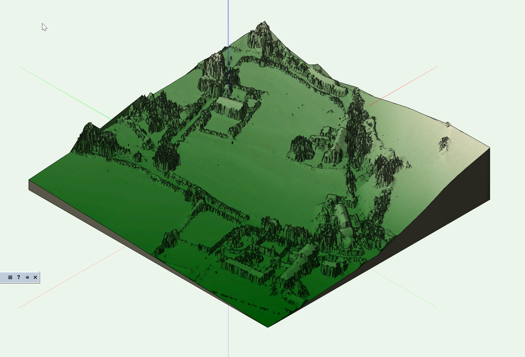
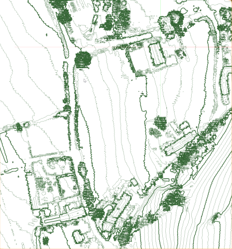
Yes, free, so at least it's not costing anything to experiment! I was only able to import the .shp files as shapefiles and they seem to contain regular polygons that don't make much sense on their own. @Adios amigos, are you able to help with this before you adios!? I'm attaching images of the site models I've been able to create with a section of the point cloud data (less than 200m2) - as you can see, it could do with some smoothing and it contains house, hedge and tree levels too which isn't ideal - not sure what to do about any of this! Any advice gratefully received!

-
Many thanks @Adios amigos, this is all really helpful information. Thanks for taking the time to help 🙂 .