Search the Community
Showing results for tags 'hydrozones'.
Found 1 result
-

Hydrozone Tool - Negative Space
loretta.at.large posted a question in Wishlist - Feature and Content Requests
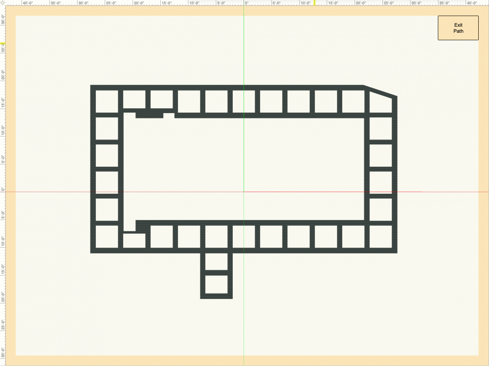
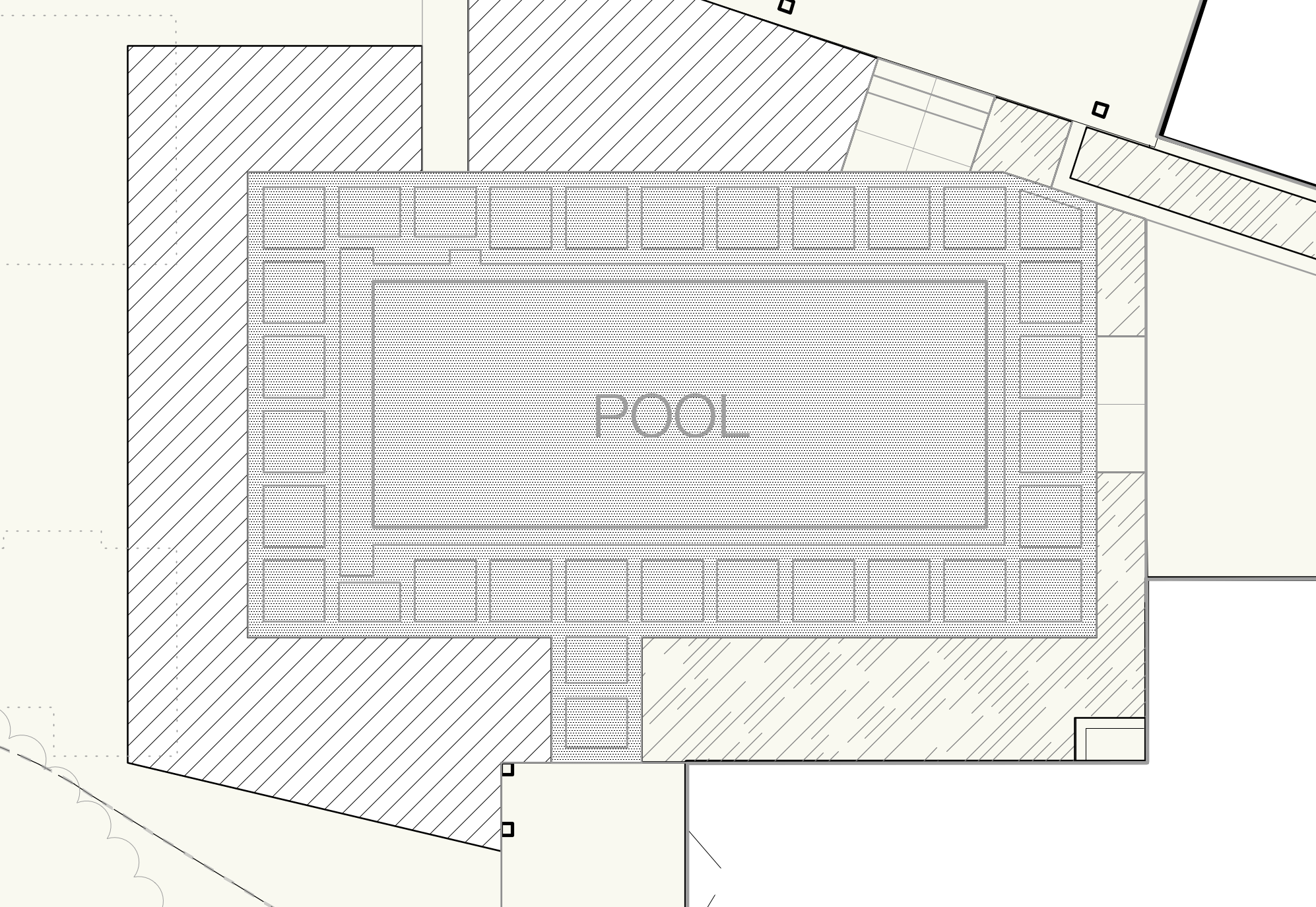
I find the Hydrozone tool to be very useful for MWELO calcs and for irrigation plans. However, I sometimes find the tool cumbersome to use. One request is how Hydrozones graphically display when there is a hole or negative space in the center of the polygon (or path object). The area seems to calculate properly, but I don't like how it looks like the hydrozone areas overlap in places it's not supposed to. Here are screenshots so you can see what I mean.