Grubba
-
Posts
3 -
Joined
-
Last visited
Content Type
Profiles
Forums
Events
Articles
Marionette
Store
Everything posted by Grubba
-
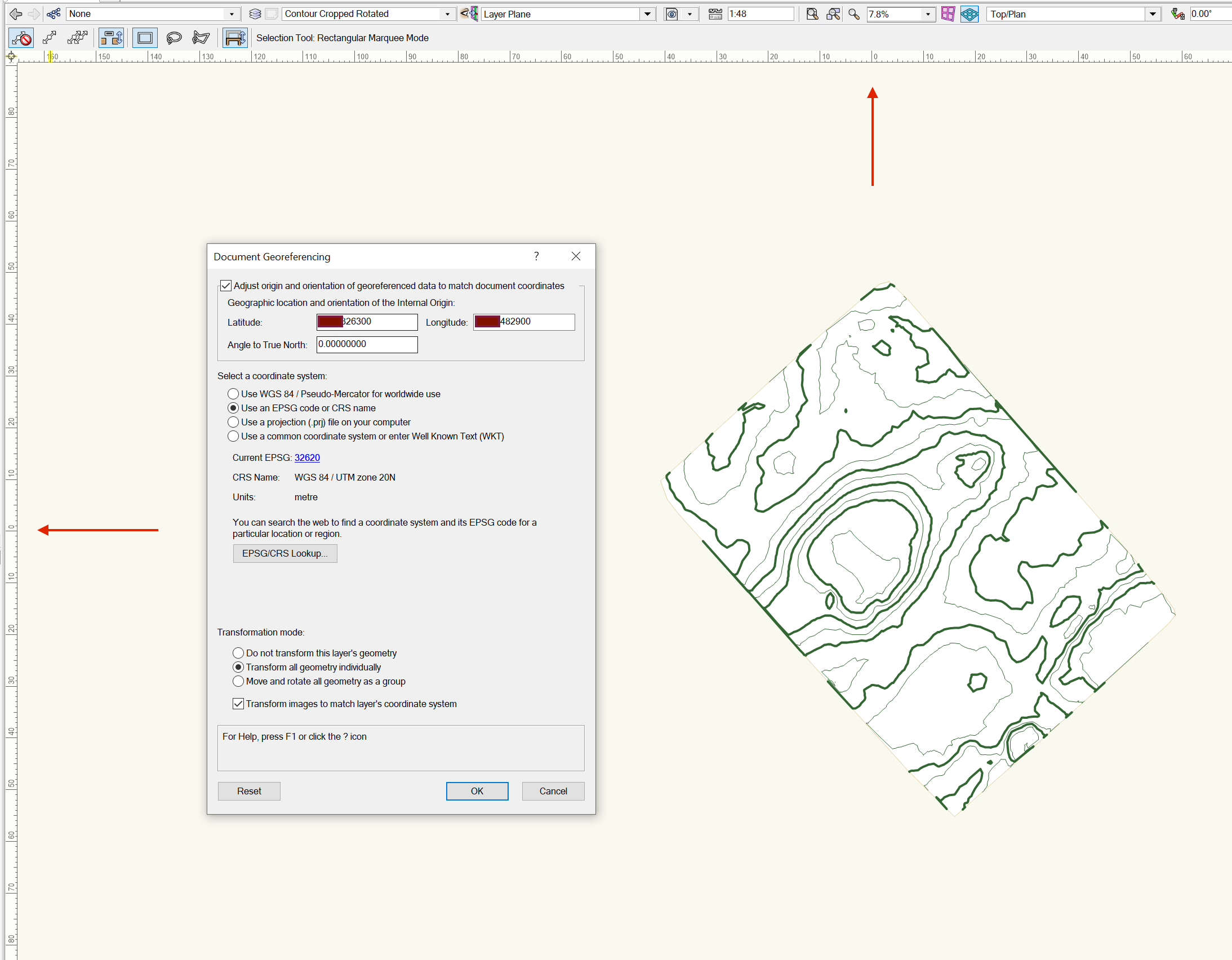
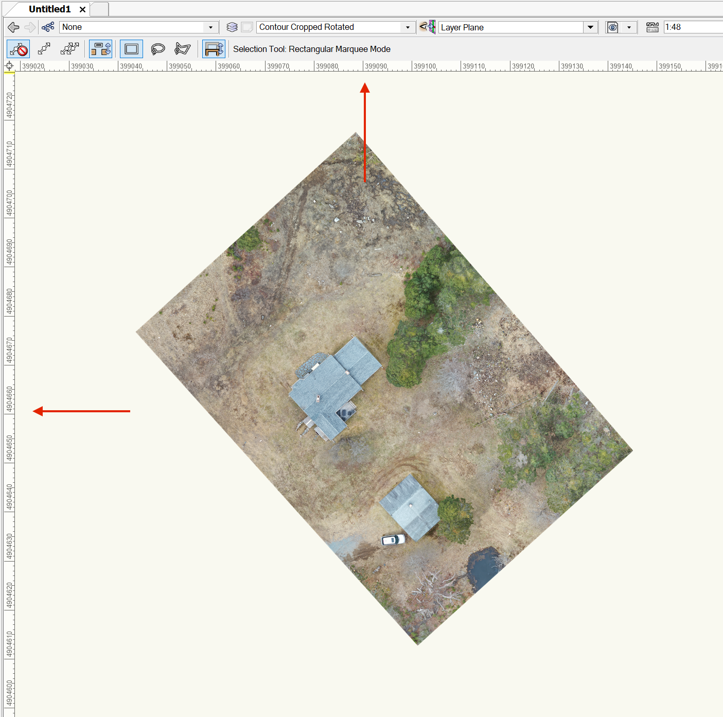
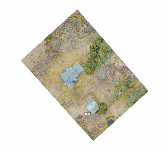
Ok, I went back and started from scratch to make sure the whole process was controlled. Within GIS, I loaded the terrain (DEM TIFF), generated a Contour (SHP) from the DEM file and loaded the photo mosaic (TIFF). I created a cropping mask and cropped a small region so I didn't have to deal with a large data set. Note that adding all these layers, which all use the same coordinate system, all line up fine within GIS. This is the cropped result within GIS. You have the photomosaic and the contours overlaid (the DEM is underneath and not visible): Within VW, I created a blank plan, changed the units to meters and set the georeference origin. I then proceeded to load the contour shape file, which loaded where it should (0,0) and with the proper dimensions. After that I proceeded to load an "image" (the photomosaic geotiff). The image loading dialog does not offer any option related to georeference. It doesn't ask to use the embedded coordinate system or assign something else as it does when loading a shape file. The image is loaded but its origin is not adjusted. It ends up thousands of miles away: That makes sense. Provided it uses the embedded georeference to map it to the terrain. Is that documented anywhere? Thanks! g


-
I'm not in front of the computer right now (well, I am in front of a computer but not the right one 😛). I will double check later. I did all that. I have the terrain loaded (shape file), everything is georeferenced and using the exact same coordinate system (it all came from the same GIS package). The document's origin is set to the proper coordinates. All geodata is loaded correctly and in the proper places. The only issue is when trying to load the (map) texture. The image, which is a standalone TIFF file (Geotiff), seems to load with the proper scale though its position doesn't match. I also saw something about "cannot apply texture to object", or something to that effect. All I want is to map the image as a texture to the terrain model. Also, I should notice that all this takes for ever. Once the terrain is loaded, everything bogs down. The model isn't that large (I cropped it down to 4 acres with 2' contours). This computer has gobs of memory, 16 CPU cores and 4 GPUs. I can load scenes with orders of magnitude more faces and textures and have it loaded, manipulated and raytraced in seconds when using other applications for instance.
-
I have a full survey done, which includes a high resolution, geotagged image (map). How can I load it instead of having to rely on third party web services? The image is a Geotiff. Thanks!