
Hi Everyone
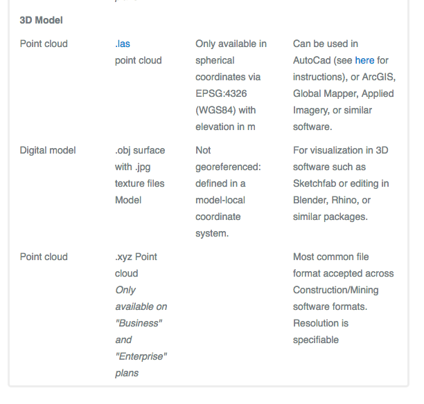
I have a question here that I'm hoping someone can help me with. I'm starting a project on a piece of agricultural land (creating a agri-tourism concept) which is about 10-15 acres in size. I'm in need of some accurate elevation data as well as some high definition images (overhead), a drone is one obvious choice. I have contacted a company that will fly a drone and collect data for me at a pretty reasonable price when compared to traditional surveying. This drone pilot uses a