
Search the Community
Showing results for tags 'property line'.
Found 4 results
-

Version 1.0.0
5 downloads
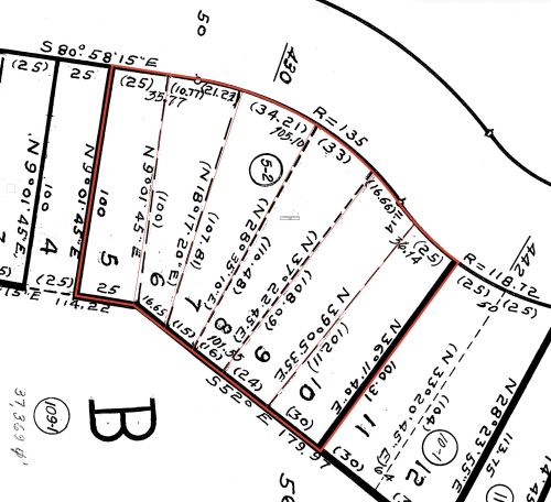
This is a pretty basic Marionette object to help me build property lines without having to use and troubleshoot the existing Vectorworks Property Lines tool. It builds a single line based on the entry of survey data (ie: 125.5' N 40° 35' 19" W). This works one at a time and does not build arcs. I've tested it on a few particularly messy plats and it seems to work well enough. After producing a single property line, ungroup and arrange it where you want it (Marionette will place the line at 0,0), then repeat until you're finished, easy! If you're super into the Property Line tool, you can gather all the lines together, compose them into one poly, and Create Objects From Shapes the whole thing into an official Property Line. I hope you find this helpful. -
Good afternoon Everyone, I'm having a real problem with calculating area summaries for the Property line plug in object. I've been trying a number functions additional to =('property line'.'area') in order to convert this string into a numeric value. I've tried =value, =area, =round, =num, =str2num, etc... and I can't for the life of me get it to work. Anyone had any similar problems - VW 2018 SP2 PS - I checked the VW forum records, there was a similar wishlist item, but for some reason =area function worked in that instance. Any help please? Thank you in advance!
-
=(('Property Line'.'Area')) returns a non-numeric string. Eg. 31106 sq ft I want use the numeric value to calculate allowable Lot Coverage as prescribed by the zoning How can I extract the area as a number?
-
I'm trying to get a rough estimate of where the existing trees are on a site using an aerial photo. After creating the dimensions of a property line taken from an assessor's map reference, i tried importing a snapshot from Google Earth. When the photo is scaled to the property lines dimensions, they don't line up. Is this result of Google Earth photos not being accurate or am i missing something?


