Search the Community
Showing results for tags 'geolocate'.
Found 4 results
-
Good afternoon folks, I'm banging my head against the computer here trying to get ECW files from my local municipality (Winnipeg, Manitoba) to import, scale and position properly in a geofenced file. I've setup a clean (new) file and geolocated it according to the system the city uses ( NDA83 / UTM zone 14N) which I pulled from the ECW files in QGIS. The Geoimage tool in VW works great but the city ECW files are far superior. The ECW images import through the Import Image route but they're not recognized as images (I have to choose all files under options) and they show up at the wrong scale and not located properly. If I import two of them they stack one on the other. The ECW files have a world file (.EWW). I've made sure the document units match the units in the ECW file. Does anyone have any idea what's going on? If you're curious where to find the City of Winnipeg ECW files, they can be found HERE. Thanks for any help / advice. - Dylan
-
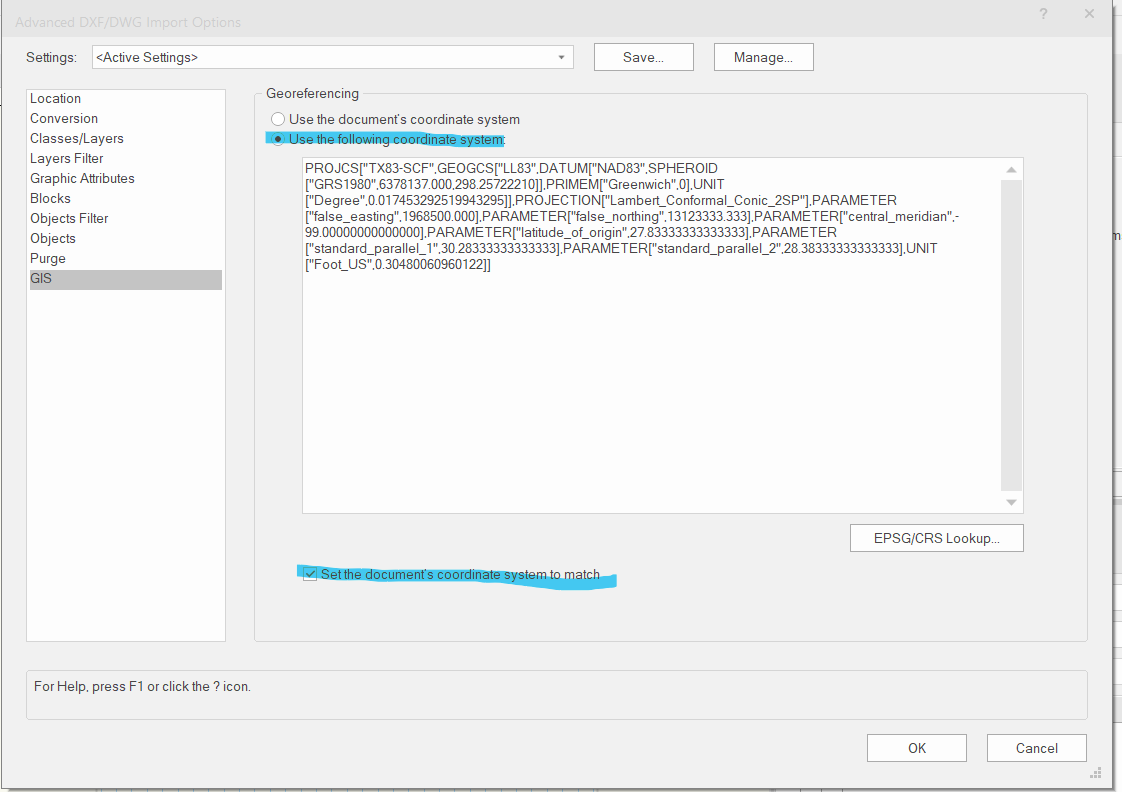
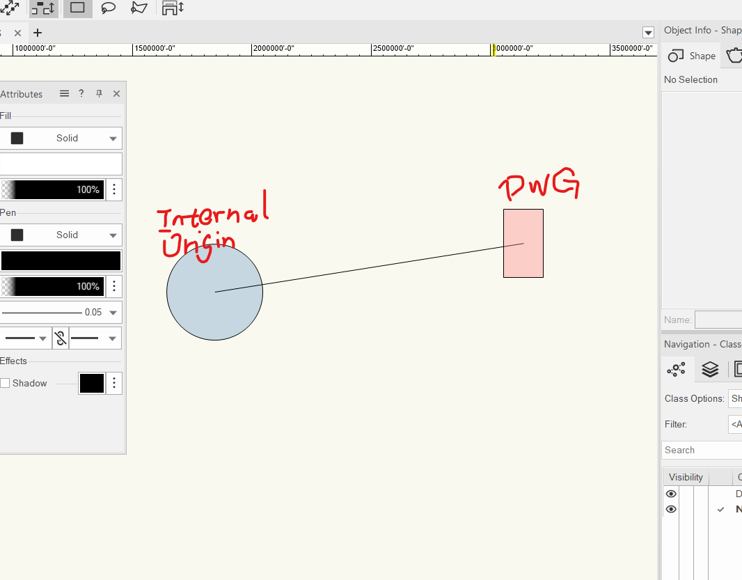
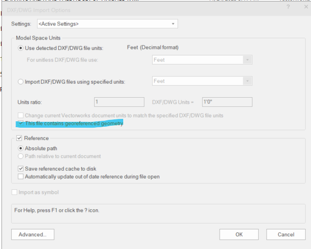
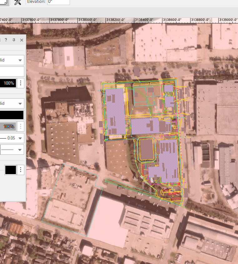
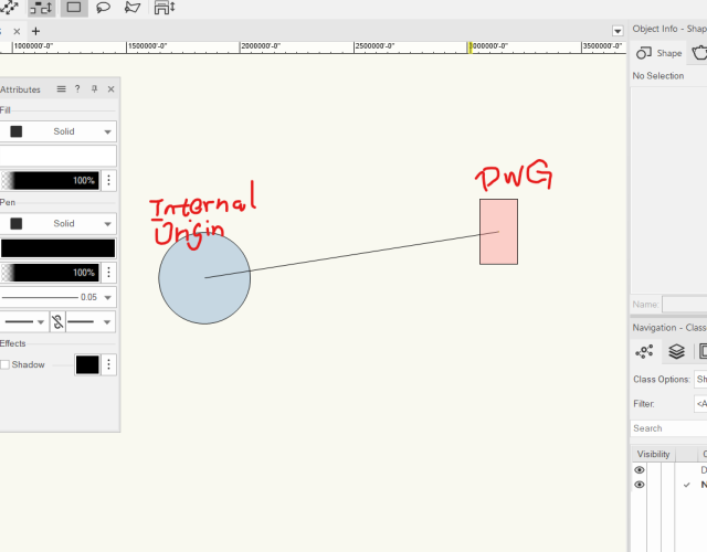
HI all, I have a question regarding handling cad file with geolocation information. I do the following procedures: a. when I see the "georeferenced file" is auto checked, I go to the advanced setting: b. I make sure the highlighted items are checked, then start referencing the dwg. c. after importing/referencing, I turn on the geoimage and it looks good. The referenced drawing is on the corrected spot with correct user coordinates. d. However the drawing ends up being far away from the internal origin Should I proceed with this or do something to fix the problem? I tried "center drawing on internal origin", but this will mess up the geolocation. Thanks in advance for your help!

-
I have a geo-referenced file, with geo-referenced data imported. The data in my file all sits in the correct place when I add a Geo-image to check the geo-graphic location - however, the file has never been 'geo-located' - so the internal origin is miles away from the data. If I try to geo-locate now, the data in my file moves position to retain it's offset position to the internal origin, which I don't want. I've tried this with both the geo-referencing turned on for all layers, and also turned off. Is there a way around this?
-
I have two files containing baseline information for my project - Topographic Survey and Architect's Layout. Both have been imported from DWG into their own new VW files, and georeferenced according to the procedure detailed in the previous georeferencing thread on this forum. I can Geo-image in both of these files and the drawings fit beautifully over the site. I now want to reference the information in these drawings into a new master file, using the design layer viewport referencing system, so that I can use the information to inform my own drawing. However, when I try to do this... while the X Y positions of the drawings remain correct, the GIS stake shows that the design layer viewport referenced layers, when created, are nowhere near the geo-located positions set in their original files. Am I missing something really straightforward? Any help much appreciated.
- 11 replies
-
- 1
-

-
- georeference
- georeferenced
- (and 3 more)