Search the Community
Showing results for tags 'drone'.
Found 1 result
-
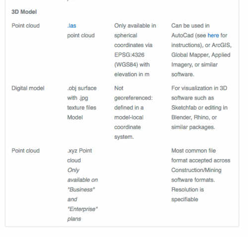
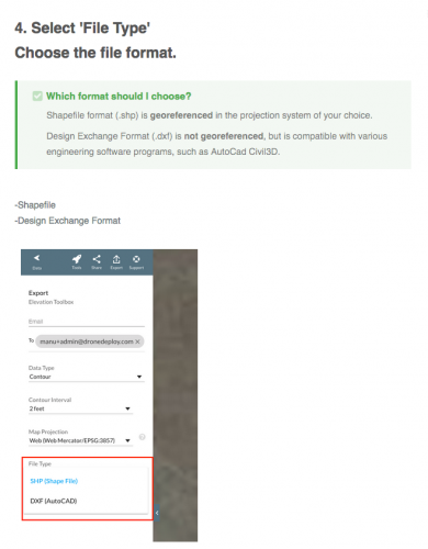
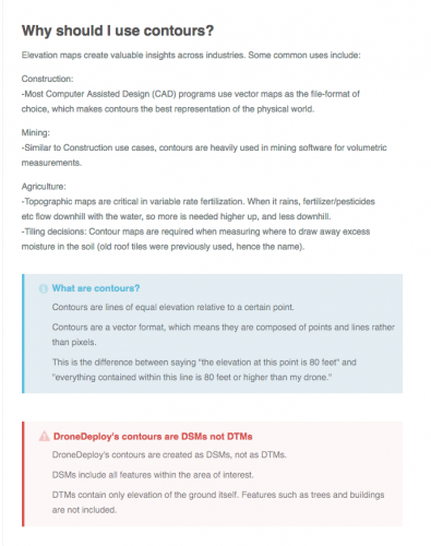
Hi Everyone I have a question here that I'm hoping someone can help me with. I'm starting a project on a piece of agricultural land (creating a agri-tourism concept) which is about 10-15 acres in size. I'm in need of some accurate elevation data as well as some high definition images (overhead), a drone is one obvious choice. I have contacted a company that will fly a drone and collect data for me at a pretty reasonable price when compared to traditional surveying. This drone pilot uses a web based software to share this information with his clients, which I think is a pretty sensible approach. http://resources.dronedeploy.com/getting-started?utm_source=hs_automation&utm_medium=email&utm_content=53288874&_hsenc=p2ANqtz-_927kOLGu-YsnBPuK3o_rF3UYgKfKJDm-bqgdqx-OeoY2-BxDVCjceb-C95fCtwxhrm-e-HsgQ5CZfc_qSIOoGzBh1OQ&_hsmi=53288874 My question is whether I can this exported data and make it useful within VW. I have provided a couple of shots from the drone Deploy website and I'm pretty sure that importing .dxf will give me some contours that I can work with. Can anyone confirm this? The service is $750+ 100/month for access to this online software which I imagine I'll use only once. I don't see the high definition image being an issue, but I'm unsure of the 3d data. Thanks in advance for any assistance.