Search the Community
Showing results for tags 'site modelling'.
Found 5 results
-
Hello all, I've inherited a typo survey from an old job, that is just 2d text boxes and 2d loci. Is there an efficient way I can turn these to 3d loci? I have seen this question asked a couple of times previously, but I can't find the thread for some script i used to solve this at the time. I was wondering if there is a known solution or script floating around for such a task? Thanks!
-
Ability to drape a georeferenced aerial photo or tiled photos onto a site model surface.
- 10 replies
-
- 2
-

-
- site modelling
- gis
- (and 2 more)
-
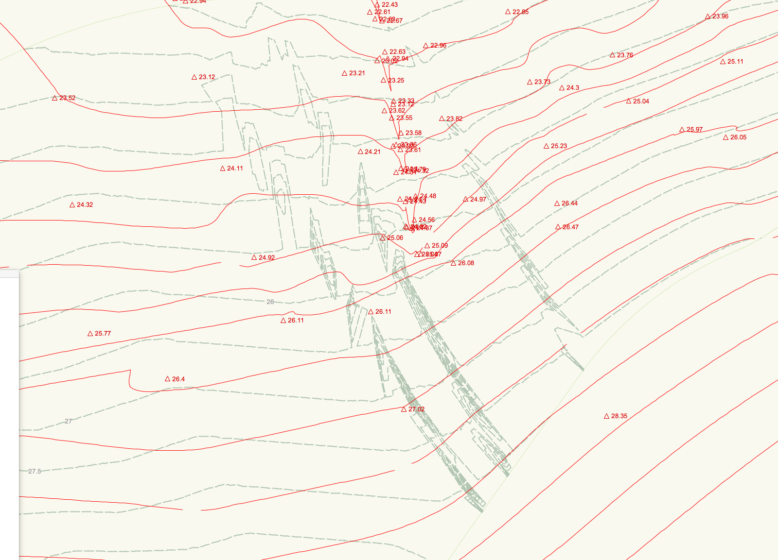
Troubleshooting - I have a site model created from 3d polys and some stake points. Generally this has worked, though in one particular area the site model is coming up with some unexplained geometry... See attached image, showing input survey data for terrain (in red) and existing site model contours (green dashed). Any ideas on why this has happened / how I can fix it?!
-

Live updating for site model section tool
Steve Riddle posted a question in Wishlist - Feature and Content Requests
It would be good to have site model sections that automatically update with the model, and the annotated levels. -
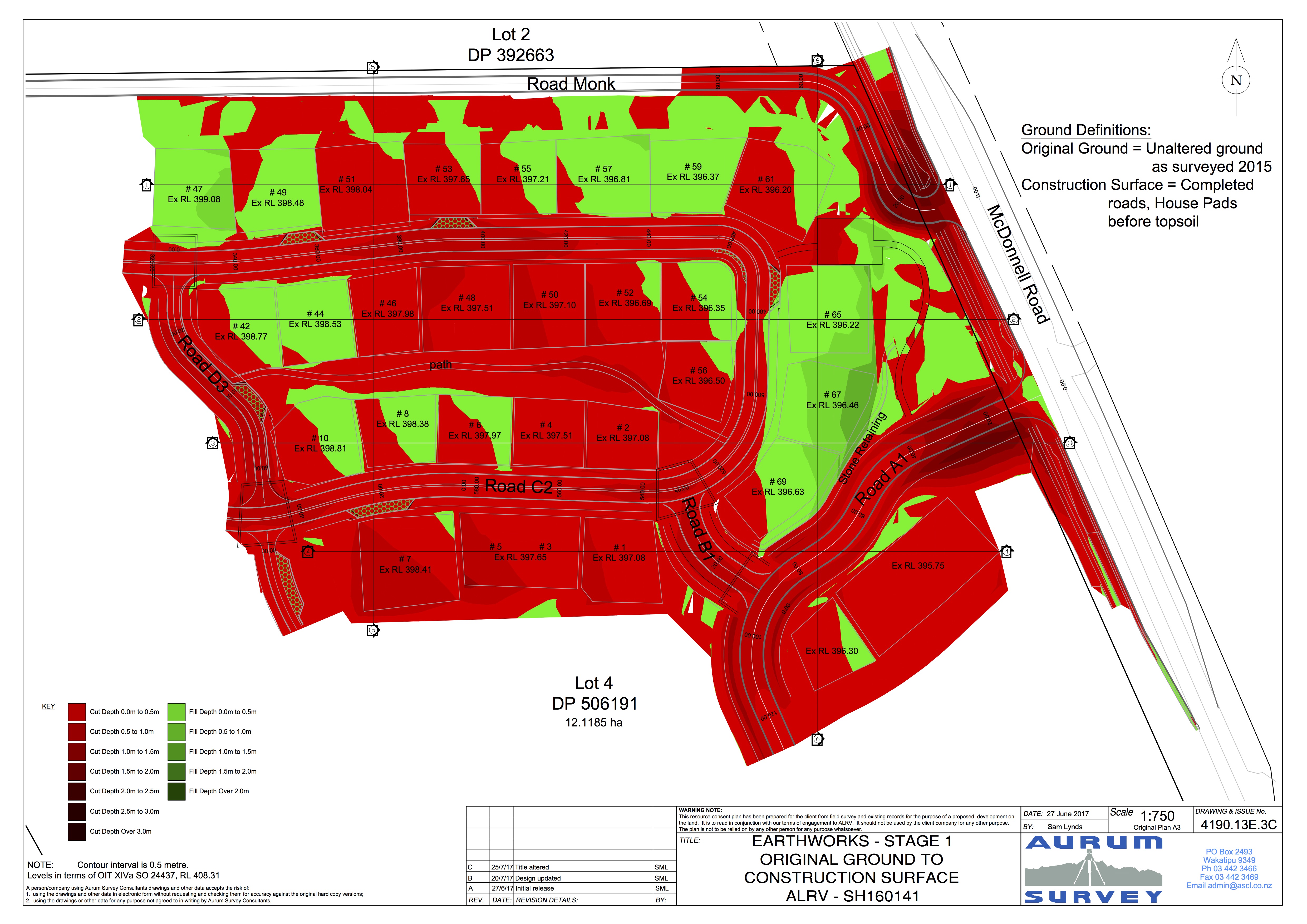
Ability to display the depth of cut and fill in plan view Software to calculate the difference between existing and proposed site models and create colored contours, This is often requested by local government for earthworks consent plans, I can almost do the work myself but without this feature I have to refer to a civil design company using AutoCAD or similar.