Search the Community
Showing results for tags 'site modeling'.
Found 10 results
-
 It it possible to createa road on a site model with a complex cross section profile? I have to design a road with a compelx road - gutter - shoulder profile. Look image attached . The examples in VW Land design only offers a road with a simpel square gutter. Any help?
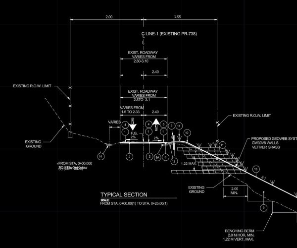
-
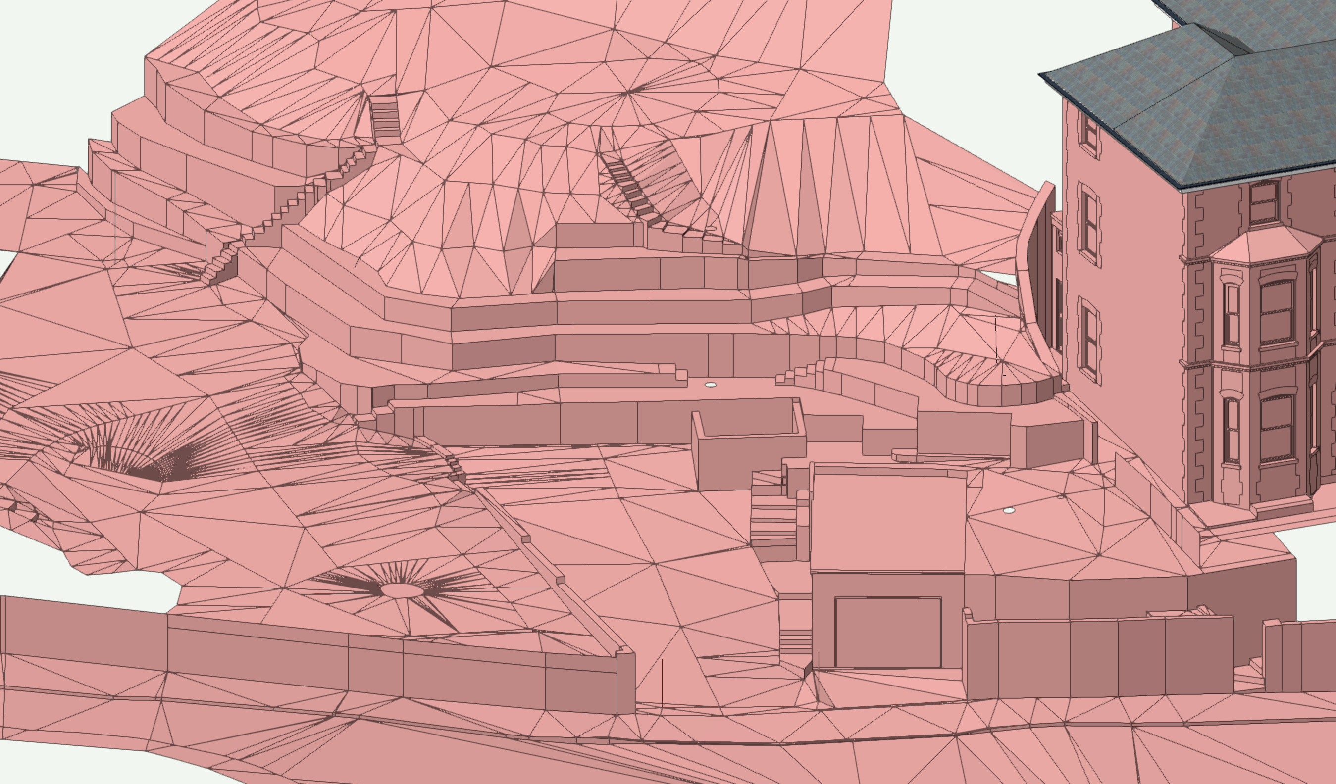
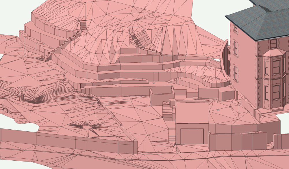
I have a site model done in Sketchup which I have input into VW. I need to create a site model from it so I can start altering it and calculate quantities etc. I would normally do this by changing the vertices of the polygons to 3D loci and then recreating it in VW. However, the model has many vertical walls so the site model in VW does not like it but only gives the option of deleting vertically duplicated points. If I do this it ends up as an inaccurate model. Is there a way of turning the 3D Sketchup or DWG model into a VW site model without losing accuracy? A screenshot of my immediate problem is shown below
-
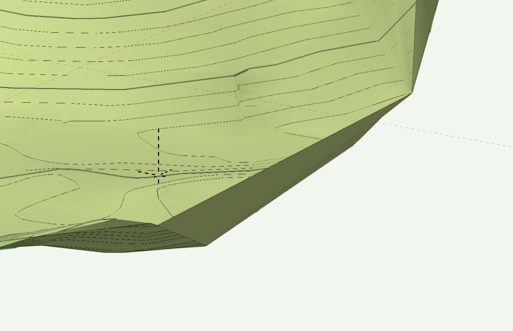
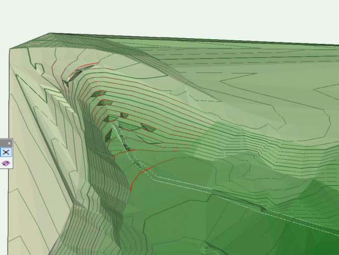
Hello! I'm attaching my file and a screenshot of the area I'm asking about. After I create the site model, everything looks good but for some reason, on one side, it creates a wall of stacked contours that have returned along the site model boundary. I tried editing the existing contours but they just end up going right back to where they were. I'm sure it's an issue with my source data or some of the settings but any help would be great. Thanks! 743298199_Untitled3.vwx
-
Did something change in 2023? I used to build simple site models and be able to put site modifiers down and have the model update and grade around everything. I have watched countless youtube videos and am seeing people put down pad and retaining wall modifiers on their site and the site model is reflecting those changes. For the life of me I can't get anything to work on my site model. It seems a lot of the learning resources are for previous versions from years ago. Is there a good place to start with the site modifiers for 2023? I'm just so frustrated because I see people doing it so easily and literally nothing works for me. I'm sure I'm doing something wrong but I dunno. Thanks.
-
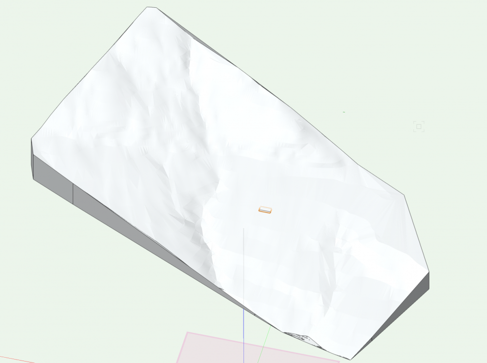
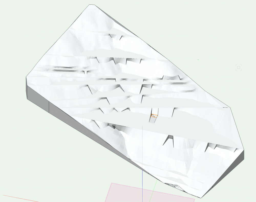
Hello! I'm trying to make a pad with retaining edge, but when I apply it to the terrain model, the topography gets weirdly jagged all over the model, even in areas nowhere near the pad. Photos below show the terrain before the pad is applied, then the messed-up terrain afterwards. A file that contains only the terrain and pad is also attached. Any suggestions would be much appreciated! Thanks. Ducros_terrain only.vwx
-
I've been using Vectorworks Landmark for a long time but really only for 2D purposes and I'm now really trying to get a grasp on the 3D capabilities and some of the features that I feel like Vectorworks is really pushing. I work in high end residential landscape architecture and many of our sites are sloping and complex. We use a lot of irregular materials and custom items so I often get frustrated with some of the tutorials that over simplify the process by using a completely flat site and pretty standard materials. At the risk of being too long winded, I'm wondering if there are any definitive training guides on the 3D modeling and a good workflow process to get started with this. I've played around and made a few site models but I'm having a hard time understanding when I should be using hardscapes or site modifiers etc... etc... I feel like I could post a million questions on here and maybe they've already been answered so I'll snoop around but I feel like it's all very overwhelming. Thanks!
- 5 replies
-
- 1
-

-
- site modeling
- hardscapes
- (and 3 more)
-
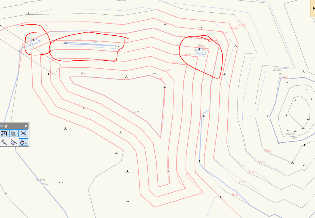
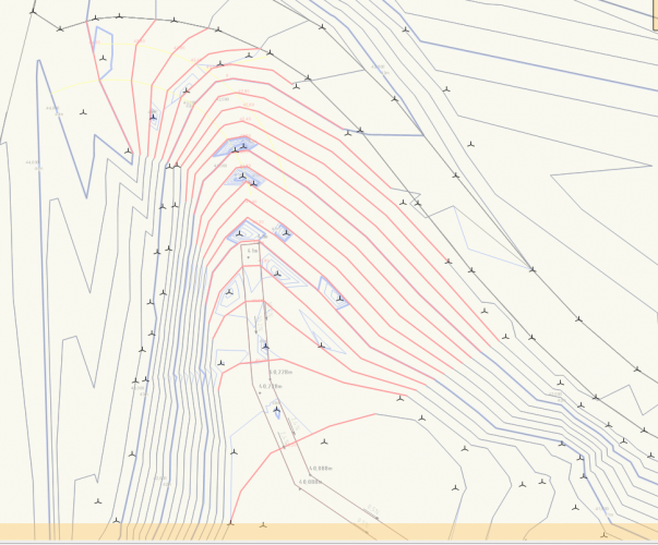
Hi, I am using c ontours to make changes in my site. When I draw them as proposed and update the model (which is also showing proposed), the 3D-locust that the site model is built up (source data) of is still affecting the terrain. Why is it like this? I don't really want to delete the imported info cause I still want the original (existing) terrain to be correct ... Ill post some pictures below .. Thanks for help 🙂

-
I have used Vectorworks for years (for landscape architecture), but have just started to learn 3D Vectorworks and I am struggling! Hardscape tool. I understand how to draw a hardscape and I can set the level at one point and then set a gradient across the area. But what about if the hardscape has more complex levels? Not just a simple fall? For example it might be a patio which comes out from a building level at FFL but falls slightly steeper at one side from the other to match up with existing ground levels on the other side. Can I set individual levels for each corner of the hardscape area? Which is what I would do on as notes on a standard 2D drawing? Custom Kerb tool. I need to extend an existing parking area. I have used the custom kerb tool to draw the area and have made it the correct shape with kerbs on the sides that need kerbs and no kerb where it meets the existing car park surfacing. But can I set this area to varied levels. As above, I would like to be able to set individual levels in each corner. The existing car park is not level and does not fall evenly across it so I need to be able to match up with this. Is this possible?? Thanks,
-
Using Landmark for about two months now and running up against what seem to be software limitations. Are there tools in Landmark for creating complex roads/paths with custom profiles, ie various curb and crown profiles? This is a HUGE must for modern day landscape architects. More specifically, we need to be able to create roads with stations such as in the polyline road tool, but with the editability of the nurbs road tool. We also need vertical curve/alignment controls. The problems with current tools: -non-realistic relationship to site model/grading and lack of vertical curve controls -lack of profile controls, ie crown and curb/gutter profiles -lack of customizability and accuracy. We need to be able to create a road with various stations at varied elevations with various curband gutter profiles and customize turning radii at junctions.
- 3 replies
-
- 2
-
-
- site modeling
- grading
- (and 1 more)
-