bob cleaver
-
Posts
239 -
Joined
-
Last visited
3 Followers


Recent Profile Visitors
4,441 profile views


-
I have tried to use worksheet labels to summarize the length of pipe and number of emitters per control valve. I feel this would be good info for pricing construction. Separately, is there a way to color code drip tubing for each valve ? use classes ??
-
Worksheet not picking up landscape area plants
bob cleaver replied to Nic_Berry's topic in Site Design
Chapeau to Vectorworks !! -
Worksheet not picking up landscape area plants
bob cleaver replied to Nic_Berry's topic in Site Design
@Tom W.I have never clicked on the Display Data Settings field until now and WOW ! this is a brilliant workflow - thank you !! -
Recommendation: I am using the Smart Options Display to have access to 4 toolsets I am a landscape architect - the Toolsets I access: Irrigation, Dim/Notes, Softscape, and Hardscape The easy access using the shift key is working well !
-
Benson I feel like I gave you short shrift with my earlier post. You always ask great questions and always support others. In order to use the balance cut and fill appropriately, the rough grading would be for pads and add paving, building, drainage swales, mounding and site sculpting. Developing a set of tools to use to develop site modifiers would be key to making a landscape architects grading design valuable. Benson, thank you for all your efforts on this forum !
-
In California, civil engineers dominate the grading review process. Landscape architects can provide 'grading studies' but are not recognized in municipal submittals for grading. I like to provide grading studies but never develop balanced cut/fill review - the balance concept is valid but so many geotechnical considerations are required to ascertain how to provide a balanced site (is the cut valid for fill, what are the sub grade needs of paving and structures, drainage requirements such as swales and bioretention basins for retaining site water on site, etc). The details of balancing a site at a schematic deign level make balancing a challenge -
-
Understood ! it sounds like a creative script could help @Tamsin Slatter @Katarina Ollikainen your review is appreciated !
-
Thank You Pat ! Any time is appreciated I have not succeeded with this - I have tried a few different options to no avail - My next attempt was to allow ‘any’ instead or ‘all’ in the conditions filter
-
can you use an existing tool like the wall or fence tool to have lengths available for reporting.
-
A screenshot of the sheet:

-
Thank you Pat Enclosed find VW file for testing The sheet layer shows the 'old way' of plant lists using worksheets and the requested legend with landscape areas and plant lists combined Bob's VW landscape area legend 2024-01-05 for forum.vwx
-
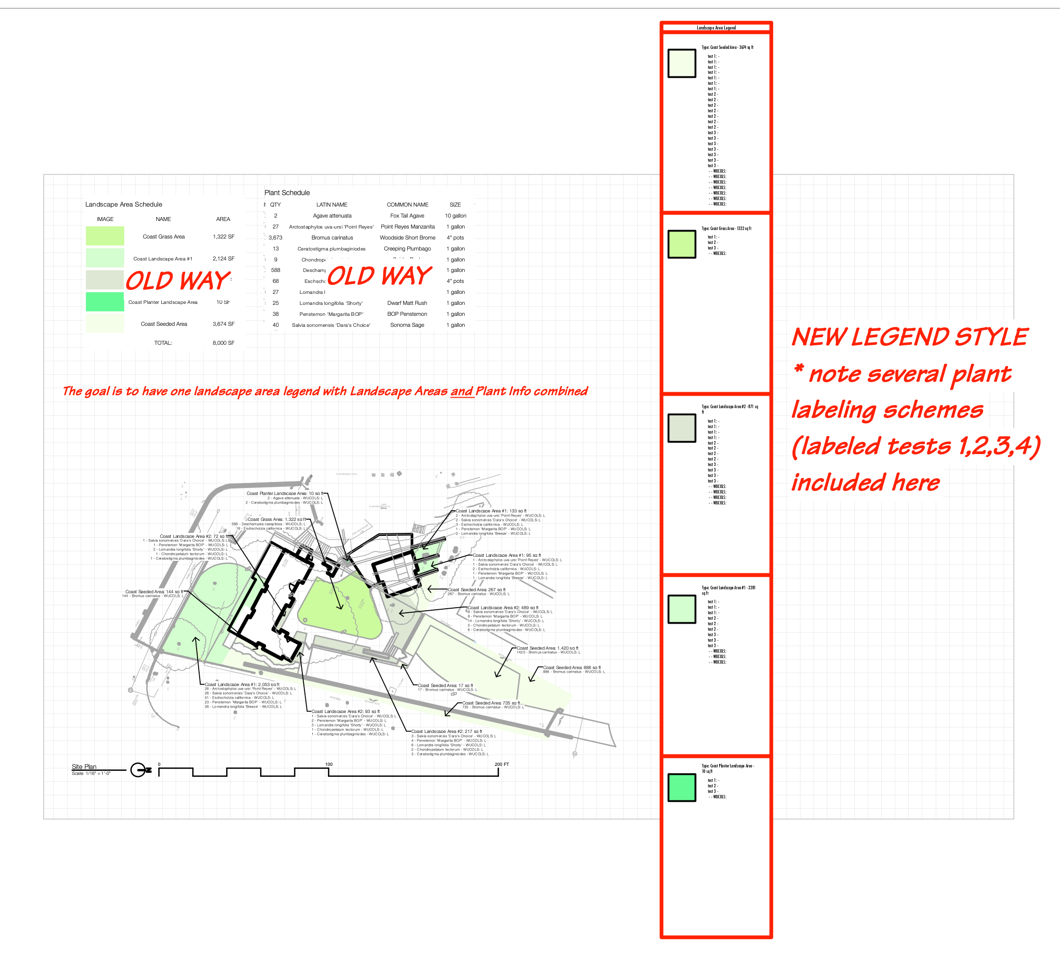
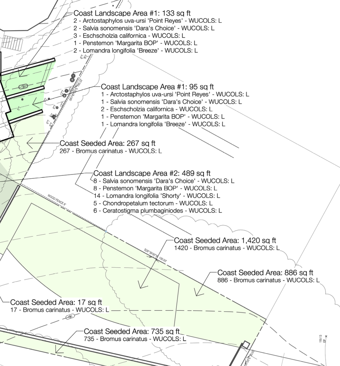
I am hoping @Katarina Ollikainen or @Pat Stanford or Jonathan Pickup can shed light on this. We use data tags to deliver landscape area names, area, and plant quantities, latin name, WUCOLS (water budget) labels (see image) but they are on a separate landscape areas and this goal is develop a true legend with this info.

-
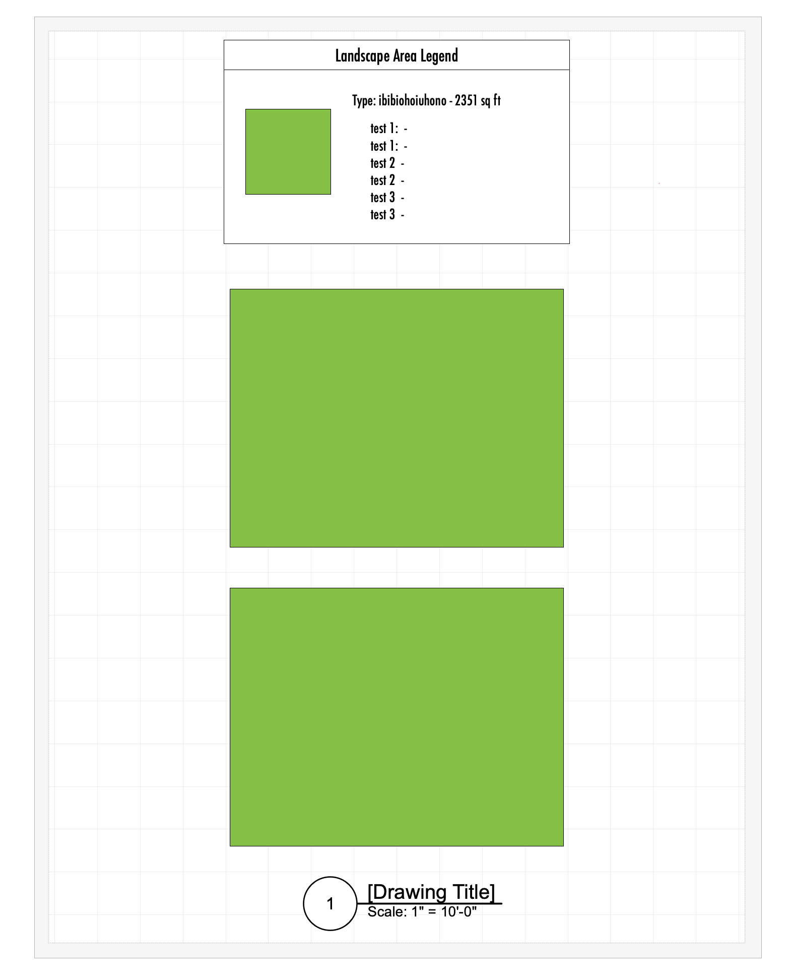
Trying to add plant info to Landscape Area Legend The goal is to have a legend with: 1.legend show a graphic for the landscape area (done) 2.legend show the landscape area name and total area (done) 3.add plant quantities and latin names for each landscape area (3 tests added without results) The VW file and screenshot enclosed. bob's plant legend test 2024-01-04.vwx

-
I refer you to the link below that has simple and well considered videos on VW including how to develop a site model that reviews extending contour beyond the site boundary and why that matters. I am not sure this is the exact video, but once you are in the link you will see her terrific content.
-
Vectorwork’s Tony K has a webinar where he combined 3 separate PCs into one site plan. The goal of mine is to create a site plan in 2D and then a 3D model. Tony’s webinar is excellent in working through the steps, but his PCs did not have the same distortion I have.