DDD
-
Posts
111 -
Joined
-
Last visited
Content Type
Profiles
Forums
Events
Articles
Marionette
Store
Everything posted by DDD
-
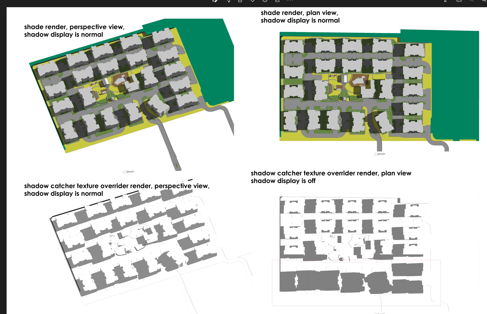
Hi, I am working on exporting a shadow drawing with Shadow Catcher Texture, and VW generates a strange shadow display glitch and I can't figure it out. The viewport will correctly render shadow in a perspective viewing angle, but when I switch to plan view it will go off - buildings on plan bottom will be covered by glitching shadows. Please see attached images. The working file is also attached, I am using Landmark 2023, please let me know if you have comments. Thank you. 1118363379_testfile.vwx

-
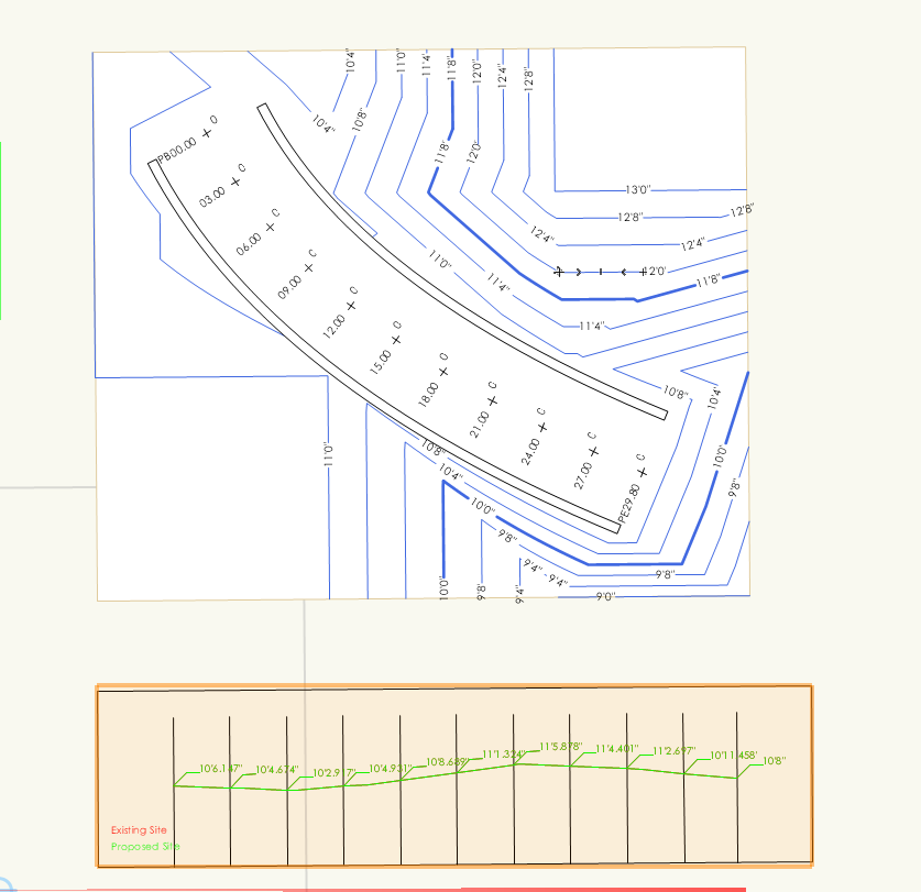
Hi, I would like to ask about the road tool. How can I get the stations to display their elevation? Currently they are showing "0". Also, is there a way to generate a profile along the center line with each station elevation reported on the profile? I attached the file below, thank you in advance! roadway tool.vwx
-
@M5dSimple like that, thank you very much!
-
Hi, I am discovering the repetitive unit tool. There is an extra linework for each object I created, is there any way to hide it? Thank you.
-
Understood, that helps a lot. Thank you so much!
-
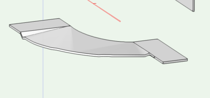
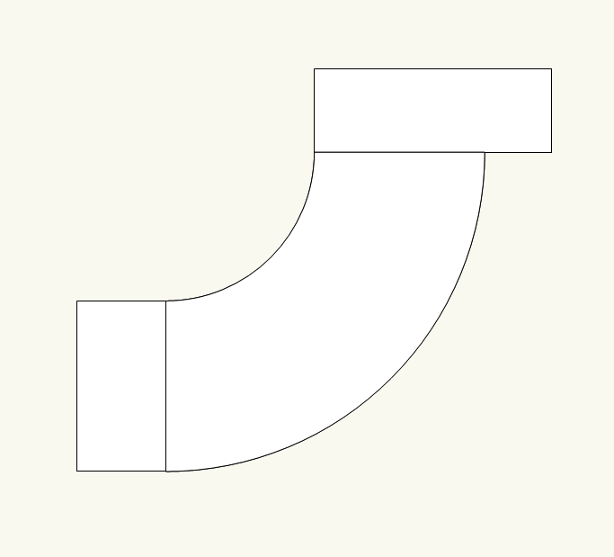
Hi all, I am having this problem creating aligned hardscape. Ideally I am expecting a smooth curved ramp generated between the two platform but somehow it gives a weird result. Is there something I did wrong? File is attached, I am using 2022 Landmark. Thank you! aligned hardscape.vwx
-
Got it, thank you!
-
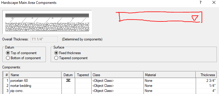
Hi I'm switching form 2021 to 2022. In 2021 I can apply slab styles to hardscapes to quickly create component sections. In 2022 I can no longer find the drop down menu to switch slab styles. Please see attached snapshot and file, let me know if y 'all have any information for this, thank you! Untitled 2.vwx
-
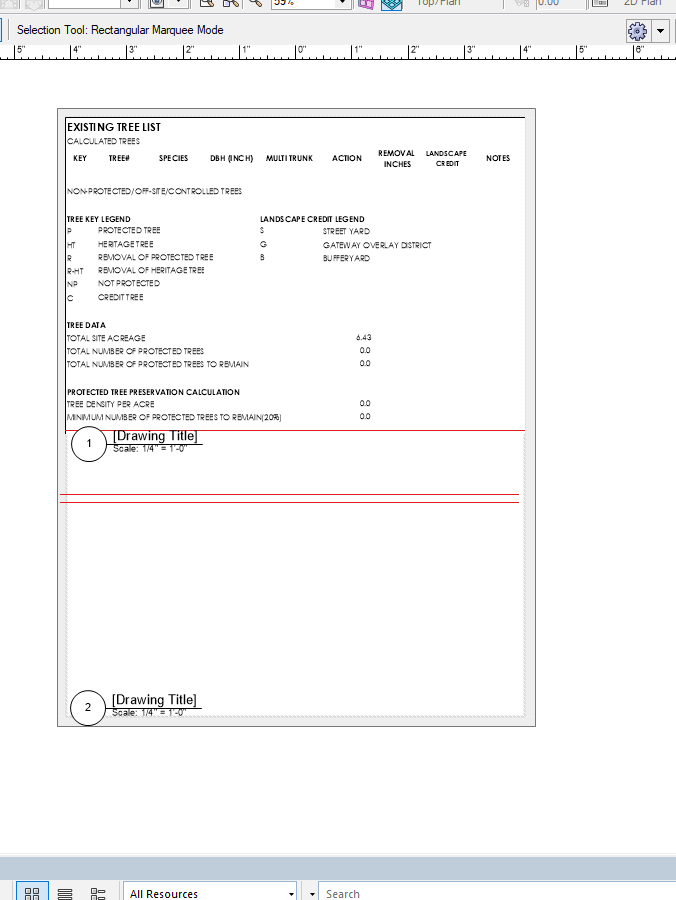
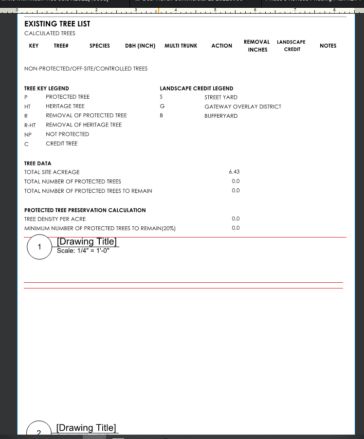
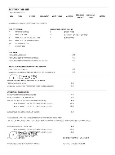
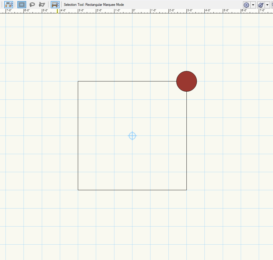
Hello I am having this problem in 2022, I didn't have this in 2021. I have a big worksheet in design layer and I would like to use viewports to "cut" it to fit on a sheet. the red box is the proposed viewport for cutting. But in the sheet layer only the first cutting viewport will display the worksheet, the other viewport shows blank. You can still see the cutting boxes in both viewports though. Looks like only the worksheet object is mal functioning somehow in multiple viewports. The exported pdf is reflecting this, but if exported as image worksheets will display normally. This file is attached, please let me know if you have any solution for this, thank you! Untitled 17.pdf Untitled 17.vwx
-
Hi Jeff, yes I tested both jpw/jpg & QGIS using the VW exported geo image file and they both failed. One thing I noticed is the CAD survey file, althongh the XY coordinates stays the same, but after impoting & exporting through VW, it's no longer aligned with CAD geomap. Thank you for your help anyways.
-
Thank you Jeff, I am have new issues, could you please help if you got some time? Thank you!
-
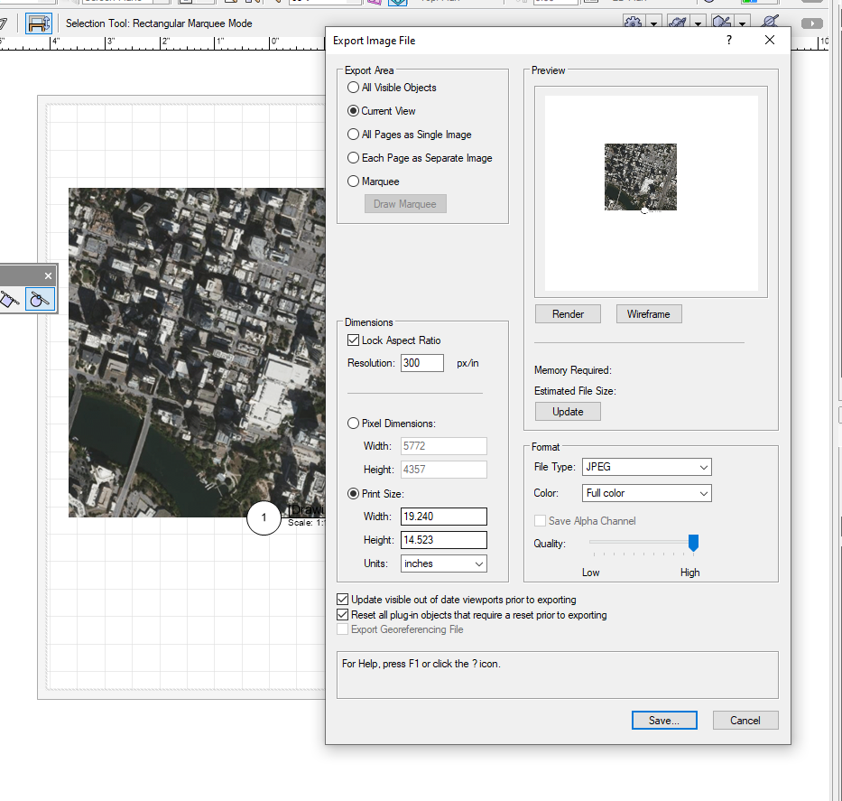
Hi, I am having trouble creating a georeferenced drawing. I open a new file, set the document geo reference - nad83 texas central 2277 geolocate the internal origin to somewhere close to my site (30.094320849637185, -98.40758238284789) import survey cad with georeferenced information checked turn on the layer geo reference switch I turn on the geo image and everything lines up. But when I export geo image (jpg+jpw) to Avenza, it says the file is not geo referenced, then I exported it to civil 3d, the civil 3d geo map doesn't line up. I don't know where the problem is. Is there a way to make sure the drawing is correctly georeferenced? And how to export a usable geo image file? I have no clue. My file and the survey file are attached below, super grateful if someone can help me trouble shoot. Many thanks, test file.vwx Survey Base.dwg
-
I read that this option is available when you select File-Export-Export Image File, but I don't see that option on my interface. I am using VW 2021 landmark, can yall please help? Thank you.
-
Got it, my cad file doesn't contain geo info. The 'Search' mode in geolocate only moves drawing based on internal origin instead of a selected base point, so I still need to adjust the internal origin to align with the known reference point. Your circle method works for me. Thank you!
-
Hi Tom, could you please elaborate on the geolocate tool? This is my case: I am working with an imported cad survey file, and I know the coordinates of a certain point A. I want to add geo referencing to align the survey with geo image underneath, but looks like I can only define the target coordinates based on my internal origin. Since my internal origin is not aligned with point A and I want to know how to adjust the internal origin to make it land on point A. Your circle method works, but is there any more straight forward way to do so by using geo locate tool? Thank you.
-
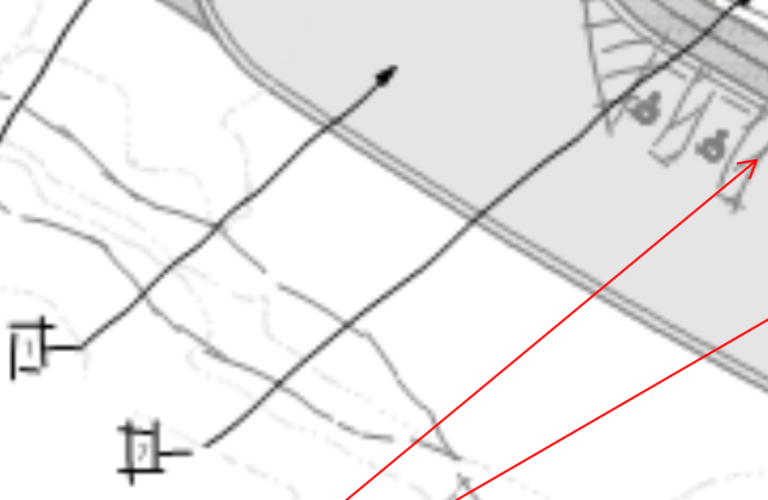
Hi all, Please see attached image, is there any way I can make the internal origin land on the red circle while maintaining the current user origin? Thank you.
-
Hi, I am wondering if I can have the sketch look in a viewport but have all annotations & drawing labels as standard straight style in the mean time? Thank you.
-
Hi Tom, thank you for clarifying this. I just checked the updates and my VW 2021 tells me no updates is available. Can I ask how did you get the access to 2022? Thank you.
-
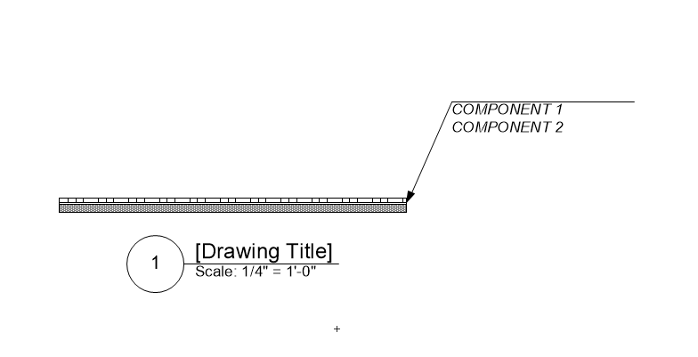
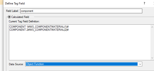
Hi Tom, I have trouble opening your file. I created another test file and somehow it doesn't work like yours. In the data tag editing window, the "data source" scroll-down doesn't have "worksheet" as an option. I also put in the #WS_COMPONENTNAME()# function but the tag is not working either. Could you please help me with it? Thank you! HARDSCAPE COMPONENT CALLOUT.vwx
-
Hi Tom, thank you very much!
-
Hi Hugues, sorry for the late response, this works! Thank you so much.
-
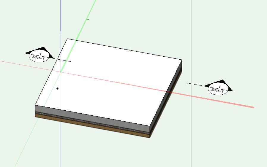
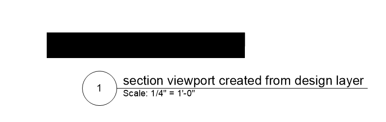
Hi community, I am having trouble creating a legible hardscape section viewport. Somehow all the viewports are showing a solid block instead of a layered section. Please see attached file for details, thank you! HARDSCAPE SECTION.vwx
-
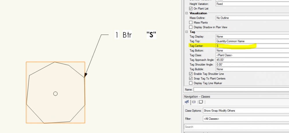
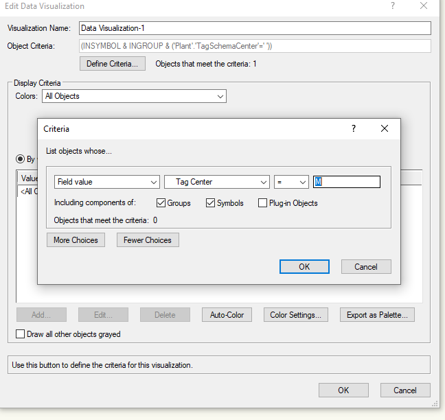
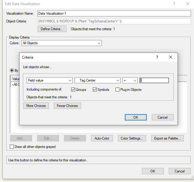
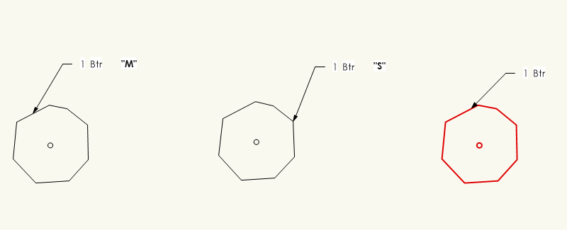
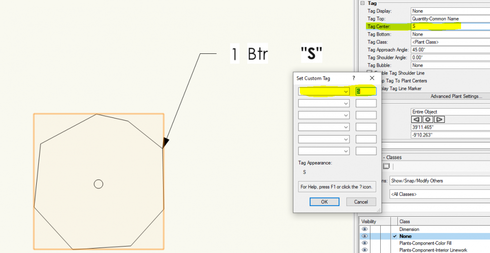
Hi all, I am having trouble with setting the criteria in data visualization for plants. I have three shrubs with different categories. The corresponding category is set in "Tag Center" for each shrub. (custom tag center) And now I am setting the criteria in data visualization, but VW can't sort the item out. Additional test, if I leave the criteria as "space", VW will sort out the shrub that is not assigned with any Tag Center value. How should I modify the criteria to let VW sort out the "M" or "S" category shrub? Thanks in advance!

-
Hi Kevin, understood, thank you for your help!
-
Hi Benson, good call! I'll definitely pay attention to the overlapping geometry, and thank you very much for your help.