SeanR
-
Posts
21 -
Joined
-
Last visited
Recent Profile Visitors
979 profile views


-
We are getting the same thing randomly since moving to Vectorworks 2022. Plant schedule worksheet inside a viewport. The viewport just goes blank.
-
Landscape Area planting schedule worksheet - 0 at end of quantities column?
SeanR replied to SeanR's topic in Site Design
Hi Bob, I had to add another criteria Subpart type / is / Plant All the rogue zeros disappeared -
Landscape Area planting schedule worksheet - 0 at end of quantities column?
SeanR replied to SeanR's topic in Site Design
Thanks Pat. I needed to add another criteria to the row which removed the rogue object. -
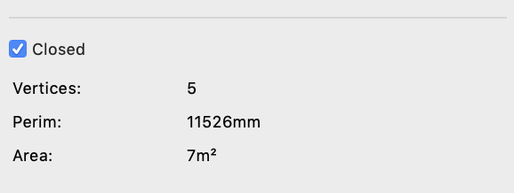
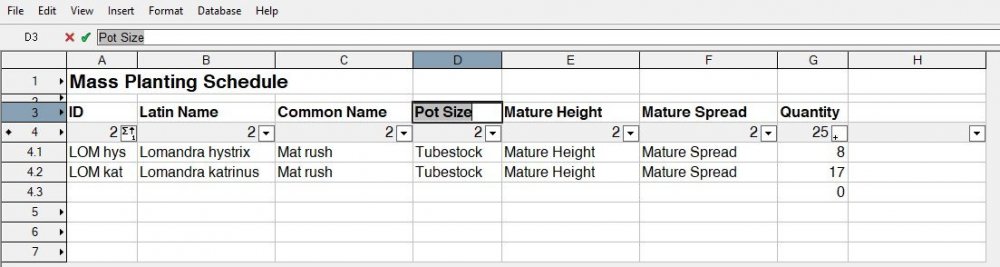
I do my planting schedule via a worksheet, and in recent versions of Vectorworks I get a 0 at the bottom of the quantity column. There's no way to manually remove it, and I don't know why it is there or what it is calculating. See image. any help would be appreciated.

-
I used the Garden Design template to create a new template and it still happens. Yes, the problem is still happening. This is the temporary fix I use. The next time I open the file and add a plant, the decimal places issue returns, and I have to go through all of this again. Every day on every file.
-
@Tamsin Slatter Is there a fix for this issue yet?
-
It's been over a year and it's still happening. Where are your Engineer's at with a solution for this. I'm having the same issue. Solve it with Edgar's workaround. Then the next time I open the file, it's gone back to 2 decimal places. It's very frustrating.
-
Customise plant data tags / landscape area tags
SeanR replied to SeanR's topic in General Discussion
OK, thanks Pat. -
Customise plant data tags / landscape area tags
SeanR replied to SeanR's topic in General Discussion
Hi Pat, that would be great, thanks. tagging setup.vwx Yes, VW 2020 -
Customise plant data tags / landscape area tags
SeanR replied to SeanR's topic in General Discussion
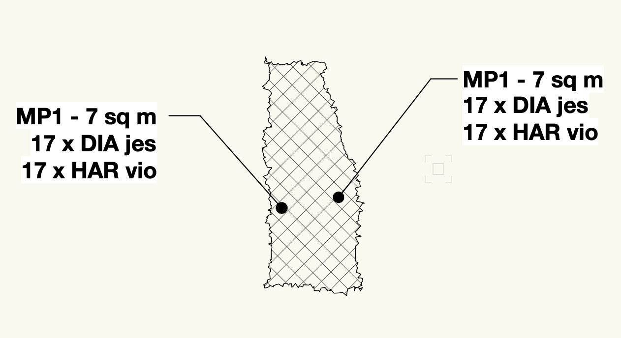
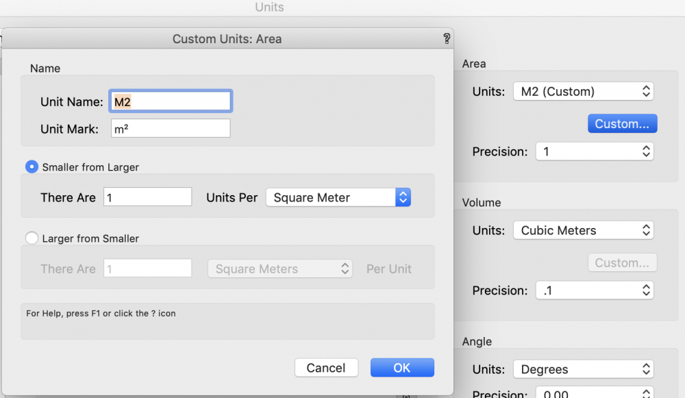
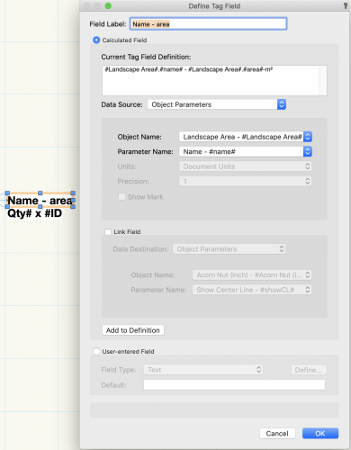
Thanks Pat. I'm almost there. I have the DATA tag showing m², but haven't been able to get the Landscape Area tag to show m² I can't find any setting to choose Document Units instead of Square Metres.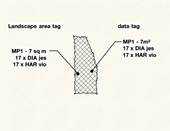
-
Customise plant data tags / landscape area tags
SeanR replied to SeanR's topic in General Discussion
Thanks Pat. I have been able to adjust the data tag so that it's format matches the Landscape area tags using the object function in the data tag pull down menu. I have also changed the document units of my drawing so that sq m is now m². The m² shows in the area part of the landscape area's OIP, but the tags still only show sq m. Have I missed a setting, or is it not possible to have the tags show m²?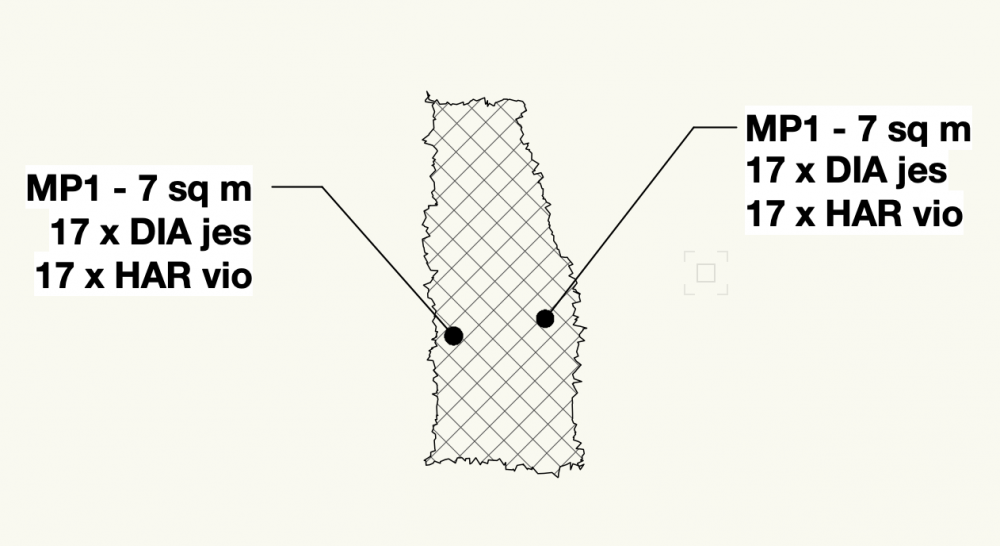

-
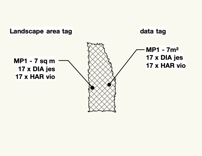
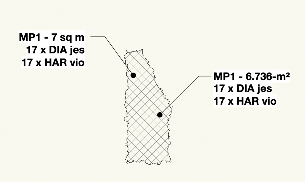
I've been looking at creating custom plant data tags to replace the tags generated by the Landscape area so our tags can be placed on the annotation layer. I have managed to get something close to what I want, but in the data tag the area is to 3 decimal places. I would like to change it to remove the decimal places. Image attached. The left tag is the Landscape area tag which has the area to the nearest sq. m. The tag on the right is the data tag. Is there a way to make the data tag show the area to the nearest sq. m? Any help would be greatly appreciated. Also, for the landscape area tag is it possible to have the area noted as m² rather than sq m?
-
Do you have a link to this video? I am hoping it will be useful for me as I'm just getting into the GIS capabilities of VW2020.
-
@Vladislav Stanev Thanks. All working well now.
-
Thanks Vlado, we will leave the user origin as is until the patch comes through.