Nathan_UK
-
Posts
17 -
Joined
-
Last visited
-
Site survey data - do I have the correct data?
Nathan_UK replied to Nathan_UK's topic in Architecture
I found the stake tool in the site modifier toolbar. The 'help' function (which is a search function of Mac, rather than an actual search function of VW) was still tripping me up! -
Site survey data - do I have the correct data?
Nathan_UK replied to Nathan_UK's topic in Architecture
Hello all, I have found manually putting in 3D loci at each of the spot heights I could not create a site model, this is definitely an error on my part. I have had better success with the polylines. I encountered the same issue as I previously have which was the z height written was not actually the z height of the model. To overcome this I manually moved (command-M) to the correct height to make it workable. @Wes Gardner I could not find the stake object tool in my 'architect' license, other resources on Google appeared to be historic, can you advise me where I could find it please? Many thanks -
Site survey data - do I have the correct data?
Nathan_UK replied to Nathan_UK's topic in Architecture
Using the 3D modelling toolset (I am using the architects VW license) I can choose '3D locus' and simply put one on-top of the existing spot heights. Your z-value can be input directly into the OIP. As an experiment I shall take both courses of action in two different models and share them here so they can be compared ongoing incase someone else comes across this decision in the future. -
Site survey data - do I have the correct data?
Nathan_UK replied to Nathan_UK's topic in Architecture
Thank you @line-weight, I shall work through on this basis today, it is very helpful to know when there is a need to be accurate and when there is a need to be 'close enough'! -
Site survey data - do I have the correct data?
Nathan_UK replied to Nathan_UK's topic in Architecture
Thank you @Wes Gardner & @line-weight for your comments, however, I cannot see how I can attribute a z-height to the lines after conversion to a polyline. Only a handful of the lines have a height value directly on them, whereas all of the crosses have values written next to them, are these crosses what I should be converting? -
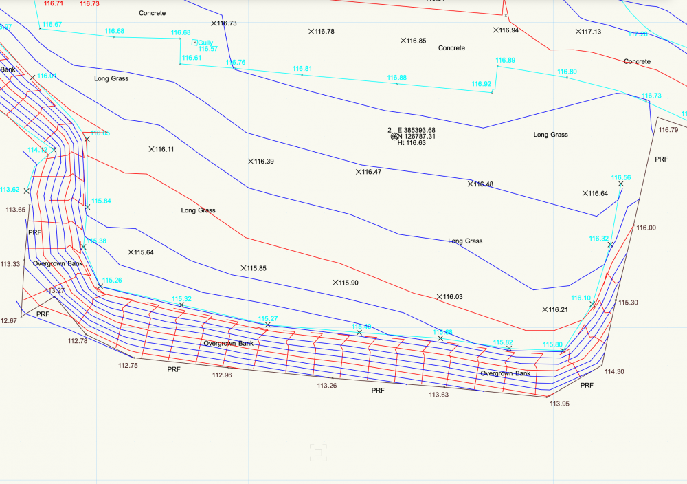
Hello all, I am unable to correctly use survey data to create a usable 3D terrain. I have attached a screenshot and file of this exact data and I would appreciate your help. I have watched many VW videos showing how to correctly import and clean the data, this is what I am stuck on... 1: The lines shown in the uploaded image are simply that, lines. They are not polylines or polygons. 2: The crosses shown are not loci and the OIP shows they hold no z-value data 3: All of the learning material I have seen show a polyline/polygon as holding one z-value (i.e. 110 metres). Looking at the data I have, one of these lines can vary from 112m to 121m so I don't believe the lines could be successfully converted to a polygon to convert to 3D data. So, how do I turn this data into a 3D terrain? I do have further questions regarding modifying the terrain but I should get the basics done first! I appreciate your help
-
Thank you again @zoomer & @Gadzooks . I found that one of my errors was the scaling specifications/setup during the import process. A new day with fresh eyes allowed me to get more in-depth with the import process. Many thanks again for your continued assistance.
-
Thank you @Gadzooks & @zoomer for your assistance with this, I now use the Resource Bar to find the object and drag & drop from there. Which brings me to my next query, scaling. I have been working with downloaded DWG files from manufacturers, these are both attached. When I try to import the cistern into the same file as the WC, the scaling is incorrect and the cistern is smaller than a bolt on the WC! It would be reasonable to question my entire process of importing etc as I only have the experience taken from this thread. Your assistance is greatly appreciated. **TEST** Bathroom | Duravit WC | CAD.dwg **TEST** Bathrooms | Cistern | CAD.dwg
-
(with the help of this forum) I have taken the site contours survey data and created a 3D terrain. I have been trying (for quite some time now!) to use the site modifier tool to create a pad (excavate the terrain) to install a slab and more. My issue has been that the z value of the terrain does not match the actual value of the terrain as dictated by the survey data. When I have drawn the pad, the z value (which should then be the lowest point of the slab) should be 165.6 (metres above sea level) where-as the elevation I have to input to get it anywhere close is -5600. How do I adjust the terrain Z value to accurately reflect the correct values. Many thanks for your time.
-
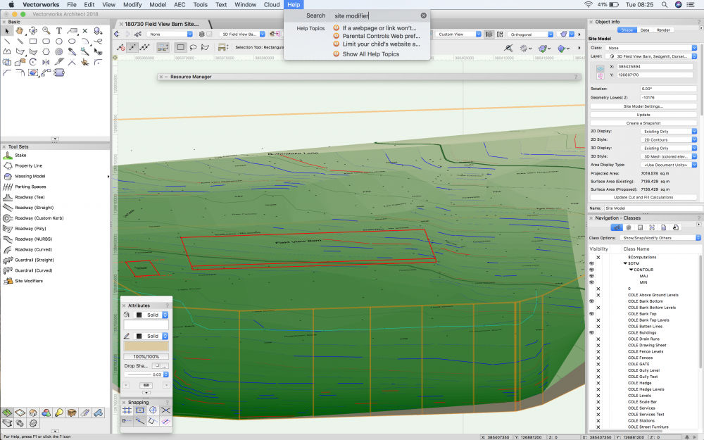
As a new user to VW I heavily rely upon the help function to show me where tools have been tucked away. What help doesn't include are the actual tool bars so I still have to go and hunt myself, making the help bar only (approx.) 50% effective. On my screen shot I have searched for 'Site Modifiers' and it doesn't direct me to it whatsoever. Am I missing the point here regarding the help function?
-
Thank you @Jim Wilson and @Tamsin Slatter , very much appreciated and I now have access to the site terrain tools.
-
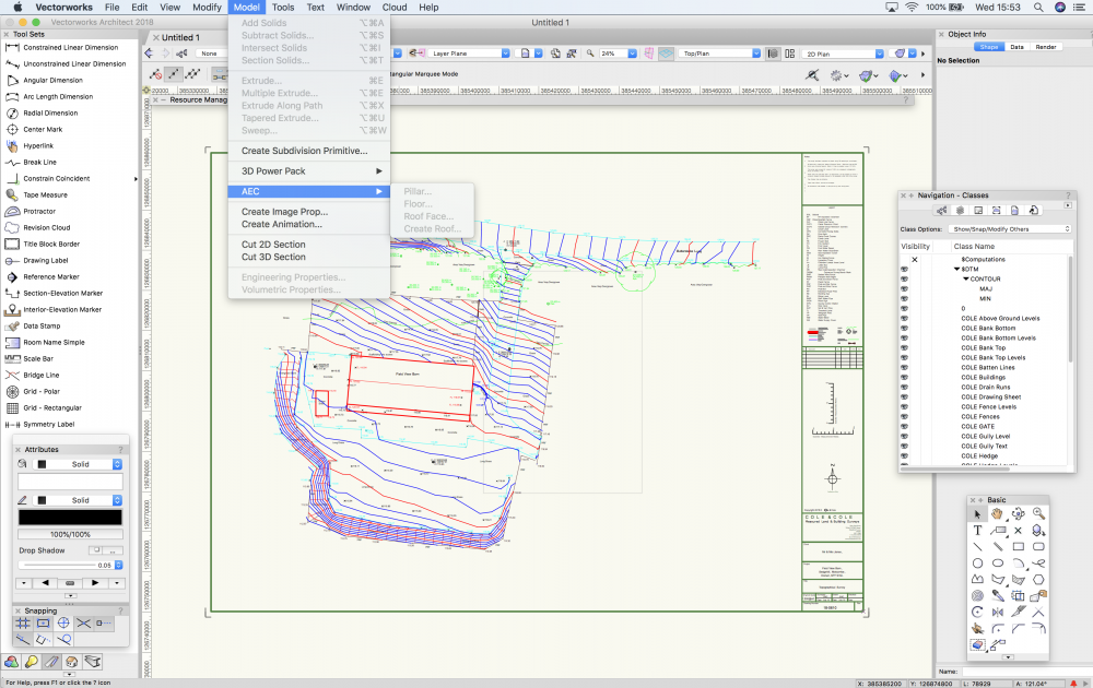
During the above discussion I had also received an email from our UK reseller confirming that "Vectorworks architect and landmark both allow for site modelling like this" in response to being posed with the same query. After a discussion in the office I was presented with a license for the 'Architect' portion. I have updated my software license and I now have 'Fundamentals, Renderworks and Architects'. HOWEVER ! Going to "Model>AEC>Create Site Model, I have no 'terrain' option as can be seen in my screenshot. What am I missing here?
-
Thank you kindly @Jim Wilson
-
Firstly, I can see that I have posted this in the wrong forum - my apologies. Can someone please confirm for me that I should have the VW Landscape option to use the Site Modelling features to be able to complete this task? Looking at my VW details I only have Fundamentals and the Renderworks options. An answer simply to stop me thinking I am totally useless at this would be helpful! Many thanks
-
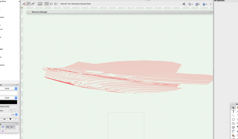
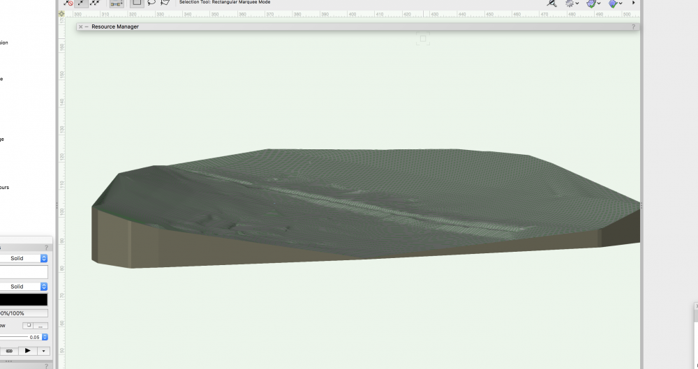
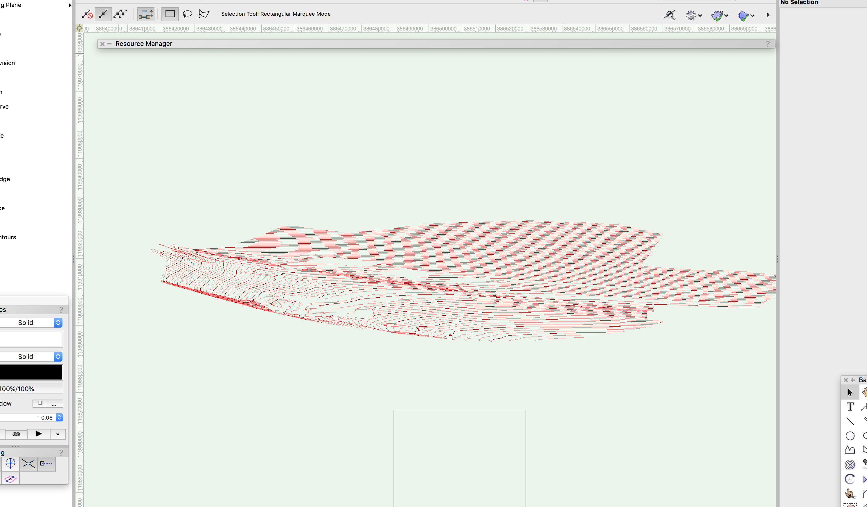
Hello all, I have received a 3D contour file (DXF) which I need to make into a solid. I have attached two shots to show exactly what I am trying to achieve. The VW I am using does not have landscape/site model options. What is the best way to do this please?