

John S. Hansen
-
Posts
67 -
Joined
-
Last visited
Content Type
Profiles
Forums
Events
Articles
Marionette
Store
Posts posted by John S. Hansen
-
-
Check this: https://architechtures.com/
What will we answer to a customer who ask if Vectorworks gets this?
John
-
 1
1
-
-
Is it possible to make a data visualization showing objects according to Material Category? (or other parameter from the Material classification)
-
This would also be great for preparing large collections of curves for sitemodelling - delete everything outside of a polygon (cutting crossing polylines)
-
Its a step back for Fundamentals, that they can't hide Data Visualization from toolbar without also hiding rendermode.
It's confusing to show tools that are not part of the license.
-
4
-
-
It would be nice with a way to paste text into an existing textstyle - giving the pasted text the same style.
-
Well I knew that - it dont work…
-
-
1
-
-
Its great to setup saved views for presentation - especially now with the Option-arrow navigation!
It could be nice to have a gerneral setting where the saved view adopted the currently available screen size so you can make a presentation on another machine wit smaller/larger screen.
-
2
-
-
-
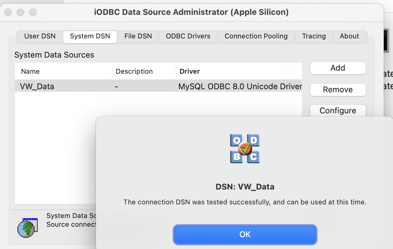
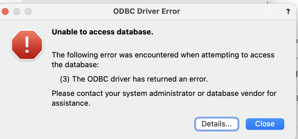
We are trying to help a customer setup a database connection on a Mac M1.
We have tried FileMaker and MySql and both gives a failure when connecting to the ODBS source from Vectorworks.

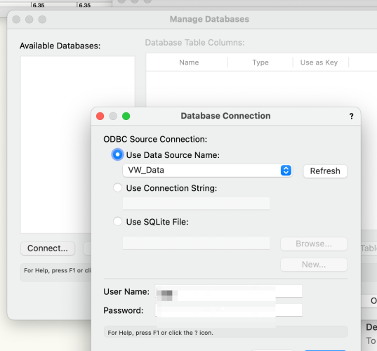

And help very much appreciated!
Best
John
-
-
its not better to pay a more???
So higher number is best - paying least for performance...
-
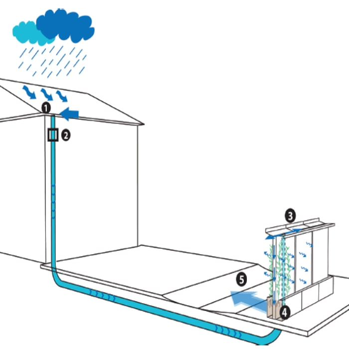
Hi,
Here is a link to a very interesting customer story. Developing a Rainwater Management System with Simulation
You might have seen images before of the rainwater management solution.
All drawings except a handdrawn is Vectorworks - the stuctural testing have been done in Comsol - a swedish application taking in parasolid obhjects with very good results.
----
BREAKING!
Latest news to the message from ealier:
Our customer is traveling to New York Nov 11th to recieve a price for the project in the video from Tech Briefs Media - they won ahead of 300 projects - price: workstation computer. (the customer will present the projects in detailss and of course mention Vectorworks in NY)
The project in Tech Brief's contect:
-
3
-
-
Public GIS data in Denmark is often only accessible in 10 kilometer x 10 kilometer squares and pretty high resolution.
That results after a (very) slow import and spending a lot of time cutting "Per side" deleting unwanted data.
I suggest a small addition to the cut tool: recktangular cut
Function: Select a rectangel and delete everything outside the rectangle.
A sample file with an imported dataset attached.
(as well as the dataset downloaded from the public service)
-
1
-
-
when importing files from GIS systems it should be easier to crop the import - a preview window to crop in - or/and after import crop by polygon (today you have to crop/cut with one line several times - which can take hours - seriously!)
Also during import it would be nice to be able to reduce data (like in Cinema's import)
-
when panning is active (by space bar or tool) it should NOT be necessaesary to pres mousekey for panning
-
Many former users of other programs have suggested a known feature: "copy this object to a distance of X from another object
-
Found a 3D version on the internet - attached Vectorworks file with 2D/3D symbols with 3-level 2D side, front and top viewsCEE resources.vwx
-
I have the same problem on iMac 17,1 - must disconnect/reconnect to make 3Dconnexion SpaceMouse work. Same on High Sierras as well as Mojave.
-
1
-
-
There is no way Vectorworks can support the Mojave OS before it is released. (Apple is known for late-minute changes...)
-
2
-
 1
1
-
-
Support for Vectorworks 2011 Mac???
-
They have used Macromedia Captivate.
More information:
Regards,
 John S Hansen
Denmark

Removing Suffix from Shapefile Export
in Wishlist - Feature and Content Requests
Posted
If you're on Mac: Try A Better Finder Rename