Helen Palmer
-
Posts
62 -
Joined
-
Last visited
Content Type
Profiles
Forums
Events
Articles
Marionette
Store
Everything posted by Helen Palmer
-
I am looking for a freelance Vectorworks Landmark operator to work on an ad hoc basis to prepare landscape plans. Must have full Landmark knowledge, including site modelling, planting plans, tree survey input etc. Being a landscape architect and a knowledge of plants would be a huge bonus!! Email helen@landshapedesign.com for more information. Helen www.landshapedesign.com
-
All the grades shown in the screenshots above are created with the grade tool. It is an excellent tool but there does appear to be a bug with it. the grades randomly appear and disappear and I can only get them to reappear by 'sending to front', when there is nothing in front of them. I've given up and added the missing elevations manually using text.
-
I'm still having this problem - I also cannot adjust the location of the % fall and arrow - sometimes they are offset, sometimes they are not, regardless of what I have shown on the global settings. This is extremely annoying. Also these grades disappear - or sections of them do, even when I have only the class and layer on Active only. I have to select move forward to get them to appear. Anyone got any ideas? Help!

-
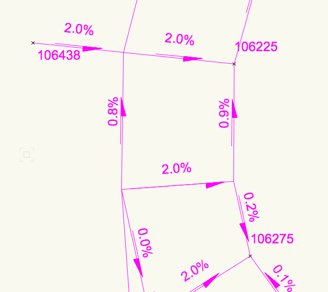
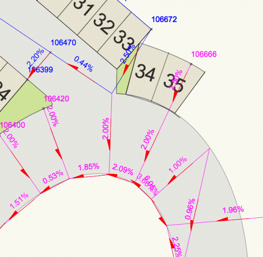
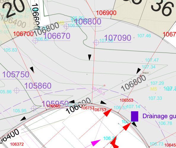
I am using grade objects and wish to show the elevation at either end of the grade lines. Show elevation is selected on the settings, but is not always shown. Particuarly when grade objects are touching (intentionally), the elevations are missing. On some grades the elevations are showing but I can't see any difference in the settings. Any ideas how to get them to show? thanks Helen
-
Grade tool information missing when viewport moved
Helen Palmer replied to Helen Palmer's topic in Site Design
Yes, it works perfectly well. I started using it in annotation mode as the text sizes were so difficult to control in the design layers (probably because I don't understand how the text scales). I use all dimensions and grades in annotation modes - makes it much easier to manage, but the only disadvantage is if you need to export to dwg it can get a bit messy, and if you suddenly find you need to refer it from the design layer, of course you can't see it. I've just tried taking heights from the site model and it won't do that in annotation mode so if you need this then you need to use the tool in the design layer but if you want to do some quick calculations it works well. -
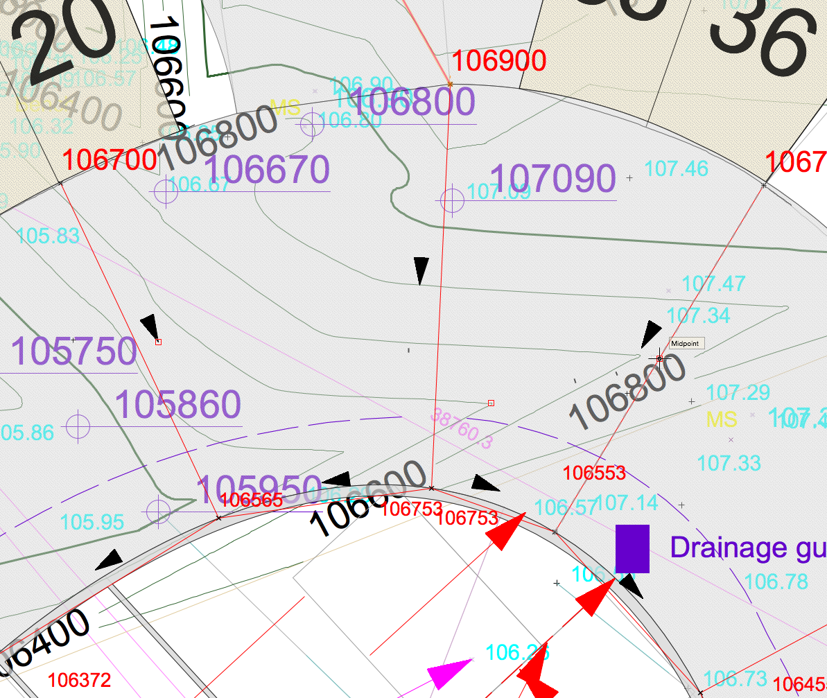
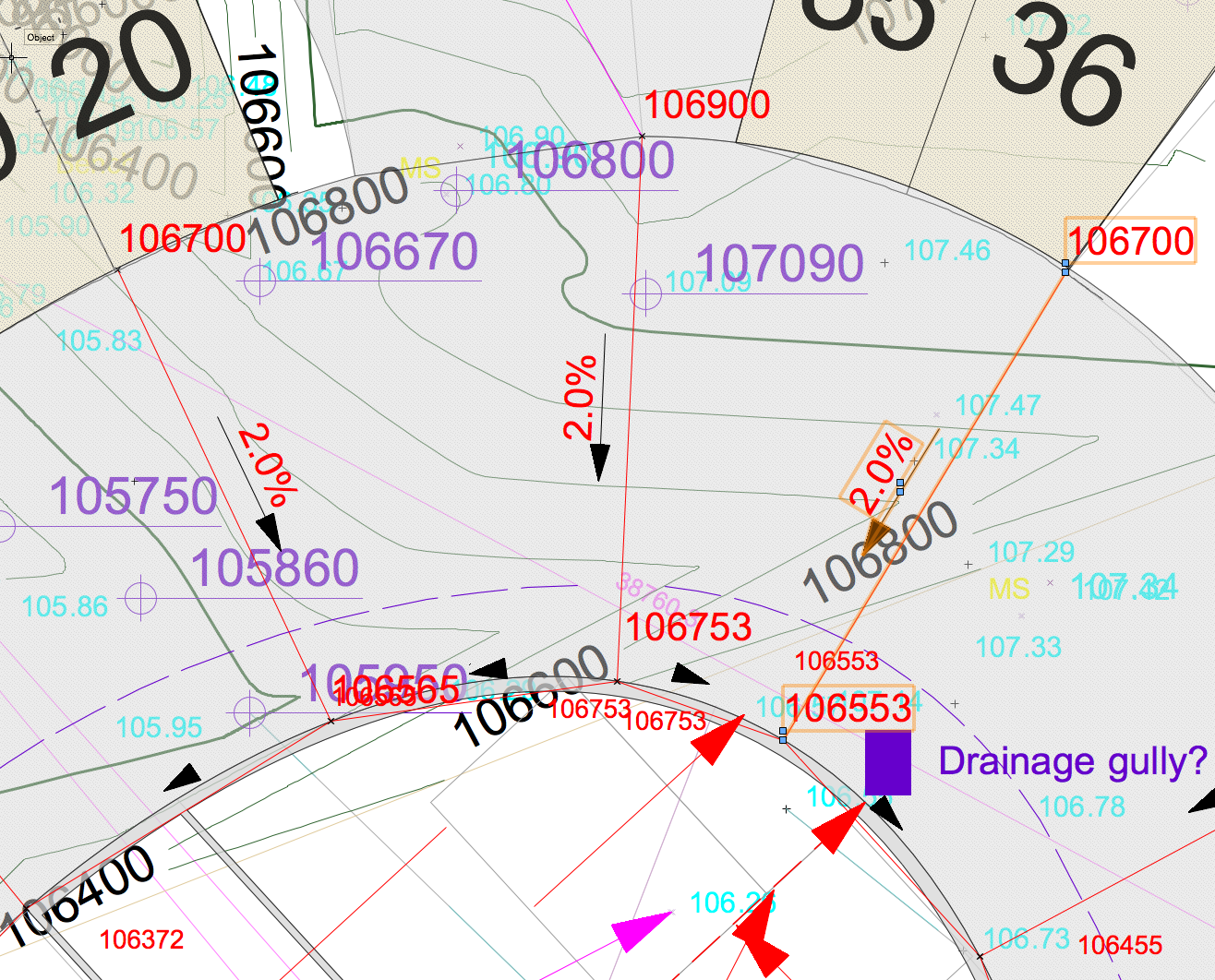
I have created a plan and calculated grades using the very useful grade tool. I have used the grade tool in viewport annotation. However, every time I move the viewport on the page the data with the arrow (percentage grade/fall) on the viewport disappears. The data is still there and correct but to get the grade to show (which is what I want) I have to go into the viewport, individually select each grade, then press return for the information to reappear. I can appreciate if I moved the viewport on the design layer or the viewport crop, the grade tool would have to reassess all the information (which it does if I do this), but why is this information missing when I just move the viewport. It is a huge waste of time do reset these each time. The first image is what it looks like, the second what it should like and what it does look like after I individually select each grade to reset. Thanks for advice, grade calculation is painful enough as it is, without this added headache! Helen

-
Complex Hardscape elevations
Helen Palmer replied to bsamailey's question in Wishlist - Feature and Content Requests
Yes, I suppose the best way is to create the slope on the site model and then use the hardscape as a texture bed modifier. I have been trying to work out how to use the slope modifier on the hardscape tool from the Vectorworks help page but it's almost impossible to see what is on the images and work out how to do it - is there a tuition video or any tips on this? -
Complex Hardscape elevations
Helen Palmer replied to bsamailey's question in Wishlist - Feature and Content Requests
I need exactly this as well! This would make my external car park design on a sloping (in multiple directions) site much easier. -
Listing Loci for use as setting out points
Helen Palmer replied to Helen Palmer's topic in General Discussion
The stake object does exactly what I want - except .... not sure I can get it to show exactly what i want. I want the stake object to show an identifier (e.g A), and this preferably to be automatically assigned - I can set this in the tools dialogue. However, I need to then create a report which sets the identifier against the coordinate (northing and easting) and I can't find a way to do this. I don't really have the space on the drawing to show the coordinates for each stake and would be much easier to show the identifier only. I think this is what Kevin is saying above - does anyone know a way around this? All it needs is more elements for selection in the report - the info is there, just getting to it is the problem! -
Listing Loci for use as setting out points
Helen Palmer replied to Helen Palmer's topic in General Discussion
Excellent very helpful ideas. I'll have a go later. many thanks. Helen -
I am producing a landscape setting out drawing where I need to provide coordinates (northings and eastings) for locating various elements. I am using loci points to generate the coordinates, but I then have the tedious task of individually cutting and pasting from the object info palette into text boxes on the drawing. Each time I have to click back onto the loci to get its coordinate. Is there a way to speed this up? Can I get a list of the loci points on the drawing or can I export them to a file or spreadsheet?
-
OK, I've worked it out. I have to select each tree, change the trunk class to something else, refresh, select each tree, change the trunk class back to trunk-3d, refresh. And I have to do this only in top/plan mode, any other mode and I lose all the canopy geometry. And then all the tags have been rotated to random angles. I've already been through this and had to manually adjust each one individually. Time to do it again. What a tedious waste of time. This existing tree tool is so buggy it's hardly worth using.
-
Hi, I have the same problem, have downloaded and replaced the file and rebooted but still no tree canopy. What next?
-
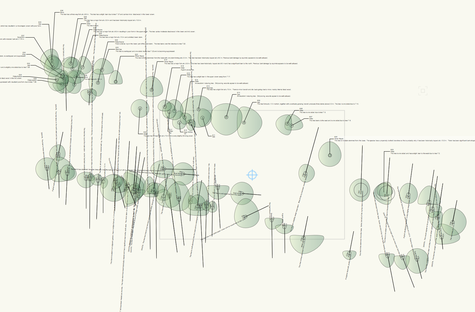
I have placed 80 surveyed trees on a drawing using the existing tree tool. I want to include information in the ID tag which includes an extra field I have created for additional notes. This field shows on the object info palette, but there is no way to include this in the ID tag - there is a limited range of choices I can make. This seems very basic - is there anyway around this? Surely I should be able to determine which fields appear in the ID tag? This complaint was raised in 2014, I'm hoping someone might have resolved this in the past 3 years! thanks Helen. Landmark 2017
-
I am creating a double staggered hedgerow but I want to include more than one species of plant, and preferably to have them randomly located, but with the species mix specified - a bit like the landscape area tool, but in a hedge. I can see how it works with just one species which is pretty useful if you want a beech hedge but is it possible for example to have a native mixed hedge or do I need to revert to landscape area tool? thanks Helen. vw2017 landmark sp3
-
How to snap to create line perpendicular to point on curve?
Helen Palmer replied to Helen Palmer's topic in Site Design
Fantastic - it's the tool tip that makes the difference as I was getting so many angles and snaps I couldn't work out which one was the perpendicular. thanks Helen. -
Stair tool creating random lines? How to get rid of them?
Helen Palmer replied to Helen Palmer's topic in Site Design
Thank you, that solved it. -
I need to create a series of lines which emanate outwards from an irregular oval shape created by polylines. These lines need to be perpendicular to the oval at the point at which they are joined. Can I set a snap parameter to set this to work automatically? I'm sure I can do this, but I can't find the snap command. thanks Helen. vw2017 landmark sp3
-
Stair tool creating random lines? How to get rid of them?
Helen Palmer posted a topic in Site Design
Two random (or maybe not random) lines appear when I have drawn a stair with the stair tool. I don't know what they mean or how to get rid of them - can anyone help? See screenshot. thanks Helen VW landmark 2017 sp3
-
Black line appearing in final render in viewport
Helen Palmer replied to Helen Palmer's topic in Rendering
Thanks Jim, it's taken a while and a lot of teeth gnashing to get this far, but pleased with the result. Created from a site model from imported site survey. The existing trees work well too.

-
Black line appearing in final render in viewport
Helen Palmer replied to Helen Palmer's topic in Rendering
Excellent Paul, that tip worked. I hadn't realised that the modifiers could be turned off and still affect the site model. thanks. -
Black line appearing in final render in viewport
Helen Palmer replied to Helen Palmer's topic in Rendering
How do you that? Within the class, i.e. set line to none? -
Black line appearing in final render in viewport
Helen Palmer replied to Helen Palmer's topic in Rendering
Thanks for all the suggestions. I've turned off display planar objects and that makes no difference. I've deleted anything which might have been a 2d shape of any kind. The boardwalk is a hardscape object with 150mm thickness and a pad modifier, bottom edge. The dark line appears to be showing the site modifier along the bottom edge of the hardscape. It's also appearing under a road polyline which is also set to modify the site model below. If I turn off indirect lighting I still get the same effect. I don't get the effect in open GL render, just in the final render works style. I'm running Landmark with renderworks 2017 SP2 and SP3 (2 machines) MacBook Pro and iMac. Same effect on both. Any more advice? thanks -
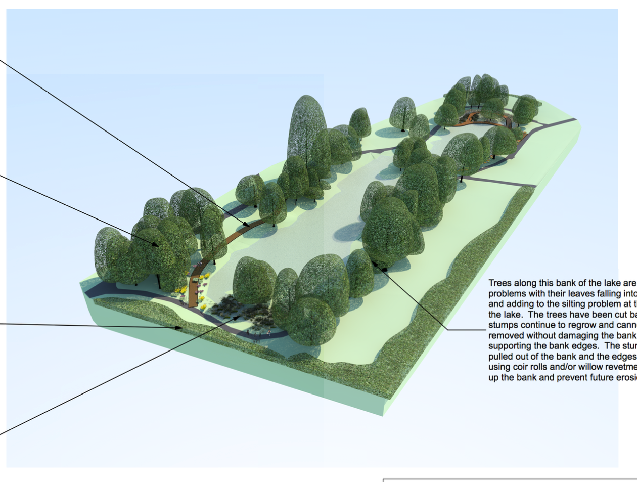
I have created a site model with 3d modelling for a landscape. It works well, but when I render in viewport I am getting a black line appearing along the line of one element of the drawing. This is always the last part of the drawing to render and the line appears on top of everything else. Anyone any ideas what this can be? I've deleted all layers that I was not using. Screenshot attached. Thanks Helen.
-
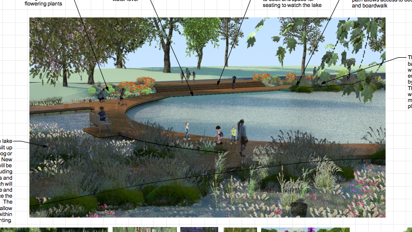
Suggestions for render texture for lake water surface please
Helen Palmer replied to Helen Palmer's topic in Rendering
Thanks Alan, that's very helpful. The only issue is that as the lake is so large the tile pattern really shows which makes it look less realistic. How much could I enlarge the tile before the resolution is adversely affected?