
unearthed
-
Posts
553 -
Joined
-
Last visited
Content Type
Profiles
Forums
Events
Articles
Marionette
Store
Everything posted by unearthed
-
I used the script on this forum page a last month.. Note my comment on that thread warning about resulting 3D points being offset from their real origin.
-

Publishing sheet layers - wrong size issue
unearthed replied to Miriam W's question in Troubleshooting
Assuming you're in an educational context does your degree/course have a dedicated IT person? - that was the case when I studied and they could sort out almost anything. -
Script to isolate or select outermost line work
unearthed replied to unearthed's topic in Vectorscript
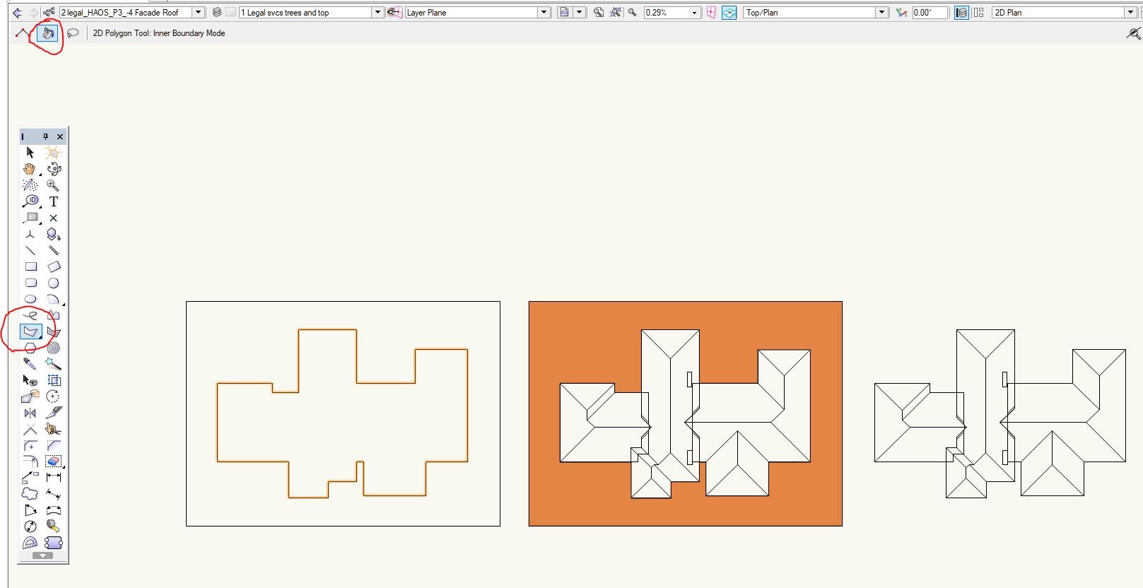
Thanks Joshua, that's a very useful workflow - basically a flood fill but but for loose vectors. I just drew a box round my various lines (they do have to be touching or crossing and form a hull / continuous closed object), and then did; 2D Tool plus Inner Boundary Mode and; Ungroup and deleted my outer rectangle No more messing around with dozens of lines/
-
Publishing sheet layers - wrong size issue
unearthed replied to Miriam W's question in Troubleshooting
So, just checking basics. Is scaling is 100% in dialog? Page Setup Width & Height set correctly? Have your tried the Export function"? Sometimes I use pdf 995 (a free pdf printer) when my VW is playing up but my 2018 seems reliable. What is your VW version?, What is your operating system? - the answers can lie here if we know what you're running. -
Script to isolate or select outermost line work
unearthed replied to unearthed's topic in Vectorscript
Thanks, I didn't know of Outer Boundary tool - It doesn't work for this, BUT it does do something else very useful - making quick polygons from unjoined lines: Even a concave gull algo may have issues (tho' I'm far from an expert) as there are self interesting lines in my case. -
I often only want the outer lines of a given 2D object that I've imported., e.g. this set of roof line work where I only want the outer roofline. I realise a lot of these lines cross into the inner space (and I'll need to trim them) but just getting the outer ones in a selection would remove a tedious small repeted action. I want to do this with drawn elements, and items like surveyor's TINS, and also the jumble of objects that results from exploding .pdfs (where there is normally only a single layer in the drawing).

-
Cancel Publish - Is this not possible?
unearthed replied to Kevin McAllister's question in Wishlist - Feature and Content Requests
Why does basic functionality like this get ignored by VW for years? - we don't need bells and whistles, we do need CAD software for day to day work. -
I normally thin (reduce closely proximate) points outside of VW in QGIS (free, FOSS, and constantly improving) using something like this or this. GIS is near instant (once you've learned the workflow) whereas this stuff will bog VW for hours ime. A problem with this new (uncleaned data) is that it is too dense - it is collected at a finer detail than we would draw at), or even perceive - for the scales we present at.
-
Artifact in a viewport, looks like a shadow, but from what?
unearthed replied to unearthed's question in Troubleshooting
Thanks Benson, I managed to it's layer, but I'm struggling to get beyond that as it looks like a nested object. The file's quite messy and has gone through at least three people; a surveyor, an architect, and possibly others. It looks like a mix of AutoCAD, Revit, and Vectorworks. I hope to be getting the original files soon, so that should reduce this problem. Searching for the artifact, I found other unusual features in the CAD but not the culprit. It's quite different from the other bug people get where there's a line crossing the space. -
Artifact in a viewport, looks like a shadow, but from what?
unearthed posted a question in Troubleshooting
I've got an artifact in a viewport, it looks like a shadow - but from what? • There's nothing above this space to cast a shadow • Nothing in drawing with an opacity setting other than 100% • Viewport has no objects within it • It is not from a 3D object as I've changed all 3D to 2D poly If I zoom right in in sheetspace, it disappears. When I click through into the model, I can't see it at all and can't see what could be generating it. I've drawn a red rectangle and put it on the bottom, and it looks like this artefact is on top I can't load the model up on here client confidentiality.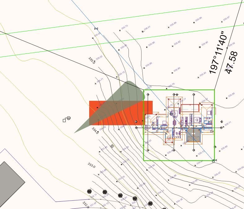
-
Thanks Pat Thanks Julian, That's a remarkably useful script, runs very sweetly!
-
All Possible Things I Can Be Doing To Keep File Sizes Down
unearthed replied to Chame_liam's topic in General Discussion
Make sure your raster files are not at greater pixel densities than your display of them, e.g. 300dpi versus 600dpi. I sometimes degrade high-res imagery, or run a monochrome set for my own use. Sometimes I'll vectorise an image (e.g. using wintopo.exe, or via QGIS) , e.g. where image is line art, and I get dramatically smaller files size If it occurs more than once it should be a symbol. Do you have access to Acad or Bricscad, or any dwg editor so you can clean incoming files? -
What is your Rhino file version? This page states vw2018 only works with Rhino 5 and all the versions prior. Until you get a real answer (maybe with a solution) try searching here: site:.forum.vectorworks.net import rhino "2018" Shows a whole lot of people having incessant problems with Rhino file imports.
-
Semi-automating image exports from sheet space
unearthed replied to unearthed's topic in General Discussion
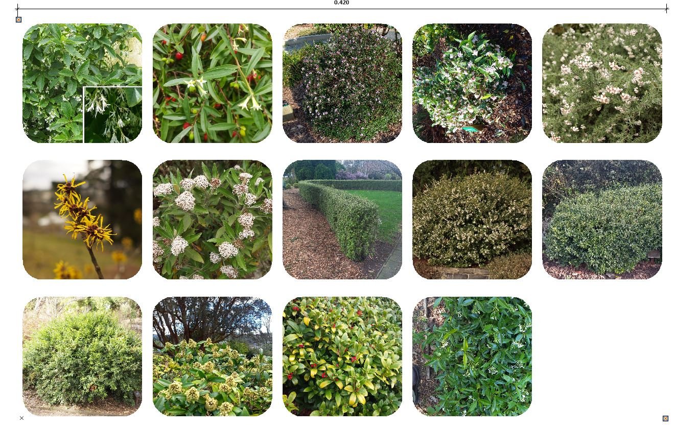
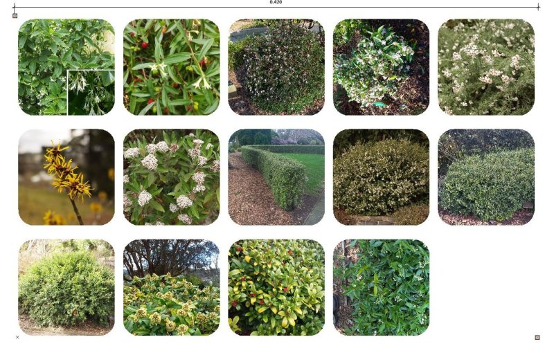
No, that's not how I use vectorworks I don’t use many of VW’s landscape tools as they don’t work for how I think or want to display my landscapes - so I don’t link images to symbols. I constantly see people having ‘huge .pdf’ issues with, and there are several ways around that (and reasons for it). For some pages I assemble everything on the page and export just the raster info – then externally reduce file size, and reimport & place under the vectors, and I can usually get 7-8 sheets with a LOT of info and rich graphics at ~10Mb or less. A friend wrote me that script and likewise it saves me hours. So my question is, is can a script be written to export an image from sheetspace, where there are two locus points in sheetspace that define the image bounding rectangle. Your Generate Portfolio script essentially does that – although it only gets you as far a sheetspace*; sending linked images (from symbols) to sheetspace . * does it reduce the file sizes as well? so you don’t end up exporting a huge image? My system means I can select my plant images at their high-res state, drag them onto my script and I get an image grid (and names file) back. As an aside re grids of images and my workflow: I make my image grid externally using a script in Imagemagick, that script also gives me file names as a .txt Then I drop the file names into a worksheet, and read those names into a separate worksheet which constitutes the image labels. I show these on the page via two viewports, one containing the images, the other containing the labels.- 3 replies
-
- 1
-

-
- export
- exportimage
- (and 3 more)
-
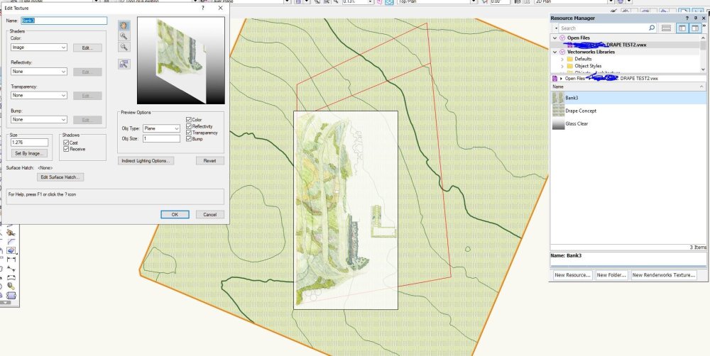
How to drape an image over terrain/ a site model?
unearthed replied to unearthed's topic in General Discussion
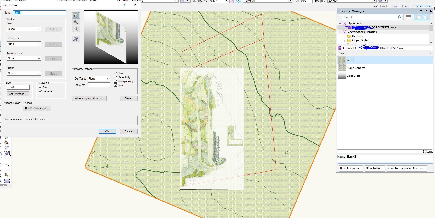
Thanks for your kind offer Jeff - I used sketchup (which also drapes better if image slightly > than model). But I will come back with the skect and the model for you as I want to learn to do this in VW. -
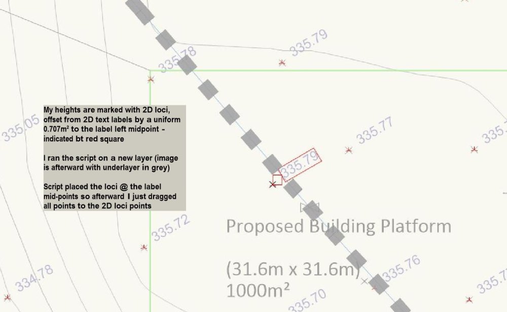
To get my .pdf file size down I’ve always set out my images for a given sheet and then exported as a single image, then adjust size externally & reimport – as in this example using a plant palette. But how can I automate this more? I’d like to hit a button and export everything within the coordinate space of the two highlit locus points (in encl. image) (ie using the export as image function). I almost always export .jpg, 300dpi (but sometimes I adjust that), at maximum quality setting. I’m not a script writer but is this something that already exists, or could someone here write such a thing? I always get width dimension of my sheetspace objects before entering dialog. I don’t use loci for anything else in sheetspace. Mouse: File > Export > Image file; Export Image File dialog {Alt f x i} - Export area, defaults to random setting. { m } - Dimensions, remembers its setting. {TAB is only access} - Quality, remembers its setting. {TAB is only access} - Format, remembers its settings. {TAB is only access} - Print size, height & width always some random number. Units defaults to inches, so always have to reset to cm ). {TAB is only access} Then press Draw Marquee Draw marquee in sheetspace Dialog returns with Save and one navigates to path and saves it A lot of steps – 13 or so, some of it forcing mousing, and I do it at least twice a day. A button would be amazing, and save a lot of time and fiddling. My musing - ignore for now A script would probably start with checking that locus points existed in current sheet. So can a script read/parse locus point positions as part of a process? Or do they need to be in a record? Or will a name suffice?
-
'tis a great pity this is Mac only. VW is the only program I have where this is a problem / has not been addressed in programing as it is neither a bell, nor a whistle.
-
How do I drape an image over terrain/ a site model? My image is a jpg with a pencil concept The image in the space is a texture in a rectangle I'm using as a visual guide at the size, orientation and position that I want the surface to be at. My site model is built from 3D polygons contours. Red poly is my referance object to orint image position I've tried the texture mapping route but get repeated crashes when I try and chhange the I and J dimensions - or the image size reverts just after it display at a larget size. I don't do a lot of 3D in VW and there seem to be a lot of possible ways to do this and a lot of ways that are a waste of time. So has anyone got a workflow that has a useful outcome? For the purposes of this I've centred my drawing on the origin.
-
I will simply never go for CAD as a service type model. My experience with Sketchup put me off ever going that route. I want my models to be available to open without having to pay a sub for the rest of my life, so I won't be going further than VW2022. Will probably change to Rhino3D in the next few years.
-
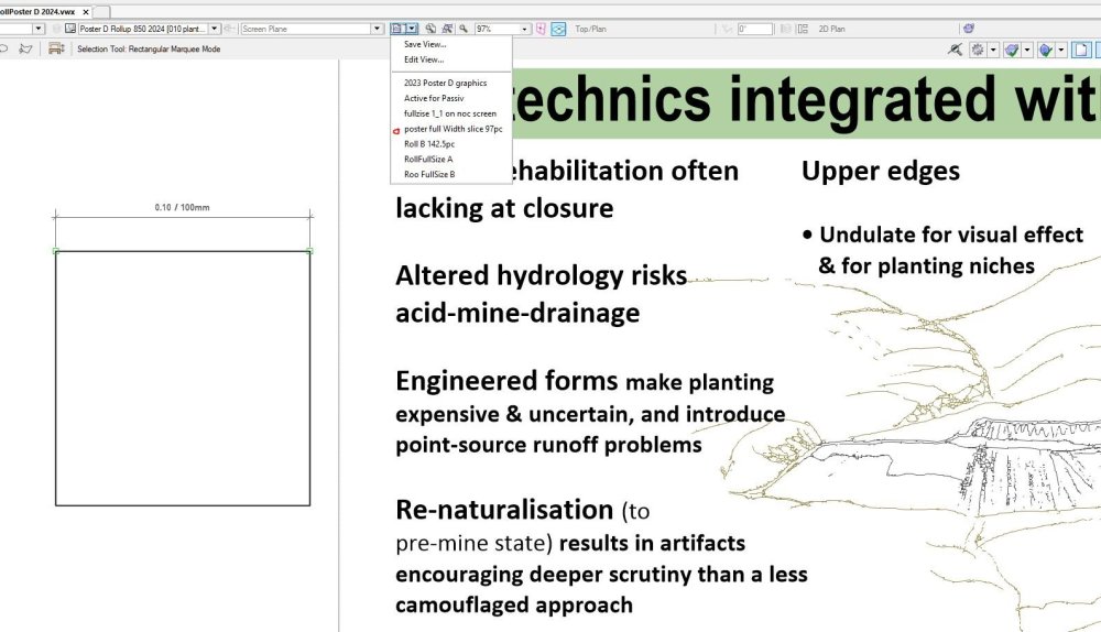
Why not just use a Saved View? I've just made a poster that'll be 2metres c .850 wide. I drew a 100mm box next to poster and zoomed until it was 100mm as measured onn screen and then saved that. For my screen that was 97%.
-
Is there not a click & drag convention to rotate an object?
unearthed replied to Scrappy_Bogart's topic in General Discussion
Select object + R [gets you the rotate tool]. -
I've been used VW since 2004, currently using v2018, VWs crashing behaviour was new to me (coming from ACAD) so I logged what I was doing for a few years (and versions) but there was no discernable pattern, although usually I was doing something minor beforehand like writing text, or a simple 2D boolean. It sems much more stable than a decade ago but still happens. It would be nice if the code base was open so we could learn what is going on. I set it to save a backup every minute.
-
.tin stands for triangular irregular network, it's an efficient way of sorting 3D coordinmate info in a vector format, basically the file is a list of xyz coordinates. It would really be easier if you can contact the surveyor direct - I always try to avoid client in the middle situations. I would normally use QGIS to open or process .tin, but these proprietary, closed-source files are often a pain to work with - here's soime info on using QGIS to work with .tin For anyone working with .tin the wikipedia page is very useful as .tin is not an open format.
-
I have a questionnaire related to Passivhaus - would any of you in this or related work be interested in answering ten questions (some of which may help you think about your own practice). I'm working on achieving a better fit between Passivhaus and related design (also at industrial / commercial scale). Despite Passivhaus being a step change in building performance their gardens and landscapes are the same as conventional; a huge lost opportunity as to want Passivhaus means the client can think ecologically and holistically. Features / considerations would include: • Using plants to deplete local CO2 for air-intake (plant science and orchard related) • Manipulating tree shelter to split fog, rain and snow for better stormwater control (exploiting isotopic forms of water). • Planting-integrated PV arrays and wastewater/septic fields (selected low, and shallow-rooting plants) • Careful planted shading to control decrement delay..., (also manipulating when a plants leaves fall) and promoting a deeper level of landscape than most clients are willing to consider e.g. wildfire planning (no one is doing despite drastic changes in wildfire behaviour). I have a background in plant science, ecology and industrial ecology and facilities maintenance as well as landsape architecture and management. I'f I get any feedback I'll put the questions up here, or on my blog.
- 1 reply
-
- 2
-
-
- passivhaus
- architecture
- (and 3 more)
-
Tell us what version your using more people likely to help you that way.